Search Icon

Explore Areas in Bangladesh

234 - 252 out of 304 areas
Purbachal Property Guide
Rating icon
3.5

Purbachal
, Dhaka

One of the largest planned townships to come up in Bangladesh is the Purbachal New Town Project, also known as Purbachal Residential Model Town. It stretches over 6,227 acres located in Rupganj thana of Narayanganj district and Kaliganj thana of Gazipur district and is expected to be Bangladesh’s biggest planned township. Positioned strategically between the Balu and Shitalakhya rivers, this ambitious development will enhance Dhaka’s northeastern corridor by promising its inhabitants a promise of contemporary living with a touch of sustainability.<br><br> Purbachal aims at being an autonomous town having all required urban facilities and infrastructures including the Iconic tower by Kajima Corporation alongside Sikder Group in addition to that other 26,000 residential plots plus 62,000 apartments would be accommodated. These encompass such things as malls, hospitals, schools, etc.<br><br> Despite its visionary planning, the project has encountered delays extending beyond its original completion target of 2008 with essential infrastructure and utility services still under development. However, progress in different sectors like road construction, bridge building, and plot handovers illustrate that Purbachal is inching towards achieving its full potential. With its wide-ranging road network, open spaces, and a strong focus on community amenities; Purbachal embodies a new approach to urban development aimed at redefining standards of living as well as connectivity around Dhaka city.<br><br> The Purbachal is the embodiment of urban development in Bangladesh for the future, combining unexplainable connectivity with Cutting-edge amenities on the Purbachal Expressway and a focus on sustainability. New living standards for residences, education, and environmental management are to be set in this area by this township that seeks to offer a complete way of life.
View Insights
Ramna Property Guide
Rating icon
3.5

Ramna
, Dhaka

Ramana is a place of significant cultural, historical, and architectural importance. Ramana is a place of historical significance located in Dhaka, Bangladesh. The Greater Ramna area is surrounded by Azimpur, New Bazar and Dhanmondi in the west, Secretariat Building, Curzon Hall and Chankharpul in the south, Purana Paltan, Segunbagicha and Rajarbagh in the east and Central Road, Paribag and Iskaton in the north. Ramna thana was an important police station among the four police stations of Dhaka city during the British and Pakistan period which still retains its importance equally. It has an area of ​​3.84 square kilometers. Its postal code is 1217.<br><br> As the Ramna area is located in the heart of Dhaka city, it has developed into a commercial center and Ramna is easily accessible from any part of Dhaka.<br><br> One of the highlights of Ramna Place is Ramna Park also known as Ramna Green. It serves as Dhaka's largest park and a recreational area for residents. Along with entertainment, shopping centers, markets, cultural festivals, etc. There are religious institutions along with some of the best educational institutions. There is an adequate supply of gas, electricity and water.<br><br> As it is located next to Dhaka city center and Dhaka University area, it is quite a populated place. Besides, the place becomes lively with the arrival of more people during the holidays. Despite being located in the capital Dhaka, Ramana maintains a relatively green and peaceful environment. The park acts as a green lung for Dhaka that gives residents a break from the hustle and bustle of the city.<br><br> Ramana hosts various cultural programs and festivals throughout the year. The park gets ready to celebrate Pohela Boishakh, Independence Day and other national holidays. Also the buildings here are beautiful and attract people for their blend of colonial-era architecture and modern design. Being an area under Ramna police station, there is a strong security system and non-communalism which is beneficial for all types of people.<br><br> Overall, Ramana Dhaka has an important cultural, historical and recreational significance which makes Ramana a cherished part of Dhaka's city landscape.
View Insights
Rampura Property Guide
Rating icon
3.5

Rampura
, Dhaka

Rampura might not be the area you are looking for to enjoy a meal in a lavish restaurant, but it is certainly one of the areas in Dhaka that offers access to many daily necessities. Just near the Banasree area, Rampura is one of Dhaka's most densely populated areas.<br><br> It is also surrounded by Gulshan, Badda, Khilgaon, Motijheel, Tejgaon, and Ramna thana from different sides. But the good thing about it is that you can easily find a variety of stores, pharmacies, and bazaars at a short distance following the Rampura area guide. <br><br> The Rampura Thana has an area of 2.8 sq./km (1.1 sq/mi) with a population of around 250,000. It has two wards and 17 mahallas. Currently, it is a part of Dhaka North City Corporation. <br><br> It also has a slum known as the Rampura slum, which is partly responsible for the pollution and other issues around the area. The Rampura Canal is connected to Eastern Dhaka to remove industrial waste and rainwater. And since there are many garment factories here, Rampura is also a place where you can often witness labor unrest.<br><br> While it is not a very developed area in Dhaka, Rampura certainly offers an affordable lifestyle for middle-class people. There are several bus routes to travel across the city from this area.<br><br> It does not have many historical landmarks. However, the area is well-known for having multiple important and well-known places, such as the Bangladesh Television headquarters and offices, Mytv Bangladesh headquarters, Rampura Power House, etc. Moreover, it is a short distance away from Hatirjheel Lake.
View Insights
Satkhira Property Guide
Rating icon
3.5

Satkhira
, Khulna

Satkhira, established under the Jashore district in 1861, was declared a full-fledged district to decentralize administration in 1984. Now a district situated in the division of Khulna, the South-western region of the country, the area has a land of 3,817 sq km with Jashore in its north, the Bay of Bengal in its south, the Khulna district in its east, and the West Bengal’s districts of South 24 Parganas and North 24 Parganas in its west.<br><br> According to the Satkhira area guide, the district sits on the scenic Arpangacchia or Betna River’s bank. It comprises 7 upazilas, 8 police stations, and 79 unions. Its 2 municipalities are Satkhira and Kalaura. The former is its biggest city and also the district headquarter.<br><br> But what sets Satkhira apart from other districts in Khulna is its internationally famous Sundarbans, the world’s largest mangrove forest. The forest is not only an amazing tourist spot to have a glance at the incredible wildlife and plants but also plays an important role in serving as the country’s natural shield to provide protection during natural calamities. Also, it contributes to the area’s economy by being the source of livelihood for many locals. Kaliganj Upazila also has a mangrove forest named Basjaria Joarar Ban or BADHA’s forest.<br><br> About the economy, the district is mostly dependent on agriculture. However, it has immense potential for economic development. The Bhomra land port and the production of multiple export goods can bring prosperity in the near future.<br><br> Another reason Satkhira has a bright future is its growing number of educational institutions. It has 79 colleges, 400+ high schools, 800+ govt. primary schools, and more. The establishment of a medical college and hospital in 2011 further advanced the region’s educational facilities. There are also private healthcare services available for the locals.<br><br> Overall, Satkhira is a beautiful place with abundant natural beauty and economic possibilities. For locals and tourists alike, the district has a lot to offer.
View Insights
Shaheb Bazar Property Guide
Rating icon
3.5

Shaheb Bazar
, Rajshahi

Shaheb Bazar is located in the city of Rajshahi. The thana, or police station, is Rajshahi’s zero point, the heart of the town. It is considered an important place because of its location, which has innumerable malls, markets, and banks in its close vicinity. Being an entirely business area, the place is a source of livelihood and fulfilling daily needs for many people. <br><br> You may have heard about Rajshahi’s Shaheb Bazar Boro Jame Mosque. Built around a couple of centuries ago in the Natore Road junction, the prominent mosque gives the place more exposure. <br><br> Even today, it is dearly valued by the Muslim community for its historical significance, not to mention how they gather in the mosque 5 times a day to say their prayers. Its recent renovations have given it a modern ambiance, the first thing to catch a traveler's eye. <br><br> The area of Shaheb Bazar is always busy. Everyone is doing something. There are throngs of stalls with their goods and crowds of people looking to buy their essentials. The fruit sellers with various seasonal fruits are especially notable. You can also visit the Kacha Bazar for fresh produce. <br><br> Besides, many restaurants, sweet stores, and street vendors offer abundant food to satisfy your cravings for local foods. But if you want to taste international cuisines, you will find restaurants for them, too. Shaheb Bazar has affordable hotels, inns, and guesthouses providing quality services. If you want to stay in Rajshahi for a while, you can check them out. <br><br> The central position of Shaheb Bazar does its locals a great deal of favor by its easy public transportation. Moreover, the old and prestigious schools and colleges are another convenience for the people of Rajshahi town, playing a role in enhancing their standard of life. Overall, Shaheb Bazar beautifully represents Rajshahi’s historical richness and present lifestyle altogether.
View Insights
Shathibari Property Guide
Rating icon
3.5

Shathibari
, Rangpur

Shathibari is located in Mithapukur Upazila of Rangpur District, Bangladesh. It is located along the Rangpur Highway in Dhaka, which is a major road connecting Rangpur with Bogra and other areas including Dhaka. Rangpur is about 30 km south of the city center, which is well connected to Rangpur by road.<br><br> Shathibari Rangpur is conveniently located on the Bogra highway, which is well connected to various surrounding districts of Rangpur. The area serves as a transportation hub. Shathibari is home to a diverse community, where people of all professions, religions and castes coexist. The local culture here reflects the traditional values of the Rangpur region. Also, emphasizes community bonding and social harmony.<br><br> Nowadays the infrastructure of this place has improved significantly. Roads have been built to accommodate the growing traffic and there are various facilities for the local population such as schools, healthcare centers and mosques. The ongoing development projects in the area aim to improve the quality of life of its residents and improve overall connectivity with other parts of Rangpur.<br><br> Shathibari has developed into a commercial area with many shops, markets and small businesses. The local economy thrives on trade, with a variety of goods available for purchase, from agricultural products to daily necessities. The area is also known for its lively markets where local vendors sell fresh produce and other items.<br><br> There are several government primary schools in Shathibari and several secondary schools in its vicinity. For religious education there are madrasas where both religious education and academic subjects are combined. There is a tendency to go to Rangpur city to teach for higher education.<br><br> The area has several small clinics and pharmacies that cater to primary health care needs. For more urgent conditions residents go to Rangpur Medical College Hospital, a premier healthcare provider and advanced medical services.<br><br> The place is not urbanized like a city, there are not so many amenities like a city but there are opportunities to be in harmony with nature. Although the area is a bit rural, it is currently developing which is a positive change.<br><br> Basically Shathibari can be a good place to live if you value a more rural community based lifestyle with the convenience of commercial activities nearby. Also if looking for a quiet environment with future growth potential this may suit your needs.
View Insights
Shatmatha Chottor Property Guide
Rating icon
3.5

Shatmatha Chottor
, Rangpur

Shatmatha Chottor area belongs to Ward No. 30 of City Corporation of Rangpur District. The place is quite busy. The place is well known for business, hotel-restaurant, shops, super shop, market etc. Shatmatha Chottor is also called as one of the focal points of Rangpur City Corporation. The Shatmatha Chottor place itself is a sight to behold that proudly makes its presence known. The place has a distance of 2.0 km from Rangpur zero point. On the other hand, the distance of this place is 2.8 km from Rangpur Sadar Upazila. The place is suitable for business because of good connectivity. One of the educational institutions of Rangpur is also located near this place. The location has great utility as both road and public transport facilities are good. Rangpur Railway Station is very close which will give you an extra convenience.<br><br> This place of Rangpur district has been carrying various professions, non-communalism, and its own traditions. The beautiful surroundings, surrounded by lush greenery will enchant you. Shatmatha Chottor will attract both locals and visitors to the place and showcase the traditional Rangpur image and culture.<br><br> Overall, Shatmatha Chottor offers a dynamic blend of lifestyles such as commerce, culture, tradition, history, freedom, inspiration etc. Which makes it one of the most preferred localities in Rangpur. Whether you want to shop, dine or just wander around or go sightseeing, you can understand the heritage of Rangpur from here.
View Insights
Shib Bari Property Guide
Rating icon
3.5

Shib Bari
, Khulna

Near the Khulna Railway Station and 5 no. customs terminal of the Rupsha River is a twin Shiva or Shib Temple. It is believed that during the 1104 Bengali Year, Sri Krishna Ram Basu established these temples, which make them over 300 years old. And because of this Shib Temple, the Shib Bari name came up.<br><br> Shib Bari is not a specific location. However, the Shib Bari area guide will tell you that it is located in the SonadangaUp Upazila and Kotwali Thana, under the Khulna City Corporation’s ward no. 17. The Shib Bari Mor or circle, which is located around 1 kilometer from the Shib Temple, is one of the most important and bursting points of the Shib Bari location.<br><br> The Shib Bari Mor is known for being a commercial and business zone. Many types of businesses have grown over the years, centering around the Mor. From travel and tour guides and shopping centers to community centers and government offices, the area offers access to all the necessary amenities.<br><br> There are several bus stops, and buses travel from Shib Bari Mor to various other routes. You can also take rides in rickshaws, CNGs, autorickshaws, etc. Trucks and other large vehicles can also easily access the roads through this area. On top of that, the Khulna Railway Station is right around the corner from there.<br><br> Other than the temple or the circle, people can travel to the area and visit the Khulna Divisional Museum, BIWTA Launch Terminal, Sangeeta Cinema Hall, and the Rupsha River itself. Though urbanization robbed the area of greenery, Shib Bari and its nearby areas have transformed into one of the sought-after locations for housing and commercial spaces.
View Insights
Sitakunda Property Guide
Rating icon
3.5

Sitakunda
, Chattogram

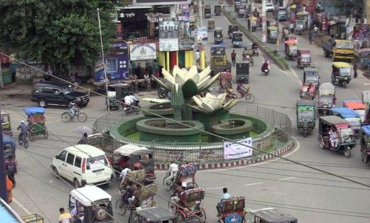
Sitakunda Upazila is located in the Chittagong District of southeastern Bangladesh, approximately 37 kilometers northwest of the port city of Chittagong. It is bounded by Mirsharai Upazila on the north, the Bay of Bengal on the west, and Hathazari and Fatikchhari Upazilas on the east. Covering an area of around 482.97 square kilometers, Sitakunda is notable for its diverse geographical features, including hills, forests, and coastal areas.<br><br> 
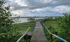
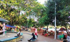
The upazila is renowned for its natural beauty, particularly the Sitakunda Eco Park and the Chandranath Hills, which attract tourists and nature enthusiasts. The Chandranath Temple, located on the Chandranath Hills, is a significant pilgrimage site for Hindus and offers panoramic views of the surrounding area. Additionally, the Sitakunda Botanical Garden and Eco Park, established to preserve the region's biodiversity, is a popular destination for visitors.<br><br> Economically, Sitakunda plays a vital role due to its industrial significance. It hosts a number of industries, including shipbreaking yards, which are some of the largest in the world. These yards recycle decommissioned ships, providing raw materials for steel production and generating employment for a large number of people. However, the industry also raises environmental and occupational health concerns.<br><br> 
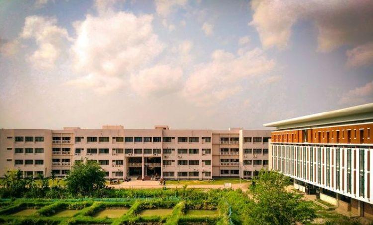
Agriculture remains an important sector in Sitakunda, with the cultivation of rice, vegetables, and fruits. Fishing is also a common livelihood due to its coastal location. The upazila's infrastructure includes educational institutions, healthcare facilities, and transport connectivity, contributing to its overall development.<br><br> Sitakunda's blend of natural beauty, industrial activity, and cultural heritage makes it a unique and important region in Bangladesh.
View Insights
Tangail Property Guide
Rating icon
3.5

Tangail
, Dhaka

Tangail is a district located in the central region of Bangladesh under the Dhaka division. This district was established in 1969. Tangail district has an area of 3,414.28 square kilometers and the present population is about 4,037,608. It is one of the cities of Bangladesh located 83 km northwest of the capital Dhaka. Jamalpur district to the north, Dhaka and Manikganj districts to the south, Mymensingh and Gazipur to the east and Sirajganj district to the west. Madhupur has an immense collection of natural beauty including forest and hilly areas. The district has some of its own culture and traditions, notably the weaving industry and the weaving of sarees. Basically the district is known for its rich cultural heritage, vibrant history and significant contribution to the country's economy and society.<br><br> The economy of Tangail is mainly based on agriculture. Major crops include paddy, jute, wheat, sugarcane and various vegetables. Tangail excels especially in jute production. Tangail is equally famous for its traditional weaving industry. Apart from agriculture and weaving, Tangail has emerging industries like textiles, ceramics and food processing. There is employment for many people. Here people from different districts come for work who live together in harmony. Here different types of people and people of different races are living together as independently as themselves.<br><br> There are all kinds of accommodation facilities here. From public and private schools to universities. There are advanced government and private hospitals. The district has its own traditions and culture. Notable among these are the Karu art and the Tangail saree. Also has its own food habits and cuisine. Tangail sweets are very popular with people all over Bangladesh.<br><br> Since the district is well connected by road and highway network, the transportation system from Dhaka to all over Bangladesh is very convenient. Along with roads, there are railways and rivers which play a useful and important role in communication systems and any supply of trade. Tangail has one of the Bangabandhu Bridges which connects North Bengal with Dhaka.<br><br> Tangail district has a tropical monsoon climate. Naturally, Tangail has been playing an important role in the socio-economic landscape of the country with its diverse population, numerous educational institutions and an unmatched combination of historical and natural attractions. Its well-connected transport network adds to its importance, making it an important and dynamic region of Bangladesh.
View Insights
Terminal Road Property Guide
Rating icon
3.5

Terminal Road
, Rangpur

Terminal Road is located in Rangpur Sadar under the jurisdiction of Rangpur City Corporation. Various buildings, residential areas have been developed around this very modern road with four lanes and it has improved several times. The beauty of the terminal road will amaze you and the road has facilitated the communication of Rangpur district with other districts. We know that the better the transport system, the better the quality of life. As the road is connected to Rangpur city, the residents can enjoy many modern facilities. Supply of electricity, gas, water etc. is adequate. Also educational institutes, hospitals, entertainment places etc. are also within reach, there are security arrangements.<br><br> As the road is connected with the bus terminal, it is easy to travel from here to the northern regions including Dinajpur, Nilphamari and Syedpur. Apart from this, Terminal Road is one of the top rated places in Rangpur. Surrounded by lush green surroundings, this place is a reflection of the hustle and bustle at the same time.<br><br> Overall, Terminal Road represents Rangpur's modernity. The residential areas, factories, commercial expansion, communal harmony, various shopping malls, markets, etc., centered around this road offer a dynamic mix of lifestyle. Besides, as the place is located in the district headquarters, you will get all kinds of facilities. The communication system from this place to other places is so advanced that you can travel with peace of mind. You can understand the entire tradition and culture of Rangpur from here.
View Insights
Tilagor Property Guide
Rating icon
3.5

Tilagor
, Sylhet

Tilagor is considered a suitable place to live in Sylhet due to its wide range of amenities, strategic location and pleasant environment. Tilagor is located within the Sylhet metropolitan area, northeast of the city center. It is also well connected to unique parts of Sylhet through the road network. The area is characterized by its rolling hills, greenery and natural beauty typical of the Sylhet region. The terrain of this place is slightly higher than that of the city. Srilekha offers a variety of attractive options including modern apartment complexes, individual homes and gated communities. The area is also known for its peaceful and family friendly atmosphere. Originally made ideal for families, professionals and students.<br><br> A variety of local businesses and small enterprises contribute to Tilagarh's economic vibrancy. There are job opportunities in education, healthcare and unique sectors. The area is also attractive for real estate investment and business ventures due to its strategic location and growing infrastructure. Also, during the paddy harvesting season, laborers come from different parts of the country for agricultural work. Overall Tilagarh contributes to a mixed economy and people of different castes, religions, castes and tribes live together and maintain a bond of harmony that is one of the virtues of its residents.<br><br> Tilagor is also very advanced in terms of education and health services. There are several reputed schools in and around Tilagor, which provide quality education from primary to secondary level. Shahjalal University of Science and Technology is one of the top public universities in Tilagore in Bangladesh. On the other hand, there are various health care facilities including hospitals and clinics providing general and specialized medical services. And since Sylhet Sadar is located very close from here, it is very easy to travel if you want to get any advanced services.<br><br> Like the economy, education and healthcare, the transport system here is also well developed. Local buses, rickshaws, autorickshaws, CNG and ride sharing are available as means of local communication. And a good road network ensures smooth transportation with other parts of Sylhet city. Also from here it is very convenient to travel around the country including the districts around Sylhet. In addition to road communication, there are communication systems through air and rail.<br><br> Tilagor is rich in history and tradition. Culturally, it is one of Sylhet's courtyards. They have their own regional language and diversity of cuisine. Which will impress others.<br><br> Basically, all the essentials for living are available here. There are selected electricity and good water supply systems. Internet connectivity and waste disposal facilities are also quite good. There are various facilities and places for entertainment. Tilagor Eco Park is a notable recreational spot. Also the beauty of the natural environment here attracts people. A design surrounded by greenery brings tranquility to the eyes of people. Besides, the security system here is also very good.<br><br> Overall, Tilagor is a lively and well-equipped area of Sylhet area. Its strategic location, extensive facilities, peaceful environment and continuous development are contributing to this. Although the area faces several challenges of natural calamities and urbanization, the region's growth and improvement in quality of life is a bright prospect for its residents.
View Insights
Town Hall Property Guide
Rating icon
3.5

Town Hall
, Mymensingh

The Sadar area of Mymensingh might seem chaotic and densely populated, but it also offers better living facilities if you plan to move to the area, whether temporarily or permanently. One significant part of it is the Town Hall and its nearby locations. This is where one of the major aspects of city life in the Mymensingh District begins.<br><br> The Town Hall area guide revolves around the old architect or landmark called Town Hall. It was established in 1884 during the Zamindari period. Maharaja Suryakanta spent over thirty thousand taka during that time to build it along with the library. It even had a revolving stage at one time.<br><br> People who practiced arts and cultural projects held various programs inside the Town Hall auditorium. It was renovated again in 1974, and everything took a new turn there. In addition to the cultural programs, many political meetings and official programs were also held inside it.<br><br> The busiest part of the area is the Town Hall mor or circle. Though there is no specific bus stoppage in the location, it is the route to many destinations across the city and the district. With transport moving around the area all the time, you can certainly expect it to be busy and hear the honking of horns and the bells of rickshaws all the time.<br><br> Despite that, housing and residential places have grown here over time. You can find apartments in various rental ranges around Town Hall. It also has a mosque at the mor, along with schools, colleges, various offices and services.
View Insights
Valuka Property Guide
Rating icon
3.5

Valuka
, Mymensingh

Bhaluka is one of the upazilas under Mymensingh district and the first model police station in Bangladesh. Bhaluka is one of the basic industrial city of Bangladesh. Baluka is called the door of Mymensingh. Rajendrapur cantonment (Gazipur) and Mauna Chowrasta (Sripur) on the Dhaka-Mymensingh highway via Sripur about 70 kilometers after Bhaluka upazila. The area of Bhaluka Upazila is 444.05 square kilometers. This Bhaluka Upazila consists of one municipality and ten unions. The entire administrative activities of this upazila are under the purview of Bhaluka police station.<br><br> According to current data, bears are home to about 15 lakh people. Baluka has become a sophisticated place for its business expansion and introduction. This Bhaluka Upazila is making a big contribution in the industrial sector, agricultural sector, fishery sector, etc. Khiru River flows past Baluka Bazar. The natural environment is also very beautiful in this place which will impress you. This place is rich with modern quality educational institutions, medical services, security systems, etc.<br><br> Usually, it is a combination of a commercial area and a residential area. The place is a bit crowded. You can experience the heritage, culture, and secularism of Mymensingh through this place. A citizen living here can enjoy all kinds of facilities for a good life.<br><br> Overall, the place is a combination of the garment industry, basic industry, agriculture sector, industrial activities, etc. Here you can get all arrangements from medical to education. The dynamic quality of life here will impress you. You can live here with peace of mind as the security system is very strong. As the place is called the Door of Mymensingh, the place will present you with the lifestyle, traditions, and culture of Mymensingh.
View Insights
Zero Point Property Guide
Rating icon
3.5

Zero Point
, Khulna

If you stand still on a random street in Khulna Sadar and listen to the conversations going around you, you will notice the name Zero Point coming up very often. Zero Point is an integral part of Khulna. If you are thinking about going on a trip to Khulna, this Zero Point area guide will help you navigate and traverse through the area.<br><br> Khulna Zero Point is situated at Batiaghata Upazila. The intersection is located near the police station Horintana Thana and the Khulna Weather Office. This is the threshold of Khulna Sadar, which interconnects the Khulna City Bypass National Highway, Rupsa Bridge approach road, and Khulna-Chuknagar-Satkhira Regional Highway.<br><br> You may be wondering why Zero Point is such the talk of the town. Zero Point is basically an intersection that works as a transportation hub. Several major highways intersect here, providing convenient access to various regions of the city and beyond. Many public transit choices are available, including buses, minibusses, and cycle rickshaws.<br><br> Many businesses and commercial institutions have flourished surrounding the Zero Point intersection. The area is well-known for its thriving business scene, with several stores, markets, and businesses catering to the needs of both locals and visitors.<br><br> This area is mostly bustled with students of Khulna University, which is adjacent to the premise of Zero Point. From hangout to daily shopping, people of Khulna and students of the university always opt for Zero point, making it a bustling hub day and night.<br><br> This intersection has a direct link to the Mongla port, which is 45 Km away from Zero Point. So, large business transportation traverses through this region to reach all over Bangladesh. So, this is certainly a critical junction for a thriving economy.
View Insights
60 Feet Road Property Guide
Rating icon
3.4

60 Feet Road
, Dhaka

As the name suggests, 60 Feet Road is a road that is 60 feet wide. But it would be incorrigible to postulate it as just another road in Dhaka. This area runs through the heart of the southern part of Mirpur and connects as a bridge between Kallyanpur, Agargaon, and Mirpur South.<br><br> Popularly known as Kamal Sarani, this road has become a crucial junction in the Dhaka traffic system. As this road bridges the gap from Mirpur to other parts of Dhaka, many buses and private cars opt for this route to reach the Mirpur area. Moreover, as the wide length of the road can accommodate more vehicles, people often choose this route to avoid traffic jams.<br><br> This 60 Feet Road cuts through some of the most densely-populated areas of Mirpur. Monipur, Kazipara, Paikpara, and Shimultola are some of the areas connected by this road. As the residents of these areas utilize this road for transportation and communication, you can guess how busy this road becomes during office and school hours.<br><br> 60 Feet Road started as a mode of communication. But somehow became a popular spot for hangouts and tasty foods. This road has become a well-known hub for commodities and food ventures for the residents living nearby. Such hustle and bustle keeps the 60 Feet Road busy and chaotic during peak hours.<br><br> Not just for hangouts and entertainment, 60 Feet Road also bears significance in trade and commerce. Many corporate houses, banking institutions, brand outlets, and showrooms are scattered throughout the road. Such establishments are a great fillip to the economy of the 60 Feet Road area.
View Insights
IconMap

Featured Projects

View All

Property Price Trends in Bangladesh for

Buy
Rent
Bedrooms:
Average Price (Last 12 months)
BDT 6,440.08 per sqft
Past 12 months' growth
4.39%
Positive Trend
Past 3 months' growth
3.63%
Positive Trend
Icon
Price information is based on historical data from ads posted on Bikroy and may not reflect the full market dynamics.
hero

Sell or Rent Fast on Bikroy: Post Your Property in 2 Mins!