Search Icon

Explore Areas in Bangladesh

252 - 270 out of 303 areas
Tangail Property Guide
Rating icon
3.8

Tangail
, Dhaka

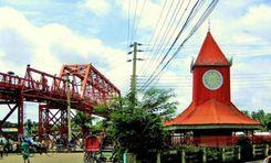
Tangail is a district located in the central region of Bangladesh under the Dhaka division. This district was established in 1969. Tangail district has an area of ​​3,414.28 square kilometers and the present population is about 4,037,608. It is one of the cities of Bangladesh located 83 km northwest of the capital Dhaka. Jamalpur district to the north, Dhaka and Manikganj districts to the south, Mymensingh and Gazipur to the east and Sirajganj district to the west. Madhupur has an immense collection of natural beauty including forest and hilly areas. The district has some of its own culture and traditions, notably the weaving industry and the weaving of sarees. Basically the district is known for its rich cultural heritage, vibrant history and significant contribution to the country's economy and society. <br><br> The economy of Tangail is mainly based on agriculture. Major crops include paddy, jute, wheat, sugarcane and various vegetables. Tangail excels especially in jute production. Tangail is equally famous for its traditional weaving industry. Apart from agriculture and weaving, Tangail has emerging industries like textiles, ceramics and food processing. There is employment for many people. Here people from different districts come for work who live together in harmony. Here different types of people and people of different races are living together as independently as themselves. <br><br> There are all kinds of accommodation facilities here. From public and private schools to universities. There are advanced government and private hospitals. The district has its own traditions and culture. Notable among these are the Karu art and the Tangail saree. Also has its own food habits and cuisine. Tangail sweets are very popular with people all over Bangladesh. <br><br> Since the district is well connected by road and highway network, the transportation system from Dhaka to all over Bangladesh is very convenient. Along with roads, there are railways and rivers which play a useful and important role in communication systems and any supply of trade. Tangail has one of the Bangabandhu Bridges which connects North Bengal with Dhaka. <br><br> Tangail district has a tropical monsoon climate. Naturally, Tangail has been playing an important role in the socio-economic landscape of the country with its diverse population, numerous educational institutions and an unmatched combination of historical and natural attractions. Its well-connected transport network adds to its importance, making it an important and dynamic region of Bangladesh.
View Insights
Tilagor Property Guide
Rating icon
3.8

Tilagor
, Sylhet

Tilagor is considered a suitable place to live in Sylhet due to its wide range of amenities, strategic location and pleasant environment. Tilagor is located within the Sylhet metropolitan area, northeast of the city center. It is also well connected to unique parts of Sylhet through the road network. The area is characterized by its rolling hills, greenery and natural beauty typical of the Sylhet region. The terrain of this place is slightly higher than that of the city. Srilekha offers a variety of attractive options including modern apartment complexes, individual homes and gated communities. The area is also known for its peaceful and family friendly atmosphere. Originally made ideal for families, professionals and students.<br><br> A variety of local businesses and small enterprises contribute to Tilagarh's economic vibrancy. There are job opportunities in education, healthcare and unique sectors. The area is also attractive for real estate investment and business ventures due to its strategic location and growing infrastructure. Also, during the paddy harvesting season, laborers come from different parts of the country for agricultural work. Overall Tilagarh contributes to a mixed economy and people of different castes, religions, castes and tribes live together and maintain a bond of harmony that is one of the virtues of its residents.<br><br> Tilagor is also very advanced in terms of education and health services. There are several reputed schools in and around Tilagor, which provide quality education from primary to secondary level. Shahjalal University of Science and Technology is one of the top public universities in Tilagore in Bangladesh. On the other hand, there are various health care facilities including hospitals and clinics providing general and specialized medical services. And since Sylhet Sadar is located very close from here, it is very easy to travel if you want to get any advanced services.<br><br> Like the economy, education and healthcare, the transport system here is also well developed. Local buses, rickshaws, autorickshaws, CNG and ride sharing are available as means of local communication. And a good road network ensures smooth transportation with other parts of Sylhet city. Also from here it is very convenient to travel around the country including the districts around Sylhet. In addition to road communication, there are communication systems through air and rail.<br><br> Tilagor is rich in history and tradition. Culturally, it is one of Sylhet's courtyards. They have their own regional language and diversity of cuisine. Which will impress others.<br><br> Basically, all the essentials for living are available here. There are selected electricity and good water supply systems. Internet connectivity and waste disposal facilities are also quite good. There are various facilities and places for entertainment. Tilagor Eco Park is a notable recreational spot. Also the beauty of the natural environment here attracts people. A design surrounded by greenery brings tranquility to the eyes of people. Besides, the security system here is also very good.<br><br> Overall, Tilagor is a lively and well-equipped area of ​​Sylhet area. Its strategic location, extensive facilities, peaceful environment and continuous development are contributing to this. Although the area faces several challenges of natural calamities and urbanization, the region's growth and improvement in quality of life is a bright prospect for its residents.
View Insights
Vodra Property Guide
Rating icon
3.8

Vodra
, Rajshahi

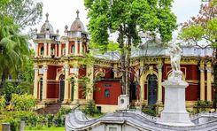
Vodra is a popular residential area of ​​Rajshahi which is well known in Rajshahi for its convenient location and amenities. It is located at a distance of just 2.4 km from Rajshahi Zero Point. The Bhadra residential area is surrounded by better security and people become interested in living here. House rent here is quite convenient compared to the divisional city. Also offers a perfect combination of education, medical, entertainment and various residential facilities.<br><br> It also has all the necessary facilities for living such as gas, electricity and drinking water. Surrounded by security, the environment of this area is quite clean which preserves the heritage of Rajshahi city. Also as the place is located in the divisional city, all the facilities of Rajshahi division are available. <br><br> People of different religions, castes and professions live here. People from different districts of the country come here for jobs and everyone maintains nice and good relations with each other. Which helps to maintain the sense of brotherhood. <br><br> There is Rajshahi Medical College Hospital for medical services. There are also public and private health centers nearby. Where you will get the opportunity to get services from one of the best doctors in the country.<br><br> In addition to medical treatment, the education system here is quite advanced. On one side is Rajshahi University and on the other side is RUET which facilitates higher education for the new generation here. Barendra Medical College and Hospital is here which plays an equally important role for both medical and educational work. <br><br> The quality of roads and transport system of Rajshahi city is very good. There is a Vodra bus stand which serves as a busy transport hub. This stand provides bus services to various nearby districts. Apart from this, there are international and national transportation opportunities by rail and air. <br><br> Vodra is one of Rajshahi's hubs for entertainment. One of them is Vodra Park and Vodra Lake. Where people get a chance to walk in the morning and evening in a pleasant environment surrounded by greenery.<br><br> Overall, Rajshahi's Vodra offers a blend of natural beauty and clean and essential urban services. And it is well developed and surrounded by security that makes it habitable and offers all the amenities.
View Insights
Agrabad Property Guide
Rating icon
3.8

Agrabad
, Chattogram

Agrabaad, a high-and-mighty commercial hub based in Chattogram, stands tall amid the Karnaphuli River and lush hills. It is an amazing confluence where commerce meets nature. This place is a home for various national and international businesses and financial institutions. Badam-tali Road and Sabdar Ali Road are the prime streets where trade meets life. <br><br> Just to give you a glimpse of its importance, the Chattogram Chamber of Commerce and Industry, the Chattogram Stock Exchange office, and the World Trade Center are based here. With top-shot business companies, banking institutions, and financial firms, Agrabad is hailed as the ‘Hong Kong’ of the East. <br><br> However, business and commerce are not in focus here. You can find all the urban facilities and amenities. Jamboree Park is one of the highlights for the Chattogram People. Agrabad has to offer medical colleges, residential areas, colonies, big streets, restaurants, and some of Chattogram’s best schools. <br><br> Doing justice to the name Port City, Agrabad is a periphery for boarding and unloading containers and transporting them to the port. This keeps the area busy day and night. The fluorescent street lights and non-stop buzz keep the city alive 24/7. The concoction between a residential space and a commercial hub makes this area unique. <br><br> Since it is a commercial area, shopping centers are a big chunk of this city. Singapore Bangkok Market, the Lucky Plaza, and Akhtaruzzaman Center are some of the finest spots for shopping. The state-of-the-art Ethnological Museum and Karnaphuli Shishu Park are the biggest tourist attraction in this area.
View Insights
Amber Khana Property Guide
Rating icon
3.8

Amber Khana
, Sylhet

Ambar khana is located in the heart of Sylhet metropolis. This point is very important point for tourism, business and transportation. On its north side are Hazrat Shahjalal International Airport and Sylhet International Cricket Stadium. Also, Bangladesh's first tea garden 'Malanichara' is located very close to this area. To the south of this area is the shrine of the famous Auliya Hazrat Shahjalal Yemeni (RA). There are also Sylhet Government Aliya Madrasa, and Ambar khana Girls School and College. The traditional MC College and Shahjalal University of Science and Technology are located on the western side of this area. <br><br> Ambar khana Jame Masjid is one of the famous mosques of this area and the country. There is a police station at Ambar khana, Address - Mojumdari Airport Road 3100, Sylhet. Fire service station is about 3 km away in Bandar-Bazar area. This area is very important as it facilitates tourism, agriculture, tea and import and export from the border area. Being an economically important area, there is a need to improve communication and accommodation. <br><br> Being a tourist city, Ambar khana in Sylhet can be reached directly by bus from the main cities of the country. About 5 km from Sylhet Railway Station, Ambar khana Point. From Amber khana, there are direct buses, CNG and hired vehicles to all the tourist spots including Sadapathar, Bholaganj, Companyganj, Ratargul Swamp Forest, Bisthakandi, Hazrat Shahjalal (RA) Shrine, Jaflong, Tamabil, Lalakhal, Hakaluki Howar.
View Insights
Amtala Property Guide
Rating icon
3.8

Amtala
, Barishal

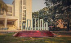
Amtala is an important commercial, economic, and residential area in Nazirpur Sadar Union of Barisal District. This area, surrounded by roads and waterways, is also important for transportation. Kaliganga River and Balaswar River flow through this area. The location is well known for the production and transportation of agricultural products. Although it is crowded with raw markets, educational institutions, government offices, banks, and various private institutions, the picturesque riverside rural landscape adds to the charm of the area. Barisal district is also known for its riverine environment, natural beauty, and rich cultural heritage. Many people call Barisal the "Venice of the East".<br><br> Amtala area is located in the southern part of Bangladesh in Barisal district. To the east of this area are Bhola, and Jhalkathi districts. Khulna and Bagerhat districts on the West. Gopalganj and Madaripur districts in the North. To the South are the districts of Pirojpur, Patuakhali, and Barguna. Gopalganj-Tungipara-Nazirpur-Pirojpur highway road connects this area with almost all the important district towns of the country. Being an area surrounded by rivers, many people use waterways for the transportation of goods and communication.<br><br> The economy of Amtala is mainly based on agriculture. Local agricultural produce includes paddy, jute, and various fruits and vegetables. Fishing is also an important part of the local economy. Local people here are involved in agriculture, fishing, and transportation-based occupations. In and around the area there are excellent schools, health care centers, and recreational centers. The area is known for its river system, green environment, and significant agricultural activity.<br><br> Due to the important economic area and advanced communication system, continuous efforts to improve the infrastructure and living conditions of this area are noteworthy. Government development projects are constantly working to improve transport, education, and healthcare facilities. Being a riverine area, Amtala is prone to floods, affecting agriculture, infrastructure, and daily life.<br><br> The Amtala area has accommodations ranging from mid-range hotels to top-class accommodations. The business network in the area is very extensive. Bus stand, port terminal, and airport are located very close to this area. Finally, the Amtala area is quite suitable for residential and commercial activities. But the overall quality is not as good as in urban areas.
View Insights
Bakerganj Property Guide
Rating icon
3.8

Bakerganj
, Barishal

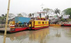
Bakerganj is a charming upazila in the Barisal district. The area is well known for agricultural activities and fish production. It is well-known as a populous and business center developed along the banks of the Srimant, Karkhana, Bighai, Payra, and Bishkhali rivers. A vibrant business environment, and improved communication system, have created a lot of employment opportunities in the area. Also, this area is unique from the administrative point of view.<br><br> All upazilas and almost all district towns of the country can be connected from Bakerganj by river and road. To the North of this upazila are Nalchiti upazila and Barisal Sadar of Jhalkathi district. Dumki Upazila of Patuakhali District, and Mirzaganj Upazila towards the South. Baufal Upazila and Bhola Sadar of Patuakhali district on the East side. Rajapur Upazila and Nalchiti Upazila of Jhalkathi District and Betagi Upazila of Barguna District on the West side.<br><br> Bakerganj Upazila is surrounded by green fields and rivers. The local economy is based on agriculture and fishing. The land in this area is very fertile. The local traditional festivals, handicrafts, and historical relics of the Mughal period will fascinate you. During the reign of Nawab Alivardi Khan of independent Bengal, Zamindar Agabaker Khan of Umedpur named this region Bakerganj after himself in 1741.<br><br> Besides the natural beauty, Bakerganj has several good-quality educational institutions, madrasas, clinics, parks, and local markets. Local people here are involved in agriculture, fishing, transportation of goods, and small businesses. Bakerganj Upazila is a great option for those who want to live away from the urban noise in a rural serene environment with standard amenities. The blend of rural life with modern conveniences here will impress you.<br><br> Barisal Airport, river port, and bus stand are close to this area. Dhaka-Patuakhali Highway, Barisal-Subidkhali Road, and Bangga-Barisal Highway connect this area with almost all district roads of the country. Bakerganj's communication system and other civic facilities are very convenient for housing, employment, and business. Being economically and commercially developed, several housing projects and infrastructure are being developed in the area. Roads connecting the surrounding areas are also well-developed.
View Insights
Bandar Bazar Property Guide
Rating icon
3.8

Bandar Bazar
, Sylhet

Immersed in people and activities, Bandar Bazar is one of the busiest places in Sylhet. According to the Bandar Bazar area guide, it is located in the 14th ward of the Sylhet City Corporation. It is distinctively known as the location of Hawkers' Market, Hasan Market, and Karimullah Market. Besides, businesses and residential hotels always keep the environment in a rush. <br><br> When visiting Bandar Bazar for the first time, you will find yourself in alleys of shops and stores. Wherever you lay your eyes, you will see stalls everywhere. Their owners display plenty of products and call potential customers to catch their attention or are busy negotiating with them. <br><br> Whatever you want to purchase, clothing, handicrafts, household items, grocery items, you will find them. The Bazaar will never let you leave empty-handed. It will be a bonus for you if you are adept at bargaining. <br><br> Bandar Bazar, an important trading zone for Sylhet, has a rich past that is as old as several centuries. In addition, the establishments in the region share that past, reflecting the architectural background of the colonial era while boasting Sylhet’s own traditional legacies at the same time. <br><br> Seated at a crucial point of the city, Bandar Bazar offers its locals easy transportation to other areas. Also, the streets are swarmed with small food vendors offering traditional Sylheti foods. If you want to relax at a cafe or eat in a restaurant, you will also find them nearby. <br><br> And there is more. The place has several historical landmarks and recreational spots, making Bandar Bazar a delightful place to roam around.
View Insights
Bandar Bazar Property Guide
Rating icon
3.8

Bandar Bazar
, Sylhet

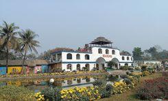
Immersed in people and activities, Bandar Bazar is one of the busiest places in Sylhet. According to the Bandar Bazar area guide, it is located in the 14th ward of the Sylhet City Corporation. It is distinctively known as the location of Hawkers' Market, Hasan Market, and Karimullah Market. Besides, businesses and residential hotels always keep the environment in a rush. <br><br> When visiting Bandar Bazar for the first time, you will find yourself in alleys of shops and stores. Wherever you lay your eyes, you will see stalls everywhere. Their owners display plenty of products and call potential customers to catch their attention or are busy negotiating with them. <br><br> Whatever you want to purchase, clothing, handicrafts, household items, grocery items, you will find them. The Bazaar will never let you leave empty-handed. It will be a bonus for you if you are adept at bargaining. <br><br> Bandar Bazar, an important trading zone for Sylhet, has a rich past that is as old as several centuries. In addition, the establishments in the region share that past, reflecting the architectural background of the colonial era while boasting Sylhet’s own traditional legacies at the same time. <br><br> Seated at a crucial point of the city, Bandar Bazar offers its locals easy transportation to other areas. Also, the streets are swarmed with small food vendors offering traditional Sylheti foods. If you want to relax at a cafe or eat in a restaurant, you will also find them nearby. <br><br> And there is more. The place has several historical landmarks and recreational spots, making Bandar Bazar a delightful place to roam around.
View Insights
Banglabazar Property Guide
Rating icon
3.8

Banglabazar
, Barishal

Banglabazar is a vibrant commercial and residential area in the heart of Barisal district. The area is economically critical, with important government and private offices, river ports, and connected highways. Located on the banks of the Kirtankhola River, the Banglabazar area is considered a bustling commercial center for goods transportation, communication, and agricultural products production. Here, you will find everything from clothing and electronics to restaurants and raw markets.<br><br> Barisal Airport, river port, and bus stand are located very close to this area. Bangga-Barisal Highway, C&B Road, Bangla Bazar Road, and Shaheed Ali Road, connect this area with almost all district roads of the country. To the West of the area are Jhalkathi, Pirojpur, Khulna, and Bagerhat. To the North are Barisal Sadar, Gopalganj, Madaripur, and Shariatpur. Bhola and Noakhali districts on the East. Patuakhali and Barguna districts on the West.<br><br> Advanced educational institutions like Sher-e-Bangla Medical College Hospital, Institute of Health Technology, and Barisal Polytechnic Institute are located in this area. There are also many schools and madrassas in and around this area. There are several advanced healthcare clinics here. Also, the parks and recreation centers here are quite interesting.<br><br> The transport network of Banglabazar is connected with other parts of the Barisal district and across the country by road and waterways. The economy of this area is mainly based on agriculture, transportation of goods, and fishing. Also, the area is always bustling with raw markets, retail, and wholesale businesses. The area is known for its rich cultural heritage, natural beauty, and historical monuments.<br><br> Surrounded by rivers, and surrounded by greenery, the natural beauty of Banglabazar will enchant you. Roads, water supply, and sanitation facilities in this area are well developed. However, footpaths and parking spaces are narrow. As river ports, factories, and businesses are built here, its main roads are congested.<br><br> Banglabazar's communication system and other civic facilities are very convenient for housing, employment, and business. Being economically and commercially developed, several housing projects and infrastructure are being developed in the area. Roads connecting the surrounding areas are also well-developed. Police Station and Fire Service are located very close by. Traffic congestion, lots of auto rickshaws, and environmental pollution are the main problems here.
View Insights
Bogura Property Guide
Rating icon
3.8

Bogura
, Rajshahi

Bogra is an important industrial and commercial city located in Rajshahi Division in northern Bangladesh. The significance of this district is very high in all aspects of agriculture, economy, communication, and education. It is also known for its rich history and cultural heritage. Mahasthangarh in Bogra is one of the oldest archaeological sites in the world.<br><br> Bogra is famous for curd, kattakti (sweets) and ghee. It also produces large quantities of rice, potatoes, vegetables, and jute, and is supplied throughout the country. The region is often called the "Granary of Bengal" due to its fertile land and abundant agricultural production. Satmatha, Banani Bazar, and New Market areas of Bogra have many public and private hospitals, shopping malls, supershops, eateries, and electronics stores.<br><br> Bogra's economy is diverse. Along with cement, bricks, sand, construction materials, textiles, and handicrafts are gradually developing. According to a recent survey, the district has a large number of small to medium enterprises (SMEs) that contribute to the local and national economy.<br><br> The city is well-connected to the rest of the country by road and rail. The railway network connects Bogra to major cities including Dhaka, Rajshahi, and Rangpur. The N5 highway connects the city with Dhaka, Tangail, Gazipur, and the northern districts. Currently, the city has undergone several infrastructural developments, including transportation, improvement of Highway Road 6 to 8 lanes, improvement of healthcare and public services, improving the quality of life of its residents, etc. Bogra is often referred to as the "Gateway to North Bengal".<br><br> Bogra is an attractive place for tourists. Mahasthangarh, Gokul Medh, and Vasu Vihar are ancient archaeological sites here. Also, the Kherua Mosque and the Nawab Palace are fine architectural examples built during the Mughal period. The people of this region are very hospitable.<br><br> There are advanced educational institutions like Bogra District School, Bogra Government Girls High School, Bogra Cantonment Public School and College, Government Azizul Haque College, Shaheed Ziaur Rahman Medical College, and Bogra Polytechnic Institute. In Bogra, you will find a variety of accommodation options ranging from standard to 5-star. Hotel Naz Garden, Hotel Siesta, Parjatan Motel, Momo-Inn, etc. are famous hotels here.
View Insights
Brahmanbaria Property Guide
Rating icon
3.8

Brahmanbaria
, Chattogram

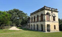
Brahmanbaria is an important economic and commercial city located in the eastern part of Bangladesh. The district is a busy center of administrative and financial activity with well-developed communication systems, natural gas, power plants, agricultural products, and import-export routes. From serene rural surroundings, local handicrafts, and lively markets to modern architecture, and commercial atmosphere, you'll find it all here.<br><br> Geographically, Brahmanbaria is located on the banks of the Titus River, which plays an important role in the agricultural and industrial sectors of the region. The cultivation of rice, jute, and fruits here contributes significantly to the local economy. Bounded by the Meghna River in the south and the Tripura Hills of India in the east, the district is rich in natural beauty. Muslin cloth and Chandramukhi sweets are very famous here.<br><br> This district is bordered by Kishoreganj and Habiganj districts to the north, Narsingdi and Narayanganj districts to the west, Comilla and Feni districts to the south, and Tripura state of India to the east. The upazilas of this district are - Brahmanbaria Sadar, Kasba, Akhaura, Ashuganj, Bancharampur, Vijaynagar, Nasirnagar, Nabinagar and Sarail upazilas.<br><br> The contribution and importance of the district to the national economy is immense. Titus, Salda, and Meghna gas fields are located in this district. These three gas fields supply about one-third of the country's total production. Besides, Ashuganj thermal power station is the second largest power generating station in the country. Ashuganj Fertilizer Factory is the largest urea fertilizer factory in the country. Garment industries, leather factories, textiles, iron mills, electricity, and natural gas establishments, and agriculture-based plants have created a lot of employment. The educational institutions and medical centers here are also standard.<br><br> Culturally, Brahmanbaria is famous for its traditional folk music. Historically, the city has been influenced by different civilizations and rulers, resulting in a variety of architecture and historical monuments. The area stands as a testament to the country's rich cultural tapestry and historical significance.<br><br> Brahmanbaria is one of the most important towns in the country in terms of economy, education, art culture, and communication. Being an important border area, the district serves as an important center of trade and commerce. The district is well-connected by road and rail. While the city is economically prosperous, the rural areas lack connectivity and infrastructure.
View Insights
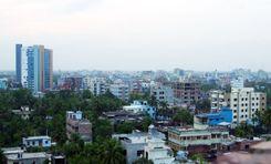
Chandpur Property Guide
Rating icon
3.8

Chandpur
, Chattogram

Chandpur is a naturally vibrant district of Chittagong division. It is located in the country's southeastern part, near the confluence of the Padma and Meghna rivers. Situated at the outfall of a river, the city is an important center for agricultural activities, river transport, and trade. The district is also known for its rich cultural heritage and natural beauty.<br><br> Chandpur district is located in the basin of the Padma and Meghna Rivers. It is bounded by Munshiganj and Comilla districts to the north, Noakhali, Laxmipur, and Barisal districts to the south, Comilla district to the east, Meghna River, Shariatpur and Munshiganj districts to the west. The upazilas of this district are - Chandpur Sadar, Faridganj, Haimchar, Hajiganj, Kachua, Matlab South, Matlab North and Shahrasti upazilas.<br><br> Chandpur, the breeding and habitat of silver hilsa, the national fish of Bangladesh. Meghna River serves as a lifeline for transportation, fishing, and agriculture. This charming environment, bustling river port, and hilsa town make this district very attractive to tourists. Beyond its economic significance, Chandpur fascinates visitors with its lush greenery, serene environment, and tapestry of riverine Bengali culture.<br><br> Chandpur's economy is mainly driven by agriculture, fishing, and trade. The city's roads, railways, and waterways have contributed significantly to the country's economy, particularly in agriculture, fisheries, and cargo trade. The city serves as an important transportation hub connecting various regions of the country by road, rail, and waterways. Education and medical facilities in Chandpur are also quite good.<br><br> Rupsa Zamindar Bari is a notable landmark, reflecting the region's rich architectural and cultural heritage. During the reign of the twelve Bhuiyans, this region was held by Chand Roy, son of Kedar Roy, the zamindar of Bikrampur. According to historian JM Sengupta, the region was named Chandpur after Chand Roy.<br><br> The city has cultural importance as a center of literature, art, and music. Also, various social programs, youth clubs, training centers, and recreation centers in the area contribute to intellectual and social development. The area attracts visitors interested in river cruises, fishing, and exploring the picturesque countryside.<br><br> Being an important center for trade, communication, and transportation of goods, the city is developing residential and commercial infrastructure. Also considering the importance of communication, roads and bridges are being constructed and renovated as planned in the rural areas of the district. Ongoing development and initiatives aimed at furthering the city's prosperity, promise a bright future.
View Insights
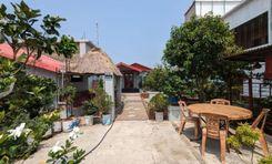
Chaukbazar Property Guide
Rating icon
3.8

Chaukbazar
, Dhaka

If you talk about one of the oldest and bustling marketplaces or areas in old Dhaka, you have to mention the Chaukbazar area. And if you want to know the Chaukbazar area guide well, you should also be familiar with its history and significance.<br><br> Also spelled “Chawkbazar,” this area was established in the 17th century CE during the Mughal period. It was first named Badshahi Bazar by Murshid Quli Khan after its establishment. But later, the area was called Chaukbazar.<br><br> The Chaukbazar thana, formed in 2009, is now a part of Dhaka South City Corporation. It is surrounded by Bangshal Thana and Laalbag Thana and has an area of 2.07 sq./km. According to the 2011 census, the area's population is about 1,60,112.<br><br> From the beginning, the area was known for its marketplace, with hundreds of shops, stalls, vendors, and more. Even after 400 years, this place is still one of the popular market areas.<br><br> The Caukbazar Shahi Jame Masjid is one of its most significant landmarks. It also has the shrine of the area’s founder, Murshid Quli Khan.<br><br> Every year during Ramadan, the streets of Chaukbazar get crowded because of its Iftar Bazaar. It is Dhaka’s oldest and most popular iftar bazaar, and people from inside and outside the city come here to buy iftar during the holy month.<br><br> Another reason Chaukbazar is known to many people is because of the old Central Jail of Bangladesh. It has recently been turned into a jail museum after the jail has been relocated. <br><br> With its narrow streets and busy lifestyle, Chaukbazar is one of the most crowded parts of Dhaka. Nevertheless, the area also offers communication access to many parts of Dhaka and has schools, colleges, and medical and financial institutions. However, many parts of the area are yet to be developed.
View Insights
Cumilla Property Guide
Rating icon
3.8

Cumilla
, Chattogram

Comilla is an important economic and commercial city in the southeastern part of Bangladesh. It is the third-largest city in the country in terms of population. From archaeological treasures, the city is known for vibrant markets, picturesque landscapes, a business-friendly environment, a well-developed communication system, and well-planned housing. It is a city bustling with modern vibrancy, surrounded by a blend of history, culture, and natural beauty. The city is also important in terms of communication and administration.<br><br> The Feni, Noakhali, and Chittagong districts are south of the city. Munshiganj, Habiganj, and Chandpur districts in the west. Dhaka, Narayanganj, Narsingdi, and Brahmanbaria districts in the north. India's Agartala border (Tripura State) to the east. Gomti and Dakatiya rivers flow through Comilla. It is well-connected by road and rail, connecting it to the country's major cities, including the capital Dhaka and the port city Chittagong. These communication networks make it a vital node in Bangladesh’s trade network.<br><br> Comilla University, Ispahani Public School and College, Cantonment College Comilla, Victoria College, etc. educational institutions are considered one of the country's best. The city has several schools and colleges serving the educational needs of the local population.<br><br> Comilla's 'Ros Malai' has been awarded Geographical Indication (GI) status. Shalbon Vihar, Mainamati Ruins, and Dharmasagar Pond are some of the historical sites of the city. The city's strategic location, cultural heritage, and growing infrastructure have contributed to its significance in the country's landscape.<br><br> The economy here is based on agriculture. The city also has small and medium-scale industries including Khadi textiles, pharmaceutical factories, garments, and IT companies, which are contributing significantly to its economy. Comilla Export Processing Zone (CEPZ) is a prominent industrial zone in the country, established to promote export-oriented industries and foreign investment. It is contributing significantly to industrial output and employment generation.<br><br> In recent years, the city has seen infrastructural improvements in roads, healthcare, and residential areas. Tourists can enjoy the historical monuments in Comilla and the natural beauty of the surrounding countryside, while the hospitality of the locals also attracts visitors. As the importance of this city increases as a center for investment, development projects, commercial; residential, and infrastructural development is increasing here.<br><br>
View Insights
Dacope Property Guide
Rating icon
3.8

Dacope
, Khulna

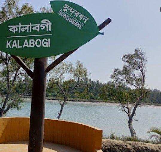
For anyone who wants to explore the mystery and beauty of the Sundarbans Mangrove Forest and its nearby locality while enjoying a few nights’ stay, there is no better way to get there than the Dacope. This upazila of the Khulna District is located at the far end of the district. It was established as a thana of the district in 1906 but was converted into an upazila in 1983.<br><br> The Dacope area guide shows the upazila has a land area of 382.85 square kilometers. However, it is about 991.56 square kilometers, including Sundarbans. It has a population of more than 1.5 lakh. It is bounded by Batiaghata Upazila in the north, Sundarban Forest in the south, Batiaghata Upazila and Rampal Upazila (of Bagerhat) in the east, and the Paikgacha Upazila in the west.<br><br> What makes this upazila stand out is that it offers more facilities and accommodations for visitors and tourists than other nearby areas. Travelers can access Dacope from the Khulna City area and use the Batiaghata upazila route directly via bus.<br><br> Though there are no railway routes in the area, people also use ferries, boats, and launches to cross rivers or visit the locations of Sundarbans forest areas. The main water bodies surrounding the upazila are the Shibsa River, Pasur River, Chunkuri River, Jhapjhapaia Canal, etc.<br><br> Though Dacope seems like a locality from the main town, it is one of the few upazilas with more paved roads than mud roads. It also has over 650 bridges and culverts. While communications in the area are pretty good compared to many others, natural disasters often cause havoc in daily life here.<br><br> Because it has many ponds, rivers, canals, and other water sources, the economy of the upazila has flourished due to fisheries and shrimp cultivation. It has over 6,110 ponds, over 4,500 lobster farms, 40 shrimp farms, and 4 shrimp hatcheries. There are also over 867 poultries in Dacope.<br><br> Notable educational institutes in Dacope are Muhammad Ali Secondary School, Chalna Bazar Government Girl's High School, Chalna MM College, etc. Historical and other notable landmarks are Karamjal Wildlife Breeding Center, Kalibagi Eco Tourism Center, Shekher Tek Eco Tourism Center, Ruin of Shibsha Temple, Chalna Lunch Terminal, etc.
View Insights
Feni Property Guide
Rating icon
3.8

Feni
, Chattogram

Feni is a district in the Chittagong Division, located in the southeastern part of Bangladesh. The city is an important center of trade and commerce due to its advanced communication system, and strategic location. The Muhuri and Feni rivers surround it. Khandal misti of this district is very famous. The climate here is humid, but the region receives a lot of rain during the monsoon season.<br><br> The district is bordered by Noakhali to the west, Chittagong to the east Comilla to the north, and Tripura state of India, Bay of Bengal to the south. This district is the only connecting road between Chittagong, Cox's Bazar, and the three hill districts of Rangamati, Bandarban, and Khagrachari. The district has a railway station which connects it with major cities.<br><br> Feni gas fields have contributed greatly to the economy and employment of the entire country. The Dhaka-Chittagong transport corridor and the Chhagalnaya border have contributed greatly to the region's commercial activities and economy. The district is known for paddy, dal, betel nut, various fruits, and fish farming.<br><br> Although a relatively small district, it has many educational institutions. There are schools, colleges, polytechnic institutes, nursing institutes, youth development institutes, teacher training institutes, vocational institutes, and private medical colleges. The healthcare facilities here are also quite good.<br><br> The district is named after the Feni River, which has enhanced the agriculture, fisheries, and scenic beauty of the district. It is a place rich in natural beauty, mineral resources, and culture. The district has several notable landmarks, including the Muhuri Project, the country's largest irrigation project, and the Vijay Singh Dighi, one of the largest historic ponds in the country.<br><br> In recent years, the city has seen more industrial plants, planned residential buildings, and commercial expansion. Several small to medium-scale industries including rice mills, textile factories, food processing units, and fish breeding centers have developed here. However, the future development of Feni needs to focus on the construction of sustainable infrastructure, and a safe water and sewage system as per the plan.<br><br> Feni is a district where you will find a remarkable blend of rural environment with modernization. But as Feni evolves, it faces the challenge of balancing sustainable development. Over the years, major improvements have been made to the communication system, housing projects, and boosting the local economy. However, this has resulted in environmental impacts such as deforestation, reduction of cropland, air pollution, etc.
View Insights
Hathazari Property Guide
Rating icon
3.8

Hathazari
, Chattogram

Hathazari is a crowded and vibrant upazila in the Chittagong district of southeastern Bangladesh. It is an important area for commercial, economic, communication, educational institutions, office-courts, housing, etc. Surrounded by green nature, and hills, the Hathazari region is rich in history, culture, and natural beauty. The area has a unique combination of traditional educational institutions and a fraternal lifestyle of followers of various religions.<br><br> Fatikchari upazila is north of Hathazari, Panchlaish and Chandgaon police stations of Chittagong City Corporation are in the south, Raujan upazila is in the east and Sitakunda upazila is in the west. The upazila is divided into several unions, each consisting of several villages. Al-Jamiyatul Ahlia Darul Uloom Moinul Islam Madrasah here, popularly known as Hathazari Madrasah, is one of the country's best and largest Qawmi Madrasas. Hathazaris has a rich cultural heritage with a blend of traditional Bengali culture and Islamic influences.<br><br> The economy of Hathazari is mainly based on trade and agriculture. The upazila has a variety of small and large businesses and markets that contribute to the local economy. The area's agricultural research center, veterinary research center, and power plant contribute greatly to the country's economy.<br><br> Hathazari has an army camp, police station, and fire brigade. The transport and communication system of this area is well developed. The connectivity from this area to Chittagong city, and other surrounding areas is quite good. It is also well connected by buses and railways to the major cities of the country.<br><br> The housing system in this area is quite good due to the pleasant environment, good public transport, educational institutions, healthcare, and good security. Also being commercially and economically important, several commercial buildings, modern apartment buildings, and various development projects are currently coming up in Hathazari. With a charming mix of rural and urban, and amenities within reach, the area has become quite populous, with residential buildings on the rise.
View Insights
IconMap

Featured Projects

View All

Property Price Trends in Bangladesh for

Buy
Rent
Bedrooms:
Average Price (Last 12 months)
Tk. 6,358.55 per sqft
Past 12 months' growth
5.85%
Positive Trend
Past 3 months' growth
5.2%
Positive Trend
Icon
Price information is based on historical data from ads posted on Bikroy and may not reflect the full market dynamics.
hero

Sell or Rent Fast on Bikroy: Post Your Property in 2 Mins!