Search Icon

Bangladesh এর এলাকাগুলি ঘুরে দেখুন

304টি এলাকার মধ্যে 36 - 54টি
বসুন্ধরা সিটি শপিং মল প্রপার্টি গাইড
Rating icon
4.5

বসুন্ধরা সিটি শপিং মল
, ঢাকা

বসুন্ধরা সিটি শপিং কমপ্লেক্স ২০০৪ সালে উদ্বোধন হওয়ার পর, এটি ঢাকা ও আশেপাশের এলাকাগুলোর মানুষের জন্য একটি বিস্ময়কর স্থান হয়ে ওঠে। ঢাকা শহরের পান্থপথে অবস্থিত বসুন্ধরা সিটি তার আর্কিটেকচারাল ও প্রাকৃতিক সৌন্দর্য নিয়ে শহরের অন্যতম প্রধান আকর্ষণ হিসেবে পরিচিত।<br><br> এটি স্বাভাবিক ছিল, কারণ এটি একটি বিশাল শপিং মল, যার আয়তন ছিল ১৭,৭৬৩ বর্গমিটার বা ১৯১,২০০ বর্গফুট। এটি শুধু বাংলাদেশে দ্বিতীয় বৃহত্তম শপিং মল নয়, বরং দক্ষিণ এশিয়ার অন্যতম বৃহত্তম মলও।<br><br> বসুন্ধরা সিটি একটি বিশাল ১৯ তলা ভবন হলেও এতে ৮টি প্রধান তলা রয়েছে। এখানে ২,৩২৫টিরও বেশি খুচরা দোকান, ১০০টি খাবারের দোকান, থিম পার্ক, সিনেমা হল, ফিটনেস ক্লাব, মুদ্রা বিনিময় বুথ, এটিএম বুথ এবং বিভিন্ন অফিস রয়েছে, যা এটিকে অঞ্চলটির অন্যতম বিস্তৃত শপিং এবং বিনোদন কমপ্লেক্সে পরিণত করেছে।<br><br> প্রতিটি তলার নিজস্ব নির্দিষ্ট বৈশিষ্ট্য রয়েছে। উদাহরণস্বরূপ, লেভেল ৪-এ শাড়ী ও মহিলাদের ফ্যাশন দোকান রয়েছে, এবং লেভেল ৫-এ গহনা, ঘড়ি, অপটিক্স, ইলেকট্রনিকস ইত্যাদি দোকান রয়েছে। এরপর, লেভেল ৬-এ উপহারসামগ্রীর দোকান, কম্পিউটার, ইলেকট্রনিকস, রান্নাঘরের জিনিসপত্র, জুতো এবং অন্যান্য সামগ্রী পাওয়া যায়।<br><br> লেভেল ৮-এ জনপ্রিয় স্টার সিনেপ্লেক্স মুভি থিয়েটার এবং ফুড কোর্টস রয়েছে। লেভেল ৯ থেকে ১৯ পর্যন্ত টাওয়ারে আড়ং এবং বাটার মতো ব্র্যান্ডের বড় শপিং এলাকা রয়েছে। আসলে, এই মলে বাটার সবচেয়ে বড় আউটলেট রয়েছে। টাওয়ারের বাকি অংশে রয়েছে অনেক গেমিং এবং অ্যাডভেঞ্চার জোন।<br><br> বিল্ডিংয়ের গ্রাউন্ড ফ্লোরটি সবসময় প্রাণবন্ত থাকে এবং ব্র্যান্ড প্রমোশন ও ক্যাম্পেইন দ্বারা পূর্ণ থাকে। এখানে গ্রাহকদের জন্য র‍্যাফেল ড্র এবং পুরস্কারের মতো ইভেন্টও আয়োজন করা হয়। আন্ডারগ্রাউন্ড পার্কিং স্পেসে ১৮০০ টি পর্যন্ত গাড়ি রাখা যায়।<br><br> সম্পূর্ণ মলটি এয়ার কন্ডিশনিং এবং ওয়াই-ফাই জোন দ্বারা সজ্জিত। মলটি সবসময় পরিষ্কার থাকে এবং এখানকার নিরাপত্তা এবং সুরক্ষা নিশ্চিতভাবে শীর্ষ মানের।<br><br> তাহলে, যারা একের মধ্যে সকল সুবিধাজনক শপিং অভিজ্ঞতা উপভোগ করতে চান বা বন্ধু এবং পরিবারদের সাথে সময় কাটাতে চান, তাদের জন্য বসুন্ধরা সিটি শপিং কমপ্লেক্স হচ্ছে সেরা স্থান।
অন্তর্দৃষ্টি দেখুন
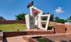
বোয়ালিয়া প্রপার্টি গাইড
Rating icon
4.5

বোয়ালিয়া
, রাজশাহী

Boalia is a notable upazila (sub-district) within the Rajshahi district in Bangladesh. Boalia is located in the northwestern part of the country; it is a part of the Rajshahi Division. The area is under Boalia Thana. Boalia has 51063 households and a total area of 96.68 km2. <br><br> According to the 2011 Bangladesh census, Boalia’s population was 221,163. Males formed 51.73% of the population, while females made up 48.27%. Muslims made up 93.21%, Hindus 6.59%, Christians 0.18%, and others 0.02% of the population. Boalia had a 76.37% literacy rate among those aged 7 and above. Boalia Thana comprises 30 unions/wards and 82 mauzas/mahallas. Boalia Thana is home to 13 famous colleges, including Bangabandhu Degree College, Rajshahi Government City College, Rajshahi Government Women's College, and many more. <br><br> Boalia Upazila is known for its rural landscape, agricultural fields, and small towns. The area benefits from a relatively flat terrain which is conducive to farming. Agriculture is the backbone of Boalia’s economy. The region is known for its cultivation of various crops, including rice, jute, and vegetables. The cultural life of Boalia reflects the broader traditions of Bangladesh, including folk music, dance, and festivals. <br><br> Although Boalia may not be a major tourist destination, its rural charm and agricultural landscape offer a glimpse into traditional Bangladeshi life. Overall, Boalia represents a slice of rural life in Bangladesh, characterised by its agricultural base, cultural heritage, and community-focused living.
অন্তর্দৃষ্টি দেখুন
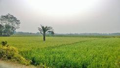
ভোলা প্রপার্টি গাইড
Rating icon
4.5

ভোলা
, বরিশাল

Bhola district is an official district in south-central Bangladesh. It comprises Bhola Island, Bangladesh’s biggest island. It is situated in the Barishal division and covers an area of 3,403.48 km2. It is flanked to the north by Lakshmipur and Barishal districts, to the south by the Bay of Bengal, to the east by Lakshmipur and Noakhali districts, the (lower) Meghna river, and the Shahbazpur Channel, and to the west by Patuakhali District and Tetulia River. Natural gas reserves of about 400 million cubic feet have been discovered in Kechia, Bhola, and are being utilized to fuel a power station.<br><Br> Bhola is a delta island. There are two rivers in this district: the Meghna and the Tetulia. Meghna is located on the district’s east and north sides, while Tetulia lies in the west. The Bay of Bengal is located south of Bhola district. There are seven islands in Bhola: Bhola Island Manpura Island Dhal Char Char Kukri Mukri Char Jahiruddin Char Nizam Char Nazeur Rahaman This district has five municipalities, 7 sub-districts, 10 thanas, 473 villages, and 70 unions. <br><Br> Agriculture is the backbone of Bhola’s economy. The fishing industry is another vital economic sector, given Bhola’s proximity to the rivers and the Bay of Bengal. Besides, Bhola has a growing number of small industries, and the area has natural gas reserves. Bhola, Barishal, is a unique and important part of Bangladesh with a rich cultural heritage, abundant natural resources, and a resilient community.
অন্তর্দৃষ্টি দেখুন
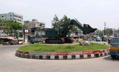
মতিহার প্রপার্টি গাইড
Rating icon
4.5

মতিহার
, রাজশাহী

Motihar is located in Rajshahi, Bangladesh. Motihar city is under Motihar Thana, which is a thana of Rajshahi under Rajshahi City Corporation in Bangladesh. Motihar is situated in the northwestern part of Bangladesh. This place is a part of the Rajshahi Metropolitan Area, which is known for its cultural heritage and educational institutions. <br><br> According to the 1991 Bangladesh Census, Motihar had a population of 38,000. Males formed 55.26% of the population, while females made up 44.74%. The average literacy rate in Motihar is 84.8%, which is higher than the national average of 32.4%. The population of Motihar was 62,172 according to the 2011 census. Males formed 53.80% of the population, while females made up 46.20%. Muslims constituted 95.91%, Hindus 3.97%, Christians 0.05%, and the rest 0.06% of the population. <br><br> Motihar is often referred to as the “Silk City” and “Education City” for its significant role in silk production and educational institutions. The area is a mix of residential and commercial zones, featuring local markets, shops, and residential buildings. The infrastructure of Motihar includes various amenities and services catering to the needs of its residents. Since the population has been rising, as of 2024, Motihar in Rajshahi has been experiencing various new developments and changes, including road upgrades, commercial sectors, residential infrastructure, etc.
অন্তর্দৃষ্টি দেখুন
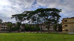
মহাখালী ডিওএইচএস প্রপার্টি গাইড
Rating icon
4.5

মহাখালী ডিওএইচএস
, ঢাকা

মহাখালী ডিওএইচএস বসবাসের জন্য ঢাকার অন্যতম আকর্ষণীয় এলাকা। এটি প্রথম ১৯৮০ এর দশকের মাঝামাঝি প্রতিরক্ষা অফিসারদের জন্য প্রতিষ্ঠিত হয়েছিল। ব্যস্ত নগরী ঢাকা মধ্যে এটি যেন শান্তির আশ্রয়স্থল। এটি তার সুপরিকল্পিত বিন্যাস এবং উচ্চ-সম্পন্ন বাড়ির জন্য পরিচিত সুপরিচিত। এর সুগঠিত অবকাঠামো এবং আধুনিক ঘরবাড়ি এবং সুন্দর সবুজ একত্রে একে আকর্ষণীয় করে তোলে।<br><br> এই জায়গার প্রধান আকর্ষণ হল এর সু-নিয়ন্ত্রিত নিরাপত্তা এবং প্রবেশের সহজতা। যারা শহরের জীবনের সাথে সহজে একটি গেটেড সম্প্রদায় ও শান্তি চায় এমন লোকেদের জন্য এখানে উন্নত আবাসনের পছন্দের ব্যবস্থা রয়েছে। এছাড়াও, যারা মহাখালী ডিওএইচএস-এ নিরাপত্তার সাথে গোপনীয়তাকে গুরুত্ব দেন তারা খুব বেশি চিন্তা না করে এখানে প্রাইভেট খাবার, কেনাকাটা এবং অন্যান্য উন্নত পরিষেবা উপভোগ করতে পারেন।<br><br> মহাখালী ডিওএইচএস-এর সুসংরক্ষিত রাস্তা এবং মূল অ্যাক্সেস পয়েন্ট রয়েছে যার ফলে সহজেই এবং দ্রুত ঘুরে বেড়ানো যায়। এই রাস্তাগুলি বাসিন্দাদেরকে ঢাকার কেন্দ্রস্থলে এবং এর বাইরে সংযুক্ত করে। এর দুর্দান্ত অবস্থানের কারণে, শহরের ব্যবসা এবং বিনোদন কেন্দ্রগুলি কেবল ছোট দূরত্বে অবস্থান করে। যা এর গুরুত্বপূর্ণ মহাসড়ক এবং শহরের রাস্তার সাথে সংযোগের কারণে এটি সম্ভব হয়েছে।<br><br> মহাখালী ডিওএইচএস শুধু পরিবারের সাথে থাকার জন্যই ভালো নয়। এটি একটি চমৎকার ব্যবসায়িক স্থানও, কারণ বাংলাদেশের অনেক বড় কোম্পানির প্রধান কার্যালয় সেখানে রয়েছে। নিরাপত্তার কারণে, এটি সর্বদা সবার জন্য উন্মুক্ত নয়, তবে আড্ডা দেওয়ার, কেনাকাটা করার এবং অন্যান্য কাজের জন্য এটি একটি অসাধারন জায়গা।<br><br> অনেকের মতে, মহাখালী ডিওএইচএস ঢাকায় বসবাসের জন্য সবচেয়ে পছন্দের স্থানগুলির মধ্যে একটি কারণ এটি গোপনীয়তা, নিরাপত্তা এবং শহুরে আবেদনের একটি অনন্য মিশ্রণ প্রদান করে। মহাখালী ডিওএইচএস বাস করার জন্য উপযুক্ত জায়গা কারণ এটি তার বাসিন্দাদের একটি ভাল মানের জীবন প্রদান করতে প্রতিশ্রুতিবদ্ধ, এটি চমৎকার জায়গায় অবস্থিত হওয়ায় এখানে প্রচুর সুবিধা রয়েছে।
অন্তর্দৃষ্টি দেখুন
রাঙামাটি প্রপার্টি গাইড
Rating icon
4.5

রাঙামাটি
, চট্টগ্রাম

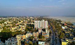
Rangamati is situated in the Chittagong Division. It is bounded by the Tripura state of India to the north, Bandarban District to the south, Mizoram State of India and Chin State of Myanmar to the east, and Khagrachari and Chittagong Districts to the west. Rangamati is Bangladesh's only district that has international boundaries with two countries, India and Myanmar.<br><br> Rangamati was a battleground for the monarchs of Tripura and Arakan. Prior to the arrival of the East India Company, it was known as Reang/Riang County. Following the Muslim conquest in 1566, the Mughal Empire annexed this territory.[6] In 1737, tribal chieftain Sher Mosta Khan sought sanctuary with the Mughals. Following this, the Chakma village began, as did several other communities of other ethnicities. The East India Company leased this area between 1760 and 1761.<br><br> After the independence of Bangladesh, our government took great care in curating this district into a tourist attraction and they’ve successfully done it, we must say. Rangamati now attracts tourists from in and out of Bangladesh round the year. It has attractive tourist spots like the Kaptai Lake, the Hanging Bridge, the Kaptai National Park, Shuvolong Waterfalls and Sajek Valley etc.<br><br> Other than the tourist spots, Rangamati is highly dependent on agriculture for its economy. Most of the people of this region are directly or indirectly connected with agriculture for their livelihood.
অন্তর্দৃষ্টি দেখুন
রাজপাড়া প্রপার্টি গাইড
Rating icon
4.5

রাজপাড়া
, রাজশাহী

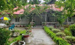
Rajpara is located in Rajshahi, Bangladesh. Rajpara is under Rajpara thana, which is a thana of Rajshahi district in Rajshahi division. Rajpara is situated in the northestern part of Bangladesh. This place is a part of the Rajshahi Metropolitan Area, which is known for its cultural heritage and educational institutions. <br><br> Rajpara had an estimated population of 137,318 in 2011 (males 51.23%, females 48.77%). Muslims constituted 93.68%, Hindus 4.5%, Christians 0.97%, and others 0.85% of the population. Rajpara has a 73.92% literacy rate among people aged 7 and above. <br><br> Rajpara is primarily a residential neighborhood, offering a range of housing options from single-family homes to apartment complexes. The area has local shops, markets, and restaurants that cater to the daily needs of residents. Rajpara might not host major educational institutions, yet, it is well-connected to these educational facilities. However, the Rajpara Thana consists of 28 secondary schools that are quite famous in Rajshahi. Rajpara has 10 unions/wards and 46 mauzas/mahallas. Rajpara benefits from Rajshahi’s transportation network, including roads and public transportation options that connect it to the other part of the city and beyond. <br><br> Overall, Rajpara is a wonderful place to explore. Though there are certain things that need to be improved, yet, this place belongs to the peace-loving community.
অন্তর্দৃষ্টি দেখুন
লক্ষ্মীপুর প্রপার্টি গাইড
Rating icon
4.5

লক্ষ্মীপুর
, চট্টগ্রাম

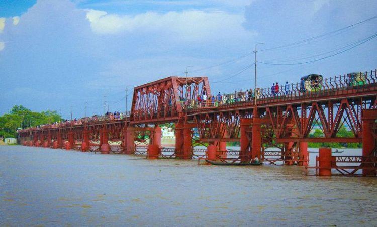
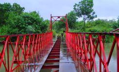
Lakshmipur is a district situated in the Chattogram division of Bangladesh. It is bounded by Chandpur to the north, Bhola and Noakhali districts to the south, Noakhali to the east, and Barisal and Bhola districts to the west of it. Lakshmipur was a region of Noakhali till February 15, 1984. During that time, the western section of Noakhali was upgraded from Lakshmipur subdivision to Lakshmipur district to give administrative amenities.<br><br> The district has historical significance regarding our war of independence as well. On July 6, 1971, the freedom fighters launched a surprise attack near the Rahmatkhali Bridge in Lakshmipur town, killing 72 Pakistani soldiers. On October 25, in Mirganj of the Sadar upazila, a direct battle between the freedom fighters and the Pakistani soldiers resulted in the deaths of 70 soldiers, including a major, and 41 Rangers.<br><br> In Fatehpur Dighi of Ramganj upazila, a fight occurred between the freedom fighters and Pakistani soldiers, resulting in numerous Pakistani casualties. Later, the Pakistani soldiers captured 14 freedom fighters and brought them to Ramganj camp, where they were killed. During the Liberation War, in a battle at Jamidar Hat of Ramgati upazila, 17 Pakistani soldiers, including several Razakars, were killed in a confrontation with the freedom fighters.<br><br> Lakshmipur has come a long way from there. Being situated adjacent to the Bay of Bengal has contributed significantly to the development of commercial and residential facilities in the district. It is also situated very close to the port city of Chattogram, so it gets commercial support from there too.<br><br> Overall, Lakshmipur is now a booming district waiting to unleash its full developmental potential.
অন্তর্দৃষ্টি দেখুন
লঞ্চ্ঘাট প্রপার্টি গাইড
Rating icon
4.5

লঞ্চ্ঘাট
, বরিশাল

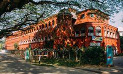
The Launch Ghat area in Barishal is a busy and important spot for river transport in Bangladesh. Located on the banks of the Kirtonkhola River, it connects Barisal with Dhaka and other districts through waterways. People use the Launch Ghat to travel to the southern parts of the country, making it a lively and crowded place.<br><br> The area is full of large passenger boats, ferries, and smaller vessels that come and go throughout the day and night. It’s especially busy during holidays when many people travel. Around the Launch Ghat, there are markets, food stalls, and shops that serve travelers, offering food, drinks, and travel essentials.<br><br> The Launch Ghat is crucial for the local economy because it helps move goods like agricultural products and fish from Barisal to other parts of Bangladesh. Despite its importance, the area faces challenges like overcrowding and pollution. There are ongoing efforts to improve the facilities and make travel safer and more efficient for everyone using the Launch Ghat.<br><br> The area surrounding the Launch Ghat in Barishal is a mix of residential and commercial facilities. On the commercial side, there are markets, shops, and food stalls catering to travelers and locals, offering a variety of goods and services. Small businesses and vendors line the streets, creating a bustling environment.<br><br> Residentially, the area consists of modest housing, including apartments and small homes, occupied mainly by those who work in the nearby markets and transport sectors. The neighborhood is densely populated, with people living close to the river for easy access to transportation and work.
অন্তর্দৃষ্টি দেখুন
সিডিএ এভিনিউ প্রপার্টি গাইড
Rating icon
4.5

সিডিএ এভিনিউ
, চট্টগ্রাম

If you want to talk about the economic hubs of Chattogram City Corporation areas, CDA Avenue is a commonly heard name. The entire area is vast, going all the way between Tigerpass Circle and East Sholoshohor, located on either side of the CDA Avenue road. The area is part of Kotwali Thana and falls into various CCC wards.<br><br> Known for both business and residential tranquility, the area's population is increasing, and the development around it is also taking place rapidly. The area is filled with various popular locations, landmarks, and other places that attack dwellers from other parts of the city every day. So, if you plan to move to the area for residential, business, or vocational purposes, it is ideal to be familiar with the CDA Avenue area guide. <br><br> The CDA Avenue is also often regarded as the GEC Mor area, which is another location within the CDA Avenue area. And because it is an economic and commercial location, it is always bustling with traffic, a busy lifestyle, and chaos, making it one of the cities that never sleeps. Even if you get out for a midnight stroll under the orange street lights, you will still find open places and busy activities of people.<br><br> In addition, several important roads and highways make it accessible to other cities and towns. Moreover, the Akhtaruzzaman Chowdhury Flyover, which is the country’s longest highway overpass, is also located in the area. It makes transportation and communication more accessible. Not only can one travel inside the city, but several bus services allow people from many other districts to travel in and out of the Chattogram district.<br><br> While CDA Avenue and its nearby locations have been turning into a preferred location to move to or settle down, it also comes with a high living cost. Being a commercial and high residential area, the property price has increased at a massive rate over the last few years. Yet, real estate developers have been building apartment complexes and residential areas to offer housing at various price ranges. The commercial spaces also cost pretty high compared to other areas.<br><br> CDA Avenue is filled with many educational institutions, religious and financial institutions, hotels, restaurants, supermarkets, super shops, shopping complexes, and many more. It also has other notable places, such as Hazrat Garib Ullah Shah Mazar, Reboti Mohan Sculpture, Jamyiatul Falah National Mosque, The Peninsula Chittagong, Biplob Udyan, etc.
অন্তর্দৃষ্টি দেখুন
সীতাকুন্ড প্রপার্টি গাইড
Rating icon
4.5

সীতাকুন্ড
, চট্টগ্রাম

Sitakunda Upazila is located in the Chittagong District of southeastern Bangladesh, approximately 37 kilometers northwest of the port city of Chittagong. It is bounded by Mirsharai Upazila on the north, the Bay of Bengal on the west, and Hathazari and Fatikchhari Upazilas on the east. Covering an area of around 482.97 square kilometers, Sitakunda is notable for its diverse geographical features, including hills, forests, and coastal areas.<br><br> The upazila is renowned for its natural beauty, particularly the Sitakunda Eco Park and the Chandranath Hills, which attract tourists and nature enthusiasts. The Chandranath Temple, located on the Chandranath Hills, is a significant pilgrimage site for Hindus and offers panoramic views of the surrounding area. Additionally, the Sitakunda Botanical Garden and Eco Park, established to preserve the region's biodiversity, is a popular destination for visitors.<br><br> Economically, Sitakunda plays a vital role due to its industrial significance. It hosts a number of industries, including shipbreaking yards, which are some of the largest in the world. These yards recycle decommissioned ships, providing raw materials for steel production and generating employment for a large number of people. However, the industry also raises environmental and occupational health concerns.<br><br> Agriculture remains an important sector in Sitakunda, with the cultivation of rice, vegetables, and fruits. Fishing is also a common livelihood due to its coastal location. The upazila's infrastructure includes educational institutions, healthcare facilities, and transport connectivity, contributing to its overall development.<br><br> Sitakunda's blend of natural beauty, industrial activity, and cultural heritage makes it a unique and important region in Bangladesh.
অন্তর্দৃষ্টি দেখুন
সীতাকুন্ড প্রপার্টি গাইড
Rating icon
4.5

সীতাকুন্ড
, চট্টগ্রাম

Sitakunda is an upazila in Chattogram district. Sitakunda is one of the earliest human settlements in Bangladesh. Talking about the history, it was dominated by the Buddhist monarchs from Myanmar in the east and Muslim rulers from Bengal in the west. The Dhaka-Chittagong highway and railway play an important role in Sitakunda’s economic growth.<br><br> Sitakunda is primarily agricultural, but it also possesses the world’s biggest ship breaking business. The sector has been accused of failing to protect workers’ rights, particularly in terms of workplace safety and child labor. Sitakunda is known for its many Islamic, Hindu, and Buddhist shrines. It contains 280 mosques, 49 Hindu temples, 8 mazars, 4 ashrams, and 3 Buddhist temples. Among its prominent religious monuments are the Chandranath temple, Vidarshana Ram vihara, and Hammadyar mosque. Sitakunda, geographical structure 70 kilometers long, 10 kilometers wide, is one of the westernmost structures of Chattogram and Chattogram Hill Tracts, bordered by the Feni river in the north, the Karnaphuli river in the south, the Halda river in the east, and the Sandwip Channel in the west.<br><br> Sitakunda as a thana was established in 1879 and renamed Sitakunda Upazila in 1983. Out of Chittagong’s 26 upazilas and thanas, it is the third largest in terms of land and the sixth most populous. Sitakunda town, consists of 28.63 square kilometers, and a population of 36650 people, is the administrative headquarters in Sitakunda upazila.
অন্তর্দৃষ্টি দেখুন
হরিপুর প্রপার্টি গাইড
Rating icon
4.5

হরিপুর
, রাজশাহী

Haripur Union is a union under Paba Upazila of Rajshahi District of Rajshahi Division of Bangladesh. This Union Parishad is located at the end of Paba upazila of Rajshahi district. Area of Haripur Union is 37.75 square miles. Rajshahi City Corporation is located east of Haripur Union and Deopara Union on the west side. Here the number of village is 24, the number of mauzas is 17, and the number of huts/bazars is 1. <br><br> The people of this union depend on agriculture. Harpur Union has a canal. It flows from Tengramari village in Haripur Union across parts of Damkura Union. The overflowing water of the Padma River flows through this canal. The approximate length of the canal is 7.00 km. Water is available in this canal almost throughout the year. Different species of fish are produced in this canal, and the farmers use the water of the canal for irrigation purposes to improve the production of agricultural crops. <br><br> The literacy rate of Haripur Union is 37%. Among the educational institutions, the number of colleges is 1, high school 2, madrasa 1, government primary school 6, and private school 5. <br><br> The list of population: Women 17196, Men 18137, Total 35333 <br><br> Living in Haripur offers a blend of rural and semi-urban experiences. This place is ideal for those who appreciate a quiet lifestyle close to nature while still having access to the facilities of Rajshahi city.
অন্তর্দৃষ্টি দেখুন
দরগাহ মহল্লা প্রপার্টি গাইড
Rating icon
4.5

দরগাহ মহল্লা
, সিলেট

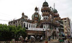
Dargah means shrine, and mahalla means a small area or neighborhood. The Dargah Mahalla is a neighborhood in south Sylhet in the Sylhet District’s metropolitan area. It is under the jurisdiction of Sylhet City Corporation’s ward no. 01 and Jalalabad Thana. Most people who travel to Sylhet and all over the country look into the Dargah Mahalla area guide.<br><br> Why? Because it is one of the most famous locations in Bangladesh because of the Shrine of Hazrat Shah Jalal. The Hazrat Shahjalal Rah. Mazar Sharif was constructed in 1505. It was the residence of the 14th-century Muslim Sufi saint Hazrat Shah Jalal, who came to Bangladesh in 1303. After his death in 1347, he was buried in the place, which was then turned into a shrine.<br><br> Over time, it became one of the most sacred religious centers for people. This place now attracts thousands of visitors from the country and the world every day. Centering the mazar sharif, many businesses grew over time. Other than souvenir shops or shops for religious or burial items, the neighborhood is filled with small and grand residential hotels and motels, which contribute to the area’s economy. <br><br> Some of the popular hotels are the Grand Mostafa Hotel Ababil, Hotel Noorjahan Grand, Hotel Star Pacific, and Hotel Holy Side. You can enjoy your stay in the area in various hotels at different price ranges and facilities. There are also many restaurants and meal hotels in the area.<br><br> Since the Dargah Mahalla is one of the most famous tourist spots in the Sylhet District, it has wider access to communication by road. From Dhaka or Chattogram, people can easily travel to the Dargah area by bus. You can also travel to Sylhet City by train and the rest of the route by buses, cars, CNGs, and any other vehicles. People who prefer to travel by plane will have to reach Sylhet Osmani International Airport first before taking the bus or car to the Dargah Mahalla.<br><br> Other notable institutions and landmarks in the area are Osmani Medical High School, Sylhet Science and Technology College, and the Government. Alia Madrasah, Central Muslim Sahitya Sangsad, Mohanogor Hospital, View Point Shopping Complex, etc. Despite an occasional chaotic lifestyle, Dargah Mahalla is one of the best localities in the Sylhet Sadar area.
অন্তর্দৃষ্টি দেখুন
ক্যান্টনমেন্ট প্রপার্টি গাইড
Rating icon
4.5

ক্যান্টনমেন্ট
, ময়মনসিংহ

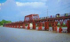
Mymensingh Cantonment, situated in the Mymensingh district of Bangladesh, is a vital military establishment with a rich history and strategic importance. Officially known as Momenshahi Cantonment, it was established to support the defense and administrative needs of the Bangladesh Army. The Mymensingh Cantonment area guide provides insights into the region's history, transport facilities, and housing options, reflecting its significance beyond just a military hub.<br><br> Historically, Mymensingh Cantonment was established post-independence to strengthen its military presence in the northern part of Bangladesh. The cantonment has since evolved, accommodating various military units and institutions. It is known for its disciplined environment and structured layout, contributing to its reputation as a secure and orderly area.<br><br> Geographically, the cantonment is located on the outskirts of Mymensingh city, offering a blend of urban and rural landscapes. The area has wide, tree-lined roads, well-maintained parks, and military facilities. The proximity to the Brahmaputra River adds to the natural beauty of the region.<br><br> Communication and transportation facilities around Mymensingh Cantonment are well-developed. The area is accessible by road, with several bus routes connecting it to Mymensingh city and other regions. Local buses and auto-rickshaws provide convenient transportation options within the area. The nearest train station, Mymensingh Railway Station, is just a short drive away, connecting the cantonment to major cities like Dhaka, Chittagong, and Sylhet. This accessibility makes the cantonment a well-connected location.<br><br> The economy of the Mymensingh Cantonment area is closely tied to the presence of the military. The cantonment supports various local businesses, including retail shops, restaurants, and service providers catering to military personnel and their families' needs. Additionally, the nearby city of Mymensingh, with its educational institutions and industries, further boosts its economic activity.<br><br> Housing and property availability in Mymensingh Cantonment are primarily limited to military personnel and their families. However, the surrounding areas offer residential options for civilians, including apartments, houses, and development plots. Property values in the region have been steadily rising due to the cantonment's security and amenities.<br><br> Notable landmarks within and around Mymensingh Cantonment include the Shahid Minar, as well as several parks and recreational facilities. Additionally, the cantonment is home to educational institutions, hospitals, and shopping centers, making it a self-sufficient area with ample amenities for residents and visitors alike.
অন্তর্দৃষ্টি দেখুন
ফুলপাড় প্রপার্টি গাইড
Rating icon
4.4

ফুলপাড়
, ময়মনসিংহ

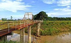
Phulpur, located in the Mymensingh district, is a vibrant upazila known for its scenic beauty, agricultural landscape, and rich cultural heritage. Located 30 kilometers from the Mymensingh Sadar, the Phulpur area guide states that it was formed as a Thana in 1874 and then established as an upazila or subdistrict in 1983. Now, this area spans a geographical land area of 319.01 square kilometers, with a population exceeding 350,967.<br><br> Phulpur upazila is surrounded by Haluaghat and Dhobaura upazilas to the north, Tarakanda and Mymensingh Sadar upazilas to the south, and Gauripur and Netrokona’s Purbadhala upazila to the east, and Sherpur’s Nakla upazila to the west. This creates a diverse and well-connected locality.<br><br> The Phulpur area is characterized by lush green fields and numerous water bodies like the Bhogai and Kangsa Rivers, which enrich the soil and support local agriculture. Road conditions vary, with some main roads being well-maintained while others are less developed, making travel slightly challenging in certain parts. However, the area is serviced by a network of buses, auto-rickshaws, and CNGs that facilitate local transportation, connecting it to Mymensingh city and other neighboring upazilas.<br><br> Residences in Phulpur range from traditional village homes to more modern buildings, reflecting the area's gradual development. The local economy is primarily driven by agriculture, with rice, jute, and various vegetables being the main crops. Small businesses and local markets also contribute to the economy, supporting the daily needs of the residents.<br><br> Educational facilities include a mix of primary and secondary schools, madrasas, and a few colleges, providing basic education to the local population. Phulpur is a religiously diverse area, with mosques, temples, and churches serving the community, reflecting the harmony among different faiths.<br><br> The upazila is equipped with essential amenities, including healthcare centers, small hospitals, and pharmacies, although more specialized medical services may require travel to Mymensingh city. Some of the notable landmarks of the area are Phulpur Gol Chattar, Nilganj Badhyabhumi, Phulpur Mini Stadium, and many more.
অন্তর্দৃষ্টি দেখুন
IconMap

ফিচারড প্রজেক্ট

সবগুলো দেখুন

Bangladesh-এর প্রপার্টি প্রাইস ট্রেন্ড

কেনা
ভাড়া
বেডরুম:
গড় মূল্য (বিগত ১২ মাসের)
Tk. 6,358.55 per sqft
বিগত ১২ মাসের বৃদ্ধি
5.85%
Positive Trend
বিগত ৩ মাসের বৃদ্ধি
5.2%
Positive Trend
Icon
দ্রষ্টব্য: মূল্য তথ্য Bikroy-এর পোস্ট করা বিজ্ঞাপন থেকে ঐতিহাসিক তথ্যের উপর ভিত্তি করে দেওয়া। সম্পূর্ণ মার্কেটের ডায়নামিক প্রতিফলিত নাও হতে পারে।
hero

Bikroy এ বিক্রি বা ভাড়া দিন: মাত্র ২ মিনিটেই প্রপার্টির বিজ্ঞাপন দিন!