Search Icon

Bangladesh এর এলাকাগুলি ঘুরে দেখুন

304টি এলাকার মধ্যে 270 - 288টি
নিরালা প্রপার্টি গাইড
Rating icon
3.8

নিরালা
, খুলনা

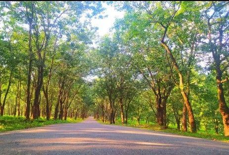
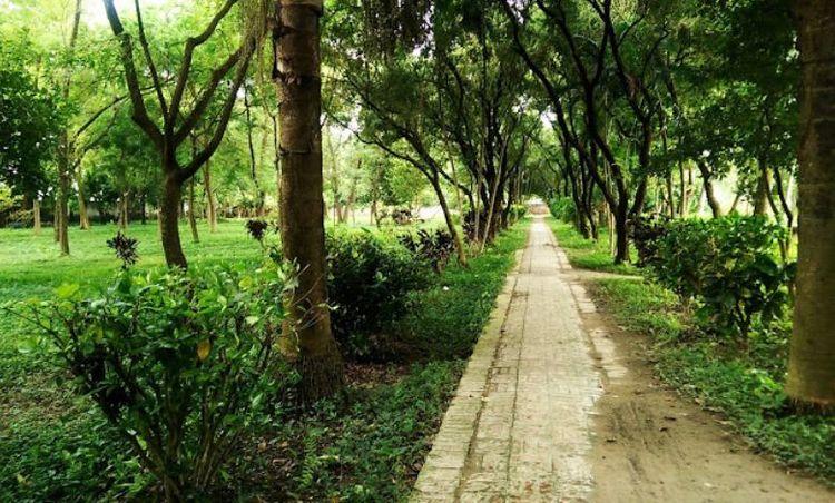
Nirala is a one-of-a-kind residential hub perched at the heart of Khulna. This meticulously crafted area was designed by the Khulna Development Authority in the early eighties. This is a posh neighborhood whose lifestyle and cost of living surpass the surrounding areas and most parts of Khulna. <br><br> This Nirala area guide will take you on a virtual expedition to learn about this residential area in detail. As you know, Nirala is a complete residential hub packed with all urban facilities and provisions. The area is designed with sheer calculation and planning, so the housing facilities are very organized and assembled neatly. <br><br> Khulna Development Authority acquired 67.31 acres of land and segregated 544 plots. The plots are divided into three categories and sectioned as 3 Kantha, 4 Kantha, and 5 Kantha. It is easier for the residents to choose and build their homes based on their preferences and budget. So, from the bird-eye view, this sub-division looks very neatly orchestrated.<br><br> Nirala is not just a place where you can build a home and live. It is a complete package crammed with eateries, restaurants, parks, schools, madrasahs, and other urban amenities.<br><br> Many restaurants in the area serve authentic Khulna cuisine. Nirala Park, nestled at the core of the residential area, is a great attraction for both residents and tourists. Two mosques are inside the area. The residential hub also has some pre-school, primary and high schools in the vicinity.<br><br> Moreover, Nirala is only 3 km away from the Khulna Sadar. So, it would take only 6 minutes of driving to get there. Many residents prefer to live at Nirala and commute via bus or bike to Sadar for work or business. That’s what makes Nirala a coveted residential area among Khulna dwellers.
অন্তর্দৃষ্টি দেখুন
নোয়াখালী প্রপার্টি গাইড
Rating icon
3.8

নোয়াখালী
, চট্টগ্রাম

Noakhali District is an important commercial city located in the southeastern coastal region of Bangladesh. It has created a distinct identity in the tapestry of Bangladesh through its natural beauty, riverine environment, and vibrant culture. The district is known for its flat terrain, which is characteristic of the delta region of Bangladesh. The area and islands south of Noakhali, exposed to the Bay of Bengal, are often exposed to cyclonic storms.<br><br> Its economy is mainly dependent on agriculture, fishing, and small industries. Rice cultivation and fishing in the Bay of Bengal are important economic bases here. The people of Noakhali are making a special contribution to the economy of Bangladesh in the remittance sector.<br><br> Noakhali is surrounded by Meghna and Feni rivers. There is an extensive network of waterways, which serve as an important transportation route. The district is divided into several upazilas including Noakhali Sadar, Begumganj, Chatkhil, Companyganj, Hatia, and Senbagh. Each Upazila is further divided into Union and Village.<br><br> This district belongs to the Chittagong division; the total area is 3600.99 sq km. It is bounded by the Comilla district to the north, the Meghna estuary and Bay of Bengal to the south, the Feni and Chittagong districts to the east, Lakshmipur and Bhola districts to the west. Noakhali district is well connected by road and waterways. The main road here is connected with the Dhaka-Chittagong highway. There are ferries connecting the district to various islands and coastal areas.<br><br> This district has several tourist attractions. Places to visit here include Sonapur Beach, Chatla Haor, Hatiya Island, Ramgati, etc. Gandhi Ashram was established by Mahatma Gandhi during India's independence movement, this ashram holds historical significance. Begumganj Shahi Mosque and Chatla Shitala Mandir are also historical monuments here.<br><br> Noakhali Science and Technology University, Noakhali Law College, Abdul Malek Ukil Medical College, Noakhali Government College, Begumgonj Textile Engineering College, etc. are famous educational institutions in this district. The importance of this area is also immense from the administrative point of view.<br><br> As this district is economically and commercially important, several ongoing infrastructure projects, such as road widening, bridge construction, housing projects, etc., are underway to enhance connectivity.
অন্তর্দৃষ্টি দেখুন
পাবনা প্রপার্টি গাইড
Rating icon
3.8

পাবনা
, রাজশাহী

Pabna is an important and pleasant district located northwest of the Rajshahi Division of Bangladesh. It is known for its rich history, cultural heritage, and lively economy. Since the Padma and Jamuna River basin is located, agriculture and fish have become the main economic center of the region. This district is also beautiful in terms of natural beauty.<br><br> It is bound by Natore and Sirajganj districts on the north, Rajbari and Kushia districts on the south, Manikganj districts on the east, and Kushtia and Rajshahi districts on the west. Ishwardi Junction, and Hardinge Bridge, are the historic establishments of this district. Also, Ishwardi has made significant contributions to the economy of Bangladesh through the export processing zone, textile, pharmaceuticals, and food processing.<br><br> Pabna district is known for its handloom and textile industry, especially for sarees and lungi. The main crops include rice, jute, sugarcane, and various vegetables. The district is also known for dairy cultivation and milk production. The region has several small and medium-sized industries, including textile, pharmaceuticals, and food processing. Pabna Sugar Mills is one of the most prominent industrial companies in the region.<br><br> This district was an important region during the rule of the Maurya, Gupta, and Pala dynasties. This area was known for its blue garden in the British colonial era. There are advanced educational institutions like Pabna University of Science and Technology, Edward College, and Cadet College. There are also advanced healthcare institutions like Pabna Medical College Hospital and Mental Hospital.<br><br> From this district, roads, railways, and boats can be contacted across the country. Bus routes from Pabna are connecting to major cities and towns across the country. It is also a pilgrimage place for tourists, a unique glimpse of the natural beauty and a unique glimpse of the rural environment. The biggest problem in this district is flood and river erosion. There is also a need for further development in infrastructure, healthcare, and education to improve the quality of life. Pabna is safe for tourists. The people of this district are overwhelmed by religion.
অন্তর্দৃষ্টি দেখুন
পাবলা প্রপার্টি গাইড
Rating icon
3.8

পাবলা
, খুলনা

Pabla is a vibrant commercial, economic, and communication area at Khalishpur police station in Khulna district of Bangladesh. The location is known for shipbuilding, shrimp farming, and textile industries. The area is also important industrially, agriculturally, and administratively.<br><br> Shrimp farming and agriculture are the mainstays of the local economy. The area is surrounded by rivers, canals, and wetlands, which make it suitable for shrimp farming. Also, the area and surrounding fertile alluvial soil is suitable for agriculture. The local wholesale business, raw market, and commercial activities here have made Khulna's economy vibrant. Most of the local people here are involved in agriculture, fishing, and small businesses.<br><br> Jessore Highway Road, Outer Bypass Road, and Khulna City Bypass Road have improved the connectivity and socio-economic management of the area. Rupsa and Bairab rivers play an important role in the area's economic development and transportation of goods. Buses to all major cities of the country are available from the main road here. Mongla Port has increased the importance of the highway in this area. Also, Padma Bridge and Khan Jahan Ali Bridge have contributed to the economic prosperity of the area.<br><br> Sundarban, Sixty Dome Mosque, Shilaidah Kuthibari, Fakir Lalan Shah Mazar, 71' Genocide-Torture Archive Museum, Khan Jahan Ali Tomb and Bridge, being close to this area, many tourists visit here. There are several hotels here for travelers to stay overnight.<br><br> Surrounded by green and serene landscape, the area is very soothing to live in. Due to public and private educational institutions, medical services, banking, various business establishments, administrative facilities, and good communication, residential buildings, and apartments are constantly being developed in this area. The people here are very hospitable. Also, the culture here, vibrant markets, and local delicacies like Chui Jhal will impress you.<br><br> In addition to infrastructure development, the area needs to improve its transport network, health care facilities, and other essential services such as clean water, electricity, and sanitation systems.
অন্তর্দৃষ্টি দেখুন
ফেনী প্রপার্টি গাইড
Rating icon
3.8

ফেনী
, চট্টগ্রাম

Feni is a district in the Chittagong Division, located in the southeastern part of Bangladesh. The city is an important center of trade and commerce due to its advanced communication system, and strategic location. The Muhuri and Feni rivers surround it. Khandal misti of this district is very famous. The climate here is humid, but the region receives a lot of rain during the monsoon season.<br><br> The district is bordered by Noakhali to the west, Chittagong to the east Comilla to the north, and Tripura state of India, Bay of Bengal to the south. This district is the only connecting road between Chittagong, Cox's Bazar, and the three hill districts of Rangamati, Bandarban, and Khagrachari. The district has a railway station which connects it with major cities.<br><br> Feni gas fields have contributed greatly to the economy and employment of the entire country. The Dhaka-Chittagong transport corridor and the Chhagalnaya border have contributed greatly to the region's commercial activities and economy. The district is known for paddy, dal, betel nut, various fruits, and fish farming.<br><br> Although a relatively small district, it has many educational institutions. There are schools, colleges, polytechnic institutes, nursing institutes, youth development institutes, teacher training institutes, vocational institutes, and private medical colleges. The healthcare facilities here are also quite good.<br><br> The district is named after the Feni River, which has enhanced the agriculture, fisheries, and scenic beauty of the district. It is a place rich in natural beauty, mineral resources, and culture. The district has several notable landmarks, including the Muhuri Project, the country's largest irrigation project, and the Vijay Singh Dighi, one of the largest historic ponds in the country.<br><br> In recent years, the city has seen more industrial plants, planned residential buildings, and commercial expansion. Several small to medium-scale industries including rice mills, textile factories, food processing units, and fish breeding centers have developed here. However, the future development of Feni needs to focus on the construction of sustainable infrastructure, and a safe water and sewage system as per the plan.<br><br> Feni is a district where you will find a remarkable blend of rural environment with modernization. But as Feni evolves, it faces the challenge of balancing sustainable development. Over the years, major improvements have been made to the communication system, housing projects, and boosting the local economy. However, this has resulted in environmental impacts such as deforestation, reduction of cropland, air pollution, etc.
অন্তর্দৃষ্টি দেখুন
বগুড়া প্রপার্টি গাইড
Rating icon
3.8

বগুড়া
, রাজশাহী

Bogra is an important industrial and commercial city located in Rajshahi Division in northern Bangladesh. The significance of this district is very high in all aspects of agriculture, economy, communication, and education. It is also known for its rich history and cultural heritage. Mahasthangarh in Bogra is one of the oldest archaeological sites in the world.<br><br> Bogra is famous for curd, kattakti (sweets) and ghee. It also produces large quantities of rice, potatoes, vegetables, and jute, and is supplied throughout the country. The region is often called the "Granary of Bengal" due to its fertile land and abundant agricultural production. Satmatha, Banani Bazar, and New Market areas of Bogra have many public and private hospitals, shopping malls, supershops, eateries, and electronics stores.<br><br> Bogra's economy is diverse. Along with cement, bricks, sand, construction materials, textiles, and handicrafts are gradually developing. According to a recent survey, the district has a large number of small to medium enterprises (SMEs) that contribute to the local and national economy.<br><br> The city is well-connected to the rest of the country by road and rail. The railway network connects Bogra to major cities including Dhaka, Rajshahi, and Rangpur. The N5 highway connects the city with Dhaka, Tangail, Gazipur, and the northern districts. Currently, the city has undergone several infrastructural developments, including transportation, improvement of Highway Road 6 to 8 lanes, improvement of healthcare and public services, improving the quality of life of its residents, etc. Bogra is often referred to as the "Gateway to North Bengal".<br><br> Bogra is an attractive place for tourists. Mahasthangarh, Gokul Medh, and Vasu Vihar are ancient archaeological sites here. Also, the Kherua Mosque and the Nawab Palace are fine architectural examples built during the Mughal period. The people of this region are very hospitable.<br><br> There are advanced educational institutions like Bogra District School, Bogra Government Girls High School, Bogra Cantonment Public School and College, Government Azizul Haque College, Shaheed Ziaur Rahman Medical College, and Bogra Polytechnic Institute. In Bogra, you will find a variety of accommodation options ranging from standard to 5-star. Hotel Naz Garden, Hotel Siesta, Parjatan Motel, Momo-Inn, etc. are famous hotels here.
অন্তর্দৃষ্টি দেখুন
বন্দর বাজার প্রপার্টি গাইড
Rating icon
3.8

বন্দর বাজার
, সিলেট

মানুষ আর কার্যকলাপে পূর্ণ, সিলেটের অন্যতম ব্যস্ত এলাকা হলো বন্দরবাজার। বন্দরবাজার এরিয়া গাইড অনুসারে, এটি সিলেট সিটি কর্পোরেশনের ১৪ নম্বর ওয়ার্ডে অবস্থিত। এই এলাকাটি বিশেষভাবে পরিচিত হকার্স মার্কেট, হাসান মার্কেট এবং করিমুল্লাহ মার্কেটের জন্য। এছাড়াও, ব্যবসা প্রতিষ্ঠান ও আবাসিক হোটেলগুলো সবসময় এ পরিবেশটিকে ব্যস্ত রাখে।<br><br> প্রথমবার বন্দরবাজারে গেলে আপনি নিজেকে দোকানপাটে ঘেরা গলিগুলোর মধ্যে খুঁজে পাবেন। চারদিকে চোখ মেললেই দোকানের সারি দেখতে পাবেন। দোকানিরা বিভিন্ন পণ্য সাজিয়ে রাখে এবং সম্ভাব্য ক্রেতাদের দৃষ্টি আকর্ষণ করতে ডাক দেয় কিংবা তাদের সাথে দরদাম করতে ব্যস্ত থাকে।<br><br> আপনি যা-ই খুঁজছেন না কেন – পোশাক, হস্তশিল্প, গৃহস্থালী সামগ্রী, মুদি দ্রব্য – সবই এখানে পাবেন। এই বাজার আপনাকে খালি হাতে ফিরতে দেবে না।<br><br> বন্দরবাজার, সিলেটের একটি গুরুত্বপূর্ণ বাণিজ্যিক এলাকা, যার সমৃদ্ধ ইতিহাস কয়েক শতাব্দী পুরনো। এখানে থাকা প্রতিষ্ঠানগুলোও সেই পুরনো ইতিহাসের সাক্ষী, ঔপোনিবেশিক যুগের স্থাপত্যের ছোঁয়া এবং সিলেটের নিজস্ব ঐতিহ্যের মিশ্রণ নিয়ে দাঁড়িয়ে আছে।<br><br> শহরের একটি গুরুত্বপূর্ণ স্থানে অবস্থিত হওয়ায়, বন্দরবাজার স্থানীয়দের জন্য সহজে অন্য এলাকায় যাওয়ার সুবিধা দেয়। রাস্তাগুলোতে প্রচুর ছোটখাটো খাবারের দোকান রয়েছে, যেখানে ঐতিহ্যবাহী সিলেটি খাবার পাওয়া যায়। আপনি যদি কোনো ক্যাফেতে বিশ্রাম নিতে বা রেস্টুরেন্টে খেতে চান, সেগুলোও কাছেই পাবেন।<br><br> এখানেই শেষ নয়। বন্দরবাজারে বেশ কিছু ঐতিহাসিক স্থাপনা এবং বিনোদন কেন্দ্র রয়েছে, যা এটিকে ঘুরে বেড়ানোর জন্য এক আকর্ষণীয় জায়গা করে তুলেছে।
অন্তর্দৃষ্টি দেখুন
বন্দর বাজার প্রপার্টি গাইড
Rating icon
3.8

বন্দর বাজার
, সিলেট

Immersed in people and activities, Bandar Bazar is one of the busiest places in Sylhet. According to the Bandar Bazar area guide, it is located in the 14th ward of the Sylhet City Corporation. It is distinctively known as the location of Hawkers' Market, Hasan Market, and Karimullah Market. Besides, businesses and residential hotels always keep the environment in a rush. <br><br> When visiting Bandar Bazar for the first time, you will find yourself in alleys of shops and stores. Wherever you lay your eyes, you will see stalls everywhere. Their owners display plenty of products and call potential customers to catch their attention or are busy negotiating with them. <br><br> Whatever you want to purchase, clothing, handicrafts, household items, grocery items, you will find them. The Bazaar will never let you leave empty-handed. It will be a bonus for you if you are adept at bargaining. <br><br> Bandar Bazar, an important trading zone for Sylhet, has a rich past that is as old as several centuries. In addition, the establishments in the region share that past, reflecting the architectural background of the colonial era while boasting Sylhet’s own traditional legacies at the same time. <br><br> Seated at a crucial point of the city, Bandar Bazar offers its locals easy transportation to other areas. Also, the streets are swarmed with small food vendors offering traditional Sylheti foods. If you want to relax at a cafe or eat in a restaurant, you will also find them nearby. <br><br> And there is more. The place has several historical landmarks and recreational spots, making Bandar Bazar a delightful place to roam around.
অন্তর্দৃষ্টি দেখুন
বাকেরগঞ্জ প্রপার্টি গাইড
Rating icon
3.8

বাকেরগঞ্জ
, বরিশাল

Bakerganj is a charming upazila in the Barisal district. The area is well known for agricultural activities and fish production. It is well-known as a populous and business center developed along the banks of the Srimant, Karkhana, Bighai, Payra, and Bishkhali rivers. A vibrant business environment, and improved communication system, have created a lot of employment opportunities in the area. Also, this area is unique from the administrative point of view.<br><br> All upazilas and almost all district towns of the country can be connected from Bakerganj by river and road. To the North of this upazila are Nalchiti upazila and Barisal Sadar of Jhalkathi district. Dumki Upazila of Patuakhali District, and Mirzaganj Upazila towards the South. Baufal Upazila and Bhola Sadar of Patuakhali district on the East side. Rajapur Upazila and Nalchiti Upazila of Jhalkathi District and Betagi Upazila of Barguna District on the West side.<br><br> Bakerganj Upazila is surrounded by green fields and rivers. The local economy is based on agriculture and fishing. The land in this area is very fertile. The local traditional festivals, handicrafts, and historical relics of the Mughal period will fascinate you. During the reign of Nawab Alivardi Khan of independent Bengal, Zamindar Agabaker Khan of Umedpur named this region Bakerganj after himself in 1741.<br><br> Besides the natural beauty, Bakerganj has several good-quality educational institutions, madrasas, clinics, parks, and local markets. Local people here are involved in agriculture, fishing, transportation of goods, and small businesses. Bakerganj Upazila is a great option for those who want to live away from the urban noise in a rural serene environment with standard amenities. The blend of rural life with modern conveniences here will impress you.<br><br> Barisal Airport, river port, and bus stand are close to this area. Dhaka-Patuakhali Highway, Barisal-Subidkhali Road, and Bangga-Barisal Highway connect this area with almost all district roads of the country. Bakerganj's communication system and other civic facilities are very convenient for housing, employment, and business. Being economically and commercially developed, several housing projects and infrastructure are being developed in the area. Roads connecting the surrounding areas are also well-developed.
অন্তর্দৃষ্টি দেখুন
বাংলাবাজার প্রপার্টি গাইড
Rating icon
3.8

বাংলাবাজার
, বরিশাল

Banglabazar is a vibrant commercial and residential area in the heart of Barisal district. The area is economically critical, with important government and private offices, river ports, and connected highways. Located on the banks of the Kirtankhola River, the Banglabazar area is considered a bustling commercial center for goods transportation, communication, and agricultural products production. Here, you will find everything from clothing and electronics to restaurants and raw markets.<br><br> Barisal Airport, river port, and bus stand are located very close to this area. Bangga-Barisal Highway, C&B Road, Bangla Bazar Road, and Shaheed Ali Road, connect this area with almost all district roads of the country. To the West of the area are Jhalkathi, Pirojpur, Khulna, and Bagerhat. To the North are Barisal Sadar, Gopalganj, Madaripur, and Shariatpur. Bhola and Noakhali districts on the East. Patuakhali and Barguna districts on the West.<br><br> Advanced educational institutions like Sher-e-Bangla Medical College Hospital, Institute of Health Technology, and Barisal Polytechnic Institute are located in this area. There are also many schools and madrassas in and around this area. There are several advanced healthcare clinics here. Also, the parks and recreation centers here are quite interesting.<br><br> The transport network of Banglabazar is connected with other parts of the Barisal district and across the country by road and waterways. The economy of this area is mainly based on agriculture, transportation of goods, and fishing. Also, the area is always bustling with raw markets, retail, and wholesale businesses. The area is known for its rich cultural heritage, natural beauty, and historical monuments.<br><br> Surrounded by rivers, and surrounded by greenery, the natural beauty of Banglabazar will enchant you. Roads, water supply, and sanitation facilities in this area are well developed. However, footpaths and parking spaces are narrow. As river ports, factories, and businesses are built here, its main roads are congested.<br><br> Banglabazar's communication system and other civic facilities are very convenient for housing, employment, and business. Being economically and commercially developed, several housing projects and infrastructure are being developed in the area. Roads connecting the surrounding areas are also well-developed. Police Station and Fire Service are located very close by. Traffic congestion, lots of auto rickshaws, and environmental pollution are the main problems here.
অন্তর্দৃষ্টি দেখুন
ব্রাহ্মণবাড়িয়া প্রপার্টি গাইড
Rating icon
3.8

ব্রাহ্মণবাড়িয়া
, চট্টগ্রাম

Brahmanbaria is an important economic and commercial city located in the eastern part of Bangladesh. The district is a busy center of administrative and financial activity with well-developed communication systems, natural gas, power plants, agricultural products, and import-export routes. From serene rural surroundings, local handicrafts, and lively markets to modern architecture, and commercial atmosphere, you'll find it all here.<br><br> Geographically, Brahmanbaria is located on the banks of the Titus River, which plays an important role in the agricultural and industrial sectors of the region. The cultivation of rice, jute, and fruits here contributes significantly to the local economy. Bounded by the Meghna River in the south and the Tripura Hills of India in the east, the district is rich in natural beauty. Muslin cloth and Chandramukhi sweets are very famous here.<br><br> This district is bordered by Kishoreganj and Habiganj districts to the north, Narsingdi and Narayanganj districts to the west, Comilla and Feni districts to the south, and Tripura state of India to the east. The upazilas of this district are - Brahmanbaria Sadar, Kasba, Akhaura, Ashuganj, Bancharampur, Vijaynagar, Nasirnagar, Nabinagar and Sarail upazilas.<br><br> The contribution and importance of the district to the national economy is immense. Titus, Salda, and Meghna gas fields are located in this district. These three gas fields supply about one-third of the country's total production. Besides, Ashuganj thermal power station is the second largest power generating station in the country. Ashuganj Fertilizer Factory is the largest urea fertilizer factory in the country. Garment industries, leather factories, textiles, iron mills, electricity, and natural gas establishments, and agriculture-based plants have created a lot of employment. The educational institutions and medical centers here are also standard.<br><br> Culturally, Brahmanbaria is famous for its traditional folk music. Historically, the city has been influenced by different civilizations and rulers, resulting in a variety of architecture and historical monuments. The area stands as a testament to the country's rich cultural tapestry and historical significance.<br><br> Brahmanbaria is one of the most important towns in the country in terms of economy, education, art culture, and communication. Being an important border area, the district serves as an important center of trade and commerce. The district is well-connected by road and rail. While the city is economically prosperous, the rural areas lack connectivity and infrastructure.
অন্তর্দৃষ্টি দেখুন
রমনা প্রপার্টি গাইড
Rating icon
3.8

রমনা
, ঢাকা

রমনা একটি গুরুত্বপূর্ণ সাংস্কৃতিক, ঐতিহাসিক এবং স্থাপত্যিক গুরুত্বের স্থান। রমনা বাংলাদেশের ঢাকায় অবস্থিত একটি ঐতিহাসিক গুরুত্বের স্থান। বৃহত্তর রমনা এলাকাটি পশ্চিমে আজিমপুর, নতুন বাজার ও ধানমন্ডি, দক্ষিণে সচিবালয় ভবন, কার্জন হল ও চানখারপুল, পূর্বে পুরানা পল্টন, সেগুনবাগিচা ও রাজারবাগ এবং উত্তরে সেন্ট্রাল রোড, পরিবাগ ও ইস্কাটন দ্বারা বেষ্টিত। বৃটিশ ও পাকিস্তান আমলে ঢাকা শহরের চারটি থানার মধ্যে রমনা থানা ছিল একটি গুরুত্বপূর্ণ থানা যা এখনও সমানভাবে এর গুরুত্ব ধরে রেখেছে। এর আয়তন ৩.৮৪ বর্গ কিলোমিটার। এর পোস্টাল কোড হল 1217। রমনা এলাকাটি ঢাকা শহরের প্রাণকেন্দ্রে অবস্থিত হওয়ায় এটি একটি বাণিজ্যিক কেন্দ্রে পরিণত হয়েছে এবং ঢাকার যেকোনো প্রান্ত থেকে রমনা সহজেই যাওয়া যায়। রমনা স্থানের অন্যতম আকর্ষণ হল রমনা পার্ক যা রমনা সবুজ নামেও পরিচিত। এটি ঢাকার বৃহত্তম পার্ক এবং বাসিন্দাদের জন্য একটি বিনোদন এলাকা হিসেবে কাজ করে। বিনোদন, শপিং সেন্টার, মার্কেট, সাংস্কৃতিক উৎসব ইত্যাদির পাশাপাশি রয়েছে ধর্মীয় প্রতিষ্ঠানের পাশাপাশি কিছু সেরা শিক্ষা প্রতিষ্ঠানও। গ্যাস, বিদ্যুৎ ও পানির পর্যাপ্ত সরবরাহ রয়েছে। এটি ঢাকা শহরের কেন্দ্রস্থল এবং ঢাকা বিশ্ববিদ্যালয় এলাকার পাশে অবস্থিত হওয়ায় এটি বেশ জনবহুল জায়গা। এছাড়া ছুটির দিনে বেশি মানুষের আগমনে স্থানটি হয়ে ওঠে প্রাণবন্ত। রাজধানী ঢাকায় অবস্থিত হলেও রমনা তুলনামূলকভাবে সবুজ ও শান্তিপূর্ণ পরিবেশ বজায় রাখে। পার্কটি ঢাকার জন্য একটি সবুজ ফুসফুস হিসাবে কাজ করে যা বাসিন্দাদের শহরের কোলাহল থেকে বিরতি দেয়। রমনা সারা বছর ধরে বিভিন্ন সাংস্কৃতিক অনুষ্ঠান ও উৎসবের আয়োজন করে। পার্কটি পহেলা বৈশাখ, স্বাধীনতা দিবস এবং অন্যান্য জাতীয় ছুটি উদযাপনের জন্য প্রস্তুত হয়। এছাড়াও এখানকার বিল্ডিংগুলি সুন্দর এবং ঔপনিবেশিক যুগের স্থাপত্য এবং আধুনিক নকশার মিশ্রণের জন্য লোকেদের আকর্ষণ করে। রমনা থানার আওতাধীন এলাকা হওয়ায় এখানে রয়েছে সুদৃঢ় নিরাপত্তা ব্যবস্থা ও অসাম্প্রদায়িকতা যা সকল প্রকার মানুষের জন্য কল্যাণকর। সামগ্রিকভাবে, রমনা ঢাকার একটি গুরুত্বপূর্ণ সাংস্কৃতিক, ঐতিহাসিক এবং বিনোদনমূলক তাৎপর্য রয়েছে যা রমনাকে ঢাকার শহরের প্রাকৃতিক দৃশ্যের একটি লালিত অংশ করে তোলে।
অন্তর্দৃষ্টি দেখুন
রাঙ্গুনিয়া প্রপার্টি গাইড
Rating icon
3.8

রাঙ্গুনিয়া
, চট্টগ্রাম

The Rangunia Upazila is significant in Chattogram District because of its vast land area (around 347.72 square kilometers) and population (3.4 lakh). It is the 6th largest Upazila in land area and 9th in population, making the Rangunia area guide one of the most sought-after ones. <br><br> A little far from the Chattogram Metropolitan area, the Rangunia Upazila is bounded by Kawkhali and Rangamati Upazilas on the north and Chandanaish Upazila on the south. There are Rajasthali and Kaptai Upazilas of Rangamati and Bandarban Sadar Upazila on the east. It also has the Kawkhali, Rangamati, Raozaon, Patiya, and Boalkhali Upazilas on the west. <br><br> So, it is clear that Rangunia is one of the most accessible locations when traveling to the South of the country. Due to the Chattogram-Kaptai Road, people can travel to the upazila directly from Chattogram Metropolitan City or even from Dhaka. Another way to travel around the areas of Rangunia is via the Chandraghana Ferry Terminal. Though the area doesn’t have railway access, the nearest railway stations are Dhalghat and Patiya Railway Stations of Patiya Upazila.<br><br> While Rangunia is the administrative headquarters of the upazila, it has other notable sub-areas, such as Shilok, Kodala, Ranirhat, Padua, etc. The upazila's waterbodies are the Karnaphuli River and the Ichamoti River. While these increase Rangunia's beauty, floods often damage the area, its roads, and agricultural lands. Since Rangunia is considered a “major grain source” of the country, this type of natural disaster often causes big financial losses.<br><br> There are many notable locations and tourist attractions around the Rangunia Upazila. Some of the most popular ones are Sheikh Russel Aviary and Eco Park, Rampahar-Sitapahar Wildlife Sanctuary, Kodala Tea Garden, and Gayanasarana Buddhist Monastery. There are also various River and Sunset viewpoints near the river areas. The Chittagong University of Engineering and Technology (CUET), a prominent educational institution in Bangladesh, is also in the Rangunia Upazila.<br><br> The economy of the upazila depends largely on agriculture. However, other important economic sources include business, commerce, service, non-agricultural labor, and transport. Since the area is filled with many potential, Rangunia has been under various development projects to increase its living facilities and amenities.
অন্তর্দৃষ্টি দেখুন
রুপসা প্রপার্টি গাইড
Rating icon
3.8

রুপসা
, খুলনা

When we talk about the Rupsa area guide, the beautiful landscape of the Rupsa River might come to mind. But you should know that the Rupsa Upazilla (sub-district) under Khulna district is not just about the river. <br><br> The upazila was formed in 1983 and is located in the southwest of Bangladesh near the Rupsa River. It is bounded by Terokhada upazila (north), Fakirhat and Batiaghata upazilas (south), Mollahat and Fakirhat upazilas (east), and Kotwali (Khulna) and Khalishpur thanas (west). <br><br> The area has a total of 5 union parishads, which are divided into 64 mauzas and 78 villages. It has a land area of 120.15 sq./km, and there are no less than 179,519 people living here (according to the 2011 Census). <br><br> Other than Rupsa Ghat, people can travel between Rupsa and the other side of the river using the Khan Jahan Ali Bridge. Several bus routes connect the Rupsa Upazilla to other thanas, upazilas, and districts. <br><br> One of the notable street routes of the upazila is the Khudir Bot Tola square, which is popular for the 200-year-old banyan tree planted by a young girl named Khudi. Every year, a village fair is held between the 3rd and 9th of June in Khudi’s Temple next to the tree, as an old tradition. <br><br> Just like that, the Rupsa upazila is known for its remarkable natural and historical significance. The area is filled with many important and historical landmarks, such as the ancestral residence and museum of Rabindranath Tagore and the memorial complex of Birsrestho Ruhul Amin and Birbikrom Mohibullah. <br><br> There are many mosques, temples, and educational institutions. The upazila also has government and non-government offices, public offices, healthcare centers, libraries, cinema halls, NGOs, etc. <br><br> The main source of the economy of the Rupsa upazila is agriculture (24.99%). Other than that, commerce, services, remittance, transport, and communications are also vital sources of income for people there. With many open and green fields, landscapes, rivers, and notable areas, the Rupsa Upazila offers an experience of serene beauty.
অন্তর্দৃষ্টি দেখুন
লালখান বাজার প্রপার্টি গাইড
Rating icon
3.8

লালখান বাজার
, চট্টগ্রাম

Lalkhan Bazar is an important residential and commercial area located in the center of Chittagong city. The area is Ward No. 14 of Chittagong City Corporation and a part of Khulshi Police Station. With various commercial services, banking, government and private offices, export-import facilities, bus stands, railway stations, and ports, all nearby, the area has become a hub of busiest and commercial activities. Karnaphuli River also serves as an important hub for import and export activities.<br><br> Also, Lalkhan Bazar is a well-known market area. It is one of the busiest markets in the city. From clothes to electronics, household items to ornaments, spices to cosmetics, you will find almost everything at Lalkhan Bazar. There are numerous shops, markets, and business establishments here. Being a port city and well-connected, the area is a hub of commercial activity and is travel-friendly for tourists.<br><br> Lalkhan Bazar is connected with other parts of Chittagong through various modes of transport. Intercity bus stand and railway station are located very close to the area. Also, public buses, auto-rickshaws, and taxis are always available. The area is bounded by Agrabad and Kotwali police stations on the south, Launch Terminal, Panchlaish, and Chawkbazar on the north, Rajon upazila on the east, and Sitakund upazila on the west.<br><br> The area is also rich in religious, cultural, and educational aspects. Jamiatul Uloom Al-Islamia is one of the leading madrassas in the country. The area also has several training centers including schools and colleges. There are hospitals, residential hotels, parks, and community centers.<br><br> Lalkhan Bazar is a densely populated residential area. The demand for residential buildings in the Lalkhan Bazar area is constantly increasing as it is convenient from all aspects, commercial, economic, educational, medical, and communication. Modern buildings and apartments are being built here to improve residential facilities. Almost all the necessary facilities including electricity, gas, water, and sewerage are available in the area. Lalkhan Bazar can be a good option for those who want a balanced lifestyle in an urban environment, a densely populated area with essential amenities.
অন্তর্দৃষ্টি দেখুন
শরীয়তপুর প্রপার্টি গাইড
Rating icon
3.8

শরীয়তপুর
, ঢাকা

Among all the districts that are getting more recognition and even more popularity since the inauguration of the Padma Bridge, Shariatpur is one of them. The area was founded in 1977 by the founder of Faraizi Movement, Haji Shariatullah.<br><br> While the area was named after him, it was established as a district under the Dhaka Division in 1984. Filled with historical significance and important places, the Shariatpur area guide is now one of the most popular area guides for many.<br><br> The Shariatpur district was formed by taking lands from the great Bikrampur (southern) and Idilpur of the old Barisal District. Now, it has a land area of about 1,174 sq./km, and the population is around 1.3 million. Currently, it has 8 thanas, 6 upazilas, 65 unions, and 1355 villages.<br><br> The construction of the Padman Bridge has changed the visual of the riverside areas of the district drastically. Now, the riverside area has various VIP zones, and the roads have developed as well. On top of that, the Padma Bridge has made the communication and transportation of other districts, especially Dhaka, with Shariatpur more convenient.<br><br> The main economy of the district is agriculture (61.66%). However, the literacy rate of the district is low, which is only 47.3%. Yet, there are around 1,000 educational institutions in Shariatpur.<br><br> Nevertheless, Shariatpur has many historical landmarks and some of them are hundreds of years old. The popular historical sites in the district are Fateh Jangapur Fort, Dhanuka Manasa Bari, Rudrakar Moth, Sri Sri Satyanarayana Shiba Temple, etc. Other popular attractions are Padma Bridge and the Bridge Viewpoint, Modern Fantasy Kingdom, Shariatpur Sadar Upazila Mini Park, Burir Hat Jame Masjid, etc.<br><br> The beautiful rural nature of Shariatpur is attracting people to buy land for residential and commercial purposes. However, with the inauguration of the Padma Bridge, property prices in the district, especially the Padma Bridge area, have become scorchingly high.
অন্তর্দৃষ্টি দেখুন
IconMap

ফিচারড প্রজেক্ট

সবগুলো দেখুন

Bangladesh-এর প্রপার্টি প্রাইস ট্রেন্ড

কেনা
ভাড়া
বেডরুম:
গড় মূল্য (বিগত ১২ মাসের)
Tk. 6,358.55 per sqft
বিগত ১২ মাসের বৃদ্ধি
5.85%
Positive Trend
বিগত ৩ মাসের বৃদ্ধি
5.2%
Positive Trend
Icon
দ্রষ্টব্য: মূল্য তথ্য Bikroy-এর পোস্ট করা বিজ্ঞাপন থেকে ঐতিহাসিক তথ্যের উপর ভিত্তি করে দেওয়া। সম্পূর্ণ মার্কেটের ডায়নামিক প্রতিফলিত নাও হতে পারে।
hero

Bikroy এ বিক্রি বা ভাড়া দিন: মাত্র ২ মিনিটেই প্রপার্টির বিজ্ঞাপন দিন!