Search Icon

Bangladesh এর এলাকাগুলি ঘুরে দেখুন

304টি এলাকার মধ্যে 216 - 234টি
সুত্রাপুর প্রপার্টি গাইড
Rating icon
3.9

সুত্রাপুর
, ঢাকা

সূত্রাপুর ঢাকা জেলার একটি বিখ্যাত থানা। সূত্রাপুর উত্তরে পল্টন থানা, মতিঝিল থানা এবং সবুজবাগ থানা দ্বারা বেষ্টিত; দক্ষিণে কেরানীগঞ্জ উপজেলা; পশ্চিমে কোতোয়ালি ও বংশাল থানা; এবং পূর্বে সবুজবাগ, যাত্রাবাড়ী ও গেন্ডারিয়া থানা। এটি 2.08 বর্গ কিলোমিটার (0.80 বর্গ মাইল) একটি এলাকা।<br><br> সূত্রাপুর থানার জনসংখ্যা 211,210 জন, পরিবারের গড় আয়তন 4.9 জন, এবং গড় সাক্ষরতার হার 79.9%, যেখানে জাতীয় গড় 51.8%।<br><br> সূত্রাপুরে শহরের প্রাচীনতম কিছু প্রতিষ্ঠান রয়েছে। কল রেডি 1948 সালে আরজু লাইট হাউস হিসাবে প্রতিষ্ঠিত হয়েছিল, একটি ছোট ব্যবসা যা উদযাপনের জন্য আলো এবং ফটোগ্রাফ ভাড়া করে। তারা দ্রুত মাইক্রোফোন এবং লাউডস্পীকারে প্রসারিত হয়, যা তাদের বেশ কয়েকটি উল্লেখযোগ্য রাজনৈতিক সমাবেশ এবং সমাবেশের জন্য সরবরাহ করে। 2017 সালের হিসাবে, তাদের এখনও লক্ষ্মীবাজারে একটি স্থাপনা ছিল।<br><br> সূত্রাপুরে সরকারি শহীদ সোহাওয়ার্দী কলেজ, সেন্ট গ্রেগরিস হাই স্কুল, ঢাকা কলেজিয়েট স্কুল, মুসলিম সরকারি উচ্চ বিদ্যালয় এবং পোগোজ স্কুল সহ শহরের প্রাচীনতম এবং সবচেয়ে মর্যাদাপূর্ণ প্রতিষ্ঠানগুলির বাড়ি।<br><br> সূত্রাপুর সম্পর্কে কিছু বিষয় বিবেচনা করা উচিত, যার মধ্যে রয়েছে অনুন্নত এলাকা, কিশোর গ্যাং, অপরাধ নিয়ন্ত্রণ, দূষণ, জমায়েত ইত্যাদি। সামগ্রিকভাবে, এটি এমন একটি জায়গা যেখানে একটি পরিবারের জন্য প্রয়োজনীয় সবকিছু থাকতে পারে, কিন্তু একটি ভালো ঘুমের জন্য এই জায়গাটি প্রয়োজন। আরো ঘনত্ব।
অন্তর্দৃষ্টি দেখুন
হাজারীবাগ প্রপার্টি গাইড
Rating icon
3.9

হাজারীবাগ
, ঢাকা

বুড়িগঙ্গা নদীর তীরে অবস্থিত, হাজারীবাগ হল ঢাকা বিভাগের একটি স্থান, ঢাকা জেলা, বাংলাদেশের। হাজারীবাগ বাংলাদেশের একটি অতি প্রাচীন ও ঐতিহ্যবাহী স্থান। এটি মূলত চামড়া শিল্পের জন্য পরিচিত। হাজারীবাগ একটি থানা, এটি 22 নং ওয়ার্ডের অন্তর্গত। হাজারীবাগ একটি ঘনবসতিপূর্ণ স্থান। পুরান ঢাকার একটি অংশ হলেও আজ হাজারীবাগ শিল্প এলাকায় পরিণত হয়েছে। এলাকাটি তার ছোট ব্যবসা, দোকান, শপিং মল, রেস্তোরাঁ এবং বিভিন্ন ধরনের কারখানার জন্য সুপরিচিত।<br><br> হাজারীবাগ ছিল বাংলাদেশের সবচেয়ে বড় চামড়া প্রক্রিয়াজাতকরণ এলাকা। বর্তমানে এই কাজটি এখান থেকে সাভারে স্থানান্তর করা হয়েছে। স্থানটির উত্তরে মোহাম্মদপুর থানা, দক্ষিণ কামরাঙ্গীরচর থানা, ধানমন্ডি থানার পূর্বে এবং কেরানীগঞ্জ থানার পশ্চিমে রয়েছে যা এই স্থানটির অবস্থানে উল্লেখযোগ্য অবদান রাখছে। আজ এটি একটি বাণিজ্যিক ভেষজ এবং একটি খুব জীবন্ত এলাকা। এখানে আপনি দেখতে পাবেন বিভিন্ন পেশার বিভিন্ন শ্রমজীবী ​​মানুষ অত্যন্ত সম্প্রীতির সাথে তাদের জীবনযাপন করছেন।<br><br> এখানে প্রায় 103482 লোক বাস করে। ঘনবসতিপূর্ণ এলাকাটিতে পর্যাপ্ত গ্যাস, বিশুদ্ধ পানি এবং বিদ্যুৎ সরবরাহ সহ প্রয়োজনীয় সমস্ত জিনিস রয়েছে। হাজারীবাগ প্রথমে ট্যানারি ও চামড়া শিল্পের জন্য পরিচিত ছিল, কিন্তু এখন পরিবেশগত এবং স্বাস্থ্যগত চ্যালেঞ্জের কারণে এখান থেকে ট্রেনগুলিকে সরিয়ে দেওয়া হয়েছে। তবে এখানকার পরিবেশ দূষণ নিয়ে চিন্তিত স্থানীয় বাসিন্দারা।<br><br> হাজারীবাগে অনেক ভালো শিক্ষা প্রতিষ্ঠান রয়েছে যা নাগরিক হিসেবে কাম্য। বিনোদন থেকে শুরু করে চিকিৎসা সেবা ইত্যাদি ভালো সুবিধা রয়েছে। হাজারীবাগ তার নিজস্ব খাবার, আঞ্চলিক ভাষা ইত্যাদির জন্য খুবই বিখ্যাত।<br><br> জায়গাটি পুরনো হলেও এখানে বিভিন্ন ধরনের মানুষের মধ্যে এক ধরনের সম্প্রীতি রয়েছে যা ভালো। এখানে বিভিন্ন ধরনের ঐতিহ্যবাহী খাবার, পাইকারি পণ্য বিক্রি হয়। এছাড়াও আপনি এখানে পুরানো কাঠামো দেখতে পাবেন যা আপনাকে আমাদের পুরানো সংস্কৃতির কথা মনে করিয়ে দেবে, এই জায়গাটি বাংলাদেশের পুরানো ঐতিহ্য এবং সংস্কৃতির বই নিয়ে আসছে। জায়গাটি ঘনবসতিপূর্ণ এবং কিছুটা অপরিচ্ছন্ন তবে ভালো সুবিধা প্রদান করে। এই কোলাহলপূর্ণ জায়গাটির একটি স্বতঃস্ফূর্ত জীবন রয়েছে যা স্থানটিকে অনন্য করে তোলে।
অন্তর্দৃষ্টি দেখুন
লোহাগাড়া প্রপার্টি গাইড
Rating icon
3.9

লোহাগাড়া
, চট্টগ্রাম

The Lohagara area guide has been one of the most sought-after ones since the development of Dhaka-Cox’s Bazar train station routes. It is an upazila of the Chattogram district, located about 60 kilometers south of the metropolitan city area. With a total land area of 259.19 square kilometers and a population of nearly 2.5 lakh, Lohagara is one of the green locations of Chattogram.<br><br> It is surrounded by Satkania upazila in the north, Chakaria in the south, Bandarbad hilly areas in the east, and Banshkhali upazila in the west. The important water bodies of the area are the Hangor River and the Tankabati and Boalia canals.<br><br> Historical records show that Lohagara Thana was established first after Satkania Thana was divided into two parts in 1981. However, it became an upazila in 1983. It is said that Shah Shuja, the Mughal Prince, took shelter in this area in 1660. During his departure, the prince engraved an iron bar as a sign. As “iron” is translated as “Loha” in Bengali, people went on calling this place Lohagara. The resting area of Prince Shah Shuja is now called Chunati, a location under the upazila.<br><br> The forest areas of this upazila are filled with gorjon, boilam, chapalish, and many medicinal trees and herbs. Animals like elephants, deer, monkeys, wild boars, wild cats, foxes, etc., also wander in the forest zones of Lohagara.<br><br> Recently, the Elephant Overpass was constructed in Chunati of Lohagara Upazila, which is the first elephant overpass in Southeast Asia. It is built over the Chattogram-Cox’s Bazar Railway line so that the elephants can move freely.<br><br> Anyone who wants a taste of beautiful greenery, such as forests, hills, and other areas, can visit Chunati Wildlife Sanctuary, Padua Forest Range, Chambi Lake, Nasim Park, etc. Other notable locations of the upazila include Cox’s Bazar Gate, located on the Chattogram-Cox’s Bazar Highway of Chunati, Masadia Gyanbikash Bihar, Charamba Rubber Dam, Charamba Segun Bagan, Chambi Rubber Dam, etc.<br><br> Lohagara is a prosperous area with many educational institutions, including universities and madrasas. It has over 60 mosques, 9 temples, 4 churches and 2 pagodas. The economy of the upazila depends mainly on agriculture. There are also fisheries, dairies, and cottage industries.<br><br> Despite all the good things, Lohagara still suffers from many shortcomings. However, with proper steps and adding more modern facilities, this area can be turned into one of the important tourist attractions in the future.
অন্তর্দৃষ্টি দেখুন
সন্দ্বীপ প্রপার্টি গাইড
Rating icon
3.9

সন্দ্বীপ
, চট্টগ্রাম

Once known as a land of business and trade, the Sandwip upazila or Sandwip Island of Chattogram District used to have a vast land area of 630 square miles. However, the upazila lost its land over time due to various natural disasters. Now, it only has a land area of about 80 square miles, which is 25 miles in length and 3-9 miles in width. The population of Sandwip is around 3,27,533 (2022 Census).<br><br> According to the old Sandwip area guide and history written by the Europeans, the island is over 3 to 4 thousand years old. It was known for producing salt and manufacturing ships and garments. There are also many debates and theories on how the island was named. Some people say that there were no men on the island when Baro Auliya discovered it. They named it Shunno (Zero) Dip (Island), which later turned into Sandwip. Others say that Europeans named it Sand-Heap as the land was filled with sand and was later called Sandwip.<br><br> However the name came, Sandwip remains one of the most beautiful landscapes of Bangladesh, surrounded by the Bay of Bengal, Chattogram, Companiganj of Noakhali, Hatiya Island, Bamoni, and Meghna Rivers. While it is still one of the prosperous land areas, the lack of proper transportation facilities has made the island remote and less accessible. The only means of travel to the Sandwip Upazila is the ferry terminal from Kumira Ghat of Sitakund. There are no buses or bus routes inside the Island either.<br><br> Sandwip was formed by silt deposits from the Meghna River’s estuary, which is highly fertile and suitable for agriculture. Along with rice, jute, potato, betel nuts, sugarcane, radish, mango, and jackfruits, many other crops and fruits are grown in the land of Sanwip Upazila.<br><br> Even though it is a remote Island, the seaside and natural beauty of Sandwip attract many national and international tourists every year. Some of its popular and well-known locations are Sandwip Sea Beach, Travelly Eco Village, the Sandwip Channel, and the Bay of Bengal.<br><br> The area is prone to natural disasters, which is why it has several cyclone shelters to ensure people’s safety. However, one of the upcoming projects in Sandwip includes the construction of a jetty, which will make communication with the mainland more accessible and ensure better safety in the future.
অন্তর্দৃষ্টি দেখুন
ঝালকাঠি প্রপার্টি গাইড
Rating icon
3.9

ঝালকাঠি
, বরিশাল

Jhalokati is a southern district of Bangladesh, nestled in the Barishal Division. It is a picturesque district known for its serene rivers, landscapes, and rich cultural heritage. Covering a land area of approximately 748.32 square kilometers, it is bordered by Barishal to the north and east, Barguna District to the south, and Pirojpur to the west.<br><Br> With a population of around 6,61,160, Jhalokati is a mix of rural and urban settings, making it a unique place to explore. This Jhalokati area guide offers insight into the district's transportation, lifestyle, education, and beautiful landmarks that make it a great place to live.<br><Br> Jhalokati boasts well-connected road and waterway networks, making it accessible from nearby districts and the capital, Dhaka. Motorized boats and ferries are common, offering scenic travel experiences through the region’s lush greenery and quaint riverside villages.<br><Br> The lifestyle in Jhalokati is laid-back, with a strong sense of community among its residents. The district offers several educational institutions, including schools, colleges, and technical institutes that cater to the academic needs of students. Traditional festivals and cultural events are celebrated with great enthusiasm, adding to the vibrant lifestyle of the area.<br><Br> The district is dotted with local markets and bazaars where residents can find fresh produce, groceries, and daily necessities. It also has healthcare facilities, including hospitals and clinics, to cater to its residents' medical needs.<br><Br> Jhalokati is renowned for its stunning natural beauty and unique landmarks. The floating guava market is one of the district’s most famous attractions, drawing tourists from across the country. Visitors can experience the bustling trade of guavas directly from boats floating on tranquil waters. There are also eco-parks and historical sites that reflect the rich cultural heritage of the region, making Jhalokati a delightful destination for nature lovers.<br><Br> Overall, Jhalokati offers a peaceful living environment with affordable housing options, ranging from traditional homes to modern residences. As Jhalokati continues to grow, it is becoming an attractive option for those seeking a balanced lifestyle with access to nature and necessary amenities.
অন্তর্দৃষ্টি দেখুন
বরগুনা প্রপার্টি গাইড
Rating icon
3.9

বরগুনা
, বরিশাল

Barguna is a coastal district in the Barishal Division of the southern part of Bangladesh. This district spans an area of approximately 1,831.31 square kilometers and is home to more than 1 million people. It is surrounded by Jhalakathi, Barishal, Pirojpur, and Patuakhali to the north and the Bay of Bengal and Patuakhali to the south.<br><br> Again, it has Patuakhali to the east, and Pirojpur and Bagerhat to the west. And the Barguna area guide reveals a district rich in natural beauty, culture, and potential, making it an exciting place for residents, investors, and visitors alike.<br><br> Housing in Barguna is a combination of traditional village homes, modern residences, and developing townships. The district offers essential amenities such as schools, hospitals, banks, and markets.<br><br> The area is connected by roadways and waterways, with local buses, private vehicles, and river transports serving as the primary means of travel. The district is not directly connected by rail. However, its improved road network and ferry services help connect Barguna with major cities, enhancing trade and mobility.<br><br> The economy of Barguna primarily revolves around agriculture, fishing, and small-scale industries. Rice, betel leaf, bananas, and fish are significant economic contributors, while the local markets buzz with trading activities. Education is growing, and numerous schools, colleges, and technical institutions are providing learning opportunities. The district is also home to various religious institutions, reflecting a rich blend of cultural harmony.<br><br> Barguna’s environment is marked by its natural beauty, with dense mangrove forests, rivers, and the coastal charm of the Bay of Bengal. This unique environment supports a diverse range of flora and fauna, making it an attractive spot for nature lovers. Notable places include the majestic Sonakata Sea Beach, Taltoli Beach, and Haringhata Eco Park, which draw tourists year-round.<br><br> The real estate market in Barguna is gradually developing, with growing interest in coastal properties and agricultural land. The future of Barguna's real estate looks promising. The ongoing developments are likely to attract more investors and residents looking for a peaceful yet connected lifestyle.
অন্তর্দৃষ্টি দেখুন
Bagmara প্রপার্টি গাইড
Rating icon
3.8

Bagmara
, রাজশাহী

Bagmara is an upazila of Rajshahi district located in the northwestern part of Bangladesh. Which is known for its agricultural importance and historical background. This upazila is situated in the north eastern part of Rajshahi district and is only 1.2 km away from Rajshahi Zero Point. The upazila has a total area of ​​366.26 km and is the largest upazila. About 354,664 people live here. <br><br> Bagmara is mainly an agricultural area known for the production of paddy, wheat, sugarcane and various vegetables. Bagmara is also famous for producing mango and litchi. There are small industries and businesses supporting the local economy. Among them are rice mills, textile industry and other cottage industries. <br><br> People of different religions, castes and professions live together here. The community here maintains strong social bonds and a sense of collective responsibility. Various social and cultural organizations play an active role in the development of the society. They have their own regional language and richness in cuisine, traditional music and dance. <br><br> Bagmara has various educational institutions ranging from primary schools to higher secondary schools and colleges. Bagmara education is a key focus area for the community. Efforts by both government and non-governmental organizations to improve the literacy rate are significant here.<br><br> As with education, the treatment system of Bagmara is more convenient. There are several health care facilities including an upazila health complex, clinic and pharmacy. Also, the public health programs here are working tirelessly in maternal and child health, immunization and disease prevention.<br><br> Bagmara is well connected by road to Rajshahi Sadar and other parts of Rajshahi. Public transport like buses, rickshaws and vans are noteworthy here. There are also rail and air routes available from Sadar.<br><br> Despite this, the Bagmaras face challenges in infrastructure development, including road maintenance and clean water supply. Managing environmental issues such as monsoonal waterlogging and ensuring sustainable agricultural practices are crucial.<br><br> Naturally, Bagmara with its rich agricultural base, hub of education and vibrant community life, is one of the upazilas of Rajshahi district which is making relentless efforts to improve infrastructure, health care and education and improve the quality of life of its residents which is truly commendable.
অন্তর্দৃষ্টি দেখুন
আনোয়ারা প্রপার্টি গাইড
Rating icon
3.8

আনোয়ারা
, চট্টগ্রাম

The Anwara Upazila is located 24 kilometers opposite the Chattogram Metropolitan City, southeast of the Karnaphuli River and the coast of the Bay of Bengal. The Upazila is bounded by Patiya Upazila, Bashkhali Upazila, Chandanaish Upazila, Chattogram Port, and the Bay of Bengal. This shows how important the Anwara area guide is!<br><br> Anwara was formed as a Thana in 1876. However, in 1983, it was established as an Upazila. Now, it has 11 unions, 80 mouzas, 81 villages, and 99 wards. The land area of Anwara Upazila is 164.13 square kilometers, and the current population is over 2,59,000. <br><br> The Anwara Upazila’s locations near the riverside areas have been established as industrial zones with many export processing zones and factories. These include the Korean Export Processing Zone (KEPZ), China Export Processing Zone (CEPZ), Chittagong Urea Fertilizer Limited (CUFL), Karnaphuli Fertilizer Company Ltd (KAFCO), etc.<br><br> The construction of the Bangabandhu Tunnel has connected Anwara and other locations and established business routes that have positively affected the country’s economy. Anwara is also another important route of travel or transport of goods to Cox’s Bazar and the port area connected by the Shah Amanat Bridge.<br><br> The natural and beautiful landscape around the Upazila is not far from the industrial and economic area. One of the popular sites in Anwara is Parki Beach and the resorts. People can also enjoy the scenery of the Bay of Bengal, Karnaphuli River, and Sangu River from various locations in Anwara.<br><br> Other notable locations include Anwara Hilltop Park, Menna Park, Kala Bibir Dighi, Hazrat Shah Mohsen Aulia (R:) Mazar Sharif, Bangladesh Marine Academy, and Norman's Point Lighthouse. Along with many educational institutions, Anwara Upazila has over 350 mosques, 83 Hindu Temples, 13 banks, 20 post offices, 52 cyclone centers, and an Upazila health complex.
অন্তর্দৃষ্টি দেখুন
ওসমানী নগর প্রপার্টি গাইড
Rating icon
3.8

ওসমানী নগর
, সিলেট

Osmani Nagar is an upazila in Sylhet district of Sylhet division of Bangladesh. It became an upazila in 2014. Osmaninagar combines cultural heritage with modern development. The total area of ​​this upazila is 224.54 square kilometers and the population is about 2,30,467 km. Sylhet Sadar Upazila is to the North, Balaganj Upazila and Surma Upazila to the South and Biswanath Upazila and Jagannathpur Upazila to the West.<br><br> The economy here is mainly an agricultural based economy where rice, tea and various crops are cultivated. Also a significant part of the economy here is expatriate remittances, especially remittances from Sylhet expatriates working in the UK and the Middle East. There are also local markets and small businesses that combine to enrich the economy here.<br><br> The transport system here is also quite good. Sylhet city and other surrounding areas are well connected by regular bus and private vehicle services by road. To improve the utility system there is adequate supply of electricity, water and gas which is progress to meet the basic needs of the residents.<br><br> The upazila has several good educational institutions which are providing literacy opportunities to the new generation here. Efforts continue to improve educational facilities and literacy rates in the area. Besides education, health care is available through local clinics and hospitals. Besides, there is a good transport system in Sylhet city for urgent advanced medical services.<br><br> Religious diversity can be observed in this place. There are numerous mosques and temples, which are co-existing with each other. There are several historical monuments and places of cultural importance that highlight the historical significance and cultural richness of the place.<br><br> The natural beauty of this place is rich in greenery, rivers and tea plantations. There are habitats of various species of flora and fauna, which contribute to the ecological richness of the region.<br><br> The place is able to sustain its developmental activities despite facing several challenges. It is gradually modernizing while retaining cultural traditions. The natural beauty of this region makes it a unique part of Sylhet.
অন্তর্দৃষ্টি দেখুন
কলেজপাড়া প্রপার্টি গাইড
Rating icon
3.8

কলেজপাড়া
, রংপুর

Collegepara is located in the middle of Rangpur city. Distance from Rangpur zero point to College Para is only 5.9 km. It is close to areas like Ship Company Junction and Tajhat. Besides, this place has a special importance as it is adjacent to Carmichael College, Rangpur Government College, Rangpur District School, Rangpur Girls School and Town Hall Road. The importance of this area is high for educational reasons. A bit crowded as there are many residential buildings for several students and faculty members. Moreover, there is a combination of hostels, apartments and private houses. <br><Br> The college neighborhood carries a strong sense of community due to its large number of students and education professionals. Due to this regular police presence, this place is marked as a peaceful environment and safe area. Shops, libraries and all the necessities are close at hand from the area. <br><Br> Education and medical facilities here are much better and easily accessible. Residents here are well off and there are educational institutes at a short distance which is quite convenient. College Para is also very advanced in the medical field. There is Rangpur Hospital which provides medical services to the local residents. <br><Br> The area is well connected by public transport. It is easily reachable by rickshaws, auto rickshaws and also transport to unique places. However, the area may experience traffic congestion especially during school opening and closing times. As the road connectivity is good here, the option of using private transport is really appreciated. <br><Br> People of different religions, castes and professions live together here for professional reasons. Due to the high demand of this place, the cost of housing here is very high. Apart from the cost of accommodation, the prices of other goods can also seem high here. <br><Br> The area feels quite vibrant and dynamic. The area often hosts cultural events, seminars and academic talks, which contribute to the lively atmosphere. <br><Br> Collegepara is a good place to live if you value proximity to educational institutions and enjoy being part of an academic community. This place is especially suitable for students, academics and those who appreciate a lively, intellectually stimulating environment. Also, this collegepara is one of the packages to get education, medical facilities and a better environment. Living here is definitely a blissful experience.
অন্তর্দৃষ্টি দেখুন
কাদিরগঞ্জ প্রপার্টি গাইড
Rating icon
3.8

কাদিরগঞ্জ
, রাজশাহী

Kadirganj is an area under Rajshahi City and Rajshahi City Corporation. Rajshahi city is known for its serene environment, educational institutions and rich cultural heritage. Kadirganj mainly offers a combination of residential and commercial areas. It is a part of the central metropolitan area. It is relatively accessible and well connected to other parts of the city. Offers a mix of residential buildings, commercial establishments and community amenities. Kadirganj is just 1.2 km away from Rajshahi Zero Point. <br><br> The money collected from residential buildings and apartments in Kadirganj plays an important role in the local economy. The neighborhood also has a mix of local shops, markets and small businesses. It is a vibrant commercial area offering various amenities for daily needs. <br><br> Kadirganj is quite advanced in the field of education. There are several primary and secondary schools. Also, being a part of Rajshahi city, there are educational opportunities from prominent institutions like Rajshahi University, Rajshahi College and Rajshahi University of Engineering and Technology which really inspire hope.<br><br> Being the central area of ​​Rajshahi city, the medical services of Kadirganj are also very advanced. Residents benefit from nearby amenities including hospitals, clinics and pharmacies. Also Rajshahi Medical College Hospital is located nearby and has more facilities to receive advanced treatment. <br><br> Kadirganj is well connected with other parts of Rajshahi city by road. Local transport here includes buses, auto rickshaws and rickshaws. It also has good rail and air transportation facilities. <br><br> Cultural events, festivals and social gatherings here reflect the rich cultural heritage of Rajshahi. Also, people of different religions, castes and professions live here. Who have their own independence. There are parks for recreation, temples and Buddha temples as places of worship for a variety of people. <br><br> The area faces challenges related to urbanization including traffic congestion and infrastructure maintenance. However, current projects aim to further improve the infrastructure. It is perfect as a residential area as it has good security.
অন্তর্দৃষ্টি দেখুন
খালিশপুর প্রপার্টি গাইড
Rating icon
3.8

খালিশপুর
, খুলনা

ভৈরব ও রূপসা নদীর উপকণ্ঠে খালিশপুর থানা অবস্থিত। এটি খুলনা বিভাগের খুলনা সিটি কর্পোরেশন (KCC) এর অধীনে একটি মেট্রোপলিটন থানা। খালিশপুরের ভৌগোলিক এলাকা হল ১২.৩৫ বর্গ/কিমি।<br><br> আর এখানে খালিশপুর এলাকার গাইড বেশি। খুলনা মেট্রোপলিটন পুলিশের তথ্য অনুযায়ী, ওই এলাকায় ২ লাখ ৩৫ হাজারের বেশি মানুষ বসবাস করে।<br><br> যেহেতু এটি মধ্য খুলনা জেলায় অবস্থিত, খালিশপুর ক্রমবর্ধমান সম্প্রদায়, ব্যবসা এবং সুযোগ-সুবিধার একটি এলাকা। ঢাকা-যশোর-খুলনা সড়কটি শহরের মাঝখান দিয়ে যায় এবং প্রধান পরিবহন সুবিধা প্রদান করে। এটি এলাকাটিকে অন্যান্য প্রধান স্থানের সাথে সংযুক্ত করে, যেমন দৌলতুর, খুলনা সেনানিবাস, বয়রা, নাতুন রাস্তার মোড়, ইত্যাদি।<br><br> যাইহোক, এটির সুযোগ-সুবিধা সত্ত্বেও, শেখ আবু নাসের বাইপাস রোড, যা শহরের আরেকটি প্রধান সড়ক হওয়ার কথা ছিল, প্রায় ১৩ বছর ধরে পরিত্যক্ত রয়েছে। এটি এলাকার আশেপাশের বাসিন্দাদের স্বাচ্ছন্দ্যে চলাফেরা করতে কিছু সমস্যার সৃষ্টি করছে। তার উপরে রাস্তার বেহাল দশার কারণে প্রায়ই ছোট থেকে বড় দুর্ঘটনা ঘটছে।<br><br> খালিশপুর এলাকায় প্রায় ৩০টি মসজিদ, ২টি মন্দির এবং ১টি গির্জা রয়েছে। এলাকার আয়ের প্রধান উৎস হল ব্যবসা, পরিবহন ও নির্মাণ, ভাড়া, রেমিট্যান্স ইত্যাদি।<br><br> যদিও এই এলাকায় খুব বেশি আবাসিক এলাকা নেই, খালিশপুর হাউজিং স্টেট এই দেশের একটি সুপরিকল্পিত আবাসিক এলাকা। প্রাণবন্ত এবং পরিবর্তিত জীবনযাত্রার পাশাপাশি, খালিশপুর আধুনিক সুযোগ-সুবিধা প্রদান করে, যেমন লিবার্টি সিনেপ্লেক্স, ওয়ান্ডারল্যান্ড অ্যামিউজমেন্ট পার্ক, শেখ আবু নাসের স্টেডিয়াম, রূপশা পাওয়ার প্ল্যান্ট ইত্যাদি।<br><br> অন্যান্য উল্লেখযোগ্য স্থানগুলির মধ্যে রয়েছে নিউজপ্রিন্ট পেপার মিল, খুলনা জংশন, খুলনা রেলওয়ে স্টেশন, খালিশপুর উচ্চ বিদ্যালয়, খুলনা পাবলিক কলেজ, খালিশপুর ঈদগাহ মাঠ ইত্যাদি। প্রাকৃতিক সৌন্দর্যের একটি স্থান, খালিশপুর ধীরে ধীরে খুলনার একটি নগরায়ণ স্থানে রূপান্তরিত হচ্ছে।
অন্তর্দৃষ্টি দেখুন
গোদাগাড়ি প্রপার্টি গাইড
Rating icon
3.8

গোদাগাড়ি
, রাজশাহী

Godagari is one of the upazilas of Rajshahi district of Rajshahi division of Bangladesh. Godagari Thana was established in 1865 and converted into Upazila in 1984. Its total area is 475.26 km. It is one of the administrative and geographical units of Rajshahi Division. Godagari is located in the western part of Rajshahi district and borders India to its west. Godagari Upazila is divided into several Unions. Unions include- Basudevpur, Deopara, Gogram, Matikata, Mohanpur and Rishikul. The population density here is slightly lower than the urban areas which highlights the rural nature of the place. <br><br> The economy of Godagari is mainly based on agriculture. It is also known for mango cultivation. Livestock and farms contribute to the local economy. On the other hand, some shops were looted in the local market where there are many small traders. <br><br> Godagari has several good educational institutions that play an important role in the education of the students here. There is a government from primary school to college. The rate of education is increasing here through government and private initiatives.<br><br> Apart from education, the medical system here is also quite satisfactory. There is an upazila health complex here. Raichi Best is a village health center and private clinic. If urgent treatment is required, there is Rajshahi Medical College Hospital which is not too long to reach by road.<br><br> Godagari is well connected by road to unique parts of Rajshahi city and district. Besides, local transport includes buses, auto rickshaws and bicycles. The upazila is relatively close to the city for easy access to amenities and services.<br><br> The cultural life of Godagari reflects the rural life of Bangladesh. There are places along the Padma river for recreation. Also here the minds of different professions and religions live together and reflect the social beauty. <br><br> And other environmental challenges that affect livelihoods and sensitivities. Despite these, Godagari infrastructure including roads, and health care facilities continue to develop. And to implement the development goals, the development initiatives are striving to improve the quality of life of the residents which will bring the expected results.
অন্তর্দৃষ্টি দেখুন
গোলাপগঞ্জ প্রপার্টি গাইড
Rating icon
3.8

গোলাপগঞ্জ
, সিলেট

Golapganj is an upazila located in Sylhet district of Sylhet division of Bangladesh. Golapganj Upazila has been developed with small hills, plains and Hawar rich areas on the banks of Surma and Kushiara rivers. It has an area of ​​107.46 square miles and a population of about 316,149. Beanibazar upazila is located in the east, Surma upazila in the west, Sylhet Sadar in the north and Fenchuganj upazila in the south. Basically, this upazila is located in the north-eastern part of Sylhet division of Bangladesh. The economy of Golapganj is mainly based on agriculture. Rice, tea and betel are the main agricultural products here. On the other hand, remittances from abroad, especially from the UK, contribute significantly to the local economy. Also, this upazila has several well-known markets such as - Golapganj Bazar, Dhaka South Bazar, Bhadeshwar Bazar and Achir Ganj Bazar. Various businesses have developed around these markets which have enriched the economy of this upazila. <br><br> Along with all the other facilities for living, the image of the natural environment here attracts people greatly, among which the tea garden is the main attraction. The place has a rich cultural heritage influenced by its historical context and patterns of migration. Several old mosques, temples and colonial period buildings reflect the historical significance of Golapganj. <br><br> There are several educational institutions here from primary schools to colleges. There is Upazila Health Complex for treatment. Although the place is predominantly Muslim, there are Hindus and people of other religions and castes living in harmony. The environment here has become more beautiful due to the harmony with each other.<br><br> Along with water, electricity and gas supply, the transport system here is also very good. Transportation in Golapganj includes road and river transportation. The upazila is connected to Sylhet city and unique surrounding areas by road. Along with the supply of goods, river routes also facilitate the movement of people in rural areas. <br><br> Like many rural areas in Bangladesh, Golapganj also faces challenges. There is a need for infrastructure development, especially transport and health services. Quality education and employment opportunities need to be increased. Also, necessary steps should be taken to prevent natural calamities like floods. <br><br> Overall, Golapganj is a unique blend of natural beauty, cultural beauty and economic diversity. However, it has some developmental challenges. However, its strong sense of community and significant contribution from foreign remittances provide a promising path for future growth and development.
অন্তর্দৃষ্টি দেখুন
টাঙ্গাইল প্রপার্টি গাইড
Rating icon
3.8

টাঙ্গাইল
, ঢাকা

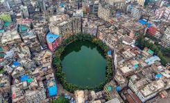
Tangail is a district located in the central region of Bangladesh under the Dhaka division. This district was established in 1969. Tangail district has an area of ​​3,414.28 square kilometers and the present population is about 4,037,608. It is one of the cities of Bangladesh located 83 km northwest of the capital Dhaka. Jamalpur district to the north, Dhaka and Manikganj districts to the south, Mymensingh and Gazipur to the east and Sirajganj district to the west. Madhupur has an immense collection of natural beauty including forest and hilly areas. The district has some of its own culture and traditions, notably the weaving industry and the weaving of sarees. Basically the district is known for its rich cultural heritage, vibrant history and significant contribution to the country's economy and society. <br><br> The economy of Tangail is mainly based on agriculture. Major crops include paddy, jute, wheat, sugarcane and various vegetables. Tangail excels especially in jute production. Tangail is equally famous for its traditional weaving industry. Apart from agriculture and weaving, Tangail has emerging industries like textiles, ceramics and food processing. There is employment for many people. Here people from different districts come for work who live together in harmony. Here different types of people and people of different races are living together as independently as themselves. <br><br> There are all kinds of accommodation facilities here. From public and private schools to universities. There are advanced government and private hospitals. The district has its own traditions and culture. Notable among these are the Karu art and the Tangail saree. Also has its own food habits and cuisine. Tangail sweets are very popular with people all over Bangladesh. <br><br> Since the district is well connected by road and highway network, the transportation system from Dhaka to all over Bangladesh is very convenient. Along with roads, there are railways and rivers which play a useful and important role in communication systems and any supply of trade. Tangail has one of the Bangabandhu Bridges which connects North Bengal with Dhaka. <br><br> Tangail district has a tropical monsoon climate. Naturally, Tangail has been playing an important role in the socio-economic landscape of the country with its diverse population, numerous educational institutions and an unmatched combination of historical and natural attractions. Its well-connected transport network adds to its importance, making it an important and dynamic region of Bangladesh.
অন্তর্দৃষ্টি দেখুন
টিলাগড় প্রপার্টি গাইড
Rating icon
3.8

টিলাগড়
, সিলেট

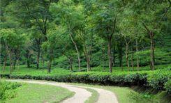
Tilagor is considered a suitable place to live in Sylhet due to its wide range of amenities, strategic location and pleasant environment. Tilagor is located within the Sylhet metropolitan area, northeast of the city center. It is also well connected to unique parts of Sylhet through the road network. The area is characterized by its rolling hills, greenery and natural beauty typical of the Sylhet region. The terrain of this place is slightly higher than that of the city. Srilekha offers a variety of attractive options including modern apartment complexes, individual homes and gated communities. The area is also known for its peaceful and family friendly atmosphere. Originally made ideal for families, professionals and students.<br><br> A variety of local businesses and small enterprises contribute to Tilagarh's economic vibrancy. There are job opportunities in education, healthcare and unique sectors. The area is also attractive for real estate investment and business ventures due to its strategic location and growing infrastructure. Also, during the paddy harvesting season, laborers come from different parts of the country for agricultural work. Overall Tilagarh contributes to a mixed economy and people of different castes, religions, castes and tribes live together and maintain a bond of harmony that is one of the virtues of its residents.<br><br> Tilagor is also very advanced in terms of education and health services. There are several reputed schools in and around Tilagor, which provide quality education from primary to secondary level. Shahjalal University of Science and Technology is one of the top public universities in Tilagore in Bangladesh. On the other hand, there are various health care facilities including hospitals and clinics providing general and specialized medical services. And since Sylhet Sadar is located very close from here, it is very easy to travel if you want to get any advanced services.<br><br> Like the economy, education and healthcare, the transport system here is also well developed. Local buses, rickshaws, autorickshaws, CNG and ride sharing are available as means of local communication. And a good road network ensures smooth transportation with other parts of Sylhet city. Also from here it is very convenient to travel around the country including the districts around Sylhet. In addition to road communication, there are communication systems through air and rail.<br><br> Tilagor is rich in history and tradition. Culturally, it is one of Sylhet's courtyards. They have their own regional language and diversity of cuisine. Which will impress others.<br><br> Basically, all the essentials for living are available here. There are selected electricity and good water supply systems. Internet connectivity and waste disposal facilities are also quite good. There are various facilities and places for entertainment. Tilagor Eco Park is a notable recreational spot. Also the beauty of the natural environment here attracts people. A design surrounded by greenery brings tranquility to the eyes of people. Besides, the security system here is also very good.<br><br> Overall, Tilagor is a lively and well-equipped area of ​​Sylhet area. Its strategic location, extensive facilities, peaceful environment and continuous development are contributing to this. Although the area faces several challenges of natural calamities and urbanization, the region's growth and improvement in quality of life is a bright prospect for its residents.
অন্তর্দৃষ্টি দেখুন
ডুমুরিয়া প্রপার্টি গাইড
Rating icon
3.8

ডুমুরিয়া
, খুলনা

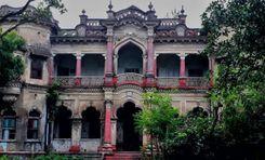
Among the 9 upazilas of the Khulna district, Dumuria is the largest, with a land area of about 454 sq./km. This upazila was established in 1983 and is located about 16 kilometers from Khulna City. Now, it has 237 villages, 204 mouzas, 14 unions, and a population of over 3 lakh.<br><br> This upazila is surrounded by rivers, canals, and other water sources. It is also bounded by multiple other upazilas, unions, and thanas. If you explore the Dumuria area guide, you will find that it has Fultola Upazila in the north, Batiaghata and Paikgacha in the south, Sonadanaga and Batiaghata in the east, and Avaynagar, Manirampur, and Keshabpur in the west.<br><br> The main economic source of this upazila is lobster farming. Other than that, people here grow seasonal vegetables that are sold across the country. Moreover, Dumuria is also known for its home craft and handicraft industry.<br><br> Though Dumuria doesn’t have a lot of historically significant landmarks, it does carry the dark past of the Liberation War of 1971. The Chuknagar Mass Killing Site is one such example. <br><br> Dumuria Upazila is significant for its many religious institutions, with over 230 mosques, 200 temples, and at least 4 churches. It also has over 200 educational institutions. Unfortunately, the area needs more government high schools and colleges. The literacy rate of Dumuria is 55.66%.<br><br> Since the area is near the Khulna City and Moyur Residential Area, it offers promising potential for real estate companies and a commercial target. The land price of the area is also affordable.<br><br> However, a large portion of Dumuria requires a modern makeover and the addition of amenities. While the area is eye-soothing due to its greenery and rural vibe, its lifestyle can certainly improve with time.
অন্তর্দৃষ্টি দেখুন
IconMap

ফিচারড প্রজেক্ট

সবগুলো দেখুন
Bangladesh-এর প্রপার্টি প্রাইস ট্রেন্ড

কেনা
ভাড়া
বেডরুম:
গড় মূল্য (বিগত ১২ মাসের)
Tk. 6,358.55 per sqft
বিগত ১২ মাসের বৃদ্ধি
5.85%
Positive Trend
বিগত ৩ মাসের বৃদ্ধি
5.2%
Positive Trend
Icon
দ্রষ্টব্য: মূল্য তথ্য Bikroy-এর পোস্ট করা বিজ্ঞাপন থেকে ঐতিহাসিক তথ্যের উপর ভিত্তি করে দেওয়া। সম্পূর্ণ মার্কেটের ডায়নামিক প্রতিফলিত নাও হতে পারে।
hero

Bikroy এ বিক্রি বা ভাড়া দিন: মাত্র ২ মিনিটেই প্রপার্টির বিজ্ঞাপন দিন!