Search Icon

Bangladesh এর এলাকাগুলি ঘুরে দেখুন

304টি এলাকার মধ্যে 252 - 270টি
শিরোইল প্রপার্টি গাইড
Rating icon
3.8

শিরোইল
, রাজশাহী

Shiroil is an exclusive residential area of ​​Rajshahi City Corporation along with other amenities. Shiroil is an area under Boalia Police Station of Ward No. 21 of Rajshahi. The area benefits from the overall infrastructure of Rajshahi city and all services provided by RCC. It is just one kilometer away from Rajshahi Zero Point. Shiroil offers a combination of residential amenities and essential amenities, making it a perfect choice for people interested in living in Rajshahi. <br><br> Shiroil is well known for its relatively peaceful environment that makes it a desirable place to live. The presence of educational institutions, activity facilities and religious places is capable of attracting the attention of any person. <br><br> From Shiroil you will be able to take the services of the best educational institutions in Rajshahi. Shiroil Government High School is a notable educational institution of Rajshahi. Also, as the capital of Rajshahi is very close from here, there is an opportunity to take services from universities, engineering universities and unique good educational institutions. <br><br> Along with education, you will also get medical care and best services here. There are decent entertainment facilities here. The area is close to amenities like Rajshahi District Stadium and Shahid Kamaruzzaman Stadium, offering opportunities for sports and leisure activities.<br><br> The transport system is also very developed here. Shiroil Bus Terminal is a major transport hub in Rajshahi providing convenient access to local and inter-district buses. There is also easy access to Rajshahi Sadar by rail and air. Also inside which they have rickshaws, auto rickshaw, CNG and bus etc. you can use private transport if you want. <br><br> Along with the livable environment, there is religious involvement. There are various religious places like mosques, temples and Buddhist temples. The main occupation of the people here is business and employment. People from different parts of the country come and live here for the convenience of jobs who come together and build a beautiful society. Also the people here have their own way of life, tradition and culture, diversity of their own cuisine, which represents Rajshahi to others. <br><br> Despite all the facilities, there is a problem of traffic congestion especially during peak hours. Naturally, Shiroil offers a good varsity of affordability and amenities that make it a favorable place to live in Rajshahi. Above all, potential residents should be aware of the traffic situation around the bus terminal.
অন্তর্দৃষ্টি দেখুন
সুবিদ বাজার প্রপার্টি গাইড
Rating icon
3.8

সুবিদ বাজার
, সিলেট

This Subid Bazar is located in the southwest of the city of Sylhet Sadar Upazila. It is a prominent locality in Sylhet, Bangladesh, known for its vibrant community, bustling markets, wealth of amenities and strategic location. Subid Bazar is well connected to other parts of Sylhet. It has become a convenient state for residents and visitors alike. <br><br> Subid Bazar is basically one of the residential areas of Sylhet city. There are modern apartment buildings, traditional houses and some high-end residential complexes that exude quality and taste. The area continues to provide diversity through local residents and their careers and expatriate residents and their foreign remittances. The area is also famous for its local market which has an ample supply of everything from fresh produce to clothing. The place is always busy and lively. Subid Bazar has banks, restaurants, cafes and numerous commercial establishments. <br><br> It also has education and health facilities. Sylhet has several well-known schools and colleges that provide quality education. This is a good aspect for the residents here. The area is equipped with various healthcare facilities including clinics and pharmacies. The quality of health services here is quite good. <br><br> Along with education, medical and other facilities, the communication system here is quite good. As the area is strategically well connected with major roads and highways, the connectivity from this place to all parts of the country including Sylhet is quite good. Local transport options like rickshaws, auto rickshaws and buses are available for local communication. <br><br> The place is also rich in culture and tradition. There is diversity within the community. There are various religious and cultural places. There are also parks and recreational areas where residents can relax, exercise and enjoy outdoor activities that contribute to the community's emotional development and well-being. All amenities are constantly increasing with new residential projects and commercial developments here. Also Subid Bazar is considered a safe area with relatively low crime rate. Local law enforcement and community presence contribute to the overall safety and security of the area. <br><br> Despite the many amenities the place has, Subid Bazar faces challenging issues like traffic jams during peak hours and occasional infrastructure maintenance issues. Overall, Subid Bazar in Sylhet is a prosperous area that offers a mix of comfort, commercial facilities and cultural richness.
অন্তর্দৃষ্টি দেখুন
হেতেমখাঁ প্রপার্টি গাইড
Rating icon
3.8

হেতেমখাঁ
, রাজশাহী

Hatemkha is part of Rajshahi City Corporation and the place has special importance as it is situated in the center of the district city. It is notable for all the amenities for accommodation and rich history and a vibrant community. Although the place is densely populated with a mix of different socio-economic groups, the atmosphere here is quite harmonious and harmonious, retaining the diversity of Rajshahi. Residents of Hatemkha are also known for their hospitality and strong community. <br><br> Hatemkha's economy is mainly dependent on shops, restaurants and service providers and various small and medium-sized entrepreneurs. There are also local markets that have been serving the residents for a long time, contributing significantly to the local economy.<br><br> There is a mix of local residential buildings and there is a mix of traditional houses to modern apartments etc. All these residents have adequate supply of electricity, water, internet and gas etc. Hatemkha also reflects Rajshahi's rich cultural heritage and the area contributes to the city's cultural scene through local arts, crafts and performances. <br><br> This place is very important for education. There are several state-of-the-art educational institutions in the vicinity including primary and secondary schools. For example - Rajshahi Medical College, Rajshahi Government Women's College etc. The journey to Rajshahi University from here is very short, so the way for students to get education here is smooth.<br><br> We all know more or less about Rajshahi medical services. Hatemkha maintains the heritage of Rajshahi by providing several healthcare facilities to its residents including clinics, hospitals and pharmacies, ensuring easy access to treatment.<br><br> Along with education and medical care, the transport system here is also very good. Road communication here is quite easy and fluent. Apart from road means, there are golden opportunities to use railway and air means of communication. There are also rickshaws, auto rickshaws and buses as public transport. There are also golden opportunities to use private transport and a well-developed road system. <br><br> On the other hand for recreation there are parks and recreational areas where people can relax and engage in outdoor activities. There are also various social and cultural institutions. <br><br> Overall, Hatemkha is suitable for living, especially those with a strong sense of community and notable for education, healthcare and cultural activities. It is a dynamic and integral part of Rajshahi that reflects the wider characteristics of the city in terms of culture, economy and community life.
অন্তর্দৃষ্টি দেখুন
আগ্রাবাদ প্রপার্টি গাইড
Rating icon
3.8

আগ্রাবাদ
, চট্টগ্রাম

আগ্রাবাদ, চট্টগ্রামে অবস্থিত একটি উন্নত এবং শক্তিশালী বাণিজ্যিক কেন্দ্র, যা কর্ণফুলী নদী এবং পাহাড়ের মাঝখানে লম্বাভাবে অবস্থিত। যেখানে বাণিজ্য ও প্রকৃতি আশ্চর্যজনক সঙ্গমে মিলিত হয়েছে। এই জায়গাটি বিভিন্ন জাতীয় এবং আন্তর্জাতিক ব্যবসা এবং আর্থিক প্রতিষ্ঠানের জন্য একটি বাড়ির মতো। বাদাম-তলী রোড এবং সাবদার আলী রোড হল প্রধান রাস্তা যেখানে বাণিজ্যের সাথে জীবনের মিলন হয়েছে।<br><br> শুধু এর গুরুত্বের আভাস দেওয়ার জন্য আপনি জেনে রাখুন, চট্টগ্রাম চেম্বার অফ কমার্স অ্যান্ড ইন্ডাস্ট্রি, চট্টগ্রাম স্টক এক্সচেঞ্জ অফিস এবং ওয়ার্ল্ড ট্রেড সেন্টার এখানে অবস্থিত। শীর্ষস্থানীয় ব্যবসায়িক কোম্পানি, ব্যাঙ্কিং প্রতিষ্ঠান এবং আর্থিক সংস্থাগুলির জন্য, আগ্রাবাদকে প্রাচ্যের 'হংকং' হিসাবে সমাদৃত করা হয়।<br><br> তবে ব্যবসা-বাণিজ্য এখানে ফোকাস নয়। আপনি সমস্ত শহুরে সুবিধা এবং সুবিধা খুঁজে পাবেন এখানে। জাম্বরী পার্ক চট্টগ্রামবাসীর অন্যতম আকর্ষণ। আগ্রাবাদ মেডিক্যাল কলেজ, আবাসিক এলাকা, কলোনি, বড় রাস্তা, রেস্তোরাঁ এবং চট্টগ্রামের সেরা কিছু স্কুল অফার করে।<br><br> পোর্ট সিটি নামের প্রতি ন্যায়বিচার করে, আগ্রাবাদ কনটেইনার বোর্ডিং এবং আনলোড এবং বন্দরে পরিবহনের জন্য একটি বিশেষ পরিধি সৃষ্টি করেছে । যার ফলে, এলাকা দিনরাত ব্যস্ত থাকে। ফ্লুরোসেন্ট স্ট্রিট লাইট এবং নন-স্টপ গুঞ্জন শহরটিকে ২৪/৭ জাগিয়ে রাখে। আবাসিক স্থান এবং বাণিজ্যিক কেন্দ্রের মধ্যে এই সমন্বয় এলাকাটিকে অনন্য করে তোলে।<br><br> যেহেতু এটি একটি বাণিজ্যিক এলাকা, তাই শপিং সেন্টারগুলি এই শহরের একটি বড় অংশ। সিঙ্গাপুর ব্যাংকক মার্কেট, লাকি প্লাজা এবং আখতারুজ্জামান সেন্টার হল কেনাকাটার জন্য সেরা কিছু স্পট। অত্যাধুনিক নৃতাত্ত্বিক জাদুঘর এবং কর্ণফুলী শিশু পার্ক এই এলাকার সবচেয়ে বড় পর্যটক আকর্ষণ।
অন্তর্দৃষ্টি দেখুন
আমতলা প্রপার্টি গাইড
Rating icon
3.8

আমতলা
, বরিশাল

Amtala is an important commercial, economic, and residential area in Nazirpur Sadar Union of Barisal District. This area, surrounded by roads and waterways, is also important for transportation. Kaliganga River and Balaswar River flow through this area. The location is well known for the production and transportation of agricultural products. Although it is crowded with raw markets, educational institutions, government offices, banks, and various private institutions, the picturesque riverside rural landscape adds to the charm of the area. Barisal district is also known for its riverine environment, natural beauty, and rich cultural heritage. Many people call Barisal the "Venice of the East".<br><br> Amtala area is located in the southern part of Bangladesh in Barisal district. To the east of this area are Bhola, and Jhalkathi districts. Khulna and Bagerhat districts on the West. Gopalganj and Madaripur districts in the North. To the South are the districts of Pirojpur, Patuakhali, and Barguna. Gopalganj-Tungipara-Nazirpur-Pirojpur highway road connects this area with almost all the important district towns of the country. Being an area surrounded by rivers, many people use waterways for the transportation of goods and communication.<br><br> The economy of Amtala is mainly based on agriculture. Local agricultural produce includes paddy, jute, and various fruits and vegetables. Fishing is also an important part of the local economy. Local people here are involved in agriculture, fishing, and transportation-based occupations. In and around the area there are excellent schools, health care centers, and recreational centers. The area is known for its river system, green environment, and significant agricultural activity.<br><br> Due to the important economic area and advanced communication system, continuous efforts to improve the infrastructure and living conditions of this area are noteworthy. Government development projects are constantly working to improve transport, education, and healthcare facilities. Being a riverine area, Amtala is prone to floods, affecting agriculture, infrastructure, and daily life.<br><br> The Amtala area has accommodations ranging from mid-range hotels to top-class accommodations. The business network in the area is very extensive. Bus stand, port terminal, and airport are located very close to this area. Finally, the Amtala area is quite suitable for residential and commercial activities. But the overall quality is not as good as in urban areas.
অন্তর্দৃষ্টি দেখুন
আম্বরখানা প্রপার্টি গাইড
Rating icon
3.8

আম্বরখানা
, সিলেট

Ambar khana is located in the heart of Sylhet metropolis. This point is very important point for tourism, business and transportation. On its north side are Hazrat Shahjalal International Airport and Sylhet International Cricket Stadium. Also, Bangladesh's first tea garden 'Malanichara' is located very close to this area. To the south of this area is the shrine of the famous Auliya Hazrat Shahjalal Yemeni (RA). There are also Sylhet Government Aliya Madrasa, and Ambar khana Girls School and College. The traditional MC College and Shahjalal University of Science and Technology are located on the western side of this area. <br><br> Ambar khana Jame Masjid is one of the famous mosques of this area and the country. There is a police station at Ambar khana, Address - Mojumdari Airport Road 3100, Sylhet. Fire service station is about 3 km away in Bandar-Bazar area. This area is very important as it facilitates tourism, agriculture, tea and import and export from the border area. Being an economically important area, there is a need to improve communication and accommodation. <br><br> Being a tourist city, Ambar khana in Sylhet can be reached directly by bus from the main cities of the country. About 5 km from Sylhet Railway Station, Ambar khana Point. From Amber khana, there are direct buses, CNG and hired vehicles to all the tourist spots including Sadapathar, Bholaganj, Companyganj, Ratargul Swamp Forest, Bisthakandi, Hazrat Shahjalal (RA) Shrine, Jaflong, Tamabil, Lalakhal, Hakaluki Howar.
অন্তর্দৃষ্টি দেখুন
কয়লাঘাট প্রপার্টি গাইড
Rating icon
3.8

কয়লাঘাট
, খুলনা

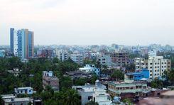
Koyla Ghat is an important economic area under Dakop Upazila in Khulna District. The area is located near the banks of the Rupsa River. It is close to the industrial area of ​​Khulna city, which facilitates the transportation of raw materials and finished goods from factories and warehouses. It is one of the oldest commercial areas of Khulna and the country. Previously it was only known for transporting coal and products. Over time, it has become a gathering commercial area.<br><br> Mongla port, shipyards, and ferry wharf have made the area a busy industrial and commercial area. The area also serves as a transportation hub for coal transportation, international container transportation, and industrial establishments. The strategic location makes it an essential part of the regional transport network, connecting Khulna to other parts of Bangladesh and beyond.<br><br> The area is bounded by Koira Upazila to the west, Paikgacha Upazila to the south, and Dumuria and Khulna City to the north. Rupsa River to the east. The strategic location makes it easily accessible from different parts of the city. Boats, launches, and ferries ply regularly to various destinations along the river.<br><br> Khulna City Bypass Road (N7 Highway), Shipyard Road, Khan Jahan Ali Road, and Rupsa Ghat Road, have improved the connectivity of the area. Using the Khan Jahan Ali Bridge and ferry ghat, you can travel to all the southern districts of the country including Sundarban, and Barisal. Beyond economic significance, the Koyla Ghat area has a unique mixture of heritage and architecture. Here you will see a wonderful combination of modern infrastructure, from the historic mosque-temple to the colonial era. Traditional fairs, religious events, and cultural performances are held here regularly.<br><br> One of the attractions of Koala Ghat is its scenic riverside scenery. The area has become a bustling commercial hub. There are numerous shops, markets, warehouses, and small- and medium-sized industrial establishments on this street. Busy commercial activities here have created huge employment opportunities and contributed to local economic development.<br><br> With public and private institutions, numerous commercial establishments, well-developed communication systems, educational institutions, health care centers, and a pleasant environment conducive to living, the amount of residential buildings in this area is increasing.
অন্তর্দৃষ্টি দেখুন
কামরাঙ্গীরচর প্রপার্টি গাইড
Rating icon
3.8

কামরাঙ্গীরচর
, ঢাকা

কামরাঙ্গীরচর উত্তরে হাজারীবাগ থানা ও লালবাগ থানা, পূর্বে লালবাগ থানা ও চকবাজার থানা এবং দক্ষিণ ও পশ্চিমে বিখ্যাত কেরানীগঞ্জ উপজেলা সীমানা দিয়ে ঘেরা। কামরাঙ্গীরচর একটি ঘনবসতিপূর্ণ স্থান যেখানে ঐতিহ্যবাহী পুরান ঢাকার একটি আভা রয়েছে। এটি বেশ বড় এলাকা, এবং এই জায়গাটির সাথে যুক্ত মোট এলাকা প্রায় ৩.৬৩ কিমি (১.৪০ বর্গ মাইল)।<br><br> কামরাঙ্গীরচরের জনসংখ্যা হল ৯৩,৬০১ জন যেখানে পরিবারের গড় সদস্য ৪.৩ এবং গড় সাক্ষরতার হার ৫৭.৬% (২০১১ সালের আদমশুমারি অনুসারে)। এই জায়গাটি বস্তি হিসেবে সুপরিচিত। বস্তিগুলি উপকণ্ঠে এবং কম অ্যাক্সেসযোগ্য অঞ্চলে, যেমন গলিতে অবস্থিত হতে পারে। বাংলাদেশের বস্তির উপর ২০০৬ সালের একটি জরিপ দেখায় যে বস্তির একক বৃহত্তম ঘনত্ব কামরাঙ্গীরচরের DUMP এলাকায়। জরিপে আরও দেখা গেছে যে সেখানে প্রায় ৩০০,০০০ লোক বাস করে এবং তাদের মধ্যে ২৬৫,০০০ বস্তিবাসী। ২০২১ সালের জরিপ অনুসারে, কামরাঙ্গীরচরের সবচেয়ে বড় বস্তি, যেখানে ৬০০,০০০-এর বেশি মানুষ বস্তিতে বাস করে।<br><br> কামরাঙ্গীরচরে সুলতানগঞ্জ নামে একটি স্থান বিখ্যাত, এটি ডিসিসি (কোতোয়ালি), ঢাকা জেলা, ঢাকা বিভাগে অবস্থিত। এটি একটি বড় জায়গা এবং এখানে প্রচুর লোক বাস করে।<br><br> সামগ্রিকভাবে, ঢাকা শহরের অন্যান্য এলাকার মতো কামরাঙ্গীরচরের জনপ্রিয়তা এবং স্বীকৃতি একই মাত্রার নাও হতে পারে, এর সাংস্কৃতিক বৈচিত্র্য, এবং সম্প্রদায়ের চেতনা এটিকে একটি উল্লেখযোগ্য স্থান এবং উন্নয়নের জন্য বিবেচনা করার মতো জায়গা করে তুলেছে।
অন্তর্দৃষ্টি দেখুন
কাসিপুর বাজার প্রপার্টি গাইড
Rating icon
3.8

কাসিপুর বাজার
, বরিশাল

Kashipur Bazar is a densely populated area in the heart of Barisal district, considered the region's commercial and economic hub. The Bhanga-Barisal highway and the C&B road have increased the area's economic importance. Also due to the Kirtankhola River and Barisal Launch Terminal, the area's trade and commerce have expanded tremendously, along with huge employment opportunities. There are raw markets, wholesale markets, shopping malls, banks, government and private offices, educational institutions, and medical centers.<br><br> Barisal Airport, river port, and bus stand are close to Kashipur Bazar. From this area, you can easily travel to all upazilas and all major roads of the country. To the West of the area are Jhalkathi, Pirojpur, Khulna, and Bagerhat. To the North are Barisal Sadar, Gopalganj, Madaripur, and Shariatpur. Bhola and Noakhali districts on the East. Patuakhali and Barguna districts on the West.<br><br> The economy of the Kashipur Bazar area is mainly based on agriculture and goods transportation. Also, the local retail and wholesale markets contribute greatly to the overall economy of the district. The area is important in terms of communication, transport, employment, etc. Fresh produce, furniture, textiles, household items, electronics, etc. can be found in the market here.<br><br> Here you will find several architectural examples including temples and mosques from the Mughal period. Also, there are several tourist centers including Durga Sagar Pond, Museum, Kirtankhola River, and Parks. The area has several budget-friendly hotels and guesthouses where you can spend the night. In and around the area, there are quality educational institutions, madrasahs, medical centers, and restaurants. Police Station and Fire Service are located very close by.<br><br> Although a densely populated area, Kashipur Bazar's natural environment, surrounded by riverside greenery, will charm you. The communication system from this area to the surrounding areas is quite good, and the sanitation system is also well structured. The main road is always congested as river ports, factories, and businesses are built nearby.<br><br> Kashipur Bazar's communication system and other civic facilities are very convenient for housing, employment, and business. Due to economic and commercial development, several housing projects and infrastructure are being developed in the area. Traffic congestion, a large number of autorickshaws, and environmental pollution are the main problems here.
অন্তর্দৃষ্টি দেখুন
কুমিল্লা প্রপার্টি গাইড
Rating icon
3.8

কুমিল্লা
, চট্টগ্রাম

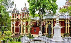
Comilla is an important economic and commercial city in the southeastern part of Bangladesh. It is the third-largest city in the country in terms of population. From archaeological treasures, the city is known for vibrant markets, picturesque landscapes, a business-friendly environment, a well-developed communication system, and well-planned housing. It is a city bustling with modern vibrancy, surrounded by a blend of history, culture, and natural beauty. The city is also important in terms of communication and administration.<br><br> The Feni, Noakhali, and Chittagong districts are south of the city. Munshiganj, Habiganj, and Chandpur districts in the west. Dhaka, Narayanganj, Narsingdi, and Brahmanbaria districts in the north. India's Agartala border (Tripura State) to the east. Gomti and Dakatiya rivers flow through Comilla. It is well-connected by road and rail, connecting it to the country's major cities, including the capital Dhaka and the port city Chittagong. These communication networks make it a vital node in Bangladesh’s trade network.<br><br> Comilla University, Ispahani Public School and College, Cantonment College Comilla, Victoria College, etc. educational institutions are considered one of the country's best. The city has several schools and colleges serving the educational needs of the local population.<br><br> Comilla's 'Ros Malai' has been awarded Geographical Indication (GI) status. Shalbon Vihar, Mainamati Ruins, and Dharmasagar Pond are some of the historical sites of the city. The city's strategic location, cultural heritage, and growing infrastructure have contributed to its significance in the country's landscape.<br><br> The economy here is based on agriculture. The city also has small and medium-scale industries including Khadi textiles, pharmaceutical factories, garments, and IT companies, which are contributing significantly to its economy. Comilla Export Processing Zone (CEPZ) is a prominent industrial zone in the country, established to promote export-oriented industries and foreign investment. It is contributing significantly to industrial output and employment generation.<br><br> In recent years, the city has seen infrastructural improvements in roads, healthcare, and residential areas. Tourists can enjoy the historical monuments in Comilla and the natural beauty of the surrounding countryside, while the hospitality of the locals also attracts visitors. As the importance of this city increases as a center for investment, development projects, commercial; residential, and infrastructural development is increasing here.<br><br>
অন্তর্দৃষ্টি দেখুন
খান জাহান আলি প্রপার্টি গাইড
Rating icon
3.8

খান জাহান আলি
, খুলনা

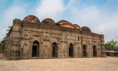
Khan Jahan Ali is an important economic area included in the city of Khulna, Bangladesh. It is a Metropolitan Police Station of Khulna Metropolitan Police in Khulna Division. Located on the banks of the Bhairab ​​River, the area is rich in natural beauty, connectivity, and culture. The river provides irrigation, transportation, and recreational opportunities. The proximity of roads, waterways, and railways makes the area an attractive choice for commercial, economic, and residential purposes.<br><br> The jute mills here are contributing greatly to the country's economy. Also, Dhaka-Khulna Highway Road, Khulna City Bypass Road, and KUET Road have greatly improved the trade and connectivity of the area. These roads can be used to transport goods to all important cities of the country via Mongla Port, Barisal, Jessore, and Padma Bridge.<br><br> The area is named after the revered Sufi saint Khan Jahan Ali. The area is bounded by Koira Upazila in the west, Paikgacha Upazila in the south, and Dumuria and Khulna towns in the north. Bhairab River to the east. Several public and private educational institutions, including Khulna University of Engineering & Technology, and Khulna Agricultural University, are located near the area. Also, healthcare and recreation facilities are good.<br><br> Bridges, culverts, and infrastructure projects here have facilitated trade, commerce, and communication, contributing to the economic development of the western region of the country. The wholesale business, raw market, and commercial activities here have made Khulna's economy vibrant. Also, the culture, vibrant markets, and local cuisine like Chui Jhal will fascinate you.<br><br> Khan Jahan Ali area is mainly agricultural. Jute, rice, betel nut, and animal husbandry form the backbone of the local economy. The fertile land of the area is suitable for the cultivation of paddy, jute, sugarcane, and various seasonal crops. There are several fish, cattle, and poultry farms. Also, the traditional crafts of this area like pottery and weaving are popular all over the country.<br><br> The area underwent extensive development of roads, bridges, sewerage, and other utility infrastructure to accommodate the growing population and spur economic activity. New buildings and facilities are also being constructed to modernize the living standards of the residents and meet the growing needs.
অন্তর্দৃষ্টি দেখুন
চকবাজার প্রপার্টি গাইড
Rating icon
3.8

চকবাজার
, ঢাকা

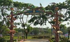
If you talk about one of the oldest and bustling marketplaces or areas in old Dhaka, you have to mention the Chaukbazar area. And if you want to know the Chaukbazar area guide well, you should also be familiar with its history and significance.<br><br> Also spelled “Chawkbazar,” this area was established in the 17th century CE during the Mughal period. It was first named Badshahi Bazar by Murshid Quli Khan after its establishment. But later, the area was called Chaukbazar.<br><br> The Chaukbazar thana, formed in 2009, is now a part of Dhaka South City Corporation. It is surrounded by Bangshal Thana and Laalbag Thana and has an area of 2.07 sq./km. According to the 2011 census, the area's population is about 1,60,112.<br><br> From the beginning, the area was known for its marketplace, with hundreds of shops, stalls, vendors, and more. Even after 400 years, this place is still one of the popular market areas.<br><br> The Caukbazar Shahi Jame Masjid is one of its most significant landmarks. It also has the shrine of the area’s founder, Murshid Quli Khan.<br><br> Every year during Ramadan, the streets of Chaukbazar get crowded because of its Iftar Bazaar. It is Dhaka’s oldest and most popular iftar bazaar, and people from inside and outside the city come here to buy iftar during the holy month.<br><br> Another reason Chaukbazar is known to many people is because of the old Central Jail of Bangladesh. It has recently been turned into a jail museum after the jail has been relocated. <br><br> With its narrow streets and busy lifestyle, Chaukbazar is one of the most crowded parts of Dhaka. Nevertheless, the area also offers communication access to many parts of Dhaka and has schools, colleges, and medical and financial institutions. However, many parts of the area are yet to be developed.
অন্তর্দৃষ্টি দেখুন
চাঁদপুর প্রপার্টি গাইড
Rating icon
3.8

চাঁদপুর
, চট্টগ্রাম

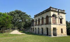
Chandpur is a naturally vibrant district of Chittagong division. It is located in the country's southeastern part, near the confluence of the Padma and Meghna rivers. Situated at the outfall of a river, the city is an important center for agricultural activities, river transport, and trade. The district is also known for its rich cultural heritage and natural beauty.<br><br> Chandpur district is located in the basin of the Padma and Meghna Rivers. It is bounded by Munshiganj and Comilla districts to the north, Noakhali, Laxmipur, and Barisal districts to the south, Comilla district to the east, Meghna River, Shariatpur and Munshiganj districts to the west. The upazilas of this district are - Chandpur Sadar, Faridganj, Haimchar, Hajiganj, Kachua, Matlab South, Matlab North and Shahrasti upazilas.<br><br> Chandpur, the breeding and habitat of silver hilsa, the national fish of Bangladesh. Meghna River serves as a lifeline for transportation, fishing, and agriculture. This charming environment, bustling river port, and hilsa town make this district very attractive to tourists. Beyond its economic significance, Chandpur fascinates visitors with its lush greenery, serene environment, and tapestry of riverine Bengali culture.<br><br> Chandpur's economy is mainly driven by agriculture, fishing, and trade. The city's roads, railways, and waterways have contributed significantly to the country's economy, particularly in agriculture, fisheries, and cargo trade. The city serves as an important transportation hub connecting various regions of the country by road, rail, and waterways. Education and medical facilities in Chandpur are also quite good.<br><br> Rupsa Zamindar Bari is a notable landmark, reflecting the region's rich architectural and cultural heritage. During the reign of the twelve Bhuiyans, this region was held by Chand Roy, son of Kedar Roy, the zamindar of Bikrampur. According to historian JM Sengupta, the region was named Chandpur after Chand Roy.<br><br> The city has cultural importance as a center of literature, art, and music. Also, various social programs, youth clubs, training centers, and recreation centers in the area contribute to intellectual and social development. The area attracts visitors interested in river cruises, fishing, and exploring the picturesque countryside.<br><br> Being an important center for trade, communication, and transportation of goods, the city is developing residential and commercial infrastructure. Also considering the importance of communication, roads and bridges are being constructed and renovated as planned in the rural areas of the district. Ongoing development and initiatives aimed at furthering the city's prosperity, promise a bright future.
অন্তর্দৃষ্টি দেখুন
তেরোখাদা প্রপার্টি গাইড
Rating icon
3.8

তেরোখাদা
, খুলনা

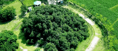
Several Upazilas of the Khulna District are located across the Rupsha River, and one such upazila is Terokhada. It is about 24 kilometers away from Khulna City and has a land area of about 186.54 square kilometers. As for population, according to the official website of the Upazila, there are over 26 thousand families living in the area, and the population is about 1,18,854. So anyone who plans to get to know this upazila will find this Terokhada area guide helpful.<br><br> There are no direct bus routes, roads, or bridges to Terokhada from the Khulna Sadar area. From the Sadar area, travelers must first go through Upper Jessore Road and pass the K.D. Ghosh Road to reach the Jailkaha Ferry Ghat. From there, they can cross the river to reach Senerbazar Ferry Ghat. Several means of travel, such as buses, trucks, vans, tempos, or laguna, will take you directly to the Upazila Sadar area.<br><br> While there might not be a bridge connecting the Upazila to the city, there are more than 450 bridges and culverts inside the Upazila to improve communication. However, the number of underdeveloped roads is still a matter of concern. The roads also need to be wider for better access to transport.<br><br> Terokhada has two major rivers: Atharobaki and Katakhali. The main economic source of people here is farming and cultivation, and a large part of Terokhada is covered by farmland. The main crops here are paddy, sugarcane, coconuts, etc. Other economic sources include shrimp framing, non-agricultural labor, business, industry, fisheries, transport, poultries and dairies, and cottage industries.<br><br> The environment in Terokhada is green, filled with trees, rivers, and rural beauty. While there isn’t big and modern housing, it certainly offers fresh air, as heavy industrial activities still haven’t polluted it. Moreover, the area has access to basic and average educational, religious, and financial institutions, along with many hats, bazaars, and marketplaces.
অন্তর্দৃষ্টি দেখুন
দাকোপ প্রপার্টি গাইড
Rating icon
3.8

দাকোপ
, খুলনা

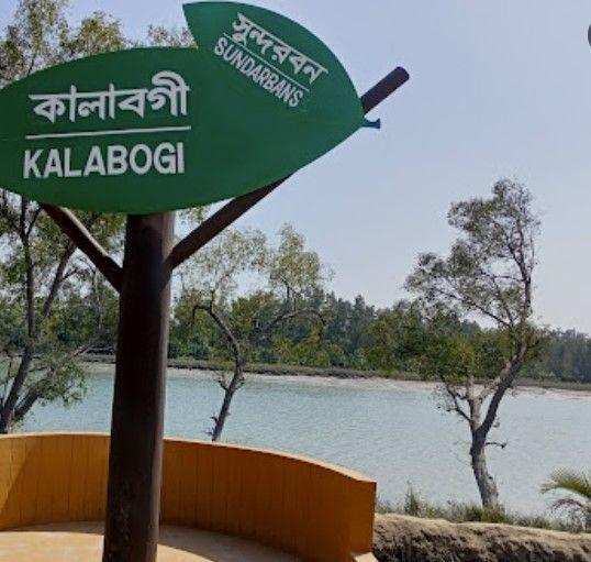
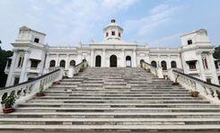
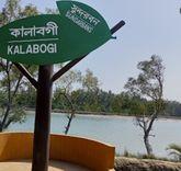
For anyone who wants to explore the mystery and beauty of the Sundarbans Mangrove Forest and its nearby locality while enjoying a few nights’ stay, there is no better way to get there than the Dacope. This upazila of the Khulna District is located at the far end of the district. It was established as a thana of the district in 1906 but was converted into an upazila in 1983.<br><br> The Dacope area guide shows the upazila has a land area of 382.85 square kilometers. However, it is about 991.56 square kilometers, including Sundarbans. It has a population of more than 1.5 lakh. It is bounded by Batiaghata Upazila in the north, Sundarban Forest in the south, Batiaghata Upazila and Rampal Upazila (of Bagerhat) in the east, and the Paikgacha Upazila in the west.<br><br> What makes this upazila stand out is that it offers more facilities and accommodations for visitors and tourists than other nearby areas. Travelers can access Dacope from the Khulna City area and use the Batiaghata upazila route directly via bus.<br><br> Though there are no railway routes in the area, people also use ferries, boats, and launches to cross rivers or visit the locations of Sundarbans forest areas. The main water bodies surrounding the upazila are the Shibsa River, Pasur River, Chunkuri River, Jhapjhapaia Canal, etc.<br><br> Though Dacope seems like a locality from the main town, it is one of the few upazilas with more paved roads than mud roads. It also has over 650 bridges and culverts. While communications in the area are pretty good compared to many others, natural disasters often cause havoc in daily life here.<br><br> Because it has many ponds, rivers, canals, and other water sources, the economy of the upazila has flourished due to fisheries and shrimp cultivation. It has over 6,110 ponds, over 4,500 lobster farms, 40 shrimp farms, and 4 shrimp hatcheries. There are also over 867 poultries in Dacope.<br><br> Notable educational institutes in Dacope are Muhammad Ali Secondary School, Chalna Bazar Government Girl's High School, Chalna MM College, etc. Historical and other notable landmarks are Karamjal Wildlife Breeding Center, Kalibagi Eco Tourism Center, Shekher Tek Eco Tourism Center, Ruin of Shibsha Temple, Chalna Lunch Terminal, etc.
অন্তর্দৃষ্টি দেখুন
নথুল্লাবাদ প্রপার্টি গাইড
Rating icon
3.8

নথুল্লাবাদ
, বরিশাল

Natun Bazar is a lively and bustling area located in the heart of Barisal district. Located on the banks of the Kirtankhola River, the area is very important in terms of trade and economy. The area serves as an important commercial center for communication and transportation of goods due to the Barisal launch terminal and connecting roads. With local markets, banks, and private and administrative offices, it is always bustling.<br><br> From Natun Bazar, you can travel to all upazilas of the Barisal district. Bhola and Noakhali upazilas are on the east side of this area. Jhalkathi, Bagerhat, and Khulna districts on the west. Chandpur, Shariatpur, and Gopalganj districts in the north. Barguna and Patuakhali districts on the south side. BM College Road, Hospital Road, Bogra Road, and Bhanga-Barisal Highway Road connect this area to the rest of the country. You can travel to different districts of the country, including Dhaka, Chandpur, Patuakhali, and Chittagong, by river route.<br><br> The communication system and local markets here served as a trading center for the transport of agricultural products, fish, and other products across the country. This market offers everything from fresh produce, aromatic spices, textiles to electronics. Due to the launch terminal, local market, and goods transportation facilities, there is a lot of job creation here.<br><br> Natun Bazar is known for its natural beauty and rich cultural heritage. Due to a business-friendly environment, improved communication system, adequate educational institutions, medical centers, transportation, parks, etc., many residential buildings are being developed in and around this area. Despite being a densely populated area, the rural surroundings of the area will charm you.<br><br> The Natun Bazar area is developing with many amenities including new apartments, banks, and restaurants. There are shopping malls, restaurants, and parks. Police Station and Fire Service are located very close by. Natun Bazar's communication system and other civic facilities are very convenient for housing, employment, and business. Although several infrastructures and residential buildings have been developed, traffic congestion and sanitation systems are not structured. Traffic congestion, lots of auto rickshaws, and environmental pollution are the main problems here.
অন্তর্দৃষ্টি দেখুন
নবাবগঞ্জ প্রপার্টি গাইড
Rating icon
3.8

নবাবগঞ্জ
, ঢাকা

নবাবগঞ্জ ঢাকার একটি উপজেলা, যা ইছামতি নদীর তীরে অবস্থিত। এটি ঢাকা শহর থেকে ৩৫ কিলোমিটার দক্ষিণ-পশ্চিমে অবস্থিত। ইতিহাস ও উন্নয়নের মেলবন্ধনে গড়ে ওঠা নবাবগঞ্জ এর ভৌগোলিক অবস্থানের কারণে বাণিজ্য ও ব্যবসার জন্য ঢাকার অন্যতম গুরুত্বপূর্ণ স্থান হিসেবে পরিচিত।<br><br> নবাবগঞ্জ আধুনিক সময়ের একটি শহর নয়। নামটিই এর সমৃদ্ধ ইতিহাস এবং নবাবি আমলের নবাবদের সাথে সংযোগের ইঙ্গিত দেয়। এই উপজেলা তিনটি নদী দ্বারা পরিবেষ্টিত, যা ইছামতি, কালিগঙ্গা এবং পদ্মা নদী। এই অনন্য বৈশিষ্ট্যটি এটিকে পণ্য বিনিময়ের জন্য অর্থনৈতিকভাবে লাভজনক একটি কেন্দ্র হিসেবে গড়ে তুলেছে।<br><br> নবাবগঞ্জ উপজেলা ১৪টি ইউনিয়ন পরিষদের সমন্বয়ে গঠিত। সাম্প্রতিক জনগণনা অনুসারে এখানে ৭০,৭৫৭টি পরিবার এবং ৩,১৮,৮১১ জন লোকের বসবাস। এলাকাটি কৌশলগতভাবে গুরুত্বপূর্ণ হওয়ায় এর রাজনৈতিক প্রভাব অনস্বীকার্য। এখানকার বাণিজ্য এবং দৈনন্দিন জীবনে রাজনীতির প্রভাব স্পষ্টভাবে পরিলক্ষিত হয়।<br><br> ঢাকাবাসীদের মধ্যে দিনভ্রমণের সংস্কৃতি জনপ্রিয় হয়ে ওঠায় এলাকা নিয়ে আলোচনা তুঙ্গে ওঠে। ঢাকা শহরের কোলাহল থেকে দূরে একদিন কাটানোর জন্য ঢাকার আশেপাশে উপযুক্ত স্থান খুঁজতে শুরু করেন ঢাকাবাসীরা। প্রাকৃতিক সৌন্দর্য ও ঐতিহাসিক গুরুত্বের কারণে নবাবগঞ্জ একটি আকর্ষণীয় পর্যটনস্থলে পরিণত হয়েছে।<br><br> বন্ধু ও পরিবার-পরিজনেরা এখন সুযোগ পেলেই নবাবগঞ্জে ছুটে আসেন, যেখানে প্রকৃতির সাথে মিলিত হওয়া, তাজা বাতাস গ্রহণ এবং ইছামতি নদীর শান্ত পরিবেশ উপভোগ করা যায়। এই পর্যটন বৃদ্ধির ফলে ব্যবসা-বাণিজ্য বিকশিত হচ্ছে এবং নবাবগঞ্জ উপজেলার অর্থনীতির গতিপথ প্রাণবন্ত হচ্ছে।
অন্তর্দৃষ্টি দেখুন
IconMap

ফিচারড প্রজেক্ট

সবগুলো দেখুন
Bangladesh-এর প্রপার্টি প্রাইস ট্রেন্ড

কেনা
ভাড়া
বেডরুম:
গড় মূল্য (বিগত ১২ মাসের)
Tk. 6,358.55 per sqft
বিগত ১২ মাসের বৃদ্ধি
5.85%
Positive Trend
বিগত ৩ মাসের বৃদ্ধি
5.2%
Positive Trend
Icon
দ্রষ্টব্য: মূল্য তথ্য Bikroy-এর পোস্ট করা বিজ্ঞাপন থেকে ঐতিহাসিক তথ্যের উপর ভিত্তি করে দেওয়া। সম্পূর্ণ মার্কেটের ডায়নামিক প্রতিফলিত নাও হতে পারে।
hero

Bikroy এ বিক্রি বা ভাড়া দিন: মাত্র ২ মিনিটেই প্রপার্টির বিজ্ঞাপন দিন!