Search Icon

Explore Areas in Bangladesh

288 - 306 out of 303 areas
Shariatpur Property Guide
Rating icon
3.8

Shariatpur
, Dhaka

Among all the districts that are getting more recognition and even more popularity since the inauguration of the Padma Bridge, Shariatpur is one of them. The area was founded in 1977 by the founder of Faraizi Movement, Haji Shariatullah.<br><br> While the area was named after him, it was established as a district under the Dhaka Division in 1984. Filled with historical significance and important places, the Shariatpur area guide is now one of the most popular area guides for many.<br><br> The Shariatpur district was formed by taking lands from the great Bikrampur (southern) and Idilpur of the old Barisal District. Now, it has a land area of about 1,174 sq./km, and the population is around 1.3 million. Currently, it has 8 thanas, 6 upazilas, 65 unions, and 1355 villages.<br><br> The construction of the Padman Bridge has changed the visual of the riverside areas of the district drastically. Now, the riverside area has various VIP zones, and the roads have developed as well. On top of that, the Padma Bridge has made the communication and transportation of other districts, especially Dhaka, with Shariatpur more convenient.<br><br> The main economy of the district is agriculture (61.66%). However, the literacy rate of the district is low, which is only 47.3%. Yet, there are around 1,000 educational institutions in Shariatpur.<br><br> Nevertheless, Shariatpur has many historical landmarks and some of them are hundreds of years old. The popular historical sites in the district are Fateh Jangapur Fort, Dhanuka Manasa Bari, Rudrakar Moth, Sri Sri Satyanarayana Shiba Temple, etc. Other popular attractions are Padma Bridge and the Bridge Viewpoint, Modern Fantasy Kingdom, Shariatpur Sadar Upazila Mini Park, Burir Hat Jame Masjid, etc.<br><br> The beautiful rural nature of Shariatpur is attracting people to buy land for residential and commercial purposes. However, with the inauguration of the Padma Bridge, property prices in the district, especially the Padma Bridge area, have become scorchingly high.
View Insights
Terokhada Property Guide
Rating icon
3.8

Terokhada
, Khulna

Several Upazilas of the Khulna District are located across the Rupsha River, and one such upazila is Terokhada. It is about 24 kilometers away from Khulna City and has a land area of about 186.54 square kilometers. As for population, according to the official website of the Upazila, there are over 26 thousand families living in the area, and the population is about 1,18,854. So anyone who plans to get to know this upazila will find this Terokhada area guide helpful.<br><br> There are no direct bus routes, roads, or bridges to Terokhada from the Khulna Sadar area. From the Sadar area, travelers must first go through Upper Jessore Road and pass the K.D. Ghosh Road to reach the Jailkaha Ferry Ghat. From there, they can cross the river to reach Senerbazar Ferry Ghat. Several means of travel, such as buses, trucks, vans, tempos, or laguna, will take you directly to the Upazila Sadar area.<br><br> While there might not be a bridge connecting the Upazila to the city, there are more than 450 bridges and culverts inside the Upazila to improve communication. However, the number of underdeveloped roads is still a matter of concern. The roads also need to be wider for better access to transport.<br><br> Terokhada has two major rivers: Atharobaki and Katakhali. The main economic source of people here is farming and cultivation, and a large part of Terokhada is covered by farmland. The main crops here are paddy, sugarcane, coconuts, etc. Other economic sources include shrimp framing, non-agricultural labor, business, industry, fisheries, transport, poultries and dairies, and cottage industries.<br><br> The environment in Terokhada is green, filled with trees, rivers, and rural beauty. While there isn’t big and modern housing, it certainly offers fresh air, as heavy industrial activities still haven’t polluted it. Moreover, the area has access to basic and average educational, religious, and financial institutions, along with many hats, bazaars, and marketplaces.
View Insights
Batighata Property Guide
Rating icon
3.7

Batighata
, Khulna

In 1860, there was a camp in Khulna district, which turned into a police station in 1892. Thus, it formed the Batiaghata thana. Later, in 1983, the Batighata Upazila was established. It is located around 13 kilometers from Khulna City and has a land area of 235.32 square kilometers.<br><br> Now it has 7 unions/wards, 13 mouza/mahallas, and 158 villages. With around 40,779 families, the population of the upazila is 1,71,752. That is why it is important to be familiar with the Batighata area guide.<br><br> Batighata Upazila is surrounded by Khulna Sadar and Ruphsa Upazila in the north, Paikgacha and Dakop Upazila in the south, Fakirhat and Rampal Upazila in the east, Dumuria Upazila in the west. The upazila has several rivers, such as Rupsha, Kazibacha, Bhadra, etc.<br><br> Being a land with several rivers, Batighata offers a great potential for fish farming. The main economy of the area depends on fish farming, paddy, jute, wheat, cotton, poultries, dairies, etc. <br><br> Batighata is an upazila near the Sadar area, offering a suburban lifestyle and access to modern amenities. However, a large part of the upazila is still underdeveloped. Yet, several major roads, such as Khulna City Bypass, Khulna-Satkhira Highway, Dhaka-Jessore-Khulna Road, etc., offer major transportation facilities. The nearest railway station is the Khulna Railway Station.<br><br> Nevertheless, Batighata has many reputed educational institutions, including Khulna University and Govt. Batighata Degree College. It also has multiple health complexes. As for recreational areas and tourist sites, the area has some popular ones, such as Batiaghata Riverview, Gollamari Memorial Monument, Linear Park, Sheikh Russell Eco Park, Rana Resort & Amusement Park, etc.<br><br> Overall, the Batighata Upazila offers not just a diverse environment but also living facilities. However, it is not the most suitable place if you are looking for a modern living facility.
View Insights
Companiganj Property Guide
Rating icon
3.7

Companiganj
, Sylhet

The Companiganj Upazila is one of the closest locations in Bangladesh to the Bangladesh-India border line. It is also a location with many water bodies, significant tourist spots, industrial zones, and more. So today, you will get to know more about the Companiganj area guide.<br><br> Companiganj was a police station or thana area founded in 1976. However, it was established as an upazila with about 296.90 square kilometers of land area in 1983. According to the 2022 Census, the population of the area is more than 1,92,000, and it is located 30 kilometers from Sylhet Sadar by road.<br><br> Geographically, the upazila is bounded by the Meghalaya State of India in the north, Sylhet Sadar Upazila in the south, Gowainghat Upazila in the east, and Sunamganj District’s Chatak Upazila in the west. The main water bodies of Companiganj Upazila are the Surma River and the Piyain Gang. It also has other haors and beels all around the upazila.<br><br> While the upside of the water bodies in the upazila is that they have naturally beautiful locations, they also have a few drawbacks. Because of the rivers and other waterlines, the Companiganj area suffers from heavy floods every year. Not only does it destroy homes and crops, but it also causes loss of lives due to unexpected disasters.<br><br> Yet, life goes on even in the roughest part of the upazila. Despite the damages, stone and agricultural goods have been two of Companiganj's major economic resources. The Shada Pathor area in Bholaganj is one of the popular tourist destinations for many. People who are visiting that area can lodge in Shada Pathor Hotel & Resort.<br><br> There are other popular locations, such as the Shah Arfin Tila, Mayabon Eco Park, Rauti Beel, High Tech Park Electronics City Sylhet, etc. Companiganj offers good access to educational institutions such as schools, colleges, and madrasas. Yet, the upazila's literacy level is only 28.8%. There are 254 mosques and 31 temples in Companiganj.<br><br> The communication facility from Sylhet Sadar to Companiganj is accessible by buses, cars, and CNGs. However, the village localities of the upazila lack developed concrete or even asphalt roads. But if you are looking for properties in Companiganj, you will find a lot of affordable land for residential, commercial, and industrial purposes.
View Insights
Dighalia Property Guide
Rating icon
3.7

Dighalia
, Khulna

One of the parts of the Khulna District that are divided into multiple land areas by various rivers is the Dighalia Upazila. True to its name, the upazila is surrounded by several water bodies, such as the Bhairab River, Ichamoti River, Atrai River, and the Majudkhali River. In today’s Dighalia area guide, we will explore the beauty, territory, and environment of the upazila.<br><br> The Dighalia Upazila, established in 1983, has a land area of 86.52 square kilometers. It has 6 unions and a population of about 1,15,585. The literacy rate of the upazila is 55.64%, and it has over 70 educational institutes. While a large part of the economy depends on agriculture, fisheries, mango and vegetable cultivation, jute and rice mills, etc., also play a role in the economy.<br><br> The Deara village has a scarred history from the 1971 Liberation War, during which mass murder occurred. The area is also known for other notable architects, such as the Shenhati Shiva Temple, Katanipara Shiva Temple, Kobi Krishna Chandra Institute, etc.<br><br> Other notable landmarks and institutes include Dighalia Police Station, Dighalia Eidgah, Dighalia Ferry Terminal, Bhairab River, Chitra River, etc. Many people also like to visit the Pottery Industry area behind the Sentati Secondary School.<br><br> When it comes to transportation and commuting, there are certain limitations, as the area is bound by rivers. People use rickshaws, vans, bikes, and other mini-transports inside the area. However, if you want to travel to any other part of Khulna from Dighalia, boats, and ferries are the only means of transport as there are no bridges.<br><br> However, one of the good things about this upazila is its beauty and tranquility. The sides of the roads are mostly filled with trees, green open fields, farmlands, and rivers, which are instant mood-boosters.
View Insights
Kanaighat Property Guide
Rating icon
3.7

Kanaighat
, Sylhet

It has been said that there was a boatman named Kanai at the Surma River of Sylhet District. The area is named Kanaighat after him. However, there was no proof of the story, and there are many more tales behind it. Nevertheless, the Kanaighat area guide explores the landscape and beauty of this upazila, located in the northeast of Bangladesh.<br><Br> Though the Kanaighat Upazila was established in 1983, it was a thana of Sylhet since 1880. Now, there are 1 pourashava, 9 unions, and 250 mouzas in the upazila. It has a land area of about 412.25 square kilometers and a population of 3,17,575 (2022 Census). The upazila is bounded by the Meghalaya State of India and Jaintapur Upazila in the north, Beanibazar, and Jakiganj Upazilas in the south, Assam State of India in the east, and Gowainghat, Jaintapur, and Sylhet Sadar upazilas in the west. <br><Br> Being surrounded by several major upazilas and cities, Kanaighat offers broader transportation facilities across the country. Other than offering various communication routes inside the country, Kanaighat also offers transportation facilities beyond the border. However, the upazila roads and streets still suffer from the lack of proper development as there are more mud roads and many bus routes are not wide enough for better-traveling access. Several roads in the Upazila Sadar area are even damaged and have potholes.<br><Br><br><Br> Since the majority of the population in Kanaighat is Muslim, you will find several mosques in each village. There are more than 470 mosques all over the upazila, along with 30 temples and 2 churches. The upazila also has cultural organizations, political and sports clubs, religious services, community centers, banks, financial institutions, etc.<br><Br> Among its over 150 educational institutions, the most notable ones are the Kanaighat Government High School, Kanaighat Government College, Kanaighat Women College, Durgapur High School And College, Jamea Islamia Yousufia Fazil Madrasa, Jhingabari Fazil (Degree) Madrasah, etc.<br><Br> The most remarkable natural resource of Kanaighat is stone. The government earns a lot of revenue from Lovachora Stone Quarry in the upazila. Besides that, agriculture is the main economic source of the people in the upazila, which is about 48%. Other economic sources include non-agricultural labor, business, industries, jobs and services, remittance, etc.<br><Br> Kanaighat Upazila has many popular tourist spots. Among them, the Surma River, Andal Beel, Satbak Andu Lake, Lovachora Tea Estate and Park, East Barchatola Rubber Plantation, etc, are frequently visited by tourists.
View Insights
Paikgachha Property Guide
Rating icon
3.7

Paikgachha
, Khulna

If you travel from the Khulna Sadar area via bus, you can go directly to Paikgacha Zero Point. But during the journey, you can stop in a few other areas, such as Chuknagar, Atharomile, Kapilmuni, Tala, etc. You have guessed right! Today, we will share the Paikgacha area guide and everything you need to know about the Upazila and its various localities.<br><br> The Paikgacha Upazila is located in the southern areas of Khulna District, near the Sundarban Mangrove forest. It is about 65 kilometers away from the Khulna Sadar and has a land area of 383.27 square kilometers. The population of Paikgacha upazila is nearly 2.50 lakh.<br><br> Paikgacha is also regarded as the White Gold of Bangladesh because it is renowned for shrimp farming. Bangladesh Fisheries Research Institute (BFRI) Brackish Water Center and various shrimp farms are located in this upazila. The shrimp price in the area is lower than in other areas. The economy of the people in the area also relies on agriculture, dairy, and poultry.<br><br> It has many ancient and historical landmarks. Some of the popular and notable places are Paikgacha Zero Point, Sir P.C. Roy House, Bakabazar Jomidar Bari, Saral Kha Dighi, Sree Sree Ramakrishna Sevashram, Pir Jafar Aulia Shrine, etc.<br><br> Other than these, the Paikgacha Fantasy Park and Garden is another attraction for locals and tourists. The Kopotakkho River also flows through the upazila. However, Paikgacha upazila still requires some additional sources of amenities, such as shopping centers, service centers, restaurants, and more.<br><br> Paikgacha upazila is always bustling with life. The bazaar and market areas keep people engaged with daily businesses throughout the day. It also has many educational institutions, mostly primary schools. It also has many religious institutions, such as mosques, temples, churches, etc. There are several financial institutions and offices in Paikgacha as well.
View Insights
Zakiganj Property Guide
Rating icon
3.7

Zakiganj
, Sylhet

Zakiganj is currently known as an upazila (sub-district) of the Sylhet Division in Bangladesh. But the Zakiganj area guide hasn’t always looked the way it does now. Before 1947, the present-day Zakiganj Bazar area was only known as Zakiganj. It used to be a part of India’s Karimganj Sadar Thana.<br><br> However, during the India-Pakistan division in 1947, it became a part of West Pakistan (now Bangladesh) as a thana area. In 1983, the Zakiganj Upazila was established, which now includes 9 unions, 114 mouzas, and 278 villages.<br><br> The Zakiganj Upazila’s land area is about 267 square kilometers, and the population is 2,67309 (2022 Census). It is yet another part of Bangladesh located near the India-Bangladesh border. The upazila is bounded by Kanaighat Upazila and India’s Meghalaya State in the north, the Beanibazar Upazila in the west, and India’s Assam State in both south and east. The length of the Bangladesh-India borderline in Zakiganj is about 53 kilometers.<br><br> If you are traveling to Zakiganj from Sylhet Sadar Upazila, the most convenient way to travel is by bus, using the Zakiganj-Sylhet Road. However, if you are on a lighter vehicle, opt for the Karimganj-Sylhet Road. Most of the main roads of the area are in good condition. However, there are more mud roads that need to be developed.<br><br> The two main rivers in the area are the Surma and Kushiyara Rivers. The Barak River from India meets these two, and the mouth of these three rivers is known as Trimohona, which is a notable spot in the upazila. But if you travel to Zakiganj, you can enjoy many more beautiful things there.<br><br> Other than Trimohona, some of the most popular sites in Zakiganj Upazila are Dewan Sajid Raja’s House, Zakiganj Custom Ghat, Balai Haor, Moricha Bagan Bari, Jannat Entertainment Park, Atgram Boro Bari Masjid, etc. Among its notable educational institutions in the area are the Zakiganj Government High School, Zakiganj Government College, Isamoti Degree College, Zakiganj Senior Fazil Madrasa, etc. Though there are around 200 educational institutions in Zakiganj, it doesn’t have any universities.<br><br> 80% of the population in the area depends on agriculture as the main source of economic activity. While Zakiganj Upazila is a partially urban and developing location, it still has problems like heavy flooding every year.
View Insights
Balaganj Property Guide
Rating icon
3.6

Balaganj
, Sylhet

Balaganj Upazila or subdistrict is located on the bank of the Kushiyara River. It is a renowned and important area in the south of the Sylhet District. The distance between Sylhet Sadar and Balaganj Upazila is 37 kilometers by road. The Balaganj Thana was established in 1882 and included Balaganj, Fenchuganj, and Rajnagar. In 1922, the present-day Balaganj became a separate area from Fenchuganj and Rajnagar, which is why we are exploring the Balaganj area guide today.<br><br> The Balaganj Upazila, established in 1982, has a land area of 375.92 square kilometers, making it the 3rd largest upazila in Bangladesh. The Osmaninagar Upazila, established in 2014, is also part of this upazila. It is bounded by South Surma and Bishwanath Upazilas in the north, Moulvibazar and Rajnagar Upazilas in the South, Fenchuganj Upazila in the east, and Bishwanath and Nabiganj Upazilas in the west. Currently, more than 3,20,000 people live in the area, which has 14 unions, 237 mouzas, and 472 villages.<br><br> Balaganj has 596 mosques, 54 temples, and 173 educational institutions. The upazila areas also include three rivers: Kushariya, Borobhaga, and Amirding. In addition, the upazila has various haors and beels, such as Patachatal Beel, Chepti Beel, Majail Beel, and Merowar Haor. Locals and tourists often explore these locations to experience a glimpse of their natural beauty. Yet, there are more!<br><br> Another popular location in the area is the Osmani Museum, located at the Doyamir village of the upazila. It was the paternal home of General Muhammad Ataul Gani Osmani, the former Chief of the Army of Bangladesh. Other notable landmarks in the upazila are Gopal Jiur Ashram, SOS Shishu Palli, Kadipur Dighirpar Jame Masjid, Adityopur Martyr Memorial, etc.<br><br> The best route to take to Balaganj Upazila is by using the Dhaka-Sylhet Highway. The road enters the Upazila area through Nazir Bazar and goes through Kurua, Doyamir, and Osmaninagar. From there, people can reach Balaganj by the Osmaninagar-Balaganj Road to reach the Upazila Sadar area.<br><br> The town areas of the upazila, especially Osmaninagar, offer access to convenient travel due to high roads. Other than buses, you can use different types of transport to travel inside and outside the upazila. However, the upazila does not have a railway station. On top of that, frequent flooding destroys lowlands, roads, and farmlands. This causes heavy losses every year as agriculture is the main economic source of the upazila.
View Insights
Karnafuly Property Guide
Rating icon
3.6

Karnafuly
, Chattogram

Karnafuly, a place of around 55.36 sq km, is situated by the south bank of the Karnafuly River under the Chattogram City Corporation. The Karnafuly Area Guide shows the distance between the Chattogram district and the upazila is almost 10 kilometers. Around Karnafuly are Chandgaon Thana and Boalkhali Upazila in the south and Anwara Upazila in the north. In the east, Patiya Upazila is present, whereas Patenga Thana and Bandar Thana are in the west. <br><br> The area was formed with the 5 unions of the Patiya Upazila in 2016. Before this development, it used to be a thana under Patiya. So, currently, Karnafuly consists of these 5 unions: 1 no. Char Lakhya, 1 no. (Ka) Juldha, 1 no. (Kha) Char Patharghata, 2 no. Bara Uthan, and 3 no. Shikalbaha. According to the 2011 census, it is the residence of more than 160,000 people. <br><br> Karnafuly is a beautiful suburban area that is always refreshing because of its river. The locals often spend quality time in the Karnafuly breeze, soaking in its calm and therapeutic breeze during the evening.<br><br> If you ever decide to roam around the city, make sure to schedule a visit to the bridge in your travel plan! Other than the river and its bridge, Karnafuly has more places one would like to see, i.e., Shah Amanat Bridge, Bara Uthan Jamidar Bari, Kalarpool Bridge, etc.<br><br> Karnafuly is not just a scenic area but also a key player in the country’s economic development. Its Karnafuly Export Processing Zone (KEPZ) is a significant contributor to the national economy. The area’s growing economy is evident with the presence of numerous banks. The upcoming Karnafuly tunnel is set to further enhance the area's connectivity, making it an attractive hub for trade and commerce. <br><br> As a suburban area, Karnafuly is quite developed and has immense potential for further development. At present, it has many primary schools and several high schools, colleges, and madrasas. The Karnafuly CDA residential area provides standard housing for its community. Overall, life in Karnafuly is affordable and peaceful with its available amenities of living.
View Insights
Chawkbazar Property Guide
Rating icon
3.6

Chawkbazar
, Chattogram

Chawkbazar is located at the heart of Chattogram City. This area rightfully encapsulates the spirit of Chattogram due to its abundance of commerce, nature, culture, and history. It is a mosaic of educational institutions, commercial spaces, and residential areas. Chawkbazar is the no.16 ward of Chattogram City Corporation that accommodates over 200,000 people. Chawkbazar is a city of rich history. Once regarded as Police Fari, it is now a bustling city replete with trade and commerce. During the British period, it was a place of rendezvous for merchants and traders to commence their day-to-day business. The name itself resonates with the glorious past of the trade and marketing that catapulted in the area. The city evolved, and so did the people. But the essence of the past still lingers there within old buildings, narrow streets, and age-old shops. However, the commercial core of the city is still alive and teeming with more trade and commerce. Textile is a big market in this area. Beyond that, you will find electronics, spices, and household items at an affordable price. Chawkbazar has another identity other than trade and commerce. It is one of the prime educational hubs filled with prestigious schools predating Bangladesh's liberation. Some noteworthy institutions are Chittagong Government High School, Government Hazi Mohammad Mohsin College, and Chattogram College. Even though it is stocked with urban facilities, Chawkbazar has that traditional neighborhood connection, which is lost in many areas. The residential areas are often buzzing for hangouts and gatherings. The tea stalls, street food stalls, and eateries are seen to be abuzz with discussions of either politics or cricket.
View Insights
Daulatpur Property Guide
Rating icon
3.6

Daulatpur
, Khulna

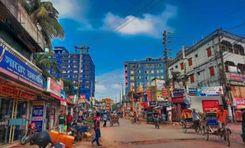
Located only a short distance from the heart of the Khulna, Daultapur is one of the prominent areas under Khulna Metropolitan City. It is a Thana of Khulna District near the Bhairab River with a 7.69 sq./km land area. The Daulatpur area guide shows that the Thana has a population of 1,17,560. It consists of two Khulna City Corporation wards and 37 mauza/mahallas. <br><br> Since it is one of the major areas of Khulna District and the city, Daulatpur offers accessible transportation. It has two major highways, the Dhaka-Jessore-Khulna Road and the Khulna City Bypass, on both sides. The newly constructed Outer Bypass Road offers additional transportation facilities. <br><br> Transportation inside the localities includes cars, CNGs, rickshaws, auto rickshaws, vans, bicycles, etc. However, despite all the good things, most roads in Daulatpur are underdeveloped, and the local roads also need major development. <br><br> On top of that, untreated water and chemicals get discharged into canals, causing major water pollution. Though some parts of the area are facing new developments, most parts of the area are still far from having a modern lifestyle, facilities, and amenities. <br><br> Daulatpur is a rural and naturally beautiful area with lots of greenery. One can enjoy the beauty of open fields and lands around the area. The housing and living costs in Daulatpur are quite affordable. <br><br> But despite all that, Daulatpur, bearing notable landmarks and historical places, is changing day by day. The Daulatpur area alone consists of many notable educational institutions, government offices, special hospitals, religious institutions, etc. <br><br> The Daulatpur Bazar is one of the area's busiest marketplaces, where people gather daily for trade and business. And the Daulatpur Ferry Terminal helps thousands of people cross the Bhairab River.
View Insights
Boyra Bazar Property Guide
Rating icon
3.5

Boyra Bazar
, Khulna

Boyra Bazar, often known as the Choto Boyra Bazar, is one of the busiest and most crowded market areas in Khulna Metropolitan City. It is located near several important roads, such as Sheikh Abu Naser Bypass Road, Dhaka-Jessore-Khulna Road, Jalil Sarani, and Boyra Main Road. <br><br> The bazar falls under the Khulna City Corporation’s Ward 16. It is a part of Sonadanga Thana and one of the oldest marketplaces in Khulna City. And in case you are interested in the Boyra Bazar area guide, you should know that it is a place with many known and important locations. <br><br> From small to large shops, groceries, raw markets to clothing markets, the bazar has it all. That is why it is one of the most chaotic locations that doesn’t sleep until late at night. <br><br> Since the bazar is located near several main roads, vendors, business people, customers, and even the residents of the area can easily travel from different parts of the city. Other than the raw market shops, the Khokon Shopping Complex is the go-to shopping mall for the locals. There are also banks, medical centers, real estate companies, mosques, churches, temples, etc., near the bazar area. <br><br> It has several educational institutes nearby, such as the Fatema Memorial School, Hazi Foyez Uddin Girls’ School, Sundarban Institute of Technology, Sundarban Medical Institute, Bangladesh Institute Of Management (BIM), etc. <br><<br> There are also government, non-government, private, and public offices and institutions near the bazar. Some of the notable ones are the Khulna Directorate of Posts, Regional Jute Goods Laboratory, Regional Family Planning Office, Quantum Foundation, World Vision Child Care Center, Soil Resource Development Institute (SRDI), etc. <br><br> The area has residential homes and properties that are mostly family-owned. However, new residential and commercial properties are currently under development near the Boyra Bazar areas.
View Insights
Muradpur Property Guide
Rating icon
2.3

Muradpur
, Chattogram

Muradpur is a vibrant city with lots of colors, situated in Chittagong. It is a perfect sophisticated area with the serene vibes of a community-centered area. This locality shows a rich culture with significant history. Also, a unique blend of modernity and tradition attracts visitors and people to live there. <br><br> Though as an area Muradpur is not so big in size (around 21.59 Km^2), it plays an important role in Chittagong's daily life. It is located in the central part of the city which is why it becomes effortless to get to this area. And also going from any important place. This area has a great transportation system and good connectivity with major and big roads of the city. That is why it has become the main spot for tourists. <br><br> The main charm of this area is the various kinds of buildings, markets, restaurants and shopping centers. These restaurants show the rich culinary history of Chittagong. The local markets are great places to shop because they have a wide range of goods, from traditional crafts to modern clothes. On the other hand, Muradpur's food scene is a treat for foodies, with a wide range of local and foreign dishes. <br><br> However, Muradpur is not only famous for its location and cultural background. It also has adequate resources and services to serve the residents well. It has 4 secondary and 13 primary schools, 3 Madrasas. So, it's a good place to live all around. The community is helpful and friendly, and there are many social and cultural events that make people feel like they belong. <br><br> Moreover, the good thing about this area is there is more greenery in this place than in other parts of the city. The only thing that is missing is some scopes for recreation like Cineplex parks of Cineplex etc.
View Insights
IconMap

Featured Projects
View All

Property Price Trends in Bangladesh for
Buy
Rent
Bedrooms:
Average Price (Last 12 months)
Tk. 6,358.55 per sqft
Past 12 months' growth
5.85%
Positive Trend
Past 3 months' growth
5.2%
Positive Trend
Icon
Price information is based on historical data from ads posted on Bikroy and may not reflect the full market dynamics.
hero

Sell or Rent Fast on Bikroy: Post Your Property in 2 Mins!