Search Icon

Explore Areas in Bangladesh

162 - 180 out of 304 areas
Kadirgonj Property Guide
Rating icon
3.6

Kadirgonj
, Rajshahi

Kadirganj is an area under Rajshahi City and Rajshahi City Corporation. Rajshahi city is known for its serene environment, educational institutions and rich cultural heritage. Kadirganj mainly offers a combination of residential and commercial areas. It is a part of the central metropolitan area. It is relatively accessible and well connected to other parts of the city. Offers a mix of residential buildings, commercial establishments and community amenities. Kadirganj is just 1.2 km away from Rajshahi Zero Point.<br><br> The money collected from residential buildings and apartments in Kadirganj plays an important role in the local economy. The neighborhood also has a mix of local shops, markets and small businesses. It is a vibrant commercial area offering various amenities for daily needs.<br><br> Kadirganj is quite advanced in the field of education. There are several primary and secondary schools. Also, being a part of Rajshahi city, there are educational opportunities from prominent institutions like Rajshahi University, Rajshahi College and Rajshahi University of Engineering and Technology which really inspire hope.<br><br> Being the central area of Rajshahi city, the medical services of Kadirganj are also very advanced. Residents benefit from nearby amenities including hospitals, clinics and pharmacies. Also Rajshahi Medical College Hospital is located nearby and has more facilities to receive advanced treatment.<br><br> Kadirganj is well connected with other parts of Rajshahi city by road. Local transport here includes buses, auto rickshaws and rickshaws. It also has good rail and air transportation facilities.<br><br> Cultural events, festivals and social gatherings here reflect the rich cultural heritage of Rajshahi. Also, people of different religions, castes and professions live here. Who have their own independence. There are parks for recreation, temples and Buddha temples as places of worship for a variety of people.<br><br> The area faces challenges related to urbanization including traffic congestion and infrastructure maintenance. However, current projects aim to further improve the infrastructure. It is perfect as a residential area as it has good security.
View Insights
Kajir Dewry Property Guide
Rating icon
3.6

Kajir Dewry
, Chattogram

As the Kazir Dewri area guide suggests, Kazir Dewri, a neighborhood in Chattogram City, has a past with people known as Kazi or Judge of the Court of Arbitration. Years ago, they used to be the judges to help general people reconcile on occasions of conflicts. They would also give sentences to criminals and have them executed in order to restore justice in society.<br><br> Over time, their reputation grew, and soon, the area became known as Kazir Dewri. The word Dewri means gate, inside which the court of the Kazi was set up. This is a tale of centuries ago, probably before the Mughals came to Bengal. Later, the name Kazir Dewri was found in British documents, too.<br><br> Although their traditional job has not been in action for ages, the descendants of the Kazi family still live in Chattogram. Even though their popularity declined as time went by, the name of the area indicates the fame and significance of the Kazis’ position in the community. To date, they are fondly remembered by the locals who learned about them from their ancestors.<br><br> Fast forward to the present, Kazir Dewri is a well-developed area in the core of Chattogram City. Everyone living here enjoys the perfect urban life with every facility accessible and available to them. The urbanization of the place will give you a taste of city life, which also explains why the population is increasing day by day. The multistoried buildings and apartments attract many families to settle their lives here.<br><br> A remarkable part of this once-quiet neighborhood is its Stadiumpara. The name of the stadium is MA Aziz Stadium where local teams play football and cricket. The country’s national football team also uses the multi-purpose stadium occasionally.<br><br> The Mukta Mancha, situated at the center of Stadiumpara, is the main attraction of the locals. Over the years, it has become popular for its food stalls offering everything from tea to seafood to different cuisines. If you travel around to see the CRB area, don’t forget to stop by here and savor your favorite food!
View Insights
Kalizira Property Guide
Rating icon
3.6

Kalizira
, Barishal

Kalizira is an area of Barisal city located in the southern region of Bangladesh and is under the City Corporation. Kalizira is accessible from the central part of Barisal and is connected by local roads. Kalizira is just 4.3 km from Barisal Zero Point. Kalizira is mainly a residential area with traditional houses and modern buildings. The area has a vibrant community life with a mix of religious and cultural events. There are mosques and unique religious centers where residents have opportunities for prayer and religious activities that truly strengthen the bond of harmony.<br><br> Kalizira's economy is centered on small businesses, retail shops, bazaars and bazaars. Local people here are involved in market activities and small businesses. Besides, the people of this area are engaged in various professions including jobs which contribute to the local economy.<br><br> Kalizira, like the Ananya part of Barisal, is also slowly undergoing urbanization. Infrastructure is being improved with the development of new roads, buildings and amenities. Kalizira is also considered a safe area to live in with a relatively low crime rate. Along with this it will provide you a decent life.<br><br> There are area-based small health care centers and clinics that provide primary care to the locals. Barisal headquarters for emergency services have access to advanced medical facilities and are well connected by road. There are public and private primary and secondary schools for education here. Also for higher education there are Barisal University and Barisal Medical College which are within commuting distance of people here.<br><br> Kalizira is well connected with the rest of Barisal by local roads and public transport. Part of Barisal, Kalizira benefits from the natural beauty of the region, including the surrounding rivers and green spaces.<br><br> The area is still developing, with gradual urbanization and infrastructure improvements making it a promising area for long-term living. Benefit from ongoing projects to enhance the livability of the area.<br><br> Overall, people prefer living in Kalizira for its affordability, sense of community, convenient access to amenities and peaceful environment. It is particularly suitable for families and those looking for a balance between city life and a more relaxed lifestyle.
View Insights
Karnafuly Property Guide
Rating icon
3.6

Karnafuly
, Chattogram

Karnafuly, a place of around 55.36 sq km, is situated by the south bank of the Karnafuly River under the Chattogram City Corporation. The Karnafuly Area Guide shows the distance between the Chattogram district and the upazila is almost 10 kilometers. Around Karnafuly are Chandgaon Thana and Boalkhali Upazila in the south and Anwara Upazila in the north. In the east, Patiya Upazila is present, whereas Patenga Thana and Bandar Thana are in the west. <br><br> The area was formed with the 5 unions of the Patiya Upazila in 2016. Before this development, it used to be a thana under Patiya. So, currently, Karnafuly consists of these 5 unions: 1 no. Char Lakhya, 1 no. (Ka) Juldha, 1 no. (Kha) Char Patharghata, 2 no. Bara Uthan, and 3 no. Shikalbaha. According to the 2011 census, it is the residence of more than 160,000 people.<br><br> Karnafuly is a beautiful suburban area that is always refreshing because of its river. The locals often spend quality time in the Karnafuly breeze, soaking in its calm and therapeutic breeze during the evening.<br><br> If you ever decide to roam around the city, make sure to schedule a visit to the bridge in your travel plan! Other than the river and its bridge, Karnafuly has more places one would like to see, i.e., Shah Amanat Bridge, Bara Uthan Jamidar Bari, Kalarpool Bridge, etc.<br><br> Karnafuly is not just a scenic area but also a key player in the country’s economic development. Its Karnafuly Export Processing Zone (KEPZ) is a significant contributor to the national economy. The area’s growing economy is evident with the presence of numerous banks. The upcoming Karnafuly tunnel is set to further enhance the area's connectivity, making it an attractive hub for trade and commerce.<br><br> As a suburban area, Karnafuly is quite developed and has immense potential for further development. At present, it has many primary schools and several high schools, colleges, and madrasas. The Karnafuly CDA residential area provides standard housing for its community. Overall, life in Karnafuly is affordable and peaceful with its available amenities of living.
View Insights
Keshabpur Property Guide
Rating icon
3.6

Keshabpur
, Khulna

You must have heard of the famous Kapotakkho River, whose beauty captivated poet Michael Madhusudan Dutt. This famous river and the paternal home of this famous poet are located at the Sagardari Union of Keshabpur Upazila, which is located in the Jashore District of the Khulna Division. That is why the upazila welcomes people to its area through the Michael Madhusudan Gate.<br><br> The Keshabpur area guide shows that the entire upazila has a land area of 258.53 square kilometers. And the population is about 2,80,924 (Census 2022). Though there is no record of how the upazila got its name, it is said that it was named after a Landlord/Zamidar Keshab Chandra. The upazila is 32 kilometers from Jashore City and around 42 kilometers from Khulna City. It is bounded by Manirampur, Avaynagar, Dumuria, Kalaroa, and the Kapotakkho River.<br><br> Though it is located far from the city, Keshabpur is a diverse land with rural landscapes and urban localities. Most parts of the Upazila Sadar area are filled with small and tall buildings, residents, and businesses, while the rural parts are filled with agricultural lands, farms, tin-shaded homes, and ruins of the old times.<br><br> The entire upazila is filled with heritages and relics. Other than the Poet Michael Madhusudan Datt Memorial and Sagardari Pincin Spot in Madhupalli, many tourist spots exist in Keshabpur. One such spot is actor Dhiraj Bhattacharya's ancestral home, which is in dire need of renovation. Other spots include Mirzanagar Hammamkhana, Kashimpur-Dalijhara Buddhist Bihar, Baliadanga Temple, Morshina Baor and Park, etc.<br><br> Notable educational institutions of the upazila are the Sagardari Michael Madhusudan Institution, Keshabpur Government College, Keshabpur Govt. Pilot School & College, Abu Sharaf Sadek Govt Technical School and College, etc.
View Insights
Khilgaon Property Guide
Rating icon
3.6

Khilgaon
, Dhaka

Khilgaon has abruptly become the talk of the town for various eateries. Once a disregarded area, it has now flourished as a food heaven for the Dhaka people. Confined within a 14.02 square Km area, Khilgaon accommodates 327,717 residents. This Khilgaon area guide will reveal the hidden potential of Khilgaon, both for residential and commercial purposes. <br><br> One major development in Khilgaon is the upraising of small to medium food stalls spread on Taltola Road. The varieties of cuisine choices, affordable pricing, and popularity over the Internet have made this area the most hyped for food and hangouts. <br><br> The emergence of Khilgaon as a food heaven started with the popularity of Apon Coffee House. Once people became fans of their coffee, other entrepreneurs marked Khilgaon for their venture. Gradually, Khilgaon became a popular gateway for hanging out and trying different street and Western food types. <br><br> Even though Khilgaon has come to light as a food heaven, this area has been densely populated ever since. The educational institutions, nearby hospitals, parks, and reasonable rent for housing were some of the reasons people chose to base their nest here. <br><br> Many office-going bachelor people are choosing Khilgaon to set their nests. As Khilgaon is closely attached to Motijheel, Moghbazar, and Paltan, where many offices are situated, Khilgaon has been a residential paradise for people with limited income and who seek easy commute. <br><br> Khilgaon is now a name of comfort for middle-income groups, bachelors, and students. The affordable rent and a promising neighborhood have made it one of the top sought-after locations in Dhaka for residential purposes. The inauguration of Khilgaon flyover has rendered the residents of Khilgaon a faster way to commute.
View Insights
Khilkhet Property Guide
Rating icon
3.6

Khilkhet
, Dhaka

One notable administrative area in Dhaka, Bangladesh is Khilkhet Thana. It has a total area of 15.88 square kilometers (6.13 sq mi). On June 27th, 2005, Khilkhet separated from the southern parts of Badda Thana as a sign of its focused administration on urbanization and demographic challenges. Strategically located with Dhakshinkhan and Uttar Khan thana to the north, Badda thana to the south, Cantonment thana to the west and Bimanbandar thana to the northwest makes it clear that it is bordered by Turag River in the east dividing it from Rupganj Upazila of Narayanganj District. This shows that Nikunja-1 and Nikunja-2 are close to the Khilkhet Thana building as they are residential areas closest to this location.<br><br> According to Khilkhet area guide, this region is a part of Ward No. 17 under Dhaka North City Corporation covering portions of Dakshinkhan union and Dumni union which further speaks about its administrative importance as well as geographical reach within city’s urban fabric.The creation of Khilkhet thana did simplify governance in this rapidly growing locality but also boosted local development with regard to infrastructure as well as public services for their diverse population needs.<br><br> Khilkhet fully caters to its dwellers’ various requirements. However, more lifestyle facilities are required at the place considering that its population is continuously growing. Installation of surveillance cameras within the neighborhood together with a quick response team will increase the security level thus improving the minds of all who reside there.
View Insights
Khulshi Property Guide
Rating icon
3.6

Khulshi
, Chattogram

If you check on Google Maps to get your way around Khulshi in Chattogram, you will get confused as the area has been divided into separate parts. Because Khulshi Thana consists of the Kulshi residential areas, Nasirabad, Lalkhan Bazar, and part of the Pahartali and Pachshail Thanas. It is a hillside area with small cliffs and walking tracks.<br><br> So, you can tell it is a huge area that requires the Khulshi area guide to get one’s way around it. It is part of the Chattogram City Corporation and the Chattogram Metropolitan City. Kulshi Thana has an area of 13.12 sq/.km. According to the 2022 Population and Housing Census, its population is around 207,775.<br><br> The Khushi residential area is one of the most prominent residential areas in the Chattogram District. On top of that, it offers a serene and naturally beautiful landscape with lots of greenery.<br><br> This area is also well known for having some of the most famous educational institutions, such as Ispahani Public School & College, Chattogram Govt. Mohila College, National Polytechnic College, etc.<br><br> There are other significant locations in this area, such as Chattogram Veterinary University, Bangladesh Meteorological Department, Khulshi Town Center, Bangladesh Agriculture Research Institute, etc.<br><br> People from all over the country travel to Khulshi to visit Foy’s Lake, a popular amusement park, and the Chattogram Zoo. In addition, the Khulshi Thana offers easy commutes via buses, cars, and other transport centering on Zakir Hossain Road and GEC Junction. It also connects many parts of the thana by train routes.<br><br> Living in Khulshi doesn’t come cheap as it is among the sought-after localities and offers many amenities. However, it offers a better lifestyle, more facilities, vibrant natural and hillside beauty, and cultural diversity.
View Insights
Koyra Property Guide
Rating icon
3.6

Koyra
, Khulna

Koyra is an upazila located at the furthest south of the Khulna District. It is the second largest upazila in Bangladesh, with a land area of 1775.41 sq./km, and the Sundarbans Mangrove Forest covers a large part of this gigantic upazila. That makes Koyra area guide one of the most sought-after area guides for people who want to know more about the upazila.<br><br> It has Paikgacha in the north, Shundarban Mangrove Forest in the south and east, and Shaymnagar and Ashashuni Upazilas of Satkhira in the west. The upazila has 7 unions, 72 mouzas or mahallas, and 131 villages. According to the 2022 Census, there are around 2,20,100 people in Koyra.<br><br> Though Koyra Upazila does not have many developed roads, there has been a major communication development in the last few years. As a result, people in the upazila, especially in the remote areas, are gaining better accessibility to necessary amenities. However, some areas in and across the upazila are only accessible by water transports, such as ferries and launches.<br><br> The number of educational institutions and literacy rates of Koyra upazila have also increased. There are numerous religious institutions in the area, such as mosques, churches, temples, etc. The Mosjidkur Mosque is one such notable landmark. Other popular landmarks of Koyra Upazila are the Koyra Bridge, Khalishar Dighi, Koyra River, Keorakata Tourist Spot, etc. Other than the Shundarband Forest itself, Hiron Point of the upazila has also been declared as a World Heritage Site by UNESCO.<br><br> Though agriculture is the main source of the economy of the people, a large part of Koyra’s income source also depends on shrimp culture and export business. The water bodies of the area are used as shrimp ghers (a bounded area), and you are likely to come across many of them in most parts of the upazila.<br><br> The geographical location of Koyra makes it highly prone to natural disasters and heavy damage. But the Sundarbans Mangrove Forest keeps most of the upazila safe. However, many developments are still needed to offer better living conditions for all.
View Insights
Kurigram Property Guide
Rating icon
3.6

Kurigram
, Rangpur

In Bengali, kuri means twenty, and gram means village. It is said that Maharaja Bishwa Singh granted twenty Hindu fisherman families high-class recognition and sent them to a village to reign. Thus, the land is called Kurigram and, over time, people of different culture and ethnicity formed a new and diverse culture in the area.<br><br> Kurigram area is an administrative area of the Rangpur Division located at the northwest of Bangladesh. It is bounded by West Bengal of India in the north, Jamalpur and Gaibandha in the south, Assam of India in the east and Rangpur and Lalmonirhat in the west. The district has a land area of 2,255.29 square kilometers and the population is over 23 million.<br><br> The current administrative Kurigram district has 9 upazilas, 11 thanas, 3 pourashavas, 72 unions, 6,301 mouzas, and 1,585 villages. Kurigram also has 16 rivers, including Brahmaputra, Jamuna, Dharla, and Teesta. And because of its geographical location, the temperature of Kurigram remains higher in the summer and lower in the winter.<br><br> The economy of Kurigram is dependent on agriculture, which is over 70%. It is also religiously diverse and has many mosques, temples, and churches. The best way to communicate in and out of the district is by buses and trains. However, some areas can only be accessed by smaller vehicles and boats.<br><br> Kurigram is also famous for its rich history and as a birthplace of many notable people. The famous war heroine Taramon Bibi, and poet/writer Sayed Shamsul Haque are also from the area.<br><br> It has many historical architects and landmarks, such as the house of Taramon Bibi, Chandamari Masjid, Kurigram Rajbari, Ulipur Munshibari Palace, Rajarhat Shahi Jame Masjid, etc. There are also many parks and other recreational facilities. Despite all the development, Kurigram still suffers from a higher rate of poverty and heavy floods.
View Insights
Lalkhan Bazar Property Guide
Rating icon
3.6

Lalkhan Bazar
, Chattogram

Lalkhan Bazar is an important residential and commercial area located in the center of Chittagong city. The area is Ward No. 14 of Chittagong City Corporation and a part of Khulshi Police Station. With various commercial services, banking, government and private offices, export-import facilities, bus stands, railway stations, and ports, all nearby, the area has become a hub of busiest and commercial activities. Karnaphuli River also serves as an important hub for import and export activities.<br><br> Also, Lalkhan Bazar is a well-known market area. It is one of the busiest markets in the city. From clothes to electronics, household items to ornaments, spices to cosmetics, you will find almost everything at Lalkhan Bazar. There are numerous shops, markets, and business establishments here. Being a port city and well-connected, the area is a hub of commercial activity and is travel-friendly for tourists.<br><br> Lalkhan Bazar is connected with other parts of Chittagong through various modes of transport. Intercity bus stand and railway station are located very close to the area. Also, public buses, auto-rickshaws, and taxis are always available. The area is bounded by Agrabad and Kotwali police stations on the south, Launch Terminal, Panchlaish, and Chawkbazar on the north, Rajon upazila on the east, and Sitakund upazila on the west.<br><br> The area is also rich in religious, cultural, and educational aspects. Jamiatul Uloom Al-Islamia is one of the leading madrassas in the country. The area also has several training centers including schools and colleges. There are hospitals, residential hotels, parks, and community centers.<br><br> Lalkhan Bazar is a densely populated residential area. The demand for residential buildings in the Lalkhan Bazar area is constantly increasing as it is convenient from all aspects, commercial, economic, educational, medical, and communication. Modern buildings and apartments are being built here to improve residential facilities. Almost all the necessary facilities including electricity, gas, water, and sewerage are available in the area. Lalkhan Bazar can be a good option for those who want a balanced lifestyle in an urban environment, a densely populated area with essential amenities.
View Insights
Lalmonirhat Property Guide
Rating icon
3.6

Lalmonirhat
, Rangpur

Lalmonirhat is one of the notable northern districts of Bangladesh, located at the Bangladesh-India borderline. It was previously a mohakuma but was established as a district in 1984. Currently, with a land area of 1,247 square kilometers, Lalmpnirhat is an administrative area of the Rangpur Division.<br><br> The Lalmonirhat area guide shows that the district is bounded by Jalpaiguri and Kuchbihar of West Bengal in the north, the Rangpur District in the south, Kochbihar of West Bengal and Kurigram District in the east, and the Nilphamari and Rangpur Districts in the west. The length of the Bangladesh-India borderline in the district is about 282 kilometers.<br><br> The district's main rivers are Dharla and Teesta. According to the 2022 Census, the population is 14,28,406. The district's literacy rate is 71.18%, and it has around 1,000 educational institutions, including training centers. There are 2,450 mosques, 741 temples, 70 post offices, and 49 banks in Lalmonirhat.<br><br> Communication within the district is available with all types of transport. From Lalmonirhat, people can travel to almost all other districts by road. There are also railway facilities for communication, which benefit trades and businesses within and outside Bangladesh.<br><br> In 2023, Lalmonirhat was declared to be a landless and homeless-free district. Yet, many people lose home and lands due to floods almost every year.<br><br> Nevertheless, Lalmonirhat is still one of the naturally beautiful areas. Some of its popular and notable landmarks are Kalibari Mosque and Temple, Teesta Barrage, Kakina Jomidar Bari, Tushbhandar Jamidar Bari, Mogolhat Port 0 Point, etc.
View Insights
Magura Property Guide
Rating icon
3.6

Magura
, Khulna

You may know this name, Magura, as the hometown of Allrounder cricketer Sakib Al Hasan or for its famous Rosh Malai, but you still haven’t discovered the dent of the richness and beauty of this district. In this Magura area guide, we will discover this untracked territory of the southwestern district of Bangladesh.<br><br> Magura is nestled aside the Modhumoti River, encompassing 1049 square kilometers. This district has been acclaimed for being the first illiteracy-free district in Bangladesh. Magura is tethered to the tapestry of time from the Mughal period. The name is inspired by the “Mog” as this area was their den to carry out their piracy.<br><br> There is a reason pirates and dacoits prefer this location. Numerous rivers run across the Magura district like a spider web. Some of the most significant rivers are Gorai, Nobogonga, Fotki, Modhumoti, Kumar, Chitra, Bhairav, and Begot. Regretfully, some of these rivers have lost their significance due to mismanagement and illegal grabbing.<br><br> Magura first became a sub-division or Mohkuma of Jessore in 1845. Afterwards, it became a sole district in 1984. Currently, the district has 4 upazilas, namely, Magura Sadar, Sreepur, Mohammadpur, and Shalikha. Moreover, there are 18 wards, 36 union parishads, and 700 villages in Magura. It is the 4th largest district in Khulna division.<br><br> Agriculture is the backbone of its economy. Almost 90% of the working population is involved in various forms of agriculture. The fertile lands and suitable weather play a vital role in the mass production of rice paddy, onion, and other crops. A handful of small-scale businesses have bloomed recently.<br><br> A medley of culturally significant events spread out across Magura. The annual horse race competition at Mohammadpur Upazila has attracted many tourists over the years. Moreover, archeological spots from the palace to the dargah have left a fresh breath of history and rich cultures in the air of Magura.
View Insights
Mira Bazar Property Guide
Rating icon
3.6

Mira Bazar
, Sylhet

When it comes to important locations in Sylhet, one cannot ignore the importance of the Mira Bazar area. That is why it is essential to learn about the Mira Bazar area guide and what it offers.<br><br> Though there is no data on its geographical land area, Mira Bazar is a vast location and part of several ward areas of Sylhet City Corporation. It has the Tamabil Road in the middle, which is connected to the Dhaka-Sylhet Highway and is one of the busiest roads in Sylhet. These roads offer a wider range of transportation and communication facilities.<br><br> There are several other smaller roads, such as the Mira Bazar Road, East Mirabazar Road, Mirabazar-Noyapara Road, Mirabazar-Subhani Ghat Road, Mirabazar-Kharpara Road, Darjiban Mosque Road, etc. Mission Square is the main point of the city, and it is one of the busiest routes in the area.<br><br> There are several bus stops in Mira Bazar. The bus routes connect Mira Bazar to Sobhanighat Point, Airport Road, Zindabazar, Uposhohor, Dhaka, Sunamganj, etc. Most of the roads in the area are developed, making all types of rides comfortable.<br><br> Mira Bazar is more of a residential area than a commercial one. Most of the land area in Mira Bazar is filled with small and big housing with rents of various price ranges. There are also several residential hotels, such as Hotel Mira, Garden, Hotel Supreme, The Grand Mafi, and Hotel Jahan, that offer various facilities along with private parking for travelers.<br><br> Other than these, there are several educational institutions, mosques, temples, health complexes, beauty and fitness centers, a community center, etc. Though there aren’t any big shopping malls in the area, the Kumarpara Complex is the nearest shopping mall for Mira Bazar dwellers.<br><br> Overall, Mira Bazar is an excellent choice for people who want to stay in a comparatively less crowded and noisy neighborhood at an affordable price with access to various amenities.
View Insights
Modern More Property Guide
Rating icon
3.6

Modern More
, Rangpur

Modern Mor is located in the heart of Rangpur city. It has become an important intersection connecting several major roads and surrounding areas. Apart from enriching various places, this place acts as a gateway to different parts of the city. The place connects important areas like Shipping Company, Mahiganj and Rangpur Medical College. Its proximity to the cantonment is of great importance.<br><br> Living in a commercially active area provides business and employment opportunities for the local people, while there are various commercial establishments including shops, restaurants, cafes which play an important role in the local economy. The area is vibrant and culturally rich as well.<br><br> Depending on the exact location, the residential areas around Mind are quite comfortable, while it also serves as a traffic hub. Traffic management is an important aspect of this area especially during peak hours. And here rickshaws, auto rickshaws are used for local transport. Besides, there are buses and CNG for remote communication. The roads here are quite good and there is an opportunity to use private transport.<br><br> People living around Modern Mor are getting good opportunities for education. The intersection is close to several important educational institutions, including Carmichael College and Rangpur Medical College, which ensure primary school to higher education for its residents. Apart from education, medical facilities are also very good here. Rangpur Medical College Hospital is nearby for healthcare facilities. There are many small and big service centers which ensure the medical care of the people here.<br><br> As the place is a junction of business and different places, people from different places are interested to live here. People of different classes, professions and religions and castes live together and have their own way of life, thought, culture and culinary richness.<br><br> The area around Modern Mor has seen significant urban development over the years. New businesses and infrastructure projects have increased its importance as a commercial and transportation hub. And at the same time maintaining the atmosphere of the traditional market and providing modern facilities to the residents here.<br><br> All in all, the area is noisy and somewhat congested due to its busy nature. It may not be suitable for those who prefer a quiet environment. If you value convenience, accessibility and being in the heart of the city's activities, then Modern Mor could be a good place for you.
View Insights
Motalib Plaza Property Guide
Rating icon
3.6

Motalib Plaza
, Dhaka

Technically, Motalib Plaza is not an area but one of Dhaka's popular shopping and apartment complexes. However, in the Motalib Plaza area guide, we will discuss the shopping complex and the areas around it.<br><br> The plaza is located in Paribagh, Dhaka, an area under the Shahbag Thana. To be exact, it is on Sonargaon Road, right next to the Hatirpool area, not far from the Hatirpool Circle. The building is about 17 floors, and the shopping complex occupies only about the 4th floor. From 5th to upward, it is a residential complex.<br><br> The Motalib Plaza shopping area is known for having one of the largest mobile and electronics markets. Here, you can buy mobile covers, protectors, and other electronics wholesale or at comparatively low prices. In addition, several service centers repair them.<br><br> Each floor of the building has its own unique appearance and range of shops. There are even some food stalls and a conventional hall on the ground floor of the building, such as Super Kebab & Coffee and Khana Pina Restaurant.<br><br> The shopping complex's opening hours are 10 am to 8 pm. However, it closes at 5 pm on Saturday. It stays closed on Thursdays and during National Holidays.<br><br> As for the residential part, there is a different entrance for that. It is a good place for families to live in as the area offers convenient transportation and living facilities. However, living in Motalib Plaza or purchasing apartments there is expensive. However, there are often shops available for rent.<br><br> Other well-known locations near Motalib Plaza include Eastern Plaza Shopping Mall, Multiplan Center, Paribagh Jame Masjid, etc. The Metro Rail Station, Shahbag, is the nearest station in the area, which allows people from other parts of the city to travel here more easily.
View Insights
Motijheel Property Guide
Rating icon
3.6

Motijheel
, Dhaka

Motijheel is the heart of Dhaka and has more corporate offices than any other region in Dhaka. It has the largest central business district and commercial hub in Dhaka and arguably the largest in Bangladesh. In Motijheel, you can find all different types of businesses from sectors ranging from financial services to news and media.<br><br> This area houses the country's largest number of corporate headquarters and banks. Grand hotels and media publishers are based in Motijheel. Also, the head offices of two of the largest conglomerates of Bangladesh, Akij Group and Anwar Group of industries are inside Motijheel.<br><br> The road infrastructure is well-constructed, and there are multiple inter-district bus counters by the Toyenbee Circular Road, along with rickshaws and tempos. Motijheel is also in close proximate to the country’s three most important gateway terminals- Kamalapur Railway Staton, BRTC CBS-2 Bus Terminal, and Sadarghat.<br><br> There are many good hospitals in and around the Motijheel area, and there is no shortage of mosques here, especially the Baitul Mukarram mosque in Paltan. Also, there are several temples including Sri Sri Durga Mandir and Motijheel Hindupara Mandir inside the AGB colony.<br><br> There are not many notable shopping malls inside the Motijheel area besides Fakirapool Market, but we can find great stores, brand showrooms, and flea markets all around the area. Also within the thana, we can find the Baitul Mukarram Market and Polwel Super Market, which are just one rickshaw ride away from the area.<br><br> Overall, Motijheel is not necessarily the perfect place to raise a young family, but it still offers plenty of diversity and proximity to many corporate headquarters. It is an ideal location for young executives working in corporate or finance and enjoying the fast-moving city life in the country’s most famous commercial hub and central business district.
View Insights
Munshiganj Property Guide
Rating icon
3.6

Munshiganj
, Dhaka

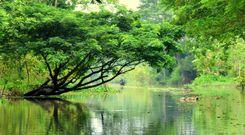
Munshiganj, a district under Dhaka Division, is known for its rich history. Previously known as Bikrompur, Munshiganj is a land surrounded by at least 14 rivers, such as Meghna, Shitalakkah, Padma, Ichamoti, and Dhaleshwari.<br><br> 
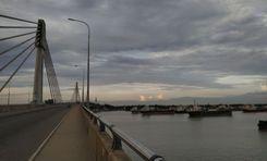
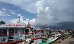
It is also surrounded by other districts, such as Dhaka, Narayanganj, Madaripur, Shatiatpur, etc. With the recent establishment of the Padma Bridge and the well-known Mawa Ghat, the Munshiganj area guide is one of the most sought-after city guides by people in Bangladesh.<br><br> Munshiganj has a land area of 954.96 sq. km. and a population of about 1,625,416. While there are roads and bridges for people to pass through villages, boats become the only means of commuting during the monsoon period as the lowlands go underwater.<br><br> Many prominent historical and public figures, such as Sir Jagadish Chandra Bose, Chashi Nazrul Islam, Humayun Azad, A. N. M. Hamidullah, Fakhruddin Ahmed, etc., are from this district.<br><br> 
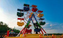
Even though Munshiganj has already been popular, the Mawa Ferry Ghat, Mawa Resort, Project Hilsa, Padma Bridge Sculpture, etc., have recently raised the area’s popularity even more. Two of the modern amusement parks, Wonderland Amusement Park and Mana Bay Water Park, are also in Munshiganj.<br><br> 
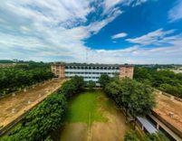
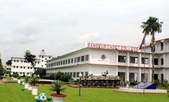
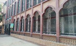
There are more than 530 primary schools, 99 high schools, and 13 universities in this district. Among them, the Haraganga College is a reputed college and university.<br><br> 
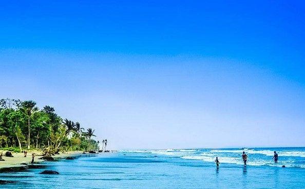
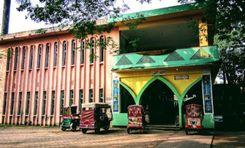
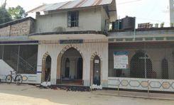
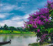
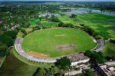
Some of the popular historical sights of the districts are Idrakpur Fort, Sonarang Twin Temples, Baba Adam Mosque, Nateshwar Buddhist Temple, etc. Other popular tourist spots include Muktarpur Bridge, Dhaka-Mawa Highway, Arial Beel, etc. Boating is a tradition of the district that is celebrated yearly.<br><br> 
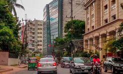
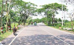
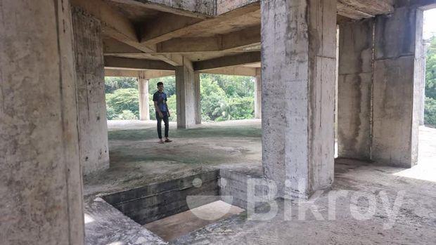
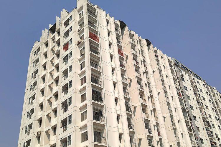
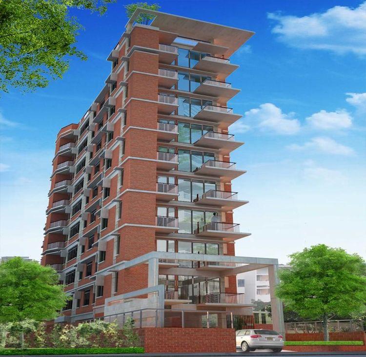
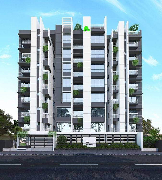
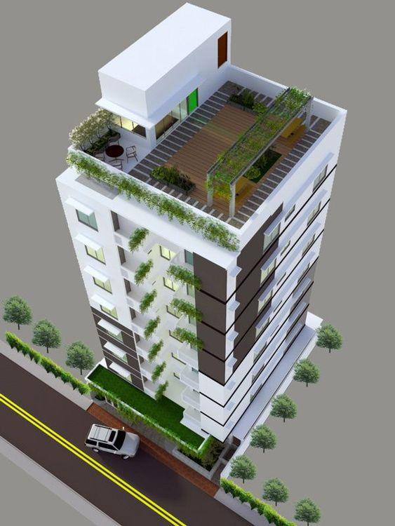
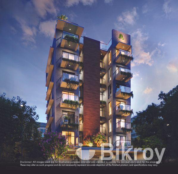
In recent years, the roads and transportation facilities of the district have developed drastically. As a result, Munshiganj has become one of the popular, sought-after locations for housing and commercial spaces.
View Insights
IconMap

Featured Projects

View All

Property Price Trends in Bangladesh for

Buy
Rent
Bedrooms:
Average Price (Last 12 months)
BDT 6,440.08 per sqft
Past 12 months' growth
4.39%
Positive Trend
Past 3 months' growth
3.63%
Positive Trend
Icon
Price information is based on historical data from ads posted on Bikroy and may not reflect the full market dynamics.
hero

Sell or Rent Fast on Bikroy: Post Your Property in 2 Mins!