Search Icon

Explore Areas in Bangladesh

126 - 144 out of 303 areas
Oxygen Property Guide
Rating icon
4.1

Oxygen
, Chattogram

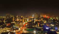
Oxygen is a very important area in the busy city of Chattogram. It is famous for its location because it plays an important role in connecting different parts of the city. This area stands out as a busy hub that combines the comfort of homes with the energy of business activities. It's a key point for people trying to find their way through the city's changing rhythms. <br> <br> The best thing about Oxygen is it combines a sense of community and connection so well that it has become the heart of the city. There are many types of homes in the area, so it can accommodate a wide range of people who are looking for the best of both city convenience and neighborhood comfort. <br> <br> Oxygen is also famous for having numerous restaurants, markets and other important services that are all easily approachable. That is why it is the center of daily needs and fun activities. <br> <br> Oxygen has a wonderful network of roads and is close to many public transit stops, which makes it very easy for people to get around. It is placed strategically so that important parts of Chattogram are only a short commute away. <br> <br> Besides commercial and residential options, it has renowned healthcare centers and educational institutions. Oxygen is one of the most popular places to live and do business in Chattogram, even though it doesn't have as many large parks as other parts of the city. This is because it has lively streets, a wide range of services, and a great sense of community.
View Insights
Raozan Property Guide
Rating icon
4.1

Raozan
, Chattogram

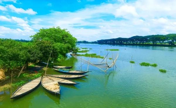
Many of us know about the beauty and serenity of the mesmerizing Halda River, and the Raozan Upazila is located near it. The central Raozan city area is about 40 kilometers from the Chattogram Sadar and only around 10 kilometers from the Halda River. So, when exploring the Raozan area guide, you can only expect an eye-catching rural scenario. <b><b> The Raozan Upazila has a land area of 243 square kilometers. It has 76 villages, 60 mouzas, and 14 unions, and the population is around 3,25,389. Other than the Halda River, some parts of the Upazila are located near the Karnaphuli River. The economy of the area depends on fishery from the Halda River, rubber gardens, chili cultivation, and many other agricultural products. Soon, the Raozan BISIC area is expected to create more employment opportunities for the people. <b><b> One of the most convenient ways to travel from Chattogram Sadar to Raozan is by taking the bus route. The Chattogram-Rangamati Highway and Chattogram-Rangunia Highway are two of the major roads connecting the localities of the Upazila to the other parts of Chattogram and other districts. There are also transport options like CNGs, rickshaws, cars, vans, bikes, etc. However, there are no railway routes to the area. The closest railway station is Janali Hat Railway Station, which is approximately 5 kilometers from Madunaghat, the nearest location under Raozan Upazila. <b><b> The Pahartali area, another well-known part of the Upazila, is often recognized widely because of the Chittagong University of Engineering and Technology (CUET). It is one of the most well-reputed educational institutions in the country. Other than CUET, the area has several other notable educational institutions. The Jagatmalla Para mass burial site bears the haunting memory of the 1971 Liberation War of Bangladesh. <b><b> There are many more landmarks and locations in the Upazila, such as Master Surja Sen’s Paternal Home and Memorial, Poet Nabin Chandra Sen’s Paternal Home and Memorial, West Dabua Shiva Temple, Mohamuni Buddhist Temple, Giri Chaya Park View, and Haladia Rubber Garden. This religiously diverse upazila has more than 340 mosques, over 100 Hindu Temples, and 120 Buddhist temples.
View Insights
Shatmatha Chottor Property Guide
Rating icon
4.1

Shatmatha Chottor
, Rangpur

Shatmatha Chottor area belongs to Ward No. 30 of City Corporation of Rangpur District. The place is quite busy. The place is well known for business, hotel-restaurant, shops, super shop, market etc. Shatmatha Chottor is also called as one of the focal points of Rangpur City Corporation. The Shatmatha Chottor place itself is a sight to behold that proudly makes its presence known. The place has a distance of 2.0 km from Rangpur zero point. On the other hand, the distance of this place is 2.8 km from Rangpur Sadar Upazila. The place is suitable for business because of good connectivity. One of the educational institutions of Rangpur is also located near this place. The location has great utility as both road and public transport facilities are good. Rangpur Railway Station is very close which will give you an extra convenience.<br><br> This place of Rangpur district has been carrying various professions, non-communalism, and its own traditions. The beautiful surroundings, surrounded by lush greenery will enchant you. Shatmatha Chottor will attract both locals and visitors to the place and showcase the traditional Rangpur image and culture.<br><br> Overall, Shatmatha Chottor offers a dynamic blend of lifestyles such as commerce, culture, tradition, history, freedom, inspiration etc. Which makes it one of the most preferred localities in Rangpur. Whether you want to shop, dine or just wander around or go sightseeing, you can understand the heritage of Rangpur from here.
View Insights
Shewrapara Property Guide
Rating icon
4.1

Shewrapara
, Dhaka

If you don’t mind moving to a noisy, crowded, and chaotic area, Shewrapara can be an ideal option. Because despite some disadvantages, this area of Dhaka City is one of the busiest areas with many living facilities. Explore the Shewrapara area guide to learn more! Shewrapara is a part of Mirpur Thana (Zone 4) and a developing area under Dhaka South City Corporation. It is one of the most populous areas in Dhaka, with many residents, commercial and business areas, schools, colleges, universities, clubs, communities, etc. The area of Shewrapara is divided into two parts: East Shewrapara and West Shewrapara. With many shops, bazaars, and other places, West Shewrapara is bigger and the busiest part of the area. The East Shewrapara also stays awake until late at night but offers a closer connection to a wider community. There are several well-known educational institutions in Shewrapara, such as Monipur High School & College, Hazi Ashraf Ali High School, Green University, etc. There are other local kindergartens, primary and high schools as well. Shewrapara is still one of the areas in Dhaka with many affordable houses and apartments to rent. However, over time, commercial and residential projects have grown across the area. Also, many people prefer Shewrapara for its convenient communication facilities despite the chaos. Due to the adjacent roads, commuting to Shewrapara is widely accessible. You can travel to and from the area using rickshaws, CNGs, buses, etc. On top of that, the Metro Rail Station in Shewrapara has increased the popularity and accessibility of communication in the area even further. There are drawbacks as well. Residents in Shewrapara often face issues like a shortage of dirty water or gas. Roads are often blocked by RMG workers, which causes traffic jams. Despite everything, many people now prefer this area to move permanently and invest in buying properties.
View Insights
Alamdangha Property Guide
Rating icon
4.1

Alamdangha
, Khulna

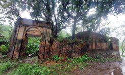
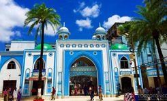
Alamdanaga is an upazila of Chuadanga District, located in the northwest of Bangladesh. It is an administrative area of the Khulna Division, Bangladesh's second-largest division. Alamdanaga was previously a thana area but was established into an upazila in 1982. Its land area is 365 square kilometers, and its population is 3,45,992, with Muslims and Hindus living together for many years.<br><br> Currently, the upazila has 1 pourashava, 15 unions, and 211 villages. Looking at the Alamdanga area guide, you will notice that the upazila doesn’t have many water bodies. Only the Mathavanga River flows through the upazila. It has some small rivers, but most are dried up. However, the upazila still has many large ponds and beels.<br><br> It is now bounded by Mirpur Upazila (Kushtia District) and Gangni Upazila (Meherpur District) in the north, Chuadanga Sadar and Damurhuda Upazila in the south, Harinkunda Upazila (Jhenaidah District) and Kushtia Sadar Upazila in the east. It also has the Gangni Upazila (Meherpur District) and Damurhuda Upazila in the west.<br><br> One of the best things about Alamdanaga Upazila is its growing and developing lifestyle. Over the years, housing and residents, along with roads and other facilities, have been developed. The communication in and out of the upazila is also convenient. In addition to buses and cars, people can also travel through the upazila by train.<br><br> Unlike some other upazila areas of Khulna district, Alamdanga doesn’t have many historical landmarks or notable locations. However, it does have certain popular and notable locations and many old buildings. Some of them are over a century old. The Alamdanga Boddho Bhumi is the mass killing site bearing the scar of the 1971 Liberation War.<br><br> Other landmarks include Alamdanga Laal Bride or railway bridge, Kumari Jomidar Bari, Alamdanga Independence Memorial of 1971, Alamdanga Badminton Club (an ancient building), etc. It also has a cinema hall and a few parks.<br><br> It also has over 120 educational institutions, including madrasa, training institutions, polytechnical institutes, etc. There are 335 mosques, 292 Eidgahs, and 30 temples. People can also access healthcare facilities, banking, and other necessities here in Alamdanga.
View Insights
Bosila Property Guide
Rating icon
4.1

Bosila
, Dhaka

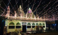
Bosila, an extended part of Mohammadpur, is one of the most up-and-coming areas of Dhaka city. If we look back at the chronicles of Dhaka city 10-15 years ago, we will discover Bosila as a submerged and downtrodden park that is almost inhabitable. Fast forward to the emergence of the Dam and Bosila bridge, Dhaka has unearthed a new area. Bosila has a historical significance. The name is etched in the tapestry of tales of liberation war. Rayer Bazar Bodhyo Bhumi, which stands as a witness to the bloody genocide of 1971, is closely attached to the Bosila area. Bosila is a one-of-a-kind area of Dhaka. The mighty Buriganga runs through the city and is connected to the Bosila Bridge. The River is a boon for the area. Many residents of Bosila are associated with businesses related to the Buriganga River and utilize the pathway and resources. The biggest development in the Bosila Area pans out in residential establishments. There are more and more high-rise buildings to accommodate the inhabitants. Bosila Garden City is an organized model town where affluent and middle-class families prefer to nestle as their home. Bosila Road is a popular road in Bosila that divides Mohammadpur from the area. This is Bosila's access point. Needless to say, this road keeps busy and chaotic. People who work near the Mohammadpur or Dhanmondi area but the rent in those areas is too high to meet up with prefer to settle in Bosila. Communication between Bosila and those areas is straightforward and swift. Bosila is a happening place. Many industries and educational and medical institutions plan to shift there as its proximity to Buriganga. Many students and bachelors opt for Bosila to live in sublets or affordable rent.
View Insights
Dhanmondi Property Guide
Rating icon
4.1

Dhanmondi
, Dhaka

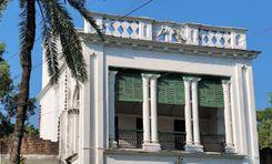
Dhanmondi, located in the heart of Dhaka, Bangladesh, is one of the city's oldest and most prestigious residential neighborhoods. Developed in the 1950s, Dhanmondi is characterized by tree-lined streets, serene lakes, and a mix of residential, commercial, and recreational spaces. Dhanmondi is divided into several blocks, each with its own distinct charm and character. The area is renowned for its well-planned layout, with spacious homes, wide roads, and ample greenery, offering a peaceful retreat from the bustling city life of Dhaka. One of the defining features of Dhanmondi is its picturesque lakes, namely Dhanmondi Lake and Rabindra Sarobar. These lakes serve as popular recreational spots where residents can enjoy boat rides, picnics, and leisurely strolls along the scenic promenades. Dhanmondi is also known for its vibrant cultural scene, with numerous art galleries, theaters, and cultural centers scattered throughout the neighborhood. The area has a rich literary heritage, with several renowned writers and intellectuals calling Dhanmondi their home. In addition to its cultural attractions, Dhanmondi offers a wide range of amenities, including top-notch educational institutions, healthcare facilities, shopping centers, and restaurants. The neighborhood is well-connected to other parts of Dhaka through a network of roads and public transportation services. Despite its age, Dhanmondi continues to evolve and thrive, with new developments complementing its historical charm. The area has witnessed rapid urbanization in recent years, with modern high-rise buildings and commercial complexes dotting its skyline while still retaining its unique character and charm. Overall, Dhanmondi is a vibrant and dynamic neighborhood that seamlessly blends tradition with modernity, making it a coveted residential area in Dhaka for both locals and expatriates alike.
View Insights
Gaibandha Property Guide
Rating icon
4.1

Gaibandha
, Rangpur

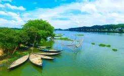
Gaibandha is one of Bangladesh's notable districts and an administrative area of the Rangpur Division. The district’s areas have a history of more than 5,200 years, so it is no wonder that the Gaibandha area guide shows many historical landmarks from the past.<br><br> Gaibandha was established as a district in 1984. It has a massive land area of 2,114.77 square kilometers and a population of about 2,621,756. The district is bounded by Rangpur and Kurigram districts in the north, Bogura in the south, Dinajpur and Joypurhat in the east, and Kurigram and Jamalpur districts and the Jamuna River in the west.<br><br> Since it is an old land area, Gaibandha is rich in historical and important landmarks. The oldest historical architects are the Gaibandha Khan Bahadur Jamidar Bari, Naldanga Jamidar Bari, and Bardhan Kuthi. The district is surrounded by rivers like Brahmaputra, Teesta, Ghaghat, Karatoya, etc.<br><br> People can go to the ghats or riverside areas to enjoy the picturesque view of the river and take a break from mundane life. If not, there are modern recreational places like the Gaibandha Pouro Park in the district's central area. There are also Dream City Park, Mini Nikli Gobindaganj, Alibaba Theme Park, etc.<br><br> Gaibandha has 5,773 mosques, 892 temples, and a few other religious institutions. It also has 2 cinema halls. There are also over 2,500 educational institutions and several training institutions. To ensure people’s health and safety, there are 64 non-government clinics, 1 general hospital, 1 Upazila health complex, and a few other health centers.<br><br> The district's economy relies on agriculture, which accounts for about 44.45% of the total economic sources. However, small businesses, non-agricultural labor, transport, services, and cottage industries also exist.<br><br> As various other districts surround Gaibandha, you are likely to hear different dialects, which makes the district more diverse. In coming years, Gaibandha is likely to go through more upgrades, with new residential properties on the rise.
View Insights
Khulshi Property Guide
Rating icon
4.1

Khulshi
, Chattogram

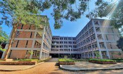
If you check on Google Maps to get your way around Khulshi in Chattogram, you will get confused as the area has been divided into separate parts. Because Khulshi Thana consists of the Kulshi residential areas, Nasirabad, Lalkhan Bazar, and part of the Pahartali and Pachshail Thanas. It is a hillside area with small cliffs and walking tracks. <br><br> So, you can tell it is a huge area that requires the Khulshi area guide to get one’s way around it. It is part of the Chattogram City Corporation and the Chattogram Metropolitan City. Kulshi Thana has an area of 13.12 sq/.km. According to the 2022 Population and Housing Census, its population is around 207,775. <br><br> The Khushi residential area is one of the most prominent residential areas in the Chattogram District. On top of that, it offers a serene and naturally beautiful landscape with lots of greenery. <br><br> This area is also well known for having some of the most famous educational institutions, such as Ispahani Public School & College, Chattogram Govt. Mohila College, National Polytechnic College, etc. <br><br> There are other significant locations in this area, such as Chattogram Veterinary University, Bangladesh Meteorological Department, Khulshi Town Center, Bangladesh Agriculture Research Institute, etc. <br><br> People from all over the country travel to Khulshi to visit Foy’s Lake, a popular amusement park, and the Chattogram Zoo. In addition, the Khulshi Thana offers easy commutes via buses, cars, and other transport centering on Zakir Hossain Road and GEC Junction. It also connects many parts of the thana by train routes. <br><br> Living in Khulshi doesn’t come cheap as it is among the sought-after localities and offers many amenities. However, it offers a better lifestyle, more facilities, vibrant natural and hillside beauty, and cultural diversity.
View Insights
Kotwali Property Guide
Rating icon
4.1

Kotwali
, Dhaka

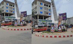
Kotwali is the Principal Thana or Sadar Thana of Dhaka District. It is bounded by Keraniganj Upazilla in the south, Chawkbazar Thana in the west, and Bangshal Thana in the east. It is right next to the Buriganga River, and the renowned Mitford Hospital and Dhaka National Medical College are only a short distance from Kotwali.<br><br> Though it has a small area of only 0.67 sq./km and around 50,000 residents, Kotwali is one of the busiest parts of Dhaka. The Sadarghat Launch Terminal (port of Dhaka) and Babubazar Bridge are located in the area, and both are the routes of many trades and businesses across the country. That is why you need the Kotwali area guide.<br><br> From the beginning, this area has been known for having many important institutions, such as judge courts, magistrate courts, trade and accessories centers, law firms, clubs, marketplaces, printing and publishing houses, schools, colleges, universities, etc. <br><br> The famous Jagannath University is also in this area, and many other institutions and businesses have grown over time surrounding it. Moreover, the Islampur clothing market, Shankhari Bazar market, and Badamtali fruits market are some of the most popular marketplaces for many retailers and other people as well. <br><br> On top of that, it has several tourist attractions. The Ahsan Manzil Museum, one of the finest architectural landmarks and residences of Dhaka Nawab bears historical significance. It is a popular destination for both native and foreign travelers. You can also visit Bahadur Shah Park, Nawab Siraj-Ud-Dawla Park, and Nawab Bari pond. Kotwali is also popular because of the many mosques in the area. <br><br> With so many important business locations, Kotwali is accessible by private, local, and public transport. As for housing, they are very affordable. However, it is yet to be a better place for a better living environment.
View Insights
Motalib Plaza Property Guide
Rating icon
4.1

Motalib Plaza
, Dhaka

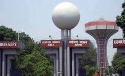
Technically, Motalib Plaza is not an area but one of Dhaka's popular shopping and apartment complexes. However, in the Motalib Plaza area guide, we will discuss the shopping complex and the areas around it. The plaza is located in Paribagh, Dhaka, an area under the Shahbag Thana. To be exact, it is on Sonargaon Road, right next to the Hatirpool area, not far from the Hatirpool Circle. The building is about 17 floors, and the shopping complex occupies only about the 4th floor. From 5th to upward, it is a residential complex. The Motalib Plaza shopping area is known for having one of the largest mobile and electronics markets. Here, you can buy mobile covers, protectors, and other electronics wholesale or at comparatively low prices. In addition, several service centers repair them. Each floor of the building has its own unique appearance and range of shops. There are even some food stalls and a conventional hall on the ground floor of the building, such as Super Kebab & Coffee and Khana Pina Restaurant. The shopping complex's opening hours are 10 am to 8 pm. However, it closes at 5 pm on Saturday. It stays closed on Thursdays and during National Holidays. As for the residential part, there is a different entrance for that. It is a good place for families to live in as the area offers convenient transportation and living facilities. However, living in Motalib Plaza or purchasing apartments there is expensive. However, there are often shops available for rent. Other well-known locations near Motalib Plaza include Eastern Plaza Shopping Mall, Multiplan Center, Paribagh Jame Masjid, etc. The Metro Rail Station, Shahbag, is the nearest station in the area, which allows people from other parts of the city to travel here more easily.
View Insights
Nilphamari Property Guide
Rating icon
4.1

Nilphamari
, Rangpur

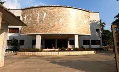
Nilphamari District is an administrative area of Bangladesh located northwest of the country. It has a 50.90-kilometer border with India. Geographically, Nilphamari is bounded by India’s Siliguri in the north, Dinajpur and Rangpur districts in the south, Rangpur and Lalmonirhat districts in the east, and Dinajpur and Panchagar districts in the west. The most notable water body in the district is the Teesta River.<br><br> The Nilphamari district has a land area of 1,643.40 square kilometers and a population of 20,92,567. It has 6 upazilas, 4 pourashavas, 60 unions, and 378 villages. It is a diverse district with both suburban and rural lifestyles. A big part of the population in Nilphamari relies on agriculture. However, other businesses, such as non-agriculture labor, services, and transport, also play a vital part in the economy.<br><br> Roads and communication have also flourished over the years, with 470 kilometers of developed roads around the district. Traveling around and outside the district by road is highly convenient. People can also travel by trains, as it has 9 railway stations. On top of that, there is an airport in Saidpur Upazila, Nilphamari.<br><br> Mosques, temples, churches, primary schools, high schools, colleges, and technical institutions, Nilphamari offers all the necessary benefits for excellent living conditions. However, climate change and natural disasters strike the land, damaging roads and properties every year. Though there has been an increase in better housing and amenities in recent year, Nilphamari is still faces certain drawbacks like poverty.<br><br> Despite everything, people still like to travel to Nilphamari every year to visit its beautiful landmarks and historical places. Some of the popular ones are the Teesta River view, Chini Masjid, Saidpur Railway Museum, Neelsagar Dighi, Nil Kuthi, etc.
View Insights
Dinajpur Property Guide
Rating icon
4.0

Dinajpur
, Rangpur

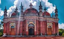
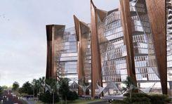
Of all the “A” class areas Bangladesh has, Dinajpur is one of the most significant. Not only is it one of the oldest locations, but it is also rich in history. Established in 1786, the best part of the Dinajpur area guide is that it is the largest of the 16 districts in northern Bangladesh. The land area of Dinajpur is 3,444.30 square kilometers, and the population is over 33.15 million. Now, it has 13 upazilas, 9 pourashavas, 103 unions, and 2,131 villages.<br><br> It is said that the founder of Dinajpur Palace was Dinaj or Dinraj. Later, even though the British rule ended, the people named the district Dinajpur. Currently, Dinajpur is a metropolitan district of the Rangpur Division. It is bounded by Panchagar and Thakurgaon Districts in the north, Joypurhat and Gaibandha in the south, Nilphamari and Rangpur in the east, and West Bengal of India in the west.<br><br> The Dhaka-Dinajpur Highway is one of the key roads that connect Dinajpur with many other districts and divisions. Other than roads, people can also travel to the district by train and river. The main rivers in the district are the Karatoya River, Punarbhaba River, Atrai River, etc.<br><br> There are many housing and growing residential areas in Dinajpur. The newly established housings and facilities have impacted the lifestyle in positive ways. As a result, the real estate business is blooming.<br><br> The district's economy relies on agriculture, with the main crops being paddy. However, lychees, mangoes, and other seasonal fruits and vegetables also contribute to the area's economy. Since the amount of food produced in the district is more than the demand, selling and exporting it across the country and internationally contributes largely.<br><br> Dinajpur has many historical landmarks and interesting locations. The most notable ones are the Dinajpur Rajbari, Kantajew Temple, Nayabad Masjid, Sura Masjid, etc. There are also various recreational locations, such as Shopnopuri Artificial Amusement Park, Birganj National Park, Ramsagar National Park, etc.
View Insights
Lalmonirhat Property Guide
Rating icon
4.0

Lalmonirhat
, Rangpur

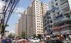
Lalmonirhat is one of the notable northern districts of Bangladesh, located at the Bangladesh-India borderline. It was previously a mohakuma but was established as a district in 1984. Currently, with a land area of 1,247 square kilometers, Lalmpnirhat is an administrative area of the Rangpur Division.<br><br> The Lalmonirhat area guide shows that the district is bounded by Jalpaiguri and Kuchbihar of West Bengal in the north, the Rangpur District in the south, Kochbihar of West Bengal and Kurigram District in the east, and the Nilphamari and Rangpur Districts in the west. The length of the Bangladesh-India borderline in the district is about 282 kilometers.<br><br> The district's main rivers are Dharla and Teesta. According to the 2022 Census, the population is 14,28,406. The district's literacy rate is 71.18%, and it has around 1,000 educational institutions, including training centers. There are 2,450 mosques, 741 temples, 70 post offices, and 49 banks in Lalmonirhat.<br><br> Communication within the district is available with all types of transport. From Lalmonirhat, people can travel to almost all other districts by road. There are also railway facilities for communication, which benefit trades and businesses within and outside Bangladesh.<br><br> In 2023, Lalmonirhat was declared to be a landless and homeless-free district. Yet, many people lose home and lands due to floods almost every year.<br><br> Nevertheless, Lalmonirhat is still one of the naturally beautiful areas. Some of its popular and notable landmarks are Kalibari Mosque and Temple, Teesta Barrage, Kakina Jomidar Bari, Tushbhandar Jamidar Bari, Mogolhat Port 0 Point, etc.
View Insights
IconMap

Featured Projects
View All

Property Price Trends in Bangladesh for
Buy
Rent
Bedrooms:
Average Price (Last 12 months)
Tk. 6,358.55 per sqft
Past 12 months' growth
5.85%
Positive Trend
Past 3 months' growth
5.2%
Positive Trend
Icon
Price information is based on historical data from ads posted on Bikroy and may not reflect the full market dynamics.
hero

Sell or Rent Fast on Bikroy: Post Your Property in 2 Mins!