Search Icon

Explore Areas in Bangladesh

144 - 162 out of 303 areas
Satkhira Property Guide
Rating icon
4.0

Satkhira
, Khulna

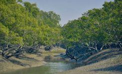
Satkhira, established under the Jashore district in 1861, was declared a full-fledged district to decentralize administration in 1984. Now a district situated in the division of Khulna, the South-western region of the country, the area has a land of 3,817 sq km with Jashore in its north, the Bay of Bengal in its south, the Khulna district in its east, and the West Bengal’s districts of South 24 Parganas and North 24 Parganas in its west.<br><br> According to the Satkhira area guide, the district sits on the scenic Arpangacchia or Betna River’s bank. It comprises 7 upazilas, 8 police stations, and 79 unions. Its 2 municipalities are Satkhira and Kalaura. The former is its biggest city and also the district headquarter. <br><br> But what sets Satkhira apart from other districts in Khulna is its internationally famous Sundarbans, the world’s largest mangrove forest. The forest is not only an amazing tourist spot to have a glance at the incredible wildlife and plants but also plays an important role in serving as the country’s natural shield to provide protection during natural calamities. Also, it contributes to the area’s economy by being the source of livelihood for many locals. Kaliganj Upazila also has a mangrove forest named Basjaria Joarar Ban or BADHA’s forest.<br><br> About the economy, the district is mostly dependent on agriculture. However, it has immense potential for economic development. The Bhomra land port and the production of multiple export goods can bring prosperity in the near future. <br><br><br><br> Another reason Satkhira has a bright future is its growing number of educational institutions. It has 79 colleges, 400+ high schools, 800+ govt. primary schools, and more. The establishment of a medical college and hospital in 2011 further advanced the region’s educational facilities. There are also private healthcare services available for the locals. <br><br> Overall, Satkhira is a beautiful place with abundant natural beauty and economic possibilities. For locals and tourists alike, the district has a lot to offer.
View Insights
60 Feet Road Property Guide
Rating icon
4.0

60 Feet Road
, Dhaka

As the name suggests, 60 Feet Road is a road that is 60 feet wide. But it would be incorrigible to postulate it as just another road in Dhaka. This area runs through the heart of the southern part of Mirpur and connects as a bridge between Kallyanpur, Agargaon, and Mirpur South. Popularly known as Kamal Sarani, this road has become a crucial junction in the Dhaka traffic system. As this road bridges the gap from Mirpur to other parts of Dhaka, many buses and private cars opt for this route to reach the Mirpur area. Moreover, as the wide length of the road can accommodate more vehicles, people often choose this route to avoid traffic jams. This 60 Feet Road cuts through some of the most densely-populated areas of Mirpur. Monipur, Kazipara, Paikpara, and Shimultola are some of the areas connected by this road. As the residents of these areas utilize this road for transportation and communication, you can guess how busy this road becomes during office and school hours. 60 Feet Road started as a mode of communication. But somehow became a popular spot for hangouts and tasty foods. This road has become a well-known hub for commodities and food ventures for the residents living nearby. Such hustle and bustle keeps the 60 Feet Road busy and chaotic during peak hours. Not just for hangouts and entertainment, 60 Feet Road also bears significance in trade and commerce. Many corporate houses, banking institutions, brand outlets, and showrooms are scattered throughout the road. Such establishments are a great fillip to the economy of the 60 Feet Road area.
View Insights
Bandar Property Guide
Rating icon
4.0

Bandar
, Chattogram

Bandar is a thana or administrative unit in Chittagong. According to the Bandar area guide, its land area is about 20.04 sq./km, surrounded by Double Mooring and Halishahar on its north, the Karnaphuli River and Karnaphuli thana on its east, Patenga on its South, and the Bay of Bengal on the west. It is the residence of over 200,000 people at present, comprising 4 wards and unions with 11 mahallas.<br><br> Among others things, what makes Bandar an important place is the Chittagong Port, one of the crucial economic forces of our country. It is located in the Bandar thana, right on the mouth of Karnaphuli river. This made the place an important hub of trade for the country while giving its people a close relation to its natural elements.<br><br> Apart from commercial significance, the area also holds historical significance. The thana’s naval commandos who fought in the Liberation War conducted multiple successful missions against the Pakistani military. Today, it is one of the busiest places in Chittagong, swarmed with different markets and institutions that cater to the needs of locals and tourists altogether. <br><br> To start with markets, Bandar has Bandar Bazar, Saber Plaza, City Corporation Market, Jalal Plaza, Fakir Hat, Steel Mill Bazar, Yasin Mistry Hat, and more. Some noteworthy establishments around the thana are Chittagong EPZ, Navy Hospital Residential Area, Bandar Bhaban, Port Colony, Shipping Corporation Bhaban, Seamen’s Hotel, and Port Trust Officers’ Colony. These parts of the area make it a vibrant place, beating with the hubbub of life. <br><br> Bandar also has a number of religious institutions of different religions, demonstrating the diversified backgrounds of its population, i.e., Bandar Tila Ali Shah Mosque, East Colony Buddhist Temple, Nischintapara Jami Mosque, Umar Shah Mazar, S Alam Mosque, Ananadabazar Kali Temple, Sree Sree Kali Bari Cremation Temple.<br><br> Besides, there are also noteworthy educational institutions to improve the literacy rate of its population, which stands at 72.6% now. As for transportation and communication, Bandar's connection with other corners of the division is well-established because of its economic importance. Also, the availability of public vehicles ensures easy commutes for its people.
View Insights
Basabo Property Guide
Rating icon
4.0

Basabo
, Dhaka

Basabo is a densely populated district known for its inexpensive households. It is part of Sabujbagh thana, which covers 6.62 square kilometers. The region has been divided into four primary zones: North Basabo, South Basabo, Middle Basabo, and East Basabo. Though it seems like a busy residential sector, Basabo is adjacent to Motijheel. Basabo is really well organized with the opportunity of having access to long-term housing options. Right now, Basabo is a place where you can find any necessary need that you want, well-established infrastructure, restaurants, schools, and medical services.<br><br> Basabo Provides a variety of conveniences for inhabitants, actively promotes extracurricular activities among youngsters, and is a well-known lodging option for middle-class people. As there are a few well-known fields, this makes the region turned into a thriving hub. Basabo is a densely inhabited neighborhood, thus there is plenty of potential for residential expansion. Projects such as Navana Silverdale and Chayabithi Eastern Housing Project have effectively made their imprint in Basabo by erecting flats throughout the years, providing residents with a distinctive style of housing in this area. As a consequence, new developers want to work on creative projects in the region.<br><br> Overall, Basaba offers a dynamic blend of culture, business, and educational facilities, making it one of the most peaceful neighborhoods in Dhaka. Whether you're looking to shop, dine, or simply explore, Basabo has something to offer for everyone.
View Insights
Chandgaon Property Guide
Rating icon
4.0

Chandgaon
, Chattogram

Chandgaon, or the Chandgaon Thana, is one of the most populated, bursting, and industrially growing areas in the Chittagong District. The Chandgaon Thana, which is under the Chattogram City Corporation, comprises the Chandgaon Residential area and the Kalurghat industrial area. <br> <br> According to the 2022 Census, the Thana has a total land area of 32.14 sq./km. and a population of 312,261. Located on the banks of the Halda and Karnaphuli rivers, the Chandgaon area guide has many residential, commercial, industrial, and diplomatic locations. <br> <br> The Chandgaon Residential Area is a well-known part of the area due to its clean and beautiful landscape and many attractions. The Mini Bangladesh, an amusement park that displays many important and famous architectures in Bangladesh, is a popular tourist destination. <br> <br> The Kalurghat BISIC area is a famous heavy industrial area of the country. The area is also famous for Kalurghat Betar Kendra or Shadhin Bangla Betar Kendra, where Ziaur Rahman declared independence during the Bangladesh Liberation War in 1972. <br> <br> The area has multiple bus routes and depots that not only connect Chandgaon to the north and south of Chattogram but also make it easier to travel outside the district. Thanks to the Chattogram-Cox's Bazar Highway, traveling to Chandgaon from Cox’s Bazar is more straightforward. <br> <br> However, the area has drawbacks as well. The residential area, which is one of Chattogram's posh locations, is losing its charm. Land and property owners are renting out the places for commercial and rehabilitation uses, which is disturbing the residents. <br> <br> But despite certain drawbacks, Chandgaon is an area of growing housing and new developments. On top of that, authorities have been working to ensure better connection and more safety for people in Chandgaon by encouraging digital services.
View Insights
Dhamrai Property Guide
Rating icon
4.0

Dhamrai
, Dhaka

Did you know that the Dhamrai Upazilla (sub-district) is the largest Upazilla in Dhaka district by land area? If you didn’t, our Dhamrai area guide will give you all the information you need.<br><br> Dhamrai was part of the Savar Thana during British rule in 1914. Later, in 1947, it was established as a separate Thana and put under the Dhaka district. The area is located about 40 km northwest of the city, and the Dhaka-Aricha Highway passes through it. At least 4,96,249 people are living in the area, which makes it densely populated.<br><br> The area is bounded by Mirzapur, Kaliakair, Singair, Savar Upazillas, etc. Moreover, you can see part of the Dhaleshwari River from various locations in the area. Moreover, the area is composed of alluvium soil of the Dhaleshwari and Bongshi rivers. <br><br> Since the area is located near the Dhaka-Aricha Highway, it offers access to communication inside and outside the Dhaka district. Using public transportation is the best way to get there, but many people rely on local transport as well.<br><br> It is also a suitable area for living for anyone who wants to settle outside the main city. Along with land, housing projects are also available in the area. Moreover, renting apartments and living costs are more affordable than in the city. There are over 300 educational institutions, including schools, colleges, universities, madrasas, and over 100 NGO schools.<br><br> Dhamrai is also a tourist attraction due to its historical landmarks and significance. Some of the known locations are Balai Jamidar House, Madhab Mondir, Shaitta Banyan Tree, and more.<br><br> The annual Dhamrai Rath is quite famous in the area. Sukanta Dhamrai Metal Crafts is also known for being the primary metal hub in Bangladesh.
View Insights
Faridpur Property Guide
Rating icon
4.0

Faridpur
, Dhaka

Faridpur is a district of Dhaka Division, known for its rich history, cultural heritage and agricultural significance. This district was established on the banks of Padma river in 1815. Faridpur is a junction point of transport in southern Bangladesh. Earlier the name of the city was Fatehabad. The total area of ​​Faridpur district is 2052.86 km and the present population is 2126.879. It is one of the oldest cities in Bangladesh. It has Rajbari and Manikganj districts to the north, Gopalganj districts to the south, Magura and Narail districts to the west and Madaripur and Munshiganj districts to the east. The district has a rich history dating back to the Mughal era.<br><br> The economy of Faridpur is mainly based on agriculture. The district is known for producing high quality jute. Apart from agriculture, Faridpur has various small-scale industries including textiles, rice mills and handicrafts. The jute industry in particular plays an important role in the local economy. Faridpur district is also an important center of hilsa fish and jute traders.<br><br> Surrounded by natural beauty, this district is highly livable. People of different religions and castes live together here. Which is a very important aspect for living here. From any district of Bangladesh, the transportation system to Faridpur is quite good. In this regard, roads and railways are particularly significant. After the Padma Setu was opened, the communication system of this district has improved more. Along with this, the possibility of construction and expansion of new industries and mills has been created. Along with the communication system, the education system and medical services are also very good here. Jute industry is characterized by the employment of many people which is a part of the need for livelihood here.<br><br> Faridpur has its own history and traditions, its own regional language and culinary diversity. Traditional folk music and routines are an integral part of this celebration. Although it is a Muslim-majority area, unique religious festivals are also celebrated here. Apart from this, Faridpur has several heritage sites and tourist centers which play a very important role in highlighting this significance. Among these, Mujibnagar, Faridpur Museum and River Landscapes are worth mentioning.<br><br> Faridpur district has ample supply of water, electricity and gas. The district has a primarily agricultural environment with fertile plains enriched by the Padma River and its tributaries. Tropical climate prevails here. Faridpur's environment also faces challenges such as river erosion and flooding that affect local communities and agriculture. Efforts to address these issues through sustainable practices and infrastructural improvements to protect and preserve the district's natural resources and agricultural productivity continue.
View Insights
Fatikchari Property Guide
Rating icon
4.0

Fatikchari
, Chattogram

The largest upazila in the Chattogram District is Fatikchari. Its land area is 773.55 square kilometers, and its population is 6,61,158 (2022 Census). The Fatikchari area guide shows that it is located 45 kilometers north of the Chattogram Metropolitan City area. It has 2 thanas, 2 pourashavas, and 18 unions. Like many other locations in Chattogram, Fatikchari is a rural land area filled with many natural attractions.<br><br> Fatikchari is bounded by many other upazilas and locations. It has India’s Tripura in the North, Kawkhali (of Rangamati District) and the Hathazari Upazila in the South, and Mirsharai and Sitakunda Upazilas in the West. It also has Raozan, Ramgarh, Lakshmichhari, and Manikchhari Upazilas in the east. With all the areas and a diverse population, Fatikchari stands to be a land known for its rich history, cultural heritage, remarkable landmarks, and many more things.<br><br> The history of this land began during the rule of Mughal Emperor Aurangzeb when Chattogram was known as Islamabad. Fatikchari became one of the ruling divisions of Mughal Ruler Shaista Khan’s son, Bujurg Umid Ali Khan. The area was known as Ichapur Pargana. Later, it was named Fatikchari after the renowned Baro-Bhuiyan chieftain Isha Khan.<br><br> Anyone who wants to travel to Fatikchari by bus can travel directly from Chattogram Metropolican City’s Oxygen Mor area. You can also travel to Fatikchari by train to Nazirhat Railway Station and go to the Upazila Sadar by bus or CNG from there. It has two notable water bodies, the Halda River and the Fatikchari Canal, which originated in the Sitakundu Hills and joined the Halda River.<br><br> While a big part of Fatikchari is filled with agricultural lands, open fields, and residents, it also has developed roads running along the way. Many of them are suitable for traveling via bus. However, the area still needs wider roads for better access to transport.<br><br> The total land suitable for agricultural use in Fatikchari is 90,500.58 acres. The main agricultural crops are paddy, potato, chilly, sesame, seasonal vegetables, etc. However, the area’s economy also depends on tea. Of 163 tea gardens in Bangladesh, 17 are in Fatikchari. These tea estates are among the popular tourist attractions in Fatikchari, especially Fatickchari Oodaleah Tea Garden, Halda Valley Tea Garden, Kaiyacherra Tea Garden, etc.<br><br> Fatikchari is also diverse in culture and natural beauty, filled with over 900 religious institutions, 35 banks or financial institutions, and more. Some of the popular and notable landmarks in Fatikchari are Maizbhandari Darbar Sharif, Amtoli Rubber Garden, Bhujpur Shishu Park, and Halda Rubber Dam.
View Insights
Fenchuganj Property Guide
Rating icon
4.0

Fenchuganj
, Sylhet

Many people believe that the name Fenchuganj came from Penchu or Fechui Shah, a guardian of the Shah Malum shrine or dargah. Then, he opened a shop in the Kushariya River’s ghat area, which later extended and became Fenchu-ganj (a market area). This Fenchuganj upazila is located in Sylhet District and covers around 114.48 square kilometers of land area. The population of the upazila is 1,38,881.<br><br> The Fenchuganj area guide shows that it was established as a thana area in 1907 and as an upazila in 1980. The upazila is located 26 kilometers from the Zilla Sadar, and there are 117 villages, 5 unions, and 30 mouzas in the upazila. It has South Surma and Gopalganj Upazilas in the north, Rajnagar and Kulaura Upazilas in the south, Kulaura and Juri Upazilas in the east, and South Surma and Balaganj Upazilas in the west.<br><br> While it is a land of opportunity for trade and business, Fenchuganj Upazila is also popular for its tourist destinations and spots. The Hakaluki Haor, which is the largest haor in Bangladesh and South Asia, is located in this upazila. It also has the Kushiyara River. Another popular tourist destination in the area is the Monipuri Tea Estate. The area also has 131 mosques, 8 temples, 36 government primary schools, 2 non-government primary schools, 11 high schools, 6 madrasas, and 3 colleges.<br><br> With over 18,000 families living in Fenchuganj, the area and its lifestyles are getting increasingly diverse. Moreover, with the upazila being accessible by roads, trains, and water transport, it is becoming one of the areas sought after by industrial and urban developers. The upazila already has such industries, and some of them are the Shahjalal Fertilizer Company Ltd.(SFCL) and Kushiara Power Company Limited. It also has brick kilns, jetties, rubber dams, and more.<br><br> Though it all seems promising, Fenchuganj also has some drawbacks. During the rainy seasons, the area is highly prone to heavy rainfall and extreme flooding, which damages roads and households and causes deaths. And as the area’s economy depends on agriculture, such natural disasters take a heavy toll on the national economy as well.
View Insights
Gopalganj Property Guide
Rating icon
4.0

Gopalganj
, Dhaka

Gopalganj is not merely a district of Bangladesh. This place is embedded in the chronicle of the history and emergence of Bangladesh. In the tapestry of Bangladesh’s independence, Gopalganj has inked an indelible mark. Yes, this is the memory-dibbed birthplace of the father of the nation, Bangabandhu Sheikh Mujibor Rahman. <br><br> Undoubtedly, its historical significance ushers many local or foreign tourists to visit the landmarks. In the Gopalganj area guide, we will delve into the core of Gopajganj and will explore some must-visit places. Moreover, we will discuss the prospectus of properties in the area as a developed city in Bangladesh. <br><br> The fresh breath of the Modhumoti River will welcome you wholeheartedly to the city of Gopalganj. This mesmerizing city is located in the southwestern part of our country. This district accommodates a population of over 1,172,415 people, covering an area of approximately 1,468.74 square kilometers. <br><br> Gopalganj's economy is primarily based on agriculture and rice farming. Fishing plays a significant role in keeping the economy afloat. The area is also abundant with lush greenery, vegetation, jute, and other crops. <br><br> After the inauguration of the Padma Bridge, Gopalganj has been witnessing tremendous advancements in trade and commerce. The wide roads and transport facilities have blossomed the area's economy and lifestyle. Recently inaugurated railway stations will also become a beacon of development and progress in the area soon. <br><br> Gopalganj has been hailed for its progress not only in trade and commerce but also in the education and health sectors. Currently, one university and one medical college operate in Gopajganj Shadar. From natural attractions to historical landmarks, Gopalganj stands as a beacon of progress and beauty in our country.
View Insights
Jamuna Future Park Property Guide
Rating icon
4.0

Jamuna Future Park
, Dhaka

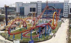
The whole Dhaka city stares with awe at the colossal structure near Bashundhara gate. The meticulous architecture and vibrant outlook will certainly draw your attention to the building. Yes, you guessed it right. I am talking about Jamuna Future Park. When this upscale shopping complex opened to the public in 2013, it shifted the dynamics of the residential and commercial future of the area. As South Asia’s largest mall, this park has uplifted the land value and rent of the area. Not that the surrounding area was downtrodden or inexpensive before this Jamuna Future Park. However, after its inauguration, the neighboring area attained the Posh area of Dhaka status for that one structure. The neighborhood adjacent to the park is Bashundhara Residential area. This area is one of the affluent and busy locations of Dhaka. Besides that, Jamuna Future Park is vicinal to the Baridhara Residential area, Baridhara DOHS, Gulshan, and Shahjalal International Airport. Such a meticulous position of the park has rippled across the vicinity, making this area one of the most coveted locations in Dhaka. The upscale lifestyle and abundant urban privileges are some of the reasons why Dhaka people are looking forward to nestling in this area. Even though the lavish lifestyle and amenities are a huge plus point, the area is more popular with some noteworthy educational institutions. Viqarunnesa Noon School, North South University, American International University Bangladesh, and Independent University Bangladesh have campuses near Jamuna Future Park. Not only the Jamuna Future Park, the park's surroundings are always replete with festivity and chaos. The bustling noise of the roads, the sizzling sound from the food courts, and the laughs and laughter resonating from the hangouts provide a unique outlook of the Jamuna Future Park area.
View Insights
Jatrabari Property Guide
Rating icon
4.0

Jatrabari
, Dhaka

Jatrabari can easily be regarded as the heart of communication across Bangladesh. It is also known for the steel furniture industry. But what you don’t hear often is that many people choose to live in Jatrabari or its surrounding areas due to transportation and other conveniences. Part of the Dhaka South City Corporation, Jatrabari area guide shows that it has an area of 13.19 sq./km (5.09 sq mi), and the population is over 4,92,166. The area is located at the center of the Dhaka-Chittagong Road highway. It is bounded by Demra, Sabujbag, Kadamtoli and Shyampur. Jatrabari is best known for its Jatrabari-Gulistan flyover (also known as the Mayor Mohammed Hanif Flyover). It is 11km long and is the largest flyover in Bangladesh, connecting 30 southern and southwestern districts. On a good day, it takes only around 10 minutes to cross the flyover in the Jatrabari-Gulistan route. The Dhaka-Demra Highway, Sayedabad Bridge New Road, Dhaka-Sylhet Highway, etc., offer easy communication in different parts of the country. Due to the increasing population, Jatrabari is also becoming a suitable target for real estate investors. Other than that, many people from different districts are investing in purchasing plots and building houses in the area. Renting rooms or apartments is very affordable here for individuals and families. The area is also famous for having some reputed educational institutions and private and commercial businesses. The Quantum Foundation, a well-known and self-funded organization, has a branch in Jatrabari. Though there aren’t many attractions nearby, it has some commonly known places, such as Jatrabari Park, Jatrabari Wapda Colony Power Development Board, Jatrabari Madrasa Masjid, etc.
View Insights
Kafrul Property Guide
Rating icon
4.0

Kafrul
, Dhaka

Whether you want to travel via rickshaws, car, bus, train, or Metro Rail, Kafrul is certainly one of the most accessible areas in Dhaka. That is why we are looking for a Kafrul area guide.<br><br> The Kafrul Thana is located at the Northwest of Dhaka and is part of Dhaka North City Corporation. It is surrounded by Sher-E-Bangla Nagar Thana on the west, Cantonment Thana on the north and east, and the Tejgaon Thana on the south.<br><br> It has an area of 17.8 sq./km and a population of around 396,182 (according to the 2011 Census). With a number of mahallas and such a huge population, Kafrul is one of the active areas in Dhaka City.<br><br> The Dhaka Cantonment, the headquarters of Bangladesh Army and Air Force, is in this area, along with many military residences, golf clubs, ministry offices, military hospitals, etc. Ultimately, it makes Kafrul one of the vital and secure places to live in.<br><br> The roads in the area are well-maintained and have less traffic. Several footover bridges ensure safety for all. Moreover, it has many significant locations, such as the Tejgaon Airport, Bangladesh Air Force Museum, Bangladesh Regional Passport Office, CMH, etc.<br><br> You can easily travel to various locations via bus or any local ride. Moreover, traveling in and out of the area is convenient because of its many bus routes. Moreover, it has several railway stations nearby, along with multiple Metro Rail stations from Farmgate to Kazipara.<br><br> The Tejgaon Airport and the National Parade Ground are two of the well-known locations in the area. On top of that, several reputed educational institutions, such as BAF Shaheen College, Cantonment School & College, and Adamjee School & College, are also in Kafrul.<br><br> Overall, Kafrul is one of the best and most convenient places to live at a reasonable cost.
View Insights
Kazitula Property Guide
Rating icon
4.0

Kazitula
, Sylhet

Kazitula has recently turned into one of the most sought-after locations in the Sylhet District. This suburban and residential cum commercial hub has been a home for thousands of people over the last few decades, and the population has been increasing day by day. Now, the Kazitula area guide shows that it is one of the most densely populated locations.<br><br> Kazitula's exact land area and population are unknown. It is located in the western part of Sylhet City and is part of Sylhet City Corporation’s ward no. 17. The Kazitula area is likely to be named after Kazi Jalal Uddin (R), as his shrine is one of the commonly known places of this locality. Kazitula is surrounded by areas like Kumarpara, Amborkhana, Shahi Eidgah, Lohapara, etc.<br><br> The area is filled with many tall buildings, most of which are residential apartments. However, you are also likely to locate some tin-shaded and semi-bricked households inside the localities and by the narrow streets. As a result, people who are looking for a residence in the area can easily find affordable options and suitable living spaces. There are also commercial buildings that offer affordable to high-priced spaces for establishing businesses. It shows that the Kazitula area offers a diverse living and social environment.<br><br> Other than housing and certain job areas, Kazitula also offers access to education. There are several schools, colleges, and madrasas inside and around the area. The reputed and well-known educational institutions in the area are the Kazi Jalal Uddin Girls' High School, Kazi Jalal Uddin Boys Government Primary School, and Madrasah Tahfizul Quran. <br><br> You can travel to Kazitula from Sylhet City by using the Ambarkhana or Chowhatta Point. Kazitula is located right across the Nayasarak and Ambarkhana Roads. Traveling to the area via buses, taxis, rickshaws, autos, and CNGs is convenient. The only problem is that the bus routes are not widely available via this road, and there are hardly any bus stops inside the area.<br><br> Jobs, businesses, and industries are the main economic sources in this area. Other than that, transport and services also contribute to Kazitula’s economy. So anyone staying in Kazitula or nearby localities can easily find safe and comfortable residential hotels. The Hotel Crystal Rose and London Inn are two such popular names. <br><br> The most notable landmark in Kazitula is the Kazi Dighi, which offers a view of a large and wide dighi at the center of the locality. There are also Kazi Jalal Uddin (R) Mazar Sharif, Kazitula Jame Mosque, Kazitula Uchasharak Jame Mosque, BTCL Guest House, BTV Station, etc.
View Insights
Khilgaon Property Guide
Rating icon
4.0

Khilgaon
, Dhaka

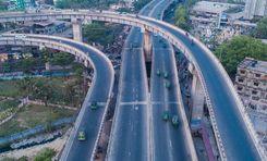
Khilgaon has abruptly become the talk of the town for various eateries. Once a disregarded area, it has now flourished as a food heaven for the Dhaka people. Confined within a 14.02 square Km area, Khilgaon accommodates 327,717 residents. This Khilgaon area guide will reveal the hidden potential of Khilgaon, both for residential and commercial purposes. <br><br> One major development in Khilgaon is the upraising of small to medium food stalls spread on Taltola Road. The varieties of cuisine choices, affordable pricing, and popularity over the Internet have made this area the most hyped for food and hangouts. <br><br> The emergence of Khilgaon as a food heaven started with the popularity of Apon Coffee House. Once people became fans of their coffee, other entrepreneurs marked Khilgaon for their venture. Gradually, Khilgaon became a popular gateway for hanging out and trying different street and Western food types. <br><br> Even though Khilgaon has come to light as a food heaven, this area has been densely populated ever since. The educational institutions, nearby hospitals, parks, and reasonable rent for housing were some of the reasons people chose to base their nest here. <br><br> Many office-going bachelor people are choosing Khilgaon to set their nests. As Khilgaon is closely attached to Motijheel, Moghbazar, and Paltan, where many offices are situated, Khilgaon has been a residential paradise for people with limited income and who seek easy commute. <br><br> Khilgaon is now a name of comfort for middle-income groups, bachelors, and students. The affordable rent and a promising neighborhood have made it one of the top sought-after locations in Dhaka for residential purposes. The inauguration of Khilgaon flyover has rendered the residents of Khilgaon a faster way to commute.
View Insights
Khilkhet Property Guide
Rating icon
4.0

Khilkhet
, Dhaka

One notable administrative area in Dhaka, Bangladesh is Khilkhet Thana. It has a total area of 15.88 square kilometers (6.13 sq mi). On June 27th, 2005, Khilkhet separated from the southern parts of Badda Thana as a sign of its focused administration on urbanization and demographic challenges. Strategically located with Dhakshinkhan and Uttar Khan thana to the north, Badda thana to the south, Cantonment thana to the west and Bimanbandar thana to the northwest makes it clear that it is bordered by Turag River in the east dividing it from Rupganj Upazila of Narayanganj District. This shows that Nikunja-1 and Nikunja-2 are close to the Khilkhet Thana building as they are residential areas closest to this location.<br><br> According to Khilkhet area guide, this region is a part of Ward No. 17 under Dhaka North City Corporation covering portions of Dakshinkhan union and Dumni union which further speaks about its administrative importance as well as geographical reach within city’s urban fabric.The creation of Khilkhet thana did simplify governance in this rapidly growing locality but also boosted local development with regard to infrastructure as well as public services for their diverse population needs.<br><br> Khilkhet fully caters to its dwellers’ various requirements. However, more lifestyle facilities are required at the place considering that its population is continuously growing. Installation of surveillance cameras within the neighborhood together with a quick response team will increase the security level thus improving the minds of all who reside there.
View Insights
IconMap

Featured Projects
View All

Property Price Trends in Bangladesh for
Buy
Rent
Bedrooms:
Average Price (Last 12 months)
Tk. 6,358.55 per sqft
Past 12 months' growth
5.85%
Positive Trend
Past 3 months' growth
5.2%
Positive Trend
Icon
Price information is based on historical data from ads posted on Bikroy and may not reflect the full market dynamics.
hero

Sell or Rent Fast on Bikroy: Post Your Property in 2 Mins!