Search Icon

Explore Areas in Bangladesh

18 - 36 out of 302 areas
Netrokona Property Guide
Rating icon
4.0

Netrokona
, Mymensingh

Netrokona District, situated in the northern part of Bangladesh, is known for its picturesque landscapes and rich cultural heritage. The Netrokona area guide highlights the district’s unique mix of cultural traditions, economic activities, and natural beauty that contribute to its growing prominence.<br><br> The district borders Mymensingh to the west, Sunamganj to the east, and the Indian state of Meghalaya to the north, making it an essential part of the region's connectivity. It has a land area of 2,810 square kilometers and a population of over 2.3 million.<br><br> Netrokona boasts a vibrant blend of ethnic communities, including Bengali Muslims, Hindus, and indigenous groups like the Garos and Hajongs. This diversity enriches social gatherings, which are reflected in various festivals and traditional events.<br><br> Economically, Netrokona is primarily driven by agriculture, with rice, jute, and various fruits and vegetables being the main crops. Fisheries also play a significant role, thanks to the district's many rivers, haors, and beels. Additionally, the region benefits from small-scale industries such as weaving, pottery, and handicrafts, which contribute to local livelihoods. These economic sources, combined with a developing service sector, make Netrokona a growing hub for trade and commerce.<br><br> Natural beauty is a defining feature of Netrokona. The district is home to several notable landmarks, including the scenic Haor regions, where vast wetlands create breathtaking views, especially during the monsoon. Places like Durgapur, famous for its rock formations and the Someshwari River, attract tourists seeking nature and tranquility. The Birishiri Tribal Cultural Academy and Ranikhong Church are notable sites showcasing the district’s cultural diversity and history.<br><br> Netrokona is rapidly evolving into one of Bangladesh's model districts, focusing on sustainable development and economic growth. As a result, the district is becoming increasingly appealing for both housing and business opportunities, offering a balanced lifestyle amidst nature and a supportive community.
View Insights
Paglapir Property Guide
Rating icon
4.0

Paglapir
, Rangpur

Paglapir is located about 8 km south west of Rangpur city center. It is located near Rangpur Medical College and Rangpur Cantonment. The place is located along Rangpur and Dinajpur Mahat Road. This place is easily accessible from anywhere in Rangpur. It is also a notable area of Rangpur known for its other historical and local importance. The name Pagalapir comes from a saint or pir the place is known for organizing religious and cultural festivals.<br><br> The area is known for its close-knit community. On the other hand, the cost of living in Paglapir is less than that of Rangpur city. Accommodation, food and daily expenses are available at affordable prices. Although the area ranges from traditional houses to modern structures that are active to provide security. The area is surrounded by agricultural fields and rural settlements, giving a mix of urban and rural characteristics.<br><br> The local economy is supported by small businesses, markets and agricultural activities. Shops, eateries and vendors here cater to the daily needs of residents and visitors. Besides that, small-scale business and commerce form the backbone of the local economy.<br><br> The area has basic educational institutions and health care facilities. Primary schools and secondary schools are there to facilitate the learning process. Also, residents of this place travel to Rangpur for higher education. There are several health care centers and pharmacies for health care. Came to Rangpur Medical College Hospital. It is possible because of the good road communication system here.<br><br> Well connected by Pagalpir Road. Regular transports including buses, rickshaws and auto rickshaws ply. Rangpur is a transit point for many traveling between the city and the unique region. The area is also well connected by road and rail.<br><br> Although Pagalpir is relatively well connected, there is an ongoing need for improved infrastructure. Especially in road maintenance, public utilities and services. An intersection between urbanization and traditional rural life is a challenge here to balance development with preservation of cultural and historical heritage.<br><br> Today, Pagalpir has become an important area of Rangpur, representing a mix of history, culture and community life. This could be a good place for you if you value a quiet and affordable lifestyle with a strong sense of community and cultural heritage.
View Insights
Banglabazar Property Guide
Rating icon
3.9

Banglabazar
, Barishal

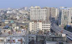
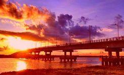
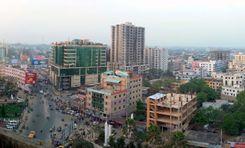
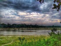
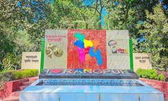
Banglabazar is a vibrant commercial and residential area in the heart of Barisal district. The area is economically critical, with important government and private offices, river ports, and connected highways. Located on the banks of the Kirtankhola River, the Banglabazar area is considered a bustling commercial center for goods transportation, communication, and agricultural products production. Here, you will find everything from clothing and electronics to restaurants and raw markets.<br><br> Barisal Airport, river port, and bus stand are located very close to this area. Bangga-Barisal Highway, C&B Road, Bangla Bazar Road, and Shaheed Ali Road, connect this area with almost all district roads of the country. To the West of the area are Jhalkathi, Pirojpur, Khulna, and Bagerhat. To the North are Barisal Sadar, Gopalganj, Madaripur, and Shariatpur. Bhola and Noakhali districts on the East. Patuakhali and Barguna districts on the West.<br><br> 
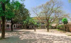
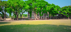
Advanced educational institutions like Sher-e-Bangla Medical College Hospital, Institute of Health Technology, and Barisal Polytechnic Institute are located in this area. There are also many schools and madrassas in and around this area. There are several advanced healthcare clinics here. Also, the parks and recreation centers here are quite interesting.<br><br> 
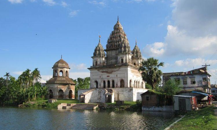
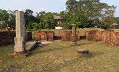
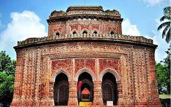
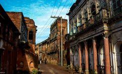
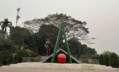
The transport network of Banglabazar is connected with other parts of the Barisal district and across the country by road and waterways. The economy of this area is mainly based on agriculture, transportation of goods, and fishing. Also, the area is always bustling with raw markets, retail, and wholesale businesses. The area is known for its rich cultural heritage, natural beauty, and historical monuments.<br><br> 
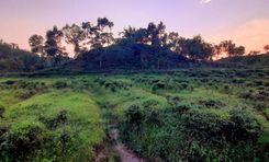
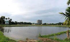
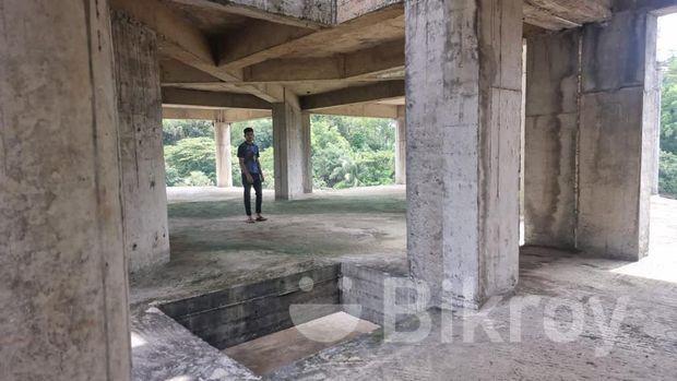
Surrounded by rivers, and surrounded by greenery, the natural beauty of Banglabazar will enchant you. Roads, water supply, and sanitation facilities in this area are well developed. However, footpaths and parking spaces are narrow. As river ports, factories, and businesses are built here, its main roads are congested.<br><br> 
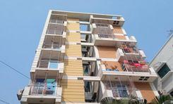
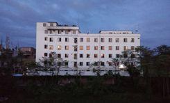
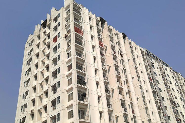
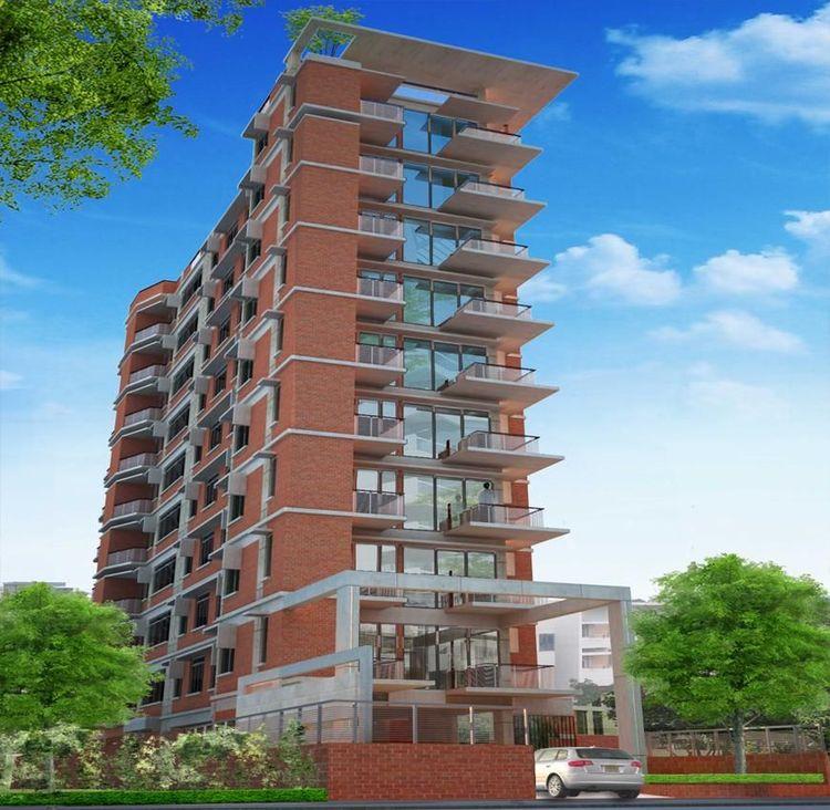
Banglabazar's communication system and other civic facilities are very convenient for housing, employment, and business. Being economically and commercially developed, several housing projects and infrastructure are being developed in the area. Roads connecting the surrounding areas are also well-developed. Police Station and Fire Service are located very close by. Traffic congestion, lots of auto rickshaws, and environmental pollution are the main problems here.
View Insights
Bimanbondor Property Guide
Rating icon
3.9

Bimanbondor
, Sylhet

Among all the prominent areas in Sylhet Sadar Upazila, the Bimanbondor Thana or Airport Thana is one of the most notable ones. This is mostly because Thana has many important and notable places, including the Osmani International Airport, which is the third largest airport in Bangladesh. The Bimanbondor Thana is located in the northeast of Sylhet District and is located less than 10 kilometers from the Sylhet Sadar area.<br><br> The Bimanbondor Thana was established in 20211. It has a land area of 110.59 square kilometers with a population of 97,524. It is bounded by Gowainghat Upazila in the north, Kotwali and Shah Poran Thanas in the south, Jaintapur Upazila in the east, and Jalalabad Thana in the west. SCC’s wards, no. 6, 7, 8, and the Khadimnagar and Tuker Bazar Unions are included in the thana area.<br><br> It is one of the most progressive areas of the district and is also filled with many modern sculptures and other heritages. Most of its roads are either developed or under development, which ensures an improved communication facility. The Thana area also has a growing community. This is making it more sought-after by developers who are adding residential housing states across the thana. As a result, land and property prices are increasing gradually.<br><br> A big part of the population depends on farms and agricultural lands as economic sources. Tea estates, palm and rubber cultivations, non-agricultural labor, and other industries are among the top contributing sectors. The popular tea gardens in the Bimanbondor Thana area are the Khadimnagar Tea Garden, Malnicherra Tea Estate, Tarapur Tea Estate, and the Lakkatura Tea Garden.<br><br> Other popular tourist destinations are the Adventure World Fun & Family Tourism Park, Khadimnagar National Park, Tilagor Eco Park, Lakkatura Water Lily Pond, Sylhet International Cricket Stadium, etc. Reputed educational institutions like Sylhet Cadet College, Sylhet Agricultural University (SAU), and Shahjalal University of Science and Technology are located in the Thana area.
View Insights
Bodorganj Property Guide
Rating icon
3.9

Bodorganj
, Rangpur

Bodorganj is a well-known upazila of Rangpur district of Rangpur division of Bangladesh. It is known for its rich cultural heritage, agrarian economy and vibrant local markets. It has Rangpur Sadar Upazila and Saidpur Upazila in the North, Nawabganj Upazila in the South, Rangpur Sadar Upazila and Mithapukur Upazila in the East and Parvatipur Upazila in the West. Bodorganj Upazila has a total area of 301.28 km and a population of about 287,746. It sees a mix of Hindu and Muslim Bengali families and is known for its communal harmony. Also traditional handicrafts such as weaving, pottery and embroidery are practiced by some communities.<br><br> The economy of Bodorganj is mainly based on agriculture. Major crops include paddy, jute, wheat and various green vegetables. The region produces a significant amount of potatoes which are exported to other parts of the country. Besides, the local markets here are quite active. There are small businesses and textiles that also contribute to the local economy. Not to mention, Bodorganj is specially for producing Shatranji. Among the unique cottage industries are bamboo work, weaving, pottery and unique small scale cottage industries. Cost of living is comparatively lower in Bodorganj as compared to Rangpur city area. Accommodation, food and unique items are very affordable here.<br><br> Bodorganj has many primary and secondary schools for education. Notable institutions include Bodorganj Government High School and Bodorganj Government College. The education rate is currently increasing here due to the efforts of NGOs as well as government initiatives to promote education. Along with education, medical services are also good and primary health care is well provided. There is a government upazila hospital and several government clinics and private institutions that provide primary health care to the local population. Rangpur has good road connectivity if you need good treatment on an urgent basis.<br><br> Along with the medical services, the transport system here is also quite satisfactory. Bodorganj is well connected by road with Rangpur city and other nearby upazilas. Public buses, rickshaws and auto rickshaws are common modes of transportation. Apart from the road system, the railway system is also very good here. The area is accessible by rail with train connectivity to major cities like Dhaka Rangpur which is truly remarkable.<br><br> Bodorganj is known for its natural beauty. There are green fields, rivers and rural landscapes that attract visitors for a little peaceful retreat. The region also has several ancient temples and mosques that reflect the historical and religious significance of the region. It is an ideal place for those who love nature and enjoy a peaceful lifestyle.<br><br> Like many rural areas in Bangladesh, Bodorganj faces challenges related to structural development, poverty alleviation and quality education and healthcare. And limited employment opportunities and few challenges. Overall, this place can be a good place to stay for those who value rural lifestyle, community ties and natural beauty. However, Bodorganj has improved a lot due to government and various private initiatives. This is an excellent choice for families looking for a safe and nurturing environment with a strong sense of community and low cost of living.
View Insights
Cantonment Property Guide
Rating icon
3.9

Cantonment
, Mymensingh

Mymensingh Cantonment, situated in the Mymensingh district of Bangladesh, is a vital military establishment with a rich history and strategic importance. Officially known as Momenshahi Cantonment, it was established to support the defense and administrative needs of the Bangladesh Army. The Mymensingh Cantonment area guide provides insights into the region's history, transport facilities, and housing options, reflecting its significance beyond just a military hub.<br><br> Historically, Mymensingh Cantonment was established post-independence to strengthen its military presence in the northern part of Bangladesh. The cantonment has since evolved, accommodating various military units and institutions. It is known for its disciplined environment and structured layout, contributing to its reputation as a secure and orderly area.<br><br> Geographically, the cantonment is located on the outskirts of Mymensingh city, offering a blend of urban and rural landscapes. The area has wide, tree-lined roads, well-maintained parks, and military facilities. The proximity to the Brahmaputra River adds to the natural beauty of the region.<br><br> Communication and transportation facilities around Mymensingh Cantonment are well-developed. The area is accessible by road, with several bus routes connecting it to Mymensingh city and other regions. Local buses and auto-rickshaws provide convenient transportation options within the area. The nearest train station, Mymensingh Railway Station, is just a short drive away, connecting the cantonment to major cities like Dhaka, Chittagong, and Sylhet. This accessibility makes the cantonment a well-connected location.<br><br> The economy of the Mymensingh Cantonment area is closely tied to the presence of the military. The cantonment supports various local businesses, including retail shops, restaurants, and service providers catering to military personnel and their families' needs. Additionally, the nearby city of Mymensingh, with its educational institutions and industries, further boosts its economic activity.<br><br> Housing and property availability in Mymensingh Cantonment are primarily limited to military personnel and their families. However, the surrounding areas offer residential options for civilians, including apartments, houses, and development plots. Property values in the region have been steadily rising due to the cantonment's security and amenities.<br><br> Notable landmarks within and around Mymensingh Cantonment include the Shahid Minar, as well as several parks and recreational facilities. Additionally, the cantonment is home to educational institutions, hospitals, and shopping centers, making it a self-sufficient area with ample amenities for residents and visitors alike.
View Insights
Chakaria Property Guide
Rating icon
3.9

Chakaria
, Chattogram

Chakaria Upazila is located in the Cox's Bazar District of southeastern Bangladesh. Covering an area of approximately 643.46 square kilometers, it is bordered by Lohagara Upazila on the north, Cox's Bazar Sadar and Ramu Upazilas on the south, the Bay of Bengal on the west, and Lama and Naikhongchhari Upazilas on the east. Chakaria is the largest upazila in the Cox's Bazar District in terms of area.<br><br> The upazila is divided into 18 unions and has a diverse population engaged in various occupations. Agriculture is a significant part of the local economy, with rice, betel nut, and salt being the primary crops. Fishing and salt production are notable activities due to its coastal location. The area is also known for its horticultural produce, including fruits like pineapple and watermelon.<br><br> Chakaria is rich in natural beauty and biodiversity. The region includes parts of the Malumghat Forest and several coastal and marine ecosystems, making it an important area for environmental conservation. The Matamuhuri River, which flows through Chakaria, adds to the scenic landscape and supports the local agriculture and fishing industries.<br><br> In terms of infrastructure, Chakaria has seen significant development in recent years. Educational institutions, healthcare facilities, and improved road networks contribute to the upazila's growth. The upazila is also home to several notable establishments, including the Chakaria Upazila Health Complex and various non-governmental organizations working towards community development.<br><br> Chakaria's blend of agricultural productivity, natural beauty, and infrastructural development makes it a vital part of the Cox's Bazar District, contributing to the overall socio-economic development of the region.
View Insights
College Para Property Guide
Rating icon
3.9

College Para
, Rangpur

Collegepara is located in the middle of Rangpur city. Distance from Rangpur zero point to College Para is only 5.9 km. It is close to areas like Ship Company Junction and Tajhat. Besides, this place has a special importance as it is adjacent to Carmichael College, Rangpur Government College, Rangpur District School, Rangpur Girls School and Town Hall Road. The importance of this area is high for educational reasons. A bit crowded as there are many residential buildings for several students and faculty members. Moreover, there is a combination of hostels, apartments and private houses.<br><br> The college neighborhood carries a strong sense of community due to its large number of students and education professionals. Due to this regular police presence, this place is marked as a peaceful environment and safe area. Shops, libraries and all the necessities are close at hand from the area.<br><br> Education and medical facilities here are much better and easily accessible. Residents here are well off and there are educational institutes at a short distance which is quite convenient. College Para is also very advanced in the medical field. There is Rangpur Hospital which provides medical services to the local residents.<br><br> The area is well connected by public transport. It is easily reachable by rickshaws, auto rickshaws and also transport to unique places. However, the area may experience traffic congestion especially during school opening and closing times. As the road connectivity is good here, the option of using private transport is really appreciated.<br><br> People of different religions, castes and professions live together here for professional reasons. Due to the high demand of this place, the cost of housing here is very high. Apart from the cost of accommodation, the prices of other goods can also seem high here.<br><br> The area feels quite vibrant and dynamic. The area often hosts cultural events, seminars and academic talks, which contribute to the lively atmosphere.<br><br> Collegepara is a good place to live if you value proximity to educational institutions and enjoy being part of an academic community. This place is especially suitable for students, academics and those who appreciate a lively, intellectually stimulating environment. Also, this collegepara is one of the packages to get education, medical facilities and a better environment. Living here is definitely a blissful experience.
View Insights
Cornelhat Property Guide
Rating icon
3.9

Cornelhat
, Chattogram

Cornel hat, which is also named by ‘City Gate’ in Chattagram, the main entrance of Chattagram city. It is also situated at Uttar Pahartali. Chattagram Govt. College, Chattagram Medical College, Bangladesh Railway Museum, and Patenga Sea Beach are close to Cornel hat as well.<br><br> Cornel hat Bus stop is beside The Bay of Bengal. So different industrial and commercial companies are situated here. This place is a home for various national and international businesses and financial institutions. As the place is close to the Bay of Bengal, it is a highly demanding place for tourists.<br><br> Just to give you a glimpse of its importance, the Chattogram export processing zone is beside sea beach! Oil Pump Bangladesh, Unilever Bangladesh, and Golden Ispat Limited; these giant companies are situated near Cornel Hat.<br><br> However, not only the business sector but also the Bay of Bengal, Patenga Sea Beach has the greatest contribution to the whole commercial sector of Bangladesh. Bangladesh Naval Academy is also an important place in this area. So, it can be said, that Cornel hat is the center of the Chattagram commercial sector.<br><br> Since it is a commercial area, shopping centers are a big chunk of this city. Cornel Hut City Corporation's multistoried market is the finest and biggest market for shopping for your daily life. If you want to visit tourist spots like Sitakundu, khoiyachora, and Guliyakhali Sea Beach, you have to go through Cornel Hut. Due to its importance, people are becoming interested in buying properties in this area and different settlements have also been built.
View Insights
Dinajpur Property Guide
Rating icon
3.9

Dinajpur
, Rangpur

Of all the “A” class areas Bangladesh has, Dinajpur is one of the most significant. Not only is it one of the oldest locations, but it is also rich in history. Established in 1786, the best part of the Dinajpur area guide is that it is the largest of the 16 districts in northern Bangladesh. The land area of Dinajpur is 3,444.30 square kilometers, and the population is over 33.15 million. Now, it has 13 upazilas, 9 pourashavas, 103 unions, and 2,131 villages.<br><br> It is said that the founder of Dinajpur Palace was Dinaj or Dinraj. Later, even though the British rule ended, the people named the district Dinajpur. Currently, Dinajpur is a metropolitan district of the Rangpur Division. It is bounded by Panchagar and Thakurgaon Districts in the north, Joypurhat and Gaibandha in the south, Nilphamari and Rangpur in the east, and West Bengal of India in the west.<br><br> The Dhaka-Dinajpur Highway is one of the key roads that connect Dinajpur with many other districts and divisions. Other than roads, people can also travel to the district by train and river. The main rivers in the district are the Karatoya River, Punarbhaba River, Atrai River, etc.<br><br> There are many housing and growing residential areas in Dinajpur. The newly established housings and facilities have impacted the lifestyle in positive ways. As a result, the real estate business is blooming.<br><br> The district's economy relies on agriculture, with the main crops being paddy. However, lychees, mangoes, and other seasonal fruits and vegetables also contribute to the area's economy. Since the amount of food produced in the district is more than the demand, selling and exporting it across the country and internationally contributes largely.<br><br> Dinajpur has many historical landmarks and interesting locations. The most notable ones are the Dinajpur Rajbari, Kantajew Temple, Nayabad Masjid, Sura Masjid, etc. There are also various recreational locations, such as Shopnopuri Artificial Amusement Park, Birganj National Park, Ramsagar National Park, etc.
View Insights
Majortila Property Guide
Rating icon
3.9

Majortila
, Sylhet

Majortila is located in the northern part of Sylhet city. Its strategic location connects Sylhet with unique important parts. It is generally a convenient location for both residential and commercial activities. The area is known for its vibrant community life. It is one of the important places in Sylhet district. <br><br> Majortila utility and infrastructure aspects are well advanced. There is reliable electricity and water supply. There are efficient lightning collection and disposal services with strong telecommunication networking. The economy here is built around real estate businesses, local businesses and small industrial hubs. A variety of local businesses and small enterprises contribute to Majortila's economic vibrancy. There are good job opportunities in health care centers, educational centers and other sectors here. There is also a lot of small-scale employment.<br><br> There are several reputed schools in and around Majortila. Which provides quality education from primary level to secondary level. There are also nearby colleges and universities for higher education. Very convenient for the residents here. In addition to education, the major has many health care facilities such as hospitals and clinics that offer both general and specialized medical services. There are also local markets, shopping centers and supermarkets capable of fulfilling all the daily needs of the people here.<br><br> The transport system here is also quite good. The area is well served by local buses, rickshaws, auto rickshaws and ride sharing services that facilitate commuting. Besides, a good road network connects Majortila with other parts of Sylhet city which ensures smooth transportation.<br><br> For recreation there are public parks which provide tranquility to people. People of different religions, castes and tribes live together in this place which is a very good aspect for the residents. This place has its own regional language and culinary diversity. It has its own rich history and traditions and a fusion of different cultures.<br><br> The place is quite good for living. On one hand there is the lush green land of natural beauty and on the other hand there is safety and security. Local Police Stations ensure law and order in the area and also have private guard enforcement facilities for residential and commercial properties.<br><br> Overall, Majortila is a dynamic and important area of Sylhet, with a wide range of amenities that make it an attractive place to live and do business. Its strategic location caters to the needs of comprehensive services and vibrant community life. Although there are several challenges, it is a well-developed place to live.
View Insights
Narayanganj Property Guide
Rating icon
3.9

Narayanganj
, Dhaka

Narayanganj is a notable city and district of Bangladesh located in the central part of the country. It is the smallest district of Bangladesh. This district is located on the banks of Shitalaksha River and Meghna River about 20 km south-east from the capital Dhaka. Narayanganj is well known as the "Dandy of the East". A central place in Bangladesh. It became a district in 1994, before which it belonged to Dhaka district. The total area of Narayanganj district is 264.23 Bardwan and about 39,03,138 people live here.<br><br> Narayanganj is one of the oldest industrial centers of Bangladesh. Narayanganj is making a notable contribution to the national economy especially through textile, garments and jute industries. Besides contributing to the strong industry of the city and the national economy of the country, the district is playing an important role in eliminating unemployment in the country by creating employment for thousands of people. It is a culturally significant place. Various religious festivals and cultural festivals are celebrated in the city every year. Stay local cuisine and food habits. This district is famous for delicious biryani and sweets.<br><br> Narayanganj has a significant historical place in the history of Bengal. Notable places among these are - Jamdani Palli Rupganj, Sonargaon, Panam Nagar, Muslim Manufacturing Factory etc. The economy of the village is mostly based on agriculture. According to Bangladesh Bank, the district ranks third in the country in terms of gross national income and wealth possession. Along with the development, the place is densely populated due to the large number of people living here and there is a mix of people from different castes, castes, religions and tribes living here.<br><br> The district has several educational institutions ranging from primary schools to colleges and vocational training centers. There are folk arts and crafts museums, historical buildings and various archaeological sites. There is an opportunity to enjoy the scenic beauty of the Shitalakshya river and river cruise. Also the riverside ghats play an important role for both commercial, communication and cultural functions.<br><br> The city is well connected by roads, railways and rivers. It serves as a major transit point for goods and passengers between Dhaka and Ananya region. In addition to all the developmental works, efforts are being made to improve the system to meet the needs of the people including transport, housing, entertainment, markets, hospitals, etc. to meet the residential needs.<br><br> As it is a densely populated and industrial area, problems like river pollution and air pollution are disrupting the balance of the environment. Overall, Narayanganj is a dynamic and vibrant city that blends its historical heritage with modern industrial development that is making significant cultural and economic contributions to the country.
View Insights
Sirajganj Property Guide
Rating icon
3.9

Sirajganj
, Rajshahi Division

Sirajganj District is in Bangladesh's North Bengal area, specifically the Rajshahi Division. It serves as an important financial district in Bangladesh. Sirajganj is Bangladesh's 25th biggest district by land and 9th largest by population. It is referred to as the entrance to North Bengal.<br><br> It is bounded on the north by Bogra District & Natore District; on the west side by Natore District and Pabna District; on the southeast by Pabna District and Manikganj District; as well as the east by Manikganj District, Tangail District, and Jamalpur District.<br><br> Sirajganj District in Rajshahi Division possesses an area of approximately 2,497.92 square kilometers (964.45 square miles). The major rivers include Jamuna, Baral, Ichamati, Karatoya, Phuljor, and Hurasagor. The yearly average temperature ranges from 11.9 °C to 34.6 °C. The yearly rainfall total is 1,610 millimeters (63 inches).<br><br> Sirajganj District's communication system is excellent. It has Bangladesh's most major highway and railway system, which connects all of North Bengal and a portion of South Bengal to the rest of the nation. The district's excellent transportation system makes it very easy to navigate. It has the second biggest bridge, the Jamuna Bridge, as well as Bangladesh's largest railway bridge. Sirajganj District is particularly noted for its river ports.<br><br> The region is home to two universities: Rabindra University, which was founded in 2017, and Khwaja Yunus Ali University, which opened in 2012.
View Insights
Alamdangha Property Guide
Rating icon
3.8

Alamdangha
, Khulna

Alamdanaga is an upazila of Chuadanga District, located in the northwest of Bangladesh. It is an administrative area of the Khulna Division, Bangladesh's second-largest division. Alamdanaga was previously a thana area but was established into an upazila in 1982. Its land area is 365 square kilometers, and its population is 3,45,992, with Muslims and Hindus living together for many years.<br><br> Currently, the upazila has 1 pourashava, 15 unions, and 211 villages. Looking at the Alamdanga area guide, you will notice that the upazila doesn’t have many water bodies. Only the Mathavanga River flows through the upazila. It has some small rivers, but most are dried up. However, the upazila still has many large ponds and beels.<br><br> It is now bounded by Mirpur Upazila (Kushtia District) and Gangni Upazila (Meherpur District) in the north, Chuadanga Sadar and Damurhuda Upazila in the south, Harinkunda Upazila (Jhenaidah District) and Kushtia Sadar Upazila in the east. It also has the Gangni Upazila (Meherpur District) and Damurhuda Upazila in the west.<br><br> One of the best things about Alamdanaga Upazila is its growing and developing lifestyle. Over the years, housing and residents, along with roads and other facilities, have been developed. The communication in and out of the upazila is also convenient. In addition to buses and cars, people can also travel through the upazila by train.<br><br> Unlike some other upazila areas of Khulna district, Alamdanga doesn’t have many historical landmarks or notable locations. However, it does have certain popular and notable locations and many old buildings. Some of them are over a century old. The Alamdanga Boddho Bhumi is the mass killing site bearing the scar of the 1971 Liberation War.<br><br> Other landmarks include Alamdanga Laal Bride or railway bridge, Kumari Jomidar Bari, Alamdanga Independence Memorial of 1971, Alamdanga Badminton Club (an ancient building), etc. It also has a cinema hall and a few parks.<br><br> It also has over 120 educational institutions, including madrasa, training institutions, polytechnical institutes, etc. There are 335 mosques, 292 Eidgahs, and 30 temples. People can also access healthcare facilities, banking, and other necessities here in Alamdanga.
View Insights
IconMap

Featured Projects

View All

Property Price Trends in Bangladesh for

Buy
Rent
Bedrooms:
Average Price (Last 12 months)
BDT 6,428.06 per sqft
Past 12 months' growth
11.11%
Positive Trend
Past 3 months' growth
13.4%
Positive Trend
Icon
Price information is based on historical data from ads posted on Bikroy and may not reflect the full market dynamics.
hero

Sell or Rent Fast on Bikroy: Post Your Property in 2 Mins!