Search Icon

Explore Areas in Bangladesh

108 - 126 out of 302 areas
Halishahar Property Guide
Rating icon
3.7

Halishahar
, Chattogram

At the bank of the Karnaphuli river and between the Bay of Bengal and Hill Tracts is located Halishahar Thana. It is one of the thriving and prominent areas in Chattogram District. You will need the Halishahar area guide to navigate through it, as it is filled with so many important locations, institutions, heritages, and remarkable landmarks.<br><br> The Halishahar area is about 9.64 sq./km or 3.72 sq./mile under the Chattogram City Corporation. According to the 2022 Census, the area had a population of 234,443, which has increased over the years. From the early days, Halishahar has been one of the busiest areas in the entire Chattogram district. Currently. It is also densely populated and has the district’s largest residential area.<br><br> The city’s name has a significant historical fact. It is said that during the 8th and 9th centuries, it was a temporary settlement location for Arab merchants. It was called the “Hawale City” during that time, which means “City Floor”. And it later turned into Halishahar.<br><br> This coastal area also has significant and busy locations, such as the Chattogram Port, Chattogram EPZ, multiple beach areas, Navy Colony, and Fishery ghats, and many national and commercial companies and their headquarters. As a result, the Halishahar area has many transportation routes, including multiple railway stations.<br><br> Moreover, it has many reputed educational institutions, training and sports centers, parks, conventional halls, medical institutions, religious institutions, shopping complexes, and more. The Chattogram EPZ is the largest export processing zone in the area and 4th (among 700) economic zones in the world. The Halishahar area is home to people of different economic backgrounds. Renting an apartment is very affordable, and the price of buying land or an apartment is also quite competitive.
View Insights
Ishwarganj Property Guide
Rating icon
3.7

Ishwarganj
, Mymensingh

Ishwarganj Upazila, or subdistrict, is located in the Mymensingh district of Bangladesh. It is a region rich in cultural heritage and rural charm. This upazila, spanning an area of 286.19 square kilometers, is home to an estimated 4,04,598 people. There are various opinions regarding the naming of Ishwarganj, but it is most likely derived from the word 'Ishwar,' which may have originated from the name of a landlord or a religious site.<br><br> Currently, it has 1 pourashava, 11 unions, 293 mouzas, and 304 villages. Gouripur Upazila borders it in the north, Nandail Upazila in the south, Kendua Upazila of Netrokona District in the east, and Mymensingh Sadar and Trishal Upazilas in the west. The beautiful Norosunda River also flows through the upazila, even though many parts of it have dried up.<br><br> Ishwarganj is known for its strong community ties and traditional values, which are reflected in the daily lives of its inhabitants. The people of Ishwarganj are known for their hospitality, and the region's rural landscape offers a peaceful retreat from the hustle and bustle of urban life.<br><br> Most residents of Ishwarganj work in agriculture. Rice, jute, and various vegetables are the main crops cultivated here, contributing significantly to the local economy. Transport and other communication rely on roads and highways. However, having three railway stations within the upazila is an added advantage for convenient communication.<br><br> Education is a priority in Ishwarganj, with several primary and secondary schools scattered across the upazila. Many of them were established in the early or late 1900s. However, access to higher education institutions still needs to be improved, prompting many students to travel to nearby towns and cities for further studies.<br><br> Despite these challenges, the literacy rate in Ishwarganj is steadily improving, reflecting the community's commitment to education. The town community is also growing day by day, even though many people live in the rural part.<br><br> You can also explore various historical and interesting places in Ishwarganj. The most notable are the Jomidar Bari and Jomidar Bari pond in Atharobari. There are also the Ishwarganj Boro Jame Masjid, Boro Kalibari Temple, Morichar Chor, etc.
View Insights
Kashipur Bazar Property Guide
Rating icon
3.7

Kashipur Bazar
, Barishal

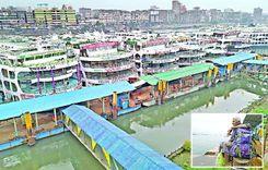
Kashipur Bazar is a densely populated area in the heart of Barisal district, considered the region's commercial and economic hub. The Bhanga-Barisal highway and the C&B road have increased the area's economic importance. Also due to the Kirtankhola River and Barisal Launch Terminal, the area's trade and commerce have expanded tremendously, along with huge employment opportunities. There are raw markets, wholesale markets, shopping malls, banks, government and private offices, educational institutions, and medical centers.<br><br> Barisal Airport, river port, and bus stand are close to Kashipur Bazar. From this area, you can easily travel to all upazilas and all major roads of the country. To the South of the area are Jhalkathi, Pirojpur, Khulna, and Bagerhat. To the North are Barisal Sadar, Gopalganj, Madaripur, and Shariatpur. Bhola and Noakhali districts on the East. Patuakhali and Barguna districts on the West.<br><br> The economy of the Kashipur Bazar area is mainly based on agriculture and goods transportation. Also, the local retail and wholesale markets contribute greatly to the overall economy of the district. The area is important in terms of communication, transport, employment, etc. Fresh produce, furniture, textiles, household items, electronics, etc. can be found in the market here.<br><br> 
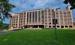
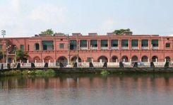
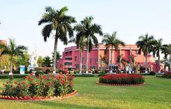
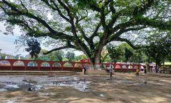
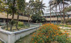
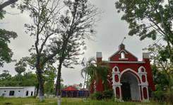
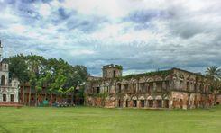
Here you will find several architectural examples including temples and mosques from the Mughal period. Also, there are several tourist centers including Durga Sagar Pond, Museum, Kirtankhola River, and Parks. The area has several budget-friendly hotels and guesthouses where you can spend the night. In and around the area, there are quality educational institutions, madrasahs, medical centers, and restaurants. Police Station and Fire Service are located very close by.<br><br> 
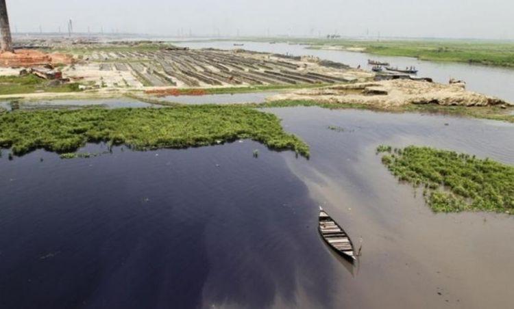
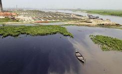
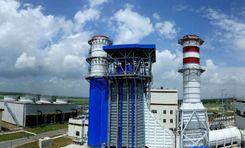
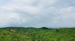
Although a densely populated area, Kashipur Bazar's natural environment, surrounded by riverside greenery, will charm you. The communication system from this area to the surrounding areas is quite good, and the sanitation system is also well structured. The main road is always congested as river ports, factories, and businesses are built nearby.<br><br> Kashipur Bazar's communication system and other civic facilities are very convenient for housing, employment, and business. Due to economic and commercial development, several housing projects and infrastructure are being developed in the area. Traffic congestion, a large number of autorickshaws, and environmental pollution are the main problems here.
View Insights
Keraniganj Property Guide
Rating icon
3.7

Keraniganj
, Dhaka

One of Dhaka’s upazilas, Keraniganj gained its historical significance in the liberation war in 1971 when it acted as the base of most guerilla operations. Today, it is a fast-developing city in Dhaka, boasting diverse communities, historical attractions, an improved standard of life, growing businesses and markets, and progressive infrastructure.<br><br> The Keraniganj area guide shows it has two thanas: Keraniganj Model Thana and South Keraniganj Thana. They are surrounded by Mohammadpur, Shyampur, Savar, Narayanganj, Kotwali, Lalbagh, and other places. There are more than 120 mahallas and about 400 villages in the 12 unions of Keraniganj. With an area of 166.87 sq/km, the city is home to around 800,000 people.<br><br> The location of Keraniganj puts it in a strategically advantageous position that has made transportation easy to major routes in crucial regions of the country. Therefore, it gradually emerged as an ideal business zone. The Dhaka-Mawa Highway connects the city to Dhaka, whereas the connection to Khulna and Chattogram is further facilitated in Keraniganj because of the Padma Multipurpose Bridge and Padma Bridge Rail Line.<br><br> Additionally, Keraniganj has become a preferable residential area for many people because of its affordable living cost. The presence of numerous schools and medical facilities has resulted in people from diverse backgrounds moving here. When necessary, they can easily go to the capital to avail of other facilities by using available transportation.<br><br> Finally, apart from locals and businesspeople, food and travel enthusiasts will also find Keraniganj a great place to explore its renowned places and local restaurants.
View Insights
Kewatkhali Property Guide
Rating icon
3.7

Kewatkhali
, Mymensingh

Situated in the vibrant city of Mymensingh, Kewatkhali is a bustling locality known for its diverse community and rich cultural heritage. The area is bordered by several key localities, including the Mymensingh Cantonment, the Shambhuganj Bridge, and the Bangladesh Agricultural University, making it a central hub for residents and visitors alike.<br><br> This Kewatkhali area guide explores the unique characteristics of this neighborhood, its connectivity, and the amenities that define daily life here. Known for its mixed-use character, the area offers a combination of both residential and commercial zones. It is bustling with activity, filled with small businesses, local markets, and eateries that offer a wide range of products and services.<br><br> Transportation in Kewatkhali is quite accessible, with various options like buses, rickshaws, and auto-rickshaws, making it easy for residents to navigate the city. The area’s proximity to key roads ensures that most daily commutes are relatively straightforward, although traffic jams are a frequent issue, especially during rush hour. However, the university area mostly remains free from heavy traffic.<br><br> The lifestyle in Kewatkhali is shaped by a sense of community and local culture. Residents have access to various amenities, including small parks, mosques, local markets, and community centers. However, there are also issues related to insufficient green spaces and occasional waterlogging during the rainy season, which can impact the quality of life. Education is well-supported in the area, with several notable educational institutions.<br><br> Economically, Kewatkhali is diverse, housing numerous small and medium-sized businesses that contribute to the local economy. The area also benefits from its proximity to larger markets and commercial zones in Mymensingh, offering residents various employment opportunities.<br><br> The environment in Kewatkhali, while lively, does face challenges related to air quality and urban density. However, with planned improvements in infrastructure and community development, there is potential for growth and enhanced livability in the future. It is also one of the most sought-after areas for real estate businesses, making it a neighborhood with both charm and opportunity.<br><br> You might not find many popular tourist spots in Kewatkhali. Yet, Bangladesh Agricultural University is a popular landmark of the area. There are also the Kewatkhali Railway Bridge, Railway Quarter Kheya Ghat, Kewatkhali Jame Mosque, Kewatkhali Kali Temple, etc.
View Insights
Khalishpur Property Guide
Rating icon
3.7

Khalishpur
, Khulna

On the outskirts of the Bhairab and Rupsha rivers is located the Khalishpur thana. It is one of the Metropolitan thanas under the Khulna City Corporation (KCC) of the Khulna Division. The geographical area of Khalishpur is 12.35 sq./km.<br><br> And here is more of the Khalishpur area guide. According to data from the Khulna Metropolitan Police, there are more than 235,000 people living in the area.<br><br> Since it is located in the central Khulna district, Khalishpur is an area of growing community, business, and amenities. The Dhaka-Jessore-Khulna Road goes through the middle of the city and offers major transportation facilities. It connects the area to other major locations, such as Daultour, Khulna Cantonment, Boyra, Natun Rastar Mor, etc.<br><br> However, despite the facilities it offers, the Sheikh Abu Naser Bypass Road, which was to be another major road in the city, has been abandoned for around 13 years. This has been causing some issues with the residents around the area to move around comfortably. On top of that, the poor condition of the road often causes minor to major accidents.<br><br> The Khalishpur area has around 30 mosques, 2 temples, and 1 church. The main sources of income in the area are business, transport and construction, rents, remittance, etc.<br><br> While there aren’t many residential areas in the area, the Khalishpur Housing State is one of the well-planned residential areas in this country. Along with the vibrant and changing living conditions, Khalishpur offers modern amenities, such as the Liberty Cineplex, Wonderland Amusement Park, Sheikh Abu Naser Stadium, Rupsha Power Plant, etc.<br><br> Other significant locations include Newsprint Paper Mill, Khulna Junction, Khulna Railway Station, Khalishpur High School, Khulna Public College, Khalishpur Eidgah Field, etc. A location of natural beauty, Khalishpur is slowly transforming into one of the urbanized locations in Khulna.
View Insights
Kishoreganj Property Guide
Rating icon
3.7

Kishoreganj
, Dhaka

Kishoreganj, previously a sub-district under the Mymensingh District, became a district under the Dhaka Division in 1984. It is the second-largest district under the Dhaka Division. So let’s take a look at the Kishoreganj area guide.<br><br> Kishoreganj has a land area of around 2,689 sq./km, which was taken from the Mymensingh District. According to the 2022 Census, the district's population is about 3,267,626, with a density of 1200 people per square kilometer.<br><br> It is filled with not just the natural beauties of greenery and haors and rivers but also historical lands and heritages to fill your eyes with. So it is no wonder that Kishoreganj City and the District are a land of attraction to many people.<br><br> Some of such notable locations are Austagram haor, Kutub Shah Mosque, Isha Khan's Jangalbari Fort, Chandrabati Temple, Egarosindur Fort, Gangatia Jomidar Bari, etc. Moreover, the Sholakia Eidgah field holds the largest Eid Jamat or congregation in Bangladesh. There are also many other tourist attractions in this district.<br><br> The haors of this district contribute largely to its economy as the fish from this area goes all over the country. Other than that, vegetables, paddy, jute, and poultry farms also play a significant role in Kishoreganj's economy.<br><br> The literacy rate of the district is 72.54% (age 7 or above), and it has many educational institutions. Some of the well-known schools here are Azim Uddin High School, Kishoreganj Model Girls' High School, Kishoreganj Model Boys’ High School, Syed Habibul Huq High School, etc.<br><br> Other notable institutions are Kishoreganj Polytechnic Institute, Kishoreganj Govt. Mohila College, Katiadi Government College, Shahid Syed Nazrul Islam Medical College, Gurudayal Govt. College, Bangabandhu Sheikh Mujibur Rahman University, etc.<br><br> From medical, social, and financial institutions to supermarkets, bazar areas, parks, cinema halls, and necessary public locations, the Kishoreganj district offers pretty much everything necessary. Whether one travels by bus or train, Kishoreganj offers a good communication facility not just on inter-district routes but also with other districts.
View Insights
Kistopur Property Guide
Rating icon
3.7

Kistopur
, Mymensingh

Kistopur, a charming suburb of Mymensingh. The Kistopur area guide introduces you to a place that combines a small-town feel with access to the broader city’s amenities. This area is known for its mix of traditional homes and newer residences, offering a blend of modern comfort and rustic charm.<br><br> When it comes to transportation, Kistopur is connected by a few main roads leading into Mymensingh city, making commutes fairly manageable. However, public transport options like buses and rickshaws can be limited, especially during peak hours, which might be a downside for those without personal vehicles. The nearest train station is in Mymensingh, which offers an alternative for long-distance travel.<br><br> Kistopur boasts a vibrant community with a rich cultural heritage. The area is dotted with lush greenery, small ponds, and quiet streets, making it perfect for nature lovers. Community events, local festivals, and traditional celebrations are common, reflecting the area’s cultural roots. The local market is the heart of the community, where people gather to shop, socialize, and enjoy street food, adding to the area’s lively and friendly atmosphere.<br><br> The local economy in Kistopur is driven mainly by small businesses and some service-oriented jobs. The simplicity of the local economy means that life in Kistopur is not as fast-paced or commercially driven as in the city, but it offers a sense of contentment and self-sufficiency.<br><br> While Kistopur has seen little large-scale development, there are a few small projects underway, including road improvements and the construction of new homes. There’s potential for future growth as Mymensingh city expands, but the pace of change is slow, preserving the area’s traditional charm. The railway and railway staff quarter area is one of the least clean parts of the area, which needs proper attention.<br><br> Yet, Kistopur has a delightful mix of nature, culture, and community spirit. Though there are many mosques around the location, the churches and missionary centers in the locality stand out. Some of the notable places in Kistopur are St. Patrick's Cathedral, Mymensingh Christian Mission's Museum, Dil Roushan Jame Masjid, Provortok Shongha Shiv Mondir, Railway Colony, etc.
View Insights
Koyla Ghat Property Guide
Rating icon
3.7

Koyla Ghat
, Khulna

Koyla Ghat is an important economic area under Dakop Upazila in Khulna District. The area is located near the banks of the Rupsa River. It is close to the industrial area of Khulna city, which facilitates the transportation of raw materials and finished goods from factories and warehouses. It is one of the oldest commercial areas of Khulna and the country. Previously it was only known for transporting coal and products. Over time, it has become a gathering commercial area.<br><br> Mongla port, shipyards, and ferry wharf have made the area a busy industrial and commercial area. The area also serves as a transportation hub for coal transportation, international container transportation, and industrial establishments. The strategic location makes it an essential part of the regional transport network, connecting Khulna to other parts of Bangladesh and beyond.<br><br> The area is bounded by Koira Upazila to the west, Paikgacha Upazila to the south, and Dumuria and Khulna City to the north. Rupsa River to the east. The strategic location makes it easily accessible from different parts of the city. Boats, launches, and ferries ply regularly to various destinations along the river.<br><br> Khulna City Bypass Road (N7 Highway), Shipyard Road, Khan Jahan Ali Road, and Rupsa Ghat Road, have improved the connectivity of the area. Using the Khan Jahan Ali Bridge and ferry ghat, you can travel to all the southern districts of the country including Sundarban, and Barisal.<br><br> Beyond economic significance, the Koyla Ghat area has a unique mixture of heritage and architecture. Here you will see a wonderful combination of modern infrastructure, from the historic mosque-temple to the colonial era. Traditional fairs, religious events, and cultural performances are held here regularly.<br><br> One of the attractions of Koala Ghat is its scenic riverside scenery. The area has become a bustling commercial hub. There are numerous shops, markets, warehouses, and small- and medium-sized industrial establishments on this street. Busy commercial activities here have created huge employment opportunities and contributed to local economic development.<br><br> With public and private institutions, numerous commercial establishments, well-developed communication systems, educational institutions, health care centers, and a pleasant environment conducive to living, the amount of residential buildings in this area is increasing.
View Insights
Kushtia Property Guide
Rating icon
3.7

Kushtia
, Khulna

Kushtia is an administrative area of the Khulna District and is located in the southeast of Bangladesh. Kushtia city is the 13th largest town, and its pourashava is the 3rd largest pourashava in the country. Kushtia stands tall with a land area of 1,621.15 square kilometers. According to the 2022 Census, the population of the district is over 2.1 million.<br><br> Kushtia is also called the Cultural Capital of Bangladesh. It has the 2nd largest Shilpakala Academy in the country, and it is also an important industrial zone. The Kushtia area guide shows that the district also has a rich history, and many historical figures, like Mir Mosharraf Hossain, Lalon Shah, Bagha Jatin, etc., are from Kushtia. Moreover, the great poet Rabindranath Tagore also spent a part of his early childhood in this district.<br><br> The Mir Mosharraf Hossain Memorial & Museum, Rabindra Kuthibari and Kachari Ghor, Tagore Lodge, Lalon Shah Mazar, etc., are some of the most frequently visited tourist spots. The Jagati Railway Station is the first railway station in Bangladesh. The Islamic University in Kushtia is the first university of independent Bangladesh.<br><br> Several other landmarks contain the history of the British and Mughal eras, such as the Jubilee Bank, Jhaudia Shahi Mosque, Harinarayanpur Shahi Mosque, etc. Kushtia is also famous for Sesame Seed Candy, locally known as Tiler Khaja, which has been produced in the district for more than 200 years. <br><br> Other than these, the Khoksha Kali Temple has also become a popular attraction, along with the YouTube Village, Kushtia Municipality Museum, Kamrul Islam Siddiqui Park, Moni Park, etc. One can also enjoy a visit to the Madhumati River, Lalon Shah Bridge, Hardinge Bridge, etc.<br><br> The district's economy depends largely on various types of industries. Along with agriculture, farming, non-agricultural labor, education, services, transport, and businesses are helping the district grow economically. However, the district also faces various crises, such as river erosion, water scarcity, flood, waste management problems, etc.
View Insights
Launch Ghat Property Guide
Rating icon
3.7

Launch Ghat
, Barishal

The Launch Ghat area in Barishal is a busy and important spot for river transport in Bangladesh. Located on the banks of the Kirtonkhola River, it connects Barisal with Dhaka and other districts through waterways. People use the Launch Ghat to travel to the southern parts of the country, making it a lively and crowded place.<br><br> The area is full of large passenger boats, ferries, and smaller vessels that come and go throughout the day and night. It’s especially busy during holidays when many people travel. Around the Launch Ghat, there are markets, food stalls, and shops that serve travelers, offering food, drinks, and travel essentials.<br><br> The Launch Ghat is crucial for the local economy because it helps move goods like agricultural products and fish from Barisal to other parts of Bangladesh. Despite its importance, the area faces challenges like overcrowding and pollution. There are ongoing efforts to improve the facilities and make travel safer and more efficient for everyone using the Launch Ghat.<br><br> The area surrounding the Launch Ghat in Barishal is a mix of residential and commercial facilities. On the commercial side, there are markets, shops, and food stalls catering to travelers and locals, offering a variety of goods and services. Small businesses and vendors line the streets, creating a bustling environment.<br><br> Residentially, the area consists of modest housing, including apartments and small homes, occupied mainly by those who work in the nearby markets and transport sectors. The neighborhood is densely populated, with people living close to the river for easy access to transportation and work.
View Insights
Lohagara Property Guide
Rating icon
3.7

Lohagara
, Chattogram

The Lohagara area guide has been one of the most sought-after ones since the development of Dhaka-Cox’s Bazar train station routes. It is an upazila of the Chattogram district, located about 60 kilometers south of the metropolitan city area. With a total land area of 259.19 square kilometers and a population of nearly 2.5 lakh, Lohagara is one of the green locations of Chattogram.<br><br> It is surrounded by Satkania upazila in the north, Chakaria in the south, Bandarbad hilly areas in the east, and Banshkhali upazila in the west. The important water bodies of the area are the Hangor River and the Tankabati and Boalia canals.<br><br> Historical records show that Lohagara Thana was established first after Satkania Thana was divided into two parts in 1981. However, it became an upazila in 1983. It is said that Shah Shuja, the Mughal Prince, took shelter in this area in 1660. During his departure, the prince engraved an iron bar as a sign. As “iron” is translated as “Loha” in Bengali, people went on calling this place Lohagara. The resting area of Prince Shah Shuja is now called Chunati, a location under the upazila.<br><br> The forest areas of this upazila are filled with gorjon, boilam, chapalish, and many medicinal trees and herbs. Animals like elephants, deer, monkeys, wild boars, wild cats, foxes, etc., also wander in the forest zones of Lohagara.<br><br> Recently, the Elephant Overpass was constructed in Chunati of Lohagara Upazila, which is the first elephant overpass in Southeast Asia. It is built over the Chattogram-Cox’s Bazar Railway line so that the elephants can move freely.<br><br> Anyone who wants a taste of beautiful greenery, such as forests, hills, and other areas, can visit Chunati Wildlife Sanctuary, Padua Forest Range, Chambi Lake, Nasim Park, etc. Other notable locations of the upazila include Cox’s Bazar Gate, located on the Chattogram-Cox’s Bazar Highway of Chunati, Masadia Gyanbikash Bihar, Charamba Rubber Dam, Charamba Segun Bagan, Chambi Rubber Dam, etc.<br><br> Lohagara is a prosperous area with many educational institutions, including universities and madrasas. It has over 60 mosques, 9 temples, 4 churches and 2 pagodas. The economy of the upazila depends mainly on agriculture. There are also fisheries, dairies, and cottage industries.<br><br> Despite all the good things, Lohagara still suffers from many shortcomings. However, with proper steps and adding more modern facilities, this area can be turned into one of the important tourist attractions in the future.
View Insights
Malibag Property Guide
Rating icon
3.7

Malibag
, Dhaka

Malibagh is a place in Dhaka, full of life and full of people and traffic. Here you will find people from all walks of life, who came to live in Malibagh and passed generations of time loving the neighbourhood. With a large number of eateries, schools, affordable housing options, and an intricate network of roads, this place is considered a ‘complete’ place for residence by many. Malibagh is a part of Dhaka South City Corporation, Region 2, Ward 12. This area might be small looking, but it is packed with everything a person might need. People of Malibagh don’t need to go anywhere far to meet their basic living needs. The old and rich history of Malibagh truly makes it a unique place to live in. In addition to its bustling streets and vibrant atmosphere, Malibagh is also a haven for community gatherings and celebrations. Parks and recreational areas offer respite from the urban hustle, where families gather for picnics and children play freely. Festivals and cultural events bring the neighborhood to life, showcasing the rich tapestry of traditions that define its identity. From colorful street parades to lively music performances, Malibagh resonates with the joyous spirit of its residents, fostering bonds that transcend the confines of everyday life. In these shared moments of laughter and camaraderie, the true essence of Malibagh shines brightest, as a place where friendships flourish and memories are made. Overall, Malibagh is mostly residential and quite a busy area. Whether you're looking to find affordable homes, shops, restaurants, or hospitals, Malibagh has it all. Despite some problems, it is one of the most demanding places to live.
View Insights
Manikganj Property Guide
Rating icon
3.7

Manikganj
, Dhaka

Though there are several debates about how the name Manikganj came up, it is one of Bangladesh's historically significant districts. Manikganj was established as a district in 1984 under the Dhaka Division.<br><br> Manikganj area guide shows it has a land area of 1,383.66 sq./km. And the population of the district is no less than 1.55 million. The district has 7 sub-districts, 2 municipalities, 603 wards, and 1678 villages.<br><br> Manikganj is filled and surrounded by beautiful landmarks and many historical sites. Some of the popular sites are Tewta Jomidar Bari, Betila Jomidar Bari, Baliati Jomidar Bari, Matta Moth, etc. Other attractions include the Saturia Upazila Complex Mosque, Nahar Garden Picnic Spot, Shahid Rafique Library & Memorial Museum, Paturia Ferry Ghat, etc.<br><br> There are over 166 haats and bazaars in the district that contribute to its economy, along with agriculture and other businesses. The rate of literacy in Manikganj is also excellent, and it has over 800 educational institutions. There are also multiple health complexes in every sub-district of Manikganj.<br><br> People are also attracted to this district due to its many traditional and cultural festivals. Every year, the district gets filled with diverse festive colors as people celebrate the Rath Yatra, chariot festival, various village fairs, sports events, etc.<br><br> Many well-known figures of Bangladesh are also from Manikganj. Some of them are Shahid Rafique Uddin, filmmaker Tareque Masud, singer Mamtaj Begum, Agun, filmmaker late Khan Ataur Rahman, etc.<br><br> When it comes to natural beauty and landscapes, Manikganj offers both rural and urban environments. In recent years, demand for land and modern housing complexes has increased in many of its areas. Roads are also developing with time. Along with many bus routes, very soon, people from Dhaka will be able to travel to Manikganj via train.
View Insights
Mehendiganj Property Guide
Rating icon
3.7

Mehendiganj
, Barishal

Mehendiganj is an upazila of Barisal district located in the southern region of Bangladesh known for its rich cultural heritage, agricultural economy and scenic beauty. Especially for its rivers and canals. Also known as Patarhat to local people. Its area is 435.79 square kilometers. Hijla and Muladi upazilas to the north, Barisal Sadar and Bhola Sadar upazilas to the south, Bhola Sadar and Raipur upazilas to the east and Muladi and Barisal Sadar upazilas to the west.<br><br> Mehendiganj has a rich heritage of ancient Bengali culture and traditions. The place has been influenced by various rulers and dynasties over the centuries. The culture of Mehendiganj reflects the larger tradition of Barisal. Where folk music, Nithya and various festivals are celebrated.<br><br> Mehendiganj It's economy is mainly based on agriculture where rice, jute and various vegetables are the main crops. The former land, nourished by the surrounding rivers, supported this agricultural lifestyle. Fish farming and fishing is one of the other means of livelihood of the people here. The place is rich with small and big factories that are involved in local handicrafts.<br><br> This place is quite advanced in terms of education, healthcare and transportation. Mehendiganj has several primary and secondary schools as well as madrasas. There are colleges and educational institutions in Barisal city to impart higher education. There are a number of health facilities, including a government hospital and small clinics, but the healthcare infrastructure is relatively basic. Along with the progress of education and medical services, the transport system here has also made a lot of progress. Mehendiganj is connected to Barisal and other parts of the country by river and road. People and ferries are used on waterways for general transportation, especially during monsoons when many areas become waterlogged. Rickshaws, autorickshaws, vans, CNG etc. are used for short distance travel. There is also good connectivity from Barisal city.<br><br> Mehendiganj population is criss-crossed by rivers and canals, which contribute to this scenic beauty and make it a hub of water-based activities. The area is rich in biodiversity, with tropical plants and a variety of project birds and fish. The natural beauty of the river here, the traditional boats and the peaceful village environment fascinate people.<br><br> Locations below and near rivers are prone to floods and various natural calamities. Basically Mehendiganj is a vibrant and culturally rich area, with its agricultural roots and a strong connection with the natural environment. It presents a blend of the traditional rural life of southern Bangladesh which is a perfect place for nature lovers.
View Insights
Muktagacha Property Guide
Rating icon
3.7

Muktagacha
, Mymensingh

If you are from Mymensingh, you must have heard of Muktagacha Monda. It is an old sweet shop that has been making sweets using traditional recipes for decades. Well, even if you don’t live in the area, today’s Muktagacha area guide will certainly help you figure out what you should check out if you ever visit the place.<br><br> Muktagacha is an upazila or sub-district of Mymensingh District. It is located only 16 kilometers west of the Mymensingh town area. History shows that the area was first known as Binodbari. However, when the King of Natore moved to the area, it was changed to Muktagacha after an inhabitant of the village named Muktaram Karmakar presented the King’s family with a gold lampstand known as Gacha by the locals.<br><br> It was turned into a thana area in 1969 but established as an upazila in 1983. Now, Muktagacha has a land area of 314.70 square kilometers and a population of 4,60,381 (2022 Census). It has 1 pourashava, 10 unions, and 283 villages. While some of the population has been moving to the Upazila Sadar area to access better lifestyles and facilities, most still live in rural areas.<br><br> However, even people living in the rural parts of the upazila can access education, healthcare, sanitation, and safe drinking water. Housing has also developed throughout the upazila sadar, offering a suburban lifestyle. From transportation and marketplace to tourist spots, you can access almost everything necessary.<br><br> The economy of the upazila is mostly dependent on agriculture. However, non-agriculture labor, transport, services, jobs, etc., are also contributing to the economy. Other than rice, jute, wheat, potato, banana, jackfruits, etc., are also cultivated and grown economically across the upazila.<br><br> Muktagacha is also an important area because of its historical landmarks that attract many tourists around the year. The Muktagacha Rajbari is one of the most popular sites. And people who visit the area also love to try the Muktagacha Monda, a traditional sweet.<br><br> You can also visit Muktagacha Twin Temple, Sri Sri Radha Govinda Temple, Khajulia Bibir Ghor, Muktagacha Boro Masjid, etc. Many people also prefer visiting the forest area of Rasulpur because of its serene and calming nature.
View Insights
IconMap

Featured Projects

View All

Property Price Trends in Bangladesh for

Buy
Rent
Bedrooms:
Average Price (Last 12 months)
BDT 6,428.06 per sqft
Past 12 months' growth
11.11%
Positive Trend
Past 3 months' growth
13.4%
Positive Trend
Icon
Price information is based on historical data from ads posted on Bikroy and may not reflect the full market dynamics.
hero

Sell or Rent Fast on Bikroy: Post Your Property in 2 Mins!