Search Icon

Explore Areas in Bangladesh

90 - 108 out of 302 areas
Barguna Property Guide
Rating icon
3.7

Barguna
, Barishal

Barguna is a coastal district in the Barishal Division of the southern part of Bangladesh. This district spans an area of approximately 1,831.31 square kilometers and is home to more than 1 million people. It is surrounded by Jhalakathi, Barishal, Pirojpur, and Patuakhali to the north and the Bay of Bengal and Patuakhali to the south.<br><br> Again, it has Patuakhali to the east, and Pirojpur and Bagerhat to the west. And the Barguna area guide reveals a district rich in natural beauty, culture, and potential, making it an exciting place for residents, investors, and visitors alike.<br><br> Housing in Barguna is a combination of traditional village homes, modern residences, and developing townships. The district offers essential amenities such as schools, hospitals, banks, and markets.<br><br> The area is connected by roadways and waterways, with local buses, private vehicles, and river transports serving as the primary means of travel. The district is not directly connected by rail. However, its improved road network and ferry services help connect Barguna with major cities, enhancing trade and mobility.<br><br> The economy of Barguna primarily revolves around agriculture, fishing, and small-scale industries. Rice, betel leaf, bananas, and fish are significant economic contributors, while the local markets buzz with trading activities. Education is growing, and numerous schools, colleges, and technical institutions are providing learning opportunities. The district is also home to various religious institutions, reflecting a rich blend of cultural harmony.<br><br> Barguna’s environment is marked by its natural beauty, with dense mangrove forests, rivers, and the coastal charm of the Bay of Bengal. This unique environment supports a diverse range of flora and fauna, making it an attractive spot for nature lovers. Notable places include the majestic Sonakata Sea Beach, Taltoli Beach, and Haringhata Eco Park, which draw tourists year-round.<br><br> The real estate market in Barguna is gradually developing, with growing interest in coastal properties and agricultural land. The future of Barguna's real estate looks promising. The ongoing developments are likely to attract more investors and residents looking for a peaceful yet connected lifestyle.
View Insights
Basabo Property Guide
Rating icon
3.7

Basabo
, Dhaka

Basabo is a densely populated district known for its inexpensive households. It is part of Sabujbagh thana, which covers 6.62 square kilometers. The region has been divided into four primary zones: North Basabo, South Basabo, Middle Basabo, and East Basabo. Though it seems like a busy residential sector, Basabo is adjacent to Motijheel. Basabo is really well organized with the opportunity of having access to long-term housing options. Right now, Basabo is a place where you can find any necessary need that you want, well-established infrastructure, restaurants, schools, and medical services.<br><br> Basabo Provides a variety of conveniences for inhabitants, actively promotes extracurricular activities among youngsters, and is a well-known lodging option for middle-class people. As there are a few well-known fields, this makes the region turned into a thriving hub. Basabo is a densely inhabited neighborhood, thus there is plenty of potential for residential expansion. Projects such as Navana Silverdale and Chayabithi Eastern Housing Project have effectively made their imprint in Basabo by erecting flats throughout the years, providing residents with a distinctive style of housing in this area. As a consequence, new developers want to work on creative projects in the region.<br><br> Overall, Basaba offers a dynamic blend of culture, business, and educational facilities, making it one of the most peaceful neighborhoods in Dhaka. Whether you're looking to shop, dine, or simply explore, Basabo has something to offer for everyone.
View Insights
Bashundhara City Property Guide
Rating icon
3.7

Bashundhara City
, Dhaka

When the Bashundhara City Shopping Complex opened in 2004, it stunned the people of Dhaka and nearby areas. Located at Panthapath, Dhaka, Bashundhara City stands out as one of the city's attractions with its architectural and landscape beauty.<br><br> That was natural, given that it was a gigantic shopping mall covering 17,763 sq./meter or 191,200 sq./ft. area. It is not only the second-largest shopping mall in Bangladesh but also one of the largest malls in South Asia.<br><br> Even though this gigantic building is 19 floors tall, it has 8 floors in total. According to the Bashundhara City area guide, the building has over 2,325 retail stores and 100 food courts. There are also theme parks, theaters, fitness clubs, foreign money exchange booths, ATM booths, and various offices.<br><br> Each floor has its own criteria. For example, Level 4 has sarees and ladies' fashion stores, and Level 5 has jewelry, watches, optics, electronics, etc., stores. Then, Level 6 is filled with gift shops, computers, electronics, cookware, shoes, and other items.<br><br> Level 8 has the popular Star Cineplex movie theater and food courts. The tower from Level 9 to 19 has large shopping areas for brands like Aarong and Bata. In fact, Bata has the largest outlet in this mall. The rest of the tower has many gaming and adventure zones.<br><br> The ground floor of the building is always vibrant and filled with brand promotions and campaigns. There are often events like raffle draws and prizes for customers. The underground parking space accommodates up to 1800 vehicles.<br><br> The entire mall is accommodated by air conditioning and Wi-Fi zones. The mall is always clean, and safety and security are certainly top-notch.<br><br> So, for anyone who wants to experience an all-in-one convenient shopping experience or hang out with friends and families, the Bashundhara City Shopping Complex is the best place.
View Insights
Batighata Property Guide
Rating icon
3.7

Batighata
, Khulna

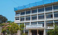
In 1860, there was a camp in Khulna district, which turned into a police station in 1892. Thus, it formed the Batiaghata thana. Later, in 1983, the Batighata Upazila was established. It is located around 13 kilometers from Khulna City and has a land area of 235.32 square kilometers.<br><br> Now it has 7 unions/wards, 13 mouza/mahallas, and 158 villages. With around 40,779 families, the population of the upazila is 1,71,752. That is why it is important to be familiar with the Batighata area guide.<br><br> 
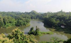
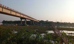
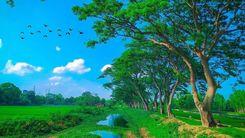
Batighata Upazila is surrounded by Khulna Sadar and Ruphsa Upazila in the north, Paikgacha and Dakop Upazila in the south, Fakirhat and Rampal Upazila in the east, Dumuria Upazila in the west. The upazila has several rivers, such as Rupsha, Kazibacha, Bhadra, etc.<br><br> Being a land with several rivers, Batighata offers a great potential for fish farming. The main economy of the area depends on fish farming, paddy, jute, wheat, cotton, poultries, dairies, etc.<br><br> 
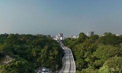
Batighata is an upazila near the Sadar area, offering a suburban lifestyle and access to modern amenities. However, a large part of the upazila is still underdeveloped. Yet, several major roads, such as Khulna City Bypass, Khulna-Satkhira Highway, Dhaka-Jessore-Khulna Road, etc., offer major transportation facilities. The nearest railway station is the Khulna Railway Station.<br><br> 
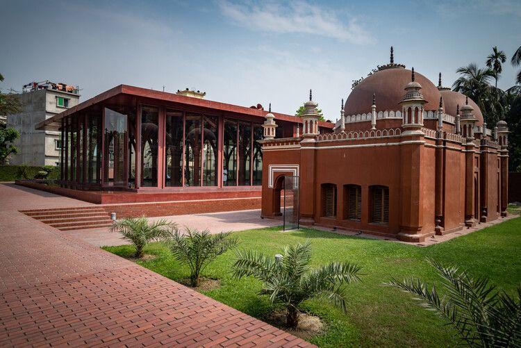
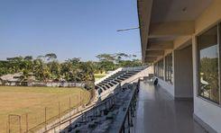
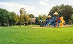
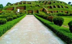
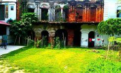
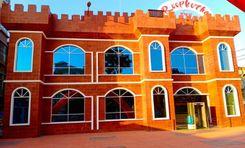
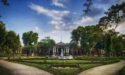
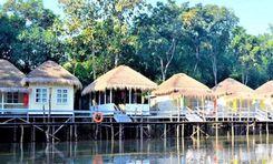
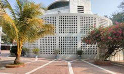
Nevertheless, Batighata has many reputed educational institutions, including Khulna University and Govt. Batighata Degree College. It also has multiple health complexes. As for recreational areas and tourist sites, the area has some popular ones, such as Batiaghata Riverview, Gollamari Memorial Monument, Linear Park, Sheikh Russell Eco Park, Rana Resort & Amusement Park, etc.<br><br> Overall, the Batighata Upazila offers not just a diverse environment but also living facilities. However, it is not the most suitable place if you are looking for a modern living facility.
View Insights
Bhola Property Guide
Rating icon
3.7

Bhola
, Barishal

Bhola district is an official district in south-central Bangladesh. It comprises Bhola Island, Bangladesh’s biggest island. It is situated in the Barishal division and covers an area of 3,403.48 km2. It is flanked to the north by Lakshmipur and Barishal districts, to the south by the Bay of Bengal, to the east by Lakshmipur and Noakhali districts, the (lower) Meghna river, and the Shahbazpur Channel, and to the west by Patuakhali District and Tetulia River. Natural gas reserves of about 400 million cubic feet have been discovered in Kechia, Bhola, and are being utilized to fuel a power station.<br><br> Bhola is a delta island. There are two rivers in this district: the Meghna and the Tetulia. Meghna is located on the district’s east and north sides, while Tetulia lies in the west. The Bay of Bengal is located south of Bhola district. There are seven islands in Bhola:<br><br> Bhola Island Manpura Island Dhal Char Char Kukri Mukri Char Jahiruddin Char Nizam Char Nazeur Rahaman<br><br> This district has five municipalities, 7 sub-districts, 10 thanas, 473 villages, and 70 unions.<br><br> Agriculture is the backbone of Bhola’s economy. The fishing industry is another vital economic sector, given Bhola’s proximity to the rivers and the Bay of Bengal. Besides, Bhola has a growing number of small industries, and the area has natural gas reserves. Bhola, Barishal, is a unique and important part of Bangladesh with a rich cultural heritage, abundant natural resources, and a resilient community.
View Insights
Bogura Property Guide
Rating icon
3.7

Bogura
, Rajshahi

Bogra is an important industrial and commercial city located in Rajshahi Division in northern Bangladesh. The significance of this district is very high in all aspects of agriculture, economy, communication, and education. It is also known for its rich history and cultural heritage. Mahasthangarh in Bogra is one of the oldest archaeological sites in the world.<br><br> Bogra is famous for curd, kattakti (sweets) and ghee. It also produces large quantities of rice, potatoes, vegetables, and jute, and is supplied throughout the country. The region is often called the "Granary of Bengal" due to its fertile land and abundant agricultural production. Satmatha, Banani Bazar, and New Market areas of Bogra have many public and private hospitals, shopping malls, supershops, eateries, and electronics stores.<br><br> Bogra's economy is diverse. Along with cement, bricks, sand, construction materials, textiles, and handicrafts are gradually developing. According to a recent survey, the district has a large number of small to medium enterprises (SMEs) that contribute to the local and national economy.<br><br> The city is well-connected to the rest of the country by road and rail. The railway network connects Bogra to major cities including Dhaka, Rajshahi, and Rangpur. The N5 highway connects the city with Dhaka, Tangail, Gazipur, and the northern districts. Currently, the city has undergone several infrastructural developments, including transportation, improvement of Highway Road 6 to 8 lanes, improvement of healthcare and public services, improving the quality of life of its residents, etc. Bogra is often referred to as the "Gateway to North Bengal".<br><br> Bogra is an attractive place for tourists. Mahasthangarh, Gokul Medh, and Vasu Vihar are ancient archaeological sites here. Also, the Kherua Mosque and the Nawab Palace are fine architectural examples built during the Mughal period. The people of this region are very hospitable.<br><br> There are advanced educational institutions like Bogra District School, Bogra Government Girls High School, Bogra Cantonment Public School and College, Government Azizul Haque College, Shaheed Ziaur Rahman Medical College, and Bogra Polytechnic Institute. In Bogra, you will find a variety of accommodation options ranging from standard to 5-star. Hotel Naz Garden, Hotel Siesta, Parjatan Motel, Momo-Inn, etc. are famous hotels here.<br><br> Above all, it can be said that Bogra holds special importance as the economic and cultural center of North Bengal.
View Insights
Brahmanbaria Property Guide
Rating icon
3.7

Brahmanbaria
, Chattogram

Brahmanbaria is an important economic and commercial city located in the eastern part of Bangladesh. The district is a busy center of administrative and financial activity with well-developed communication systems, natural gas, power plants, agricultural products, and import-export routes. From serene rural surroundings, local handicrafts, and lively markets to modern architecture, and commercial atmosphere, you'll find it all here.<br><br> Geographically, Brahmanbaria is located on the banks of the Titus River, which plays an important role in the agricultural and industrial sectors of the region. The cultivation of rice, jute, and fruits here contributes significantly to the local economy. Bounded by the Meghna River in the south and the Tripura Hills of India in the east, the district is rich in natural beauty. Muslin cloth and Chandramukhi sweets are very famous here.<br><br> This district is bordered by Kishoreganj and Habiganj districts to the north, Narsingdi and Narayanganj districts to the west, Comilla and Feni districts to the south, and Tripura state of India to the east. The upazilas of this district are - Brahmanbaria Sadar, Kasba, Akhaura, Ashuganj, Bancharampur, Vijaynagar, Nasirnagar, Nabinagar and Sarail upazilas.<br><br> The contribution and importance of the district to the national economy is immense. Titus, Salda, and Meghna gas fields are located in this district. These three gas fields supply about one-third of the country's total production. Besides, Ashuganj thermal power station is the second largest power generating station in the country. Ashuganj Fertilizer Factory is the largest urea fertilizer factory in the country. Garment industries, leather factories, textiles, iron mills, electricity, and natural gas establishments, and agriculture-based plants have created a lot of employment. The educational institutions and medical centers here are also standard.<br><br> Culturally, Brahmanbaria is famous for its traditional folk music. Historically, the city has been influenced by different civilizations and rulers, resulting in a variety of architecture and historical monuments. The area stands as a testament to the country's rich cultural tapestry and historical significance.<br><br> Brahmanbaria is one of the most important towns in the country in terms of economy, education, art culture, and communication. Being an important border area, the district serves as an important center of trade and commerce. The district is well-connected by road and rail. While the city is economically prosperous, the rural areas lack connectivity and infrastructure.
View Insights
Double Mooring Property Guide
Rating icon
3.7

Double Mooring
, Chattogram

Before we dive into the Double Mooring area guide, let’s get to know how the area got such an interesting name. In 1860, the British had constructed two jetties. Then, in 1888, they constructed two mooring jetties. That was the beginning of the name Double Mooring. It used to be an Upazila of the Chattogram District. But when the Chattogram City Corporation was established in 1978, Double Mooring was turned into one of the Thanas.<br><br> It is located at the center of the Chattogram City Corporation area. The Khulshi Thana is on its north, the Karnafuli Thana and Karnafuli River on the south, the Halishahar, Pahartali, and Bandar Thanas on the east, and Kotwali and Sadarghat Thanas on the west. It has a total land area of 8.12 square kilometers and a population of 3,61,115 (2011 Census).<br><br> Being one of the oldest areas and near the Karnaphuli River and ports, Double Mooring has been one of the notable and important areas in Chattogram and Bangladesh. Over time, business grew in and around Double Mooring, centering the port areas offering cargo and other transportation facilities. On top of that, the area is easily accessible by multiple railway stations all around it. Moreover, the roads being developed and the bridges and flyovers nearby make communication more convenient.<br><br> As for the area type, Double Mooring is a combination of residential and commercial zones, such as the Halishahar Residential Area, Ramna Residential Area, Bangladesh Bank Colony, Agrabad Commercial Area, etc. Because it is a high-end area, it is filled with many classy residential hotels, motels, and restaurants. The Jamboree Park and Karnaphuli Shishu Park are two of the popular attractions in the area. Moreover, people also visit the Bohutola Colony Shishu Park, Hazar Dighi, Ethnological Museum Chattogram, etc.<br><br> Though it is not part of the area itself, the Karnaphuli River and its port area are only a short distance from Double Mooring. It also has many reputed schools, colleges, and madrasas for better educational facilities. So overall, Double Mooring is a perfect place to choose for a diverse and advanced lifestyle and living facilities.
View Insights
Dumuria Property Guide
Rating icon
3.7

Dumuria
, Khulna

Among the 9 upazilas of the Khulna district, Dumuria is the largest, with a land area of about 454 sq./km. This upazila was established in 1983 and is located about 16 kilometers from Khulna City. Now, it has 237 villages, 204 mouzas, 14 unions, and a population of over 3 lakh.<br><br> This upazila is surrounded by rivers, canals, and other water sources. It is also bounded by multiple other upazilas, unions, and thanas. If you explore the Dumuria area guide, you will find that it has Fultola Upazila in the north, Batiaghata and Paikgacha in the south, Sonadanaga and Batiaghata in the east, and Avaynagar, Manirampur, and Keshabpur in the west.<br><br> The main economic source of this upazila is lobster farming. Other than that, people here grow seasonal vegetables that are sold across the country. Moreover, Dumuria is also known for its home craft and handicraft industry.<br><br> Though Dumuria doesn’t have a lot of historically significant landmarks, it does carry the dark past of the Liberation War of 1971. The Chuknagar Mass Killing Site is one such example.<br><br> Dumuria Upazila is significant for its many religious institutions, with over 230 mosques, 200 temples, and at least 4 churches. It also has over 200 educational institutions. Unfortunately, the area needs more government high schools and colleges. The literacy rate of Dumuria is 55.66%.<br><br> Since the area is near the Khulna City and Moyur Residential Area, it offers promising potential for real estate companies and a commercial target. The land price of the area is also affordable.<br><br> However, a large portion of Dumuria requires a modern makeover and the addition of amenities. While the area is eye-soothing due to its greenery and rural vibe, its lifestyle can certainly improve with time.
View Insights
Elephant Road Property Guide
Rating icon
3.7

Elephant Road
, Dhaka

Elephant Road, a road full of hustle and bustle, is situated between Shahbag Road and the National Science Laboratory. Stationed within New Market thana, Elephant Road accommodates around 67,439 people in 18 wards and falls within the perimeter of Dhaka South City Corporation. <br><br> However, when we think about Elephant Road, images of residences or neighborhoods hardly cross our minds. The Elephant Road area guide always focuses on the focal point of Elephant Road. That is its unique variety of businesses and ventures. From the early 80s till now, this area has been one of the top shopping destinations for Dhaka people. <br><br> Let’s hop on to an imaginary time machine and get to know from where it got such a unique name. During the British period, elephants were abundant in Dhaka, and grazing them was a daunting task. To uproot the problem, lakes near Ramna were appointed. From Pilkhana to Ramna, these elephants would cross the road now known as Elephant Road. <br><br> At the pinpoint of Elephant Road, there is a popular intersection named “Bata Signal.” This name came from the large showroom of the Bata, the shoe brand. Needless to say, there are countless shops and stores that sell various kinds of shoes at very cheap prices. However, here, you need to learn the game of bargaining. <br><br> One location that made Elephant Road popular among young people is the Multiplan Center. This center is a hub for every electronic need, from laptops to desktops. Due to the proximity to Dhaka University and Dhaka College, Elephant Road has become a one-stop shopping solution for clothes, eyewear, shops, and electronics.
View Insights
G L Roy Road Property Guide
Rating icon
3.7

G L Roy Road
, Rangpur

The Rangpur Sadar area is certainly one of the district's most prosperous regions. If you are planning to move to the developing parts of the city, you might want to look at the G L Roy Road area guide. Though the exact geographical location range of G L Roy Road is unknown, the G L Roy Road area is located on either side of the road.<br><br> Well, the G L Roy Road is located between the Jahaz Company Mor and the Satmatha Mor, which are two of the most important locations. As a result, you have access to a wider range of transport and communication facilities.<br><br> Like many parts of the Sadar area, the locations here offer an urban lifestyle with access to various living and business facilities. Currently, many empty plots are available for sale in the residential area. However, being in a major city area, the property price in the area is pretty high.<br><br> Along with JSK Tower and Jahaz Company Shopping Complex, which offer easy shopping accessibility, there are hundreds of shops for clothing, electronics, services, daily necessities, and more. The area has multiple mosques and many baking and financial institutions. There is also a mass grave killing site of 1971 in Dakhiganj of the G L Roy Road area.<br><br> G L Roy Road area has various notable educational institutions like Rangpur Engineering College, Rangpur Institute of Technology (RIT), Lions School And College, Shalbon City Corporation Girls’ High School, and International Grammar School. It also has a Special Education School for the blind and a veterinary clinic for animals.<br><br> People who travel to Rangpur City and need temporary living facilities should know that G L Roy Road has several residential hotels. The Roopkotha Theme Park & Food Corner is a popular recreational location here.<br><br> G L Roy Road is certainly an excellent area to move to, whether temporarily or permanently. However, you should also remember that it is a city area with less greenery and a growing and improving lifestyle.
View Insights
Gaibandha Property Guide
Rating icon
3.7

Gaibandha
, Rangpur

Gaibandha is one of Bangladesh's notable districts and an administrative area of the Rangpur Division. The district’s areas have a history of more than 5,200 years, so it is no wonder that the Gaibandha area guide shows many historical landmarks from the past.<br><br> Gaibandha was established as a district in 1984. It has a massive land area of 2,114.77 square kilometers and a population of about 2,621,756. The district is bounded by Rangpur and Kurigram districts in the north, Bogura in the south, Dinajpur and Joypurhat in the east, and Kurigram and Jamalpur districts and the Jamuna River in the west.<br><br> Since it is an old land area, Gaibandha is rich in historical and important landmarks. The oldest historical architects are the Gaibandha Khan Bahadur Jamidar Bari, Naldanga Jamidar Bari, and Bardhan Kuthi. The district is surrounded by rivers like Brahmaputra, Teesta, Ghaghat, Karatoya, etc.<br><br> People can go to the ghats or riverside areas to enjoy the picturesque view of the river and take a break from mundane life. If not, there are modern recreational places like the Gaibandha Pouro Park in the district's central area. There are also Dream City Park, Mini Nikli Gobindaganj, Alibaba Theme Park, etc.<br><br> Gaibandha has 5,773 mosques, 892 temples, and a few other religious institutions. It also has 2 cinema halls. There are also over 2,500 educational institutions and several training institutions. To ensure people’s health and safety, there are 64 non-government clinics, 1 general hospital, 1 Upazila health complex, and a few other health centers.<br><br> The district's economy relies on agriculture, which accounts for about 44.45% of the total economic sources. However, small businesses, non-agricultural labor, transport, services, and cottage industries also exist.<br><br> As various other districts surround Gaibandha, you are likely to hear different dialects, which makes the district more diverse. In coming years, Gaibandha is likely to go through more upgrades, with new residential properties on the rise.
View Insights
Ganginar par Property Guide
Rating icon
3.7

Ganginar par
, Mymensingh

Ganginar Par is the heart of Mymensingh city which is known as the lifeline of Mymensingh city. Ganginar Par place belongs to the municipality of Mymensingh district. This Gangina Par located in Mymensingh is a popular garment industry and listed under business services. The place is one of the busiest and commercial areas of Mymensingh. It is a bustling place rich in shops, markets, shopping for all products, educational institutions, nearby hospitals, religious harmony and religious institutions, surrounded by security by the district administration etc. This place portrays a busy image of Mymensingh. Everyday people from different places throng here for business and shopping malls. The place is densely populated. Various types of shops have been built here on both sides of the road where many people are getting employment opportunities. <br><br> Gas, electricity and water supply are adequate. The place is essentially a vibrant hub of Mymensingh offering a mix of shopping, living and working spaces. From the modern shopping malls to the bustling life here, Mymensingh reflects the fast-paced city life. There is also an educational environment with private universities and nearby universities. <br><br> The place being the headquarters of Mymensingh will help you to understand the culture, diversity and heritage of Mymensingh. <br><br> Overall, the place offers a dynamic mix of apparel industry, trade, education system, culture and a diverse lifestyle of Mymensingh which makes it a hub of Mymensingh district city. This place is famous for everything from sightseeing to shopping for products. People from far and wide come here for business purposes, the place represents the heritage of Mymensingh before them.
View Insights
Gazipur Property Guide
Rating icon
3.7

Gazipur
, Dhaka

Gazipur is one of the districts of Dhaka division. As it is located near Dhaka, it is vibrant on one side and has various amenities on the other side. It is a wonderful combination of natural attractions, cultural places and bustling markets. The area of Gazipur is 1741.53 km and the current population is about 5263450. Gazipur has Mymensingh and Kishoreganj districts to the north, Dhaka Narayanganj and Narsingdi districts to the south, Narsingdi to the east and Dhaka and Tangail districts to the west.<br><br> Established in 1984, this district has now become Gazipur City Corporation. It consists of several upazilas including Gazipur Sadar, Kaliakair, Kapasia, Sreepur and Kaliganj. Due to its administrative importance, the district is currently elevated to the City Corporation. District city is constantly crowded with people for administrative work. Located just 25 km north of Dhaka district, this district has emerged as a very developed and important place in the country.<br><br> Gazipur is a major industrial center of Bangladesh, with numerous textile, garment and pharmaceutical factories. Industrial growth is contributing significantly to the development of the area, providing employment opportunities, eliminating unemployment and improving the standard of living of the people here which is truly commendable. At the same time, people of different religions are living together here, representing secularism. Gazipur is home to Bishwa Ijtema, the second largest annual Muslim gathering in the world.<br><br> The distriect the historical depth of this place. It is the home district of the first prime minister of Bangladesh, Tajuddin Ahmed. From agricultural research centers to universities etc. educational institutions are here. Apart from these, there are vibrant markets such as Gazipur Town Market, Bhawal Rajbari Market and other markets in Jaleti. Where a variety of fresh produce to handicrafts are available at your fingertips. There is adequate water and electricity supply.<br><br> There are road and rail systems for transportation. Various types of public transport including buses, trains are easily available here which provides easy access from the district.<br><br> Gazipur has an equable and temperate climate. They have their own regional language, food habits and philosophy. Due to the unplanned construction of factories and buildings, traffic jams and various problems persist. Overall, Gazipur's mix of historical importance, industrial growth, educational excellence and natural beauty has made it a unique and dynamic region within Bangladesh which is a source of great joy for us.
View Insights
Gopalganj Property Guide
Rating icon
3.7

Gopalganj
, Dhaka

Gopalganj is not merely a district of Bangladesh. This place is embedded in the chronicle of the history and emergence of Bangladesh. In the tapestry of Bangladesh’s independence, Gopalganj has inked an indelible mark. Yes, this is the memory-dibbed birthplace of the father of the nation, Bangabandhu Sheikh Mujibor Rahman.<br><br> Undoubtedly, its historical significance ushers many local or foreign tourists to visit the landmarks. In the Gopalganj area guide, we will delve into the core of Gopajganj and will explore some must-visit places. Moreover, we will discuss the prospectus of properties in the area as a developed city in Bangladesh. <br><br> The fresh breath of the Modhumoti River will welcome you wholeheartedly to the city of Gopalganj. This mesmerizing city is located in the southwestern part of our country. This district accommodates a population of over 1,172,415 people, covering an area of approximately 1,468.74 square kilometers.<br><br> Gopalganj's economy is primarily based on agriculture and rice farming. Fishing plays a significant role in keeping the economy afloat. The area is also abundant with lush greenery, vegetation, jute, and other crops.<br><br> After the inauguration of the Padma Bridge, Gopalganj has been witnessing tremendous advancements in trade and commerce. The wide roads and transport facilities have blossomed the area's economy and lifestyle. Recently inaugurated railway stations will also become a beacon of development and progress in the area soon.<br><br> Gopalganj has been hailed for its progress not only in trade and commerce but also in the education and health sectors. Currently, one university and one medical college operate in Gopajganj Shadar. From natural attractions to historical landmarks, Gopalganj stands as a beacon of progress and beauty in our country.
View Insights
Habiganj Property Guide
Rating icon
3.7

Habiganj
, Sylhet

Located in the northeastern part of Bangladesh, Habiganj is a district within the Sylhet division. Habiganj has a rich history, dating back to ancient times when it was part of the Bengal Sultanate and Mughal Empire. It is bordered by Sunamganj, Moulvibazar, Kishoreganj, Brahmanbaria, and India’s Tripura.<br><br> Spanning over 2,636.58 square kilometers, it has a population of more than 2.35 million. The Habiganj area guide is sought after and widely recognized for its tea gardens and natural gas fields. The district plays a key role in Bangladesh's economy by supplying tea and energy. Recent developments have improved the living conditions in Habiganj.<br><br> Many people live in rural areas, where agriculture is the main livelihood. However, urban parts of the district, such as the town of Habiganj, are more developed and feature better amenities, including schools, hospitals, and markets.<br><br> The district is well-connected by roads, with highways linking it to nearby cities like Sylhet and Dhaka. The Dhaka-Sylhet highway passes through Habiganj, offering easy access to the capital. Railways and bus services are also available for intercity travel.<br><br> Habiganj is a blend of traditional Bengali practices and tribal influences. It is home to several indigenous groups, and the district celebrates various religious festivals, maintaining religious harmony.<br><br> The education sector is growing, with new schools and colleges being built to cater to the rising population. The economy of Habiganj is primarily based on agriculture, with rice, tea, rubber, and jute being the main crops. Additionally, its natural gas reserves and sand industries are a significant source of revenue.<br><br> Famous spots like Madhabkunda Waterfall and Rema-Kalenga Wildlife Sanctuary showcase the district's natural beauty, making it an attractive destination for nature lovers. The Sagor Dighi or Komola Ranir Dighi of the district is said to be the 2nd largest lake in Bangladesh.
View Insights
IconMap

Featured Projects

View All

Property Price Trends in Bangladesh for

Buy
Rent
Bedrooms:
Average Price (Last 12 months)
BDT 6,428.06 per sqft
Past 12 months' growth
11.11%
Positive Trend
Past 3 months' growth
13.4%
Positive Trend
Icon
Price information is based on historical data from ads posted on Bikroy and may not reflect the full market dynamics.
hero

Sell or Rent Fast on Bikroy: Post Your Property in 2 Mins!