Search Icon

Bangladesh এর এলাকাগুলি ঘুরে দেখুন

304টি এলাকার মধ্যে 144 - 162টি
লালমনিরহাট প্রপার্টি গাইড
Rating icon
4.0

লালমনিরহাট
, রংপুর

Lalmonirhat is one of the notable northern districts of Bangladesh, located at the Bangladesh-India borderline. It was previously a mohakuma but was established as a district in 1984. Currently, with a land area of 1,247 square kilometers, Lalmpnirhat is an administrative area of the Rangpur Division.<br><br> The Lalmonirhat area guide shows that the district is bounded by Jalpaiguri and Kuchbihar of West Bengal in the north, the Rangpur District in the south, Kochbihar of West Bengal and Kurigram District in the east, and the Nilphamari and Rangpur Districts in the west. The length of the Bangladesh-India borderline in the district is about 282 kilometers.<br><br> The district's main rivers are Dharla and Teesta. According to the 2022 Census, the population is 14,28,406. The district's literacy rate is 71.18%, and it has around 1,000 educational institutions, including training centers. There are 2,450 mosques, 741 temples, 70 post offices, and 49 banks in Lalmonirhat.<br><br> Communication within the district is available with all types of transport. From Lalmonirhat, people can travel to almost all other districts by road. There are also railway facilities for communication, which benefit trades and businesses within and outside Bangladesh.<br><br> In 2023, Lalmonirhat was declared to be a landless and homeless-free district. Yet, many people lose home and lands due to floods almost every year.<br><br> Nevertheless, Lalmonirhat is still one of the naturally beautiful areas. Some of its popular and notable landmarks are Kalibari Mosque and Temple, Teesta Barrage, Kakina Jomidar Bari, Tushbhandar Jamidar Bari, Mogolhat Port 0 Point, etc.
অন্তর্দৃষ্টি দেখুন
সাতক্ষীরা প্রপার্টি গাইড
Rating icon
4.0

সাতক্ষীরা
, খুলনা

Satkhira, established under the Jashore district in 1861, was declared a full-fledged district to decentralize administration in 1984. Now a district situated in the division of Khulna, the South-western region of the country, the area has a land of 3,817 sq km with Jashore in its north, the Bay of Bengal in its south, the Khulna district in its east, and the West Bengal’s districts of South 24 Parganas and North 24 Parganas in its west.<br><br> According to the Satkhira area guide, the district sits on the scenic Arpangacchia or Betna River’s bank. It comprises 7 upazilas, 8 police stations, and 79 unions. Its 2 municipalities are Satkhira and Kalaura. The former is its biggest city and also the district headquarter. <br><br> But what sets Satkhira apart from other districts in Khulna is its internationally famous Sundarbans, the world’s largest mangrove forest. The forest is not only an amazing tourist spot to have a glance at the incredible wildlife and plants but also plays an important role in serving as the country’s natural shield to provide protection during natural calamities. Also, it contributes to the area’s economy by being the source of livelihood for many locals. Kaliganj Upazila also has a mangrove forest named Basjaria Joarar Ban or BADHA’s forest.<br><br> About the economy, the district is mostly dependent on agriculture. However, it has immense potential for economic development. The Bhomra land port and the production of multiple export goods can bring prosperity in the near future. <br><br><br><br> Another reason Satkhira has a bright future is its growing number of educational institutions. It has 79 colleges, 400+ high schools, 800+ govt. primary schools, and more. The establishment of a medical college and hospital in 2011 further advanced the region’s educational facilities. There are also private healthcare services available for the locals. <br><br> Overall, Satkhira is a beautiful place with abundant natural beauty and economic possibilities. For locals and tourists alike, the district has a lot to offer.
অন্তর্দৃষ্টি দেখুন
৬০ ফিট রোড প্রপার্টি গাইড
Rating icon
4.0

৬০ ফিট রোড
, ঢাকা

যেমন নামটি নির্দেশ করে, ৬০ ফুট রাস্তা একটি ৬০ ফুট প্রশস্ত রাস্তা। তবে এটিকে শুধুমাত্র ঢাকার আরেকটি সাধারণ রাস্তা হিসেবে গণ্য করা ভুল হবে। এই এলাকা মিরপুরের দক্ষিণ অংশের কেন্দ্র দিয়ে প্রবাহিত হয়ে কল্যাণপুর, আগারগাঁও এবং মিরপুর দক্ষিণের মধ্যে সেতুর মতো সংযোগ তৈরি করে।<br><br> জনপ্রিয়ভাবে কামাল সরণি নামে পরিচিত এই রাস্তা ঢাকার ট্রাফিক ব্যবস্থার একটি গুরুত্বপূর্ণ সংযোগস্থলে পরিণত হয়েছে। মিরপুর থেকে ঢাকার অন্যান্য অংশে যাওয়ার সংযোগ তৈরি করার কারণে অনেক বাস এবং ব্যক্তিগত গাড়ি মিরপুরে পৌঁছানোর জন্য এই রুটটি ব্যবহার করে। তদুপরি, রাস্তার প্রশস্ততা বেশি যানবাহন ধারণ করতে সক্ষম হওয়ায় মানুষ প্রায়ই যানজট এড়ানোর জন্য এই রুটটি বেছে নেয়।<br><br> ৬০ ফুট রাস্তা মিরপুরের সবচেয়ে ঘনবসতিপূর্ণ কিছু এলাকার মধ্য দিয়ে গেছে। মনিপুর, কাজীপাড়া, পাইকপাড়া এবং শিমুলতলা এই রাস্তার সাথে সংযুক্ত কয়েকটি এলাকা। এই এলাকার বাসিন্দারা পরিবহন ও যোগাযোগের জন্য এই রাস্তা ব্যবহার করায়, অফিস ও স্কুল চলাকালীন সময়ে এই রাস্তা কতটা ব্যস্ত হয়ে ওঠে তা সহজেই অনুমান করা যায়।<br><br> ৬০ ফুট রাস্তা শুরুতে একটি যোগাযোগের মাধ্যম হিসেবে তৈরি হয়েছিল। তবে কোনোভাবে এটি আড্ডা এবং সুস্বাদু খাবারের জন্য একটি জনপ্রিয় স্থান হয়ে উঠেছে। এই রাস্তা আশেপাশের বাসিন্দাদের জন্য পণ্য এবং খাবারের ব্যবসার একটি সুপরিচিত কেন্দ্র হয়ে উঠেছে। এই ধরনের কোলাহল এবং ব্যস্ততা ৬০ ফুট রাস্তাকে বিশেষত ব্যস্ত সময়ে সরগরম এবং বিশৃঙ্খল করে রাখে।<br><br> শুধু আড্ডা ও বিনোদনের জন্য নয়, ৬০ ফুট রাস্তায় বাণিজ্য ও ব্যবসায়ের ক্ষেত্রেও গুরুত্বপূর্ণ ভূমিকা রয়েছে। বহু কর্পোরেট প্রতিষ্ঠান, ব্যাংকিং প্রতিষ্ঠান, ব্র্যান্ড আউটলেট এবং শোরুম এই রাস্তার জুড়ে ছড়িয়ে রয়েছে। এ ধরনের প্রতিষ্ঠানগুলো ৬০ ফুট রোড এলাকার অর্থনীতিতে উল্লেখযোগ্য ভূমিকা রাখে।
অন্তর্দৃষ্টি দেখুন
উত্তরা প্রপার্টি গাইড
Rating icon
4.0

উত্তরা
, ঢাকা

উত্তরা, ঢাকার উত্তরাঞ্চলে অবস্থিত, বাংলাদেশের, একটি ব্যস্ত আবাসিক এলাকা যা তার সুপরিকল্পিত বিন্যাস এবং আধুনিক সুবিধার জন্য পরিচিত। ১৯৮০ এর দশকের শেষের দিকে এটি বিকশিত হয়, যার ফলে বর্তমানে উত্তরা দ্রুত ঢাকার বৃহত্তম এবং সবচেয়ে ঘনবসতিপূর্ণ এলাকায় পরিণত হয়েছে।<br><br> এলাকাটি সেক্টরে বিভক্ত, প্রতিটি সেক্টরের নিজস্ব আবাসিক, বাণিজ্যিক এবং বিনোদনমূলক স্থানের ব্যবস্থা রয়েছে। উত্তরা তার পরিচ্ছন্ন পরিবেশ, প্রশস্ত রাস্তা এবং প্রচুর সবুজের জন্য স্থানীয় এবং প্রবাসী উভয়ের মধ্যেই জনপ্রিয়।<br><br> উত্তরা মহাসড়ক এবং গণপরিবহনের মাধ্যমে ঢাকার অন্যান্য অংশের সাথে সু-সংযুক্ত। এর স্কুল, হাসপাতাল, শপিং মল এবং পার্কের মতো সুযোগ-সুবিধা নিয়ে গর্ব করা যায়, যা এটিকে থাকার জন্য একটি সুবিধাজনক এবং আরামদায়ক জায়গা হিসেবে সুপ্রতিষ্ঠিত করে তোলে।<br><br> উত্তরার হাইলাইট এলাকাগুলির মধ্যে একটি হল উত্তরা লেক, বোটিং এবং পিকনিকিংয়ের মতো অবসর যাপনের জন্য এটি সবার একটি প্রিয় স্থান। আশেপাশে মসজিদ, মন্দির এবং গীর্জার মিশ্রণ রয়েছে, যা এর বৈচিত্র্যময় সম্প্রদায়কে প্রতিফলিত করে।<br><br> সংক্ষেপে, উত্তরা একটি প্রাণবন্ত শহুরে জীবনধারা সহ শহরতলির প্রশান্তির ছোঁয়াও অফার করে, যা এটিকে ঢাকার একটি প্রিয় আবাসিক এলাকা করে তুলেছে।
অন্তর্দৃষ্টি দেখুন
ওয়ারী প্রপার্টি গাইড
Rating icon
4.0

ওয়ারী
, ঢাকা

ঢাকার ওয়ারী এলাকা আবাসিক, বাণিজ্যিক ও সাংস্কৃতিক দিক থেকে অত্যন্ত গুরুত্বপূর্ণ এবং প্রাণবন্ত। এটি আবাসিক ভবন, বাণিজ্যিক ভবন, সরকারী ও বেসরকারী অফিস, সুপার শপ, শপিং মল, রেস্তোরাঁ এবং শিক্ষা প্রতিষ্ঠান সহ একটি ব্যস্ত এলাকা। এটি মতিঝিল, গুলিস্তান, গোপীবাগ, ইস্কাটন, রমনা এবং পুরান টাউনের মতো গুরুত্বপূর্ণ এলাকা দ্বারা বেষ্টিত।<br><br> ওয়ারির ইতিহাস অনেক পুরানো, এবং মুঘল ও ব্রিটিশ শাসনের সময় থেকেই এই এলাকার আর্থ-সামাজিক ও সাংস্কৃতিক পটভূমি বৈচিত্র্যময়। এই এলাকার স্থাপত্য, ঐতিহ্যবাহী কাঠামো এবং রন্ধনপ্রণালী কেবল অতুলনীয়। এটি ঢাকার প্রথম পরিকল্পিত আবাসিক এলাকা হিসেবে বিবেচিত হয়। সরু গলি এবং জনাকীর্ণ এলাকা সত্ত্বেও, এলাকাটি যত্ন সহকারে ডিজাইন করা হয়েছে। তাই এখানে আপনি ঐতিহ্যগত পুরানো চেহারা এবং আধুনিক জীবনধারার সমন্বয় পাবেন।<br><br> ব্রিটিশ আমলে এই এলাকার আধুনিকায়ন শুরু হয়। তখন এটি ছিল ধনী, ব্যবসায়ী এবং শিক্ষিত লোকদের একটি বড় বসতি। বাণিজ্যিক গুরুত্ব বিবেচনা করে এখানে নান্দনিক আবাসন প্রকল্প, বিভিন্ন ব্যবসা প্রতিষ্ঠান, অ্যাপার্টমেন্ট এবং উন্নয়ন প্রকল্প আসছে। পুরো এলাকা দুটি ভাগে বিভক্ত- পুরাতন ওয়ারী এবং নতুন ওয়ারী।<br><br> এই এলাকায় বেশ কয়েকটি মসজিদ, মন্দির এবং গীর্জা রয়েছে, এই উপাসনালয়ের প্রতিটিই স্থাপত্যের নিদর্শন। সবজি, জামাকাপড় এবং ইলেকট্রনিক্স থেকে শুরু করে মশলা পর্যন্ত বিস্তৃত পণ্য এখানে পাওয়া যায়। ঢাকা শহরের প্রায় কেন্দ্রস্থলে অবস্থিত হওয়ায় এখানকার যোগাযোগ ব্যবস্থা বেশ ভালো। কিন্তু এই এলাকায় যানজট, দূষণ, অপরিকল্পিত অবকাঠামোর মতো সমস্যাও রয়েছে।
অন্তর্দৃষ্টি দেখুন
কাজিটুলা প্রপার্টি গাইড
Rating icon
4.0

কাজিটুলা
, সিলেট

Kazitula has recently turned into one of the most sought-after locations in the Sylhet District. This suburban and residential cum commercial hub has been a home for thousands of people over the last few decades, and the population has been increasing day by day. Now, the Kazitula area guide shows that it is one of the most densely populated locations.<br><br> Kazitula's exact land area and population are unknown. It is located in the western part of Sylhet City and is part of Sylhet City Corporation’s ward no. 17. The Kazitula area is likely to be named after Kazi Jalal Uddin (R), as his shrine is one of the commonly known places of this locality. Kazitula is surrounded by areas like Kumarpara, Amborkhana, Shahi Eidgah, Lohapara, etc.<br><br> The area is filled with many tall buildings, most of which are residential apartments. However, you are also likely to locate some tin-shaded and semi-bricked households inside the localities and by the narrow streets. As a result, people who are looking for a residence in the area can easily find affordable options and suitable living spaces. There are also commercial buildings that offer affordable to high-priced spaces for establishing businesses. It shows that the Kazitula area offers a diverse living and social environment.<br><br> Other than housing and certain job areas, Kazitula also offers access to education. There are several schools, colleges, and madrasas inside and around the area. The reputed and well-known educational institutions in the area are the Kazi Jalal Uddin Girls' High School, Kazi Jalal Uddin Boys Government Primary School, and Madrasah Tahfizul Quran. <br><br> You can travel to Kazitula from Sylhet City by using the Ambarkhana or Chowhatta Point. Kazitula is located right across the Nayasarak and Ambarkhana Roads. Traveling to the area via buses, taxis, rickshaws, autos, and CNGs is convenient. The only problem is that the bus routes are not widely available via this road, and there are hardly any bus stops inside the area.<br><br> Jobs, businesses, and industries are the main economic sources in this area. Other than that, transport and services also contribute to Kazitula’s economy. So anyone staying in Kazitula or nearby localities can easily find safe and comfortable residential hotels. The Hotel Crystal Rose and London Inn are two such popular names. <br><br> The most notable landmark in Kazitula is the Kazi Dighi, which offers a view of a large and wide dighi at the center of the locality. There are also Kazi Jalal Uddin (R) Mazar Sharif, Kazitula Jame Mosque, Kazitula Uchasharak Jame Mosque, BTCL Guest House, BTV Station, etc.
অন্তর্দৃষ্টি দেখুন
কাফরুল প্রপার্টি গাইড
Rating icon
4.0

কাফরুল
, ঢাকা

আপনি রিকশা, গাড়ি, বাস, ট্রেন, বা মেট্রো রেল যেকোনো মাধ্যমেই ভ্রমণ করতে চান না কেন, কাফরুল নিশ্চিতভাবেই ঢাকার অন্যতম সহজলভ্য এলাকা। এ কারণেই আমরা কাফরুল এলাকার একটি পূর্ণাঙ্গ এরিয়া গাইড বা এলাকার বিবরণী খুঁজি।<br><br> কাফরুল থানা ঢাকার উত্তর-পশ্চিমে অবস্থিত এবং এটি ঢাকা উত্তর সিটি কর্পোরেশনের অংশ। এটি পশ্চিমে শেরে-বাংলা নগর থানা, উত্তরে ও পূর্বে ক্যান্টনমেন্ট থানা এবং দক্ষিণে তেজগাঁও থানার সাথে ঘিরে আছে।<br><br> এর আয়তন ১৭.৮ বর্গকিলোমিটার এবং জনসংখ্যা প্রায় ৩৯৬,১৮২ (২০১১ সালের আদমশুমারি অনুযায়ী)। অনেক মহল্লা এবং বিশাল জনসংখ্যার কারণে কাফরুল ঢাকা শহরের অন্যতম সক্রিয় এলাকা।<br><br> এ অঞ্চলে বাংলাদেশের সেনাবাহিনী ও বিমান বাহিনীর প্রধান কার্যালয়, ঢাকা ক্যান্টনমেন্ট অবস্থিত, পাশাপাশি রয়েছে অনেক সামরিক আবাসিক এলাকা, গলফ ক্লাব, মন্ত্রণালয়ের অফিস, সামরিক হাসপাতাল ইত্যাদি। সব মিলিয়ে, কাফরুলকে বসবাসের জন্য একটি গুরুত্বপূর্ণ ও নিরাপদ এলাকা হিসেবে বিবেচিত করে।<br><br> এ এলাকার সড়কগুলো বেশ ভালোভাবে নিয়ন্ত্রিত এবং যানজট কম। বেশ কয়েকটি ফুটওভার ব্রিজ রয়েছে যা সবার জন্য নিরাপত্তা নিশ্চিত করে। এছাড়াও এখানে তেজগাঁও বিমানবন্দর, বাংলাদেশ বিমান বাহিনী জাদুঘর, বাংলাদেশ আঞ্চলিক পাসপোর্ট অফিস, সিএমএইচ ইত্যাদি উল্লেখযোগ্য স্থান, স্থাপনা রয়েছে।<br><br> বাস বা যেকোনো স্থানীয় বাহনে করে সহজেই বিভিন্ন স্থানে যাতায়াত করা যায়। আরও উল্লেখযোগ্য বিষয় হল, কাফরুলের সাথে অন্যান্য এলাকার বহু বাস রুট থাকার কারণে এই এলাকা থেকে আসা-যাওয়া খুবই সুবিধাজনক। তদুপরি, কাছাকাছি বেশ কয়েকটি রেলওয়ে স্টেশন এবং ফার্মগেট থেকে কাজীপাড়া পর্যন্ত বেশ কয়েকটি মেট্রোরেল স্টেশন রয়েছে।<br><br> তেজগাঁও বিমানবন্দর এবং জাতীয় প্যারেড গ্রাউন্ড এই এলাকায় পরিচিত দুটি স্থান। এর উপর, বিএফএফ শাহীন কলেজ, ক্যান্টনমেন্ট স্কুল ও কলেজ এবং আদমজী স্কুল ও কলেজের মতো অনেক খ্যাতনামা শিক্ষাপ্রতিষ্ঠানও কাফরুলে অবস্থিত।<br><br> মোটের ওপর, কাফরুল একটি সাশ্রয়ী মূল্যে বসবাসের জন্য অন্যতম সেরা এবং সুবিধাজনক জায়গা।
অন্তর্দৃষ্টি দেখুন
কিশোরগঞ্জ প্রপার্টি গাইড
Rating icon
4.0

কিশোরগঞ্জ
, ঢাকা

Kishoreganj, previously a sub-district under the Mymensingh District, became a district under the Dhaka Division in 1984. It is the second-largest district under the Dhaka Division. So let’s take a look at the Kishoreganj area guide.<br><br> Kishoreganj has a land area of around 2,689 sq./km, which was taken from the Mymensingh District. According to the 2022 Census, the district's population is about 3,267,626, with a density of 1200 people per square kilometer.<br><br> It is filled with not just the natural beauties of greenery and haors and rivers but also historical lands and heritages to fill your eyes with. So it is no wonder that Kishoreganj City and the District are a land of attraction to many people.<br><br> Some of such notable locations are Austagram haor, Kutub Shah Mosque, Isha Khan's Jangalbari Fort, Chandrabati Temple, Egarosindur Fort, Gangatia Jomidar Bari, etc. Moreover, the Sholakia Eidgah field holds the largest Eid Jamat or congregation in Bangladesh. There are also many other tourist attractions in this district.<br><br> The haors of this district contribute largely to its economy as the fish from this area goes all over the country. Other than that, vegetables, paddy, jute, and poultry farms also play a significant role in Kishoreganj's economy.<br><br> The literacy rate of the district is 72.54% (age 7 or above), and it has many educational institutions. Some of the well-known schools here are Azim Uddin High School, Kishoreganj Model Girls' High School, Kishoreganj Model Boys’ High School, Syed Habibul Huq High School, etc.<br><br> Other notable institutions are Kishoreganj Polytechnic Institute, Kishoreganj Govt. Mohila College, Katiadi Government College, Shahid Syed Nazrul Islam Medical College, Gurudayal Govt. College, Bangabandhu Sheikh Mujibur Rahman University, etc. <br><br> From medical, social, and financial institutions to supermarkets, bazar areas, parks, cinema halls, and necessary public locations, the Kishoreganj district offers pretty much everything necessary. Whether one travels by bus or train, Kishoreganj offers a good communication facility not just on inter-district routes but also with other districts.
অন্তর্দৃষ্টি দেখুন
খিলক্ষেত প্রপার্টি গাইড
Rating icon
4.0

খিলক্ষেত
, ঢাকা

বাংলাদেশের ঢাকার একটি উল্লেখযোগ্য প্রশাসনিক এলাকা হল খিলক্ষেত থানা। এর মোট আয়তন ১৫.৮৮ বর্গ কিলোমিটার (৬.১৩ বর্গ মাইল)। ২৭শে জুন, ২০০৫-এ, খিলক্ষেত বাড্ডা থানার দক্ষিণ অংশ থেকে নগরায়ণ এবং জনসংখ্যাগত চ্যালেঞ্জের উপর মনোযোগী প্রশাসনের চিহ্ন হিসাবে বিচ্ছিন্ন হয়। কৌশলগতভাবে উত্তরে দক্ষিণখান ও উত্তর খান থানা, দক্ষিণে বাড্ডা থানা, পশ্চিমে ক্যান্টনমেন্ট থানা এবং উত্তর-পশ্চিমে বিমানবন্দর থানা এটি স্পষ্ট করে যে এটি নারায়ণগঞ্জ জেলার রূপগঞ্জ উপজেলা থেকে বিভক্ত পূর্বে তুরাগ নদীর সীমানা। . এটি দেখায় যে নিকুঞ্জ-১ এবং নিকুঞ্জ-২ খিলক্ষেত থানা ভবনের কাছাকাছি কারণ তারা এই অবস্থানের সবচেয়ে কাছাকাছি আবাসিক এলাকা।<br><br> খিলক্ষেত এলাকা নির্দেশিকা অনুসারে, এই অঞ্চলটি ঢাকা উত্তর সিটি কর্পোরেশনের অধীনে ১৭ নং ওয়ার্ডের একটি অংশ যা দক্ষিণখান ইউনিয়ন এবং ডুমনি ইউনিয়নের কিছু অংশকে কভার করে যা এর প্রশাসনিক গুরুত্বের পাশাপাশি শহরের শহুরে কাঠামোর মধ্যে ভৌগলিক প্রবেশের কথা বলে। খিলক্ষেতের সৃষ্টি। থানা এই দ্রুত বর্ধনশীল লোকালয়ে শাসনব্যবস্থাকে সহজ করেছে কিন্তু তাদের বিভিন্ন জনসংখ্যার চাহিদার জন্য অবকাঠামো এবং জনসাধারণের পরিষেবার ক্ষেত্রে স্থানীয় উন্নয়নও করেছে।<br><br> খিলক্ষেত সম্পূর্ণরূপে তার বাসিন্দাদের বিভিন্ন প্রয়োজনীয়তা পূরণ করে। যাইহোক, জনসংখ্যা ক্রমাগত বৃদ্ধি পাচ্ছে বলে বিবেচনা করে এই স্থানে আরও লাইফস্টাইল সুবিধার প্রয়োজন। একটি দ্রুত প্রতিক্রিয়া দলের সাথে আশেপাশের মধ্যে নজরদারি ক্যামেরা ইনস্টল করা নিরাপত্তার স্তরকে বাড়িয়ে দেবে এইভাবে সেখানে বসবাসকারী সকলের মনকে উন্নত করবে।jah
অন্তর্দৃষ্টি দেখুন
খিলগাঁও প্রপার্টি গাইড
Rating icon
4.0

খিলগাঁও
, ঢাকা

হঠাৎ করেই খিলগাঁও বিভিন্ন খাবারের জন্য সবার কাছে খুব জনপ্রিয় জায়গায় পরিণত হয়েছে। একসময়ের অবহেলিত এলাকা, এখন ঢাকাবাসীর জন্য খাদ্য স্বর্গ হিসেবে গড়ে উঠেছে। খিলগাঁও ১৪.০২ বর্গ কিমি এলাকার মধ্যে সীমাবদ্ধ, যেখানে বর্তমানে ৩২৭,৭১৭ বাসিন্দা থাকছে। এই খিলগাঁও-এর নির্দেশিকাতে আবাসিক এবং বাণিজ্যিক উভয় সম্ভাবনাকে প্রকাশ করে।<br><br> খিলগাঁওয়ের একটি বড় উন্নয়ন হল তালতলা রোডে ছড়িয়ে থাকা ছোট থেকে মাঝারি খাবারের স্টলের জন্য। রন্ধনপ্রণালী পছন্দের বৈচিত্র্য, সাশ্রয়ী মূল্যের মূল্য এবং ইন্টারনেটে জনপ্রিয়তা এই এলাকাটিকে খাবার এবং আড্ডার জন্য সবচেয়ে বেশি জনপ্রিয় করে তুলেছে।<br><br> খাবারের স্বর্গ হিসেবে খিলগাঁওয়ের আবির্ভাব শুরু হয় আপন কফি হাউসের জনপ্রিয়তার মধ্য দিয়ে। একসময় লোকেরা তাদের কফির ভক্ত হয়ে ওঠে, অন্যান্য উদ্যোক্তারা তাদের এই উদ্যোগের জন্য খিলগাঁওকে বিশেষভাবে চিহ্নিত করে। ধীরে ধীরে, খিলগাঁও আড্ডা দেওয়া এবং বিভিন্ন রাস্তার এবং পশ্চিমা ধরন খাবারের উদ্যোগের জন্য একটি জনপ্রিয় প্রবেশদ্বার হয়ে উঠেছে।<br><br> খিলগাঁও খাদ্যের স্বর্গ হিসেবে উল্লেখ করলেও এই এলাকা তখন থেকেই ঘনবসতিপূর্ণ। শিক্ষা প্রতিষ্ঠান, আশেপাশের হাসপাতাল, পার্ক এবং আবাসনের জন্য যুক্তিসঙ্গত ভাড়ার কারণে লোকেরা এখানে বাসা বাঁধতে বেছে নেয়।<br><br> অনেক অফিসগামী ব্যাচেলর মানুষ বাসবাসের জন্য খিলগাঁও বেছে নিচ্ছেন। খিলগাঁও মতিঝিল, মগবাজার এবং পল্টনের সাথে নিবিড়ভাবে সংযুক্ত, যেখানে অনেক অফিসও অবস্থিত। এছাড়া খিলগাঁও সীমিত আয়ের এবং যারা সহজে যাতায়াত করতে চায় তাদের জন্য আবাসিকের একটি স্বর্গ হয়ে উঠেছে।<br><br> খিলগাঁও এখন মধ্যম আয়ের মানুষজন, ব্যাচেলর এবং ছাত্রদের জন্য এক স্বস্তির নাম। সাশ্রয়ী মূল্যের ভাড়া এবং একটি প্রতিশ্রুতিশীল প্রতিবেশ এটিকে আবাসিক উদ্দেশ্যে ঢাকার শীর্ষস্থানীয় স্থানগুলির মধ্যে একটি করে তুলেছে। খিলগাঁও ফ্লাইওভারের উদ্বোধন খিলগাঁওয়ের বাসিন্দাদের দ্রুত যাতায়াতের পথ তৈরি করেছে।
অন্তর্দৃষ্টি দেখুন
গোপালগঞ্জ প্রপার্টি গাইড
Rating icon
4.0

গোপালগঞ্জ
, ঢাকা

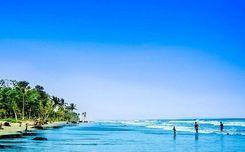
Gopalganj is not merely a district of Bangladesh. This place is embedded in the chronicle of the history and emergence of Bangladesh. In the tapestry of Bangladesh’s independence, Gopalganj has inked an indelible mark. Yes, this is the memory-dibbed birthplace of the father of the nation, Bangabandhu Sheikh Mujibor Rahman. <br><br> Undoubtedly, its historical significance ushers many local or foreign tourists to visit the landmarks. In the Gopalganj area guide, we will delve into the core of Gopajganj and will explore some must-visit places. Moreover, we will discuss the prospectus of properties in the area as a developed city in Bangladesh. <br><br> The fresh breath of the Modhumoti River will welcome you wholeheartedly to the city of Gopalganj. This mesmerizing city is located in the southwestern part of our country. This district accommodates a population of over 1,172,415 people, covering an area of approximately 1,468.74 square kilometers. <br><br> Gopalganj's economy is primarily based on agriculture and rice farming. Fishing plays a significant role in keeping the economy afloat. The area is also abundant with lush greenery, vegetation, jute, and other crops. <br><br> After the inauguration of the Padma Bridge, Gopalganj has been witnessing tremendous advancements in trade and commerce. The wide roads and transport facilities have blossomed the area's economy and lifestyle. Recently inaugurated railway stations will also become a beacon of development and progress in the area soon. <br><br> Gopalganj has been hailed for its progress not only in trade and commerce but also in the education and health sectors. Currently, one university and one medical college operate in Gopajganj Shadar. From natural attractions to historical landmarks, Gopalganj stands as a beacon of progress and beauty in our country.
অন্তর্দৃষ্টি দেখুন
চাঁদগাও প্রপার্টি গাইড
Rating icon
4.0

চাঁদগাও
, চট্টগ্রাম

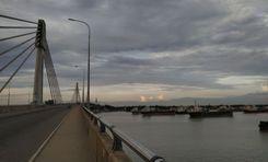
চান্দগাঁও, বা চান্দগাঁও থানা, চট্টগ্রাম জেলার অন্যতম জনবহুল, বিস্ফোরিত এবং শিল্পোন্নত এলাকা। চান্দগাঁও থানা, যা চট্টগ্রাম সিটি কর্পোরেশনের অধীনে, চান্দগাঁও আবাসিক এলাকা এবং কালুরঘাট শিল্প এলাকা নিয়ে গঠিত।<br><Br> ২০২২ সালের আদমশুমারি অনুসারে, থানার মোট জমির আয়তন ৩২.১৪ বর্গ/কিমি। এবং ৩১২,২৬১ জনসংখ্যা। হালদা ও কর্ণফুলী নদীর তীরে অবস্থিত, চান্দগাঁও এরিয়া গাইডে অনেক আবাসিক, বাণিজ্যিক, শিল্প এবং কূটনৈতিক অবস্থান রয়েছে।<br><Br> চান্দগাঁও আবাসিক এলাকাটি এর পরিচ্ছন্ন ও সুন্দর প্রাকৃতিক দৃশ্য এবং অনেক আকর্ষণের কারণে এলাকার একটি সুপরিচিত অংশ। মিনি বাংলাদেশ, একটি বিনোদন পার্ক যা বাংলাদেশের অনেক গুরুত্বপূর্ণ এবং বিখ্যাত স্থাপত্য প্রদর্শন করে, এটি একটি জনপ্রিয় পর্যটন গন্তব্য। <br><Br> কালুরঘাট বিসিক এলাকা দেশের একটি বিখ্যাত ভারী শিল্প এলাকা। এলাকাটি কালুরঘাট বেতার কেন্দ্র বা স্বাধীন বাংলা বেতার কেন্দ্রের জন্যও বিখ্যাত, যেখানে জিয়াউর রহমান ১৯৭২ সালে বাংলাদেশের স্বাধীনতা যুদ্ধের সময় স্বাধীনতা ঘোষণা করেছিলেন।<br><Br> এই এলাকায় একাধিক বাস রুট এবং ডিপো রয়েছে যা শুধুমাত্র চান্দগাঁওকে চট্টগ্রামের উত্তর ও দক্ষিণে সংযুক্ত করে না বরং জেলার বাইরে যাতায়াত করাও সহজ করে তোলে। চট্টগ্রাম-কক্সবাজার মহাসড়কের জন্য ধন্যবাদ, কক্সবাজার থেকে চান্দগাঁও ভ্রমণ আরও সহজ।<br><Br> যাইহোক, এলাকায় পাশাপাশি অপূর্ণতা আছে। আবাসিক এলাকা, যেটি চট্টগ্রামের অন্যতম পশ লোকেশন, তার আকর্ষণ হারাচ্ছে। জমি ও সম্পত্তির মালিকরা বাণিজ্যিক ও পুনর্বাসনের জন্য জায়গা ভাড়া নিচ্ছেন, যা বাসিন্দাদের বিরক্ত করছে।<br><Br> কিন্তু কিছু ত্রুটি থাকা সত্ত্বেও, চান্দগাঁও ক্রমবর্ধমান আবাসন এবং নতুন উন্নয়নের একটি এলাকা। তার উপরে, কর্তৃপক্ষ ডিজিটাল পরিষেবাগুলিকে উত্সাহিত করে চান্দগাঁওয়ের মানুষের জন্য আরও ভাল সংযোগ এবং আরও সুরক্ষা নিশ্চিত করার জন্য কাজ করছে।
অন্তর্দৃষ্টি দেখুন
জিন্দা বাজার প্রপার্টি গাইড
Rating icon
4.0

জিন্দা বাজার
, সিলেট

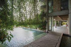
জিন্দা বাজার সিলেটের অন্যতম ব্যস্ত এলাকা, যা বিভিন্ন মার্কেট, দোকানপাট এবং ক্রেতা-বিক্রেতাদের ভিড়ে দিন-রাত জমজমাট। এখানে পণ্যের দরদাম নিয়ে তুমুল আলোচনা আর দর-কষাকষির দৃশ্য নিয়মিত দেখা যায়। জিন্দা বাজার, সিলেটের বৈচিত্র্যপূর্ণ পরিবেশ শপিংপ্রেমীদের জন্য যেন এক স্বর্গ।<br><br> জিন্দা বাজারের গাইড অনুসারে, এখানে এমন কোনো পণ্য নেই যা পাওয়া যাবে না। পোশাক, ইলেকট্রনিক ডিভাইস, ভ্রমণ স্মারক থেকে শুরু করে প্রয়োজনীয় সবকিছুই পাওয়া যায়। স্থানীয়দের জন্য রয়েছে অনেক মুদি দোকান। সরু গলিগুলোতে ঢুকলে দেখতে পাবেন ঐতিহ্যবাহী হস্তশিল্পের দোকান, আবার অন্যদিকে আছে বিভিন্ন দেশ হতে আমদানিকৃত উচ্চমানের পণ্যের শোরুম।<br><br> তবে শুধু মার্কেট ও শপিং মলই জিন্দাবাজারকে বিখ্যাত করেনি। এই এলাকাকে আরও জনপ্রিয় করেছে জল্লালপারের দুটি বিখ্যাত রেস্টুরেন্ট – পাঁচ ভাই এবং পানশি। দেশের বিভিন্ন প্রান্তে এই রেস্টুরেন্টগুলোর খ্যাতি ছড়িয়ে পরেছে। এছাড়াও এখানে মানসম্মত খাবারের জন্য আরও রেস্টুরেন্ট রয়েছে, যাদের খাবারের দামও বেশ সাশ্রয়ী।<br><br> যদি আপনি স্থানীয় খাবার খেতে চান, তবে স্থানীয় খাবারের রেস্তোরাগুলো আপনাকে দারুণ সিলেটি স্বাদের সাথে পরিচয় করিয়ে দেবে। আর যারা বুফে পছন্দ করেন, তাদের জন্য পূর্ব জিন্দাবাজারে রয়েছে বেশ কিছু বুফে রেস্টুরেন্ট, যেখানে দুপুর ও রাতের খাবার উপভোগ করা যায়। এই এলাকায় ঘুরে বেড়ানোর সময় মজাদার খাবার উপভোগ করা এক অনন্য অভিজ্ঞতা। এখানে এলে হাছন রাজা মিউজিয়ামও দেখতে ভুলবেন না; রাজার পরিবারের সমৃদ্ধ ইতিহাস সম্পর্কে জানার জন্য এটি একটি আদর্শ স্থান।<br><br> অর্থনৈতিক দিক থেকে, জিন্দা বাজার হলো সিলেটের সর্বোচ্চ রাজস্ব উৎপাদনকারী এলাকা এবং জেলার অন্যতম প্রধান ব্যবসায়িক কেন্দ্র। এই এলাকার মাধ্যমে সিলেটের অর্থনীতি আরও শক্তিশালী হয়েছে। তবে অপরিকল্পিত উন্নয়নের কারণে এই এলাকার ভিতরে এবং আশেপাশে অনেক আবাসিক এলাকা গড়ে উঠেছে।
অন্তর্দৃষ্টি দেখুন
জিরো পয়েন্ট প্রপার্টি গাইড
Rating icon
4.0

জিরো পয়েন্ট
, খুলনা

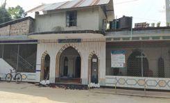
If you stand still on a random street in Khulna Sadar and listen to the conversations going around you, you will notice the name Zero Point coming up very often. Zero Point is an integral part of Khulna. If you are thinking about going on a trip to Khulna, this Zero Point area guide will help you navigate and traverse through the area. <br><br> Khulna Zero Point is situated at Batiaghata Upazila. The intersection is located near the police station Horintana Thana and the Khulna Weather Office. This is the threshold of Khulna Sadar, which interconnects the Khulna City Bypass National Highway, Rupsa Bridge approach road, and Khulna-Chuknagar-Satkhira Regional Highway. <br><br> You may be wondering why Zero Point is such the talk of the town. Zero Point is basically an intersection that works as a transportation hub. Several major highways intersect here, providing convenient access to various regions of the city and beyond. Many public transit choices are available, including buses, minibusses, and cycle rickshaws.<br><br> Many businesses and commercial institutions have flourished surrounding the Zero Point intersection. The area is well-known for its thriving business scene, with several stores, markets, and businesses catering to the needs of both locals and visitors.<br><br> This area is mostly bustled with students of Khulna University, which is adjacent to the premise of Zero Point. From hangout to daily shopping, people of Khulna and students of the university always opt for Zero point, making it a bustling hub day and night. <br><br> This intersection has a direct link to the Mongla port, which is 45 Km away from Zero Point. So, large business transportation traverses through this region to reach all over Bangladesh. So, this is certainly a critical junction for a thriving economy.
অন্তর্দৃষ্টি দেখুন
টার্মিনাল রোড প্রপার্টি গাইড
Rating icon
4.0

টার্মিনাল রোড
, রংপুর

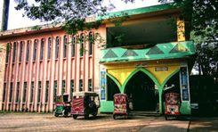
Terminal Road is located in Rangpur Sadar under the jurisdiction of Rangpur City Corporation. Various buildings, residential areas have been developed around this very modern road with four lanes and it has improved several times. The beauty of the terminal road will amaze you and the road has facilitated the communication of Rangpur district with other districts. We know that the better the transport system, the better the quality of life. As the road is connected to Rangpur city, the residents can enjoy many modern facilities. Supply of electricity, gas, water etc. is adequate. Also educational institutes, hospitals, entertainment places etc. are also within reach, there are security arrangements.<br><br> As the road is connected with the bus terminal, it is easy to travel from here to the northern regions including Dinajpur, Nilphamari and Syedpur. Apart from this, Terminal Road is one of the top rated places in Rangpur. Surrounded by lush green surroundings, this place is a reflection of the hustle and bustle at the same time.<br><br> Overall, Terminal Road represents Rangpur's modernity. The residential areas, factories, commercial expansion, communal harmony, various shopping malls, markets, etc., centered around this road offer a dynamic mix of lifestyle. Besides, as the place is located in the district headquarters, you will get all kinds of facilities. The communication system from this place to other places is so advanced that you can travel with peace of mind. You can understand the entire tradition and culture of Rangpur from here.
অন্তর্দৃষ্টি দেখুন
ধামরাই প্রপার্টি গাইড
Rating icon
4.0

ধামরাই
, ঢাকা

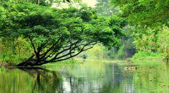
Did you know that the Dhamrai Upazilla (sub-district) is the largest Upazilla in Dhaka district by land area? If you didn’t, our Dhamrai area guide will give you all the information you need.<br><br> Dhamrai was part of the Savar Thana during British rule in 1914. Later, in 1947, it was established as a separate Thana and put under the Dhaka district. The area is located about 40 km northwest of the city, and the Dhaka-Aricha Highway passes through it. At least 4,96,249 people are living in the area, which makes it densely populated.<br><br> The area is bounded by Mirzapur, Kaliakair, Singair, Savar Upazillas, etc. Moreover, you can see part of the Dhaleshwari River from various locations in the area. Moreover, the area is composed of alluvium soil of the Dhaleshwari and Bongshi rivers. <br><br> Since the area is located near the Dhaka-Aricha Highway, it offers access to communication inside and outside the Dhaka district. Using public transportation is the best way to get there, but many people rely on local transport as well.<br><br> It is also a suitable area for living for anyone who wants to settle outside the main city. Along with land, housing projects are also available in the area. Moreover, renting apartments and living costs are more affordable than in the city. There are over 300 educational institutions, including schools, colleges, universities, madrasas, and over 100 NGO schools.<br><br> Dhamrai is also a tourist attraction due to its historical landmarks and significance. Some of the known locations are Balai Jamidar House, Madhab Mondir, Shaitta Banyan Tree, and more.<br><br> The annual Dhamrai Rath is quite famous in the area. Sukanta Dhamrai Metal Crafts is also known for being the primary metal hub in Bangladesh.
অন্তর্দৃষ্টি দেখুন
IconMap

ফিচারড প্রজেক্ট

সবগুলো দেখুন
Bangladesh-এর প্রপার্টি প্রাইস ট্রেন্ড

কেনা
ভাড়া
বেডরুম:
গড় মূল্য (বিগত ১২ মাসের)
Tk. 6,358.55 per sqft
বিগত ১২ মাসের বৃদ্ধি
5.85%
Positive Trend
বিগত ৩ মাসের বৃদ্ধি
5.2%
Positive Trend
Icon
দ্রষ্টব্য: মূল্য তথ্য Bikroy-এর পোস্ট করা বিজ্ঞাপন থেকে ঐতিহাসিক তথ্যের উপর ভিত্তি করে দেওয়া। সম্পূর্ণ মার্কেটের ডায়নামিক প্রতিফলিত নাও হতে পারে।
hero

Bikroy এ বিক্রি বা ভাড়া দিন: মাত্র ২ মিনিটেই প্রপার্টির বিজ্ঞাপন দিন!