Search Icon

Bangladesh এর এলাকাগুলি ঘুরে দেখুন

304টি এলাকার মধ্যে 126 - 144টি
মহাখালী প্রপার্টি গাইড
Rating icon
4.1

মহাখালী
, ঢাকা

মহাখালী বাংলাদেশের রাজধানী ঢাকার অন্যতম গুরুত্বপূর্ণ বাণিজ্যিক, আবাসিক এবং সংযোগ এলাকা। এলাকায় বিভিন্ন সরকারি ও বেসরকারি অফিস, ব্যবসা প্রতিষ্ঠান এবং আবাসিক কমপ্লেক্স রয়েছে। এটি মূলত যোগাযোগ এবং পরিবহনের জন্য পরিচিত। ঢাকার অন্যতম প্রধান বাস স্ট্যান্ড, হাইওয়ে এবং এলিভেটেড এক্সপ্রেসওয়ে এখানে অবস্থিত। যোগাযোগ ব্যবস্থার এই ভালো কানেক্টিভিটির কারণে এখান থেকে শহরের যেকোনো প্রান্তে এমনকি দেশের সব শহরেও যাওয়া যায়।<br><br> বিটিআরসি, বিআরটিএ, চেস্ট হসপিটাল, ব্র্যাক সেন্টার, আইসিডিডিআর, ইত্যাদি সহ বেশ কয়েকটি সরকারী বিভাগ, কর্পোরেট অফিস, ব্যাংক এবং শিক্ষা প্রতিষ্ঠান এই এলাকাটিকে একটি ব্যস্ত বাণিজ্যিক কেন্দ্র করে তুলেছে। এছাড়াও পরিকল্পিত আবাসিক ভবন, DOHS, এবং ছোট থেকে মাঝারি হাউজিং কমপ্লেক্স রয়েছে। এলাকাটি তার উন্নত শিক্ষা প্রতিষ্ঠান, ভালো সংযোগ এবং স্বাস্থ্যসেবা সুবিধার জন্য একটি সমৃদ্ধ আবাসিক এলাকা হিসেবে ব্যাপকভাবে স্বীকৃত।<br><br> এলিভেটেড এক্সপ্রেসওয়ে, আধুনিক অবকাঠামো প্রকল্প, বাণিজ্যিক কমপ্লেক্স, এবং পরিকল্পিত আবাসিক ভবন গত কয়েক বছরে এই এলাকায় নির্মিত হয়েছে। আরও বেশ কিছু উন্নয়ন প্রকল্পের কাজ চলছে। বাস টার্মিনাল, হাসপাতাল, ব্যবসা প্রতিষ্ঠান, রেস্তোরাঁ, কমিউনিটি সেন্টার, শপিং মল ইত্যাদি এই এলাকাটিকে ঢাকার অন্যতম ব্যস্ত শহরে পরিণত করেছে। এত ঘনবসতিতেও বাসিন্দাদের বিনোদনের জন্য এখানে তৈরি করা হয়েছে পার্ক, লেক, খেলাধুলার মাঠ। ডিওএইচএস পার্ক এবং হাতিরঝিলের মনোরম পরিবেশ আপনাকে বিমোহিত করবে।<br><br> মহাখালী এলাকাটি নির্জন বা নিরিবিলি নয়, এটি জনবহুল ও কোলাহলপূর্ণ। মহাখালীর ডিওএইচএস এলাকাটি দেশের অন্যতম সমৃদ্ধ আবাসিক এলাকা। এখানকার অধিকাংশ চিকিৎসা প্রতিষ্ঠানে স্বল্পমূল্যে উন্নত চিকিৎসা সেবা পাওয়া যায়, যার কারণে দেশের বিভিন্ন স্থান থেকে মানুষ উন্নত চিকিৎসার জন্য মহাখালীতে আসেন। স্বাস্থ্যসেবা সুবিধা, বিশিষ্ট শিক্ষা প্রতিষ্ঠান, সুস্বাদু রেস্তোরাঁ এবং শপিং সেন্টার সহ, এই অঞ্চলে তার বাসিন্দাদের চাহিদা মেটাতে সমস্ত সুবিধা রয়েছে।<br><br> শিক্ষা প্রতিষ্ঠান, হাসপাতাল, সরকারি ও বেসরকারি অফিস এবং ব্যাংক সহ অর্থনৈতিক গুরুত্বের কারণে এই এলাকায় অনেক আবাসিক ভবন এবং অ্যাপার্টমেন্ট রয়েছে। এখানে অনেক স্টার্টআপ ব্যবসা এবং আইটি কোম্পানি গড়ে উঠেছে। এছাড়াও, প্রশাসনিক এবং আর্থ-সামাজিক দৃষ্টিকোণ থেকে এই এলাকার গুরুত্ব অপরিসীম।
অন্তর্দৃষ্টি দেখুন
মাল্টিপ্লান সেন্টার প্রপার্টি গাইড
Rating icon
4.1

মাল্টিপ্লান সেন্টার
, ঢাকা

মাল্টিপ্ল্যান সেন্টার ঢাকার কেন্দ্রে অবস্থিত একটি এলাকা। এটি ঢাকার উত্তর সিটি কর্পোরেশনে ব্যবসা ও প্রযুক্তির একটি কেন্দ্রবিন্দু। মাল্টিপ্ল্যান সেন্টারটি এলিফ্যান্ট রোডে অবস্থিত এবং এটি খুচরা এবং প্রযুক্তির দোকানগুলির জন্য বিখ্যাত স্থান।<br><br> মোট এলাকাটি প্রায় ০.৫ কিলোমিটার এবং একটি খুব ব্যস্ত জায়গা। এই জায়গায় মানুষ সবসময় ভিড় করে। তারা এখানে আসে মূলত প্রযুক্তি পণ্য কেনাকাটার জন্য।<br><br> মূলত, মাল্টিপ্ল্যান সেন্টার প্রযুক্তি সরঞ্জাম, ইলেকট্রনিক্স এবং আধুনিক প্রযুক্তি সমাধানের স্বর্গ স্থান। এছাড়াও, এর প্রযুক্তি-বুদ্ধিমান আবেদন, মাল্টিপ্ল্যান সেন্টার বাণিজ্যিক কার্যক্রমের একটি সংযোগ স্থান। এখানে অনেক দোকান, বাজার এবং রেস্তোরাঁ রয়েছে যা এর বাসিন্দাদের এবং পর্যটকদের বিভিন্ন স্বাদ এবং চাহিদা পূরণ করে।<br><br> এই এলাকার সবচেয়ে ভালো দিক হল, এটি ঢাকার প্রায় সব রুট এবং জায়গা থেকে অ্যাক্সেসযোগ্য। মেট্রো স্টেশন ব্যতীত, এটি বাস এবং গণপরিবহনের মাধ্যমে ঢাকার সমস্ত অংশের সাথে সুন্দর সংযোগ ব্যবস্থা রয়েছে।<br><br> যদিও এই কেন্দ্রটি এত বড় নয়, তবে এটি সবার সব রকম সার্ভিস সুবিধা তৈরি করেছে। এই এলাকায় কোন স্কুল বা সবুজ এলাকা নেই, তারপরও এটি ঢাকার অর্থনীতি এবং শহুরে ল্যান্ডস্কেপের মধ্যে পার্থক্য সৃষ্টি করে। বাণিজ্য, প্রযুক্তি এবং অবিচলিত মানুষের প্রবাহের কারণে এই এলাকার প্রাণবন্ত শক্তি দেখায়, যা বুঝতে শেখায় ঢাকার বাণিজ্যিক ও প্রযুক্তিগত কেন্দ্র হিসেবে এটি কতটা গুরুত্বপূর্ণ। যার ফলে একটি ব্যবসা শুরু করার, প্রযুক্তি কেনার এবং একজন উদ্যোক্তা বৃদ্ধির জন্য এটিকে একটি জনপ্রিয় স্থান করে তোলে।
অন্তর্দৃষ্টি দেখুন
মীরসরাই প্রপার্টি গাইড
Rating icon
4.1

মীরসরাই
, চট্টগ্রাম

If you are tired of urban and chaotic city life and looking for a way to get rid of the monotonous routine for some time, a trip to Mirsharai of the Chattogram District might be just what you need. Not only is this area known for its awe-striking hill tract side areas, lakes, waterfalls, or forest areas, but it is also known as an area to live a quiet life far from city life. So, if you are curious to learn more, this Mirsarai area guide will certainly help you. <b><b> The Mirsharai Upazila was established as a Thana in 1917 but was established as an Upazila in 1983. Its 482.89 square kilometer land area is bounded by Chagalnaiya and Feni Upazila and Tripura State of India on the North, Sitakunda Upazila and the Bay of Bengal’s Sandwip channel on the South, Fatikchari Upazila on the East, and Noakhali’s Companigonj Upazila and Sonagazi Upazila on the West. The 2 major water bodies that surround the Upazila are the Feni River and the Muhuri River. <b><b> Its historical and other beautiful landmarks attract people most to this area. It has 5 mass murder sites of the 1971 Liberation War, one mass grave, and one memorial. The Mohamaya Rubber Dam, Thakur Dighi, Moghadia Jomidar Bari, etc., are some of the locally known popular spots. <b><b> However, what makes Mirsharai Upazila a national and international tourist attraction is its forest areas, lakes, and waterfalls that run along the hillside areas. The most popular sites are Napittachhara Waterfall, Khoiyachara Waterfall, Ruposhi Waterfall, and the Bawachora Lake and Waterfall. The Mirsharai Deer Camp, Mohamaya Lake, Eco Park, Arshi Nagar Future Park, etc., are also popular attractions. <b><b> While its tourist spots contribute to its economy, agriculture, fisheries, dairy, and other cultivation are also among the Upazila's main economic sources. The Dhaka-Chattogram Highway has connected Mirsharai to the north, south, and several other cities. People can also travel to the upazila using train routes. <b><b> The Mirsharai Special Economic Zone is the largest economic zone, and it has created employment opportunities for many people over time. With its attractions and heritage, the area is experiencing many developments and is due for more in the coming years.
অন্তর্দৃষ্টি দেখুন
মোতালেব প্লাজা প্রপার্টি গাইড
Rating icon
4.1

মোতালেব প্লাজা
, ঢাকা

প্রযুক্তিগতভাবে, মোতালিব প্লাজা একটি এলাকা নয়, বরং ঢাকা শহরের একটি জনপ্রিয় শপিং এবং অ্যাপার্টমেন্ট কমপ্লেক্স। তবে, মোতালিব প্লাজা এলাকার গাইডে আমরা এই শপিং কমপ্লেক্স এবং এর আশপাশের এলাকাগুলি সম্পর্কে আলোচনা করব।<br><br> প্লাজাটি ঢাকা শহরের পরীবাগ, শাহবাগ থানার আওতাধীন এলাকায় অবস্থিত। এটি সোনারগাঁও রোডে, হাতিরপুল এলাকার কাছাকাছি, হাতিরপুল মোড় থেকে বেশি দূরে নয়। ভবনটি প্রায় ১৭ তলা, এবং শপিং কমপ্লেক্সটি কেবল ৪র্থ তলায় অবস্থিত। ৫ম তলা থেকে উপরের তলাগুলি একটি আবাসিক কমপ্লেক্স।<br><br> মোতালিব প্লাজার শপিং এলাকা মোবাইল এবং ইলেকট্রনিকস বাজারের জন্য পরিচিত। এখানে আপনি মোবাইল কভার, প্রটেক্টর এবং অন্যান্য ইলেকট্রনিকস পাইকারি বা তুলনামূলকভাবে কম দামে কিনতে পারেন। এছাড়াও, এখানে কিছু সার্ভিস সেন্টার রয়েছে যা ইলেকট্রনিক ডিভাইস মেরামত করে।<br><br> বিল্ডিংটির প্রতিটি তলার একটি নিজস্ব বিশেষ চেহারা এবং দোকানের পরিসর রয়েছে। এমনকি, ভবনের নিচতলায় কিছু ফুড স্টল এবং একটি কনভেনশন হলও রয়েছে, যেমন সুপার কাবাব অ্যান্ড কফি এবং খানাপিনা রেস্টুরেন্ট।<br><br> শপিং কমপ্লেক্সের খোলার সময় সকাল ১০টা থেকে সন্ধ্যা ৮টা পর্যন্ত। তবে, শনিবার এটি বিকেল ৫টার মধ্যে বন্ধ হয়ে যায়। বৃহস্পতিবার এবং জাতীয় ছুটির দিনে এটি বন্ধ থাকে।<br><br> বাসস্থানের জন্য আলাদা প্রবেশপথ রয়েছে। এটি পরিবারগুলির বসবাসের জন্য একটি ভালো স্থান, কারণ এটি সুবিধাজনক পরিবহন এবং জীবনযাত্রার সুযোগ প্রদান করে। তবে, মোতালিব প্লাজায় বসবাস করা বা সেখানে অ্যাপার্টমেন্ট কেনা বেশ ব্যয়বহুল। তবে, এখানে প্রায়ই দোকান ভাড়ায় পাওয়া যায়।<br><br> মোতালিব প্লাজার কাছে অন্যান্য পরিচিত স্থানগুলির মধ্যে রয়েছে ইস্টার্ন প্লাজা শপিং মল, মাল্টিপ্ল্যান সেন্টার, পরীবাগ জামে মসজিদ ইত্যাদি। এর নিকটতম মেট্রো রেল স্টেশন শাহবাগ, যা শহরের অন্যান্য অংশ থেকে এখানে আসা সহজ করে তোলে।
অন্তর্দৃষ্টি দেখুন
রাউজান প্রপার্টি গাইড
Rating icon
4.1

রাউজান
, চট্টগ্রাম

Many of us know about the beauty and serenity of the mesmerizing Halda River, and the Raozan Upazila is located near it. The central Raozan city area is about 40 kilometers from the Chattogram Sadar and only around 10 kilometers from the Halda River. So, when exploring the Raozan area guide, you can only expect an eye-catching rural scenario. <b><b> The Raozan Upazila has a land area of 243 square kilometers. It has 76 villages, 60 mouzas, and 14 unions, and the population is around 3,25,389. Other than the Halda River, some parts of the Upazila are located near the Karnaphuli River. The economy of the area depends on fishery from the Halda River, rubber gardens, chili cultivation, and many other agricultural products. Soon, the Raozan BISIC area is expected to create more employment opportunities for the people. <b><b> One of the most convenient ways to travel from Chattogram Sadar to Raozan is by taking the bus route. The Chattogram-Rangamati Highway and Chattogram-Rangunia Highway are two of the major roads connecting the localities of the Upazila to the other parts of Chattogram and other districts. There are also transport options like CNGs, rickshaws, cars, vans, bikes, etc. However, there are no railway routes to the area. The closest railway station is Janali Hat Railway Station, which is approximately 5 kilometers from Madunaghat, the nearest location under Raozan Upazila. <b><b> The Pahartali area, another well-known part of the Upazila, is often recognized widely because of the Chittagong University of Engineering and Technology (CUET). It is one of the most well-reputed educational institutions in the country. Other than CUET, the area has several other notable educational institutions. The Jagatmalla Para mass burial site bears the haunting memory of the 1971 Liberation War of Bangladesh. <b><b> There are many more landmarks and locations in the Upazila, such as Master Surja Sen’s Paternal Home and Memorial, Poet Nabin Chandra Sen’s Paternal Home and Memorial, West Dabua Shiva Temple, Mohamuni Buddhist Temple, Giri Chaya Park View, and Haladia Rubber Garden. This religiously diverse upazila has more than 340 mosques, over 100 Hindu Temples, and 120 Buddhist temples.
অন্তর্দৃষ্টি দেখুন
সাত মাথা চত্বর প্রপার্টি গাইড
Rating icon
4.1

সাত মাথা চত্বর
, রংপুর

Shatmatha Chottor area belongs to Ward No. 30 of City Corporation of Rangpur District. The place is quite busy. The place is well known for business, hotel-restaurant, shops, super shop, market etc. Shatmatha Chottor is also called as one of the focal points of Rangpur City Corporation. The Shatmatha Chottor place itself is a sight to behold that proudly makes its presence known. The place has a distance of 2.0 km from Rangpur zero point. On the other hand, the distance of this place is 2.8 km from Rangpur Sadar Upazila. The place is suitable for business because of good connectivity. One of the educational institutions of Rangpur is also located near this place. The location has great utility as both road and public transport facilities are good. Rangpur Railway Station is very close which will give you an extra convenience.<br><br> This place of Rangpur district has been carrying various professions, non-communalism, and its own traditions. The beautiful surroundings, surrounded by lush greenery will enchant you. Shatmatha Chottor will attract both locals and visitors to the place and showcase the traditional Rangpur image and culture.<br><br> Overall, Shatmatha Chottor offers a dynamic blend of lifestyles such as commerce, culture, tradition, history, freedom, inspiration etc. Which makes it one of the most preferred localities in Rangpur. Whether you want to shop, dine or just wander around or go sightseeing, you can understand the heritage of Rangpur from here.
অন্তর্দৃষ্টি দেখুন
আলম ডাঙ্গা প্রপার্টি গাইড
Rating icon
4.1

আলম ডাঙ্গা
, খুলনা

Alamdanaga is an upazila of Chuadanga District, located in the northwest of Bangladesh. It is an administrative area of the Khulna Division, Bangladesh's second-largest division. Alamdanaga was previously a thana area but was established into an upazila in 1982. Its land area is 365 square kilometers, and its population is 3,45,992, with Muslims and Hindus living together for many years.<br><br> Currently, the upazila has 1 pourashava, 15 unions, and 211 villages. Looking at the Alamdanga area guide, you will notice that the upazila doesn’t have many water bodies. Only the Mathavanga River flows through the upazila. It has some small rivers, but most are dried up. However, the upazila still has many large ponds and beels.<br><br> It is now bounded by Mirpur Upazila (Kushtia District) and Gangni Upazila (Meherpur District) in the north, Chuadanga Sadar and Damurhuda Upazila in the south, Harinkunda Upazila (Jhenaidah District) and Kushtia Sadar Upazila in the east. It also has the Gangni Upazila (Meherpur District) and Damurhuda Upazila in the west.<br><br> One of the best things about Alamdanaga Upazila is its growing and developing lifestyle. Over the years, housing and residents, along with roads and other facilities, have been developed. The communication in and out of the upazila is also convenient. In addition to buses and cars, people can also travel through the upazila by train.<br><br> Unlike some other upazila areas of Khulna district, Alamdanga doesn’t have many historical landmarks or notable locations. However, it does have certain popular and notable locations and many old buildings. Some of them are over a century old. The Alamdanga Boddho Bhumi is the mass killing site bearing the scar of the 1971 Liberation War.<br><br> Other landmarks include Alamdanga Laal Bride or railway bridge, Kumari Jomidar Bari, Alamdanga Independence Memorial of 1971, Alamdanga Badminton Club (an ancient building), etc. It also has a cinema hall and a few parks.<br><br> It also has over 120 educational institutions, including madrasa, training institutions, polytechnical institutes, etc. There are 335 mosques, 292 Eidgahs, and 30 temples. People can also access healthcare facilities, banking, and other necessities here in Alamdanga.
অন্তর্দৃষ্টি দেখুন
ইস্কাটন প্রপার্টি গাইড
Rating icon
4.1

ইস্কাটন
, ঢাকা

ইস্কাটন, যা ঢাকা শহরের কেন্দ্রে অবস্থিত, ঢাকা দক্ষিণ সিটি কর্পোরেশনের অন্তর্গত। ইস্কাটন তার কৌশলগত অবস্থান এবং আবাসিক ও বাণিজ্যিক পরিবেশের মিশ্রণের জন্য প্রসিদ্ধ। এই কেন্দ্রীয়তা এবং বৈচিত্র্য ইস্কাটন কে ঢাকা শহরের শহুরে দৃশ্যপটে একটি রত্নে পরিণত করেছে, যা শহুরে জীবনের মূলত্ব অনুভব করতে ইচ্ছুকদের জন্য অপরিহার্য।<br><br> ইস্কাটনের বিশেষত্ব তার দুর্দান্ত সংমিশ্রণ থেকে আসে, যা সহজ প্রবেশযোগ্যতা এবং সম্প্রদায়ের মিশ্রণ। এটি বিভিন্ন ধরনের বাসস্থানের বিকল্প প্রদান করে, যা ভাড়াটে এবং ক্রেতাদের জন্য আকর্ষণীয়, যারা শহরের সুবিধার সাথে একটি সন্নিহিত পরিবেশ খুঁজছেন। এই এলাকা বৈচিত্র্যময় খাবার, কেনাকাটা এবং প্রয়োজনীয় সেবা পাওয়ার জন্য একটি হটস্পট, যা সব কিছু হাঁটার দূরত্বে অথবা সংক্ষিপ্ত ড্রাইভের মধ্যে পাওয়া যায়।<br><br> ইস্কাটনে পরিবহন খুবই সহজ, এর ভালভাবে সংযুক্ত রাস্তা এবং প্রধান পরিবহন সড়কগুলোর নিকটবর্তী অবস্থান থাকার কারণে এখানকার বাসিন্দাদের চলাচল সুবিধাজনক। যদিও এখানে মিরপুরের মতো মেট্রো রেল নেই, তবে এর কেন্দ্রীয় অবস্থান এর বাসিন্দাদের জন্য ঢাকা শহরের যেকোনো স্থানের কাছাকাছি থাকতে সহায়ক।<br><br> ইস্কাটন পরিচিত এখানকার সম্মানিত স্কুল এবং চিকিৎসা কেন্দ্রগুলোর জন্য, যা বাসিন্দাদের অসাধারণ সেবা পাওয়ার সুযোগ দেয়। যদিও এখানে মিরপুরের মতো বড় পার্ক বা ক্রীড়া স্টেডিয়াম নেই, ইস্কাটন তার ব্যস্ত রাস্তাগুলো, অনেক সুবিধা এবং সজীব সম্প্রদায়ের জন্য আলাদা, যা এটিকে ঢাকা শহরের সবচেয়ে পছন্দনীয় বাসস্থান এবং কর্মস্থল হিসেবে তৈরি করে।
অন্তর্দৃষ্টি দেখুন
কোতোয়ালি প্রপার্টি গাইড
Rating icon
4.1

কোতোয়ালি
, ঢাকা

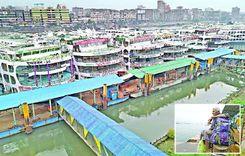
Kotwali is the Principal Thana or Sadar Thana of Dhaka District. It is bounded by Keraniganj Upazilla in the south, Chawkbazar Thana in the west, and Bangshal Thana in the east. It is right next to the Buriganga River, and the renowned Mitford Hospital and Dhaka National Medical College are only a short distance from Kotwali.<br><br> Though it has a small area of only 0.67 sq./km and around 50,000 residents, Kotwali is one of the busiest parts of Dhaka. The Sadarghat Launch Terminal (port of Dhaka) and Babubazar Bridge are located in the area, and both are the routes of many trades and businesses across the country. That is why you need the Kotwali area guide.<br><br> From the beginning, this area has been known for having many important institutions, such as judge courts, magistrate courts, trade and accessories centers, law firms, clubs, marketplaces, printing and publishing houses, schools, colleges, universities, etc. <br><br> The famous Jagannath University is also in this area, and many other institutions and businesses have grown over time surrounding it. Moreover, the Islampur clothing market, Shankhari Bazar market, and Badamtali fruits market are some of the most popular marketplaces for many retailers and other people as well. <br><br> On top of that, it has several tourist attractions. The Ahsan Manzil Museum, one of the finest architectural landmarks and residences of Dhaka Nawab bears historical significance. It is a popular destination for both native and foreign travelers. You can also visit Bahadur Shah Park, Nawab Siraj-Ud-Dawla Park, and Nawab Bari pond. Kotwali is also popular because of the many mosques in the area. <br><br> With so many important business locations, Kotwali is accessible by private, local, and public transport. As for housing, they are very affordable. However, it is yet to be a better place for a better living environment.
অন্তর্দৃষ্টি দেখুন
খুলশি প্রপার্টি গাইড
Rating icon
4.1

খুলশি
, চট্টগ্রাম

আপনি যদি চট্টগ্রামের খুলশীর আশেপাশে আপনার পথ পেতে গুগল ম্যাপে চেক করেন, আপনি বিভ্রান্ত হয়ে পড়বেন কারণ এলাকাটিকে আলাদা আলাদা ভাগে ভাগ করা হয়েছে। কারণ খুলশী থানা কুলশী আবাসিক এলাকা, নাসিরাবাদ, লালখান বাজার এবং পাহাড়তলী ও পাচশাইল থানার অংশ নিয়ে গঠিত। এটি একটি পাহাড়ি এলাকা যেখানে ছোট পাহাড় এবং হাঁটার পথ রয়েছে।<br><br> সুতরাং, আপনি বলতে পারেন এটি একটি বিশাল এলাকা যেটির চারপাশে পথ পেতে খুলশী এলাকার গাইড প্রয়োজন। এটি চট্টগ্রাম সিটি কর্পোরেশন এবং চট্টগ্রাম মেট্রোপলিটন সিটির অংশ। কুলশী থানার আয়তন ১৩.১২ বর্গ/.কিমি। ২০২২ জনসংখ্যা ও আবাসন শুমারি অনুসারে, এর জনসংখ্যা প্রায় ২০৭,৭৭৫।<br><br> খুলশি আবাসিক এলাকাটি চট্টগ্রাম জেলার অন্যতম বিশিষ্ট আবাসিক এলাকা। তার উপরে, এটি প্রচুর সবুজের সাথে একটি নির্মল এবং প্রাকৃতিকভাবে সুন্দর ল্যান্ডস্কেপ সরবরাহ করে।<br><br><br><br> ইস্পাহানি পাবলিক স্কুল অ্যান্ড কলেজ, চট্টগ্রাম গভর্নমেন্টের মতো বিখ্যাত কিছু শিক্ষা প্রতিষ্ঠান থাকার জন্যও এই এলাকাটি সুপরিচিত। মহিলা কলেজ, ন্যাশনাল পলিটেকনিক কলেজ ইত্যাদি।<br><br> এই এলাকায় অন্যান্য উল্লেখযোগ্য অবস্থান রয়েছে, যেমন চট্টগ্রাম ভেটেরিনারি বিশ্ববিদ্যালয়, বাংলাদেশ আবহাওয়া বিভাগ, খুলশী টাউন সেন্টার, বাংলাদেশ কৃষি গবেষণা ইনস্টিটিউট ইত্যাদি।<br><br> সারা দেশের মানুষ খুলশীতে ভ্রমণ করে ফয়’স লেক, একটি জনপ্রিয় বিনোদন পার্ক এবং চট্টগ্রাম চিড়িয়াখানা দেখতে। এছাড়াও, খুলশী থানা জাকির হোসেন রোড এবং জিইসি জংশনকে কেন্দ্র করে বাস, গাড়ি এবং অন্যান্য পরিবহনের মাধ্যমে সহজে যাতায়াতের ব্যবস্থা করে। এটি থানার অনেক অংশকে ট্রেনের মাধ্যমেও সংযুক্ত করে।
অন্তর্দৃষ্টি দেখুন
গাইবান্ধা প্রপার্টি গাইড
Rating icon
4.1

গাইবান্ধা
, রংপুর

Gaibandha is one of Bangladesh's notable districts and an administrative area of the Rangpur Division. The district’s areas have a history of more than 5,200 years, so it is no wonder that the Gaibandha area guide shows many historical landmarks from the past.<br><br> Gaibandha was established as a district in 1984. It has a massive land area of 2,114.77 square kilometers and a population of about 2,621,756. The district is bounded by Rangpur and Kurigram districts in the north, Bogura in the south, Dinajpur and Joypurhat in the east, and Kurigram and Jamalpur districts and the Jamuna River in the west.<br><br> Since it is an old land area, Gaibandha is rich in historical and important landmarks. The oldest historical architects are the Gaibandha Khan Bahadur Jamidar Bari, Naldanga Jamidar Bari, and Bardhan Kuthi. The district is surrounded by rivers like Brahmaputra, Teesta, Ghaghat, Karatoya, etc.<br><br> People can go to the ghats or riverside areas to enjoy the picturesque view of the river and take a break from mundane life. If not, there are modern recreational places like the Gaibandha Pouro Park in the district's central area. There are also Dream City Park, Mini Nikli Gobindaganj, Alibaba Theme Park, etc.<br><br> Gaibandha has 5,773 mosques, 892 temples, and a few other religious institutions. It also has 2 cinema halls. There are also over 2,500 educational institutions and several training institutions. To ensure people’s health and safety, there are 64 non-government clinics, 1 general hospital, 1 Upazila health complex, and a few other health centers.<br><br> The district's economy relies on agriculture, which accounts for about 44.45% of the total economic sources. However, small businesses, non-agricultural labor, transport, services, and cottage industries also exist.<br><br> As various other districts surround Gaibandha, you are likely to hear different dialects, which makes the district more diverse. In coming years, Gaibandha is likely to go through more upgrades, with new residential properties on the rise.
অন্তর্দৃষ্টি দেখুন
ধানমন্ডি প্রপার্টি গাইড
Rating icon
4.1

ধানমন্ডি
, ঢাকা

বাংলাদেশের মধ্যে ঢাকার প্রাণকেন্দ্রে অবস্থিত ধানমন্ডি শহরের অন্যতম প্রাচীন এবং সবচেয়ে মর্যাদাপূর্ণ আবাসিক এলাকা। ১৯৫০-এর দশকে বিকশিত, ধানমন্ডিতে গাছের সারিবদ্ধ রাস্তা, নির্মল হ্রদ এবং আবাসিক, বাণিজ্যিক এবং বিনোদনমূলক স্থান গুলোর মিশ্রণ দ্বারা চিহ্নিত করা হয়।<br><br> ধানমন্ডিকে কয়েকটি স্থানে বিভক্ত করা হয়েছে, প্রতিটির নিজস্ব স্বতন্ত্র আকর্ষণ এবং চরিত্র রয়েছে। এলাকাটি তার সুপরিকল্পিত বিন্যাসের জন্য বিখ্যাত, প্রশস্ত বাড়ি, প্রশস্ত রাস্তা এবং প্রচুর সবুজে ঘেরা যা ঢাকার ব্যস্ত শহরের জীবন থেকে একটি পরবর্তী শান্তি প্রদান করে।<br><br> ধানমন্ডির একটি সংজ্ঞায়িত বৈশিষ্ট হল এর মনোরম লেক, যথা ধানমন্ডি লেক এবং রবীন্দ্র সরোবর। এই স্থানগুলি জনপ্রিয় বিনোদনমূলক জায়গা হিসাবে কাজ করে যেখানে বাসিন্দারা নৌকায় চড়া, পিকনিক, এবং মনোরম পরিবেশে ঘুরে বেড়ানো উপভোগ করতে পারে।<Br><br> ধানমন্ডি তার প্রাণবন্ত সাংস্কৃতিক দৃশ্যের জন্য পরিচিত, যেখানে অসংখ্য আর্ট গ্যালারী, থিয়েটার এবং সাংস্কৃতিক কেন্দ্র ছড়িয়ে ছিটিয়ে রয়েছে। এই অঞ্চলের একটি সমৃদ্ধ সাহিত্য ঐতিহ্য রয়েছে, বেশ কয়েকজন প্রখ্যাত লেখক ও বুদ্ধিজীবী ধানমন্ডিকে তাদের বাড়ি বলে অভিহিত করেছেন।<br><br> সাংস্কৃতিক আকর্ষণ ছাড়াও, ধানমন্ডি শীর্ষস্থানীয় শিক্ষা প্রতিষ্ঠান, স্বাস্থ্যসেবা সুবিধা, শপিং সেন্টার এবং রেস্তোরাঁ সহ বিস্তারিত সুযোগ-সুবিধা প্রদান করে। আশেপাশের এলাকাটি সড়ক ও গণপরিবহন পরিষেবার যোগাযোগের মাধ্যমে ঢাকার অন্যান্য অংশের সাথে সু-সংযুক্ত।<br><br> এর বয়স হওয়া সত্ত্বেও, ধানমন্ডি ক্রমাগত বিকশিত এবং উন্নতি লাভ করছে, নতুন উন্নয়নগুলি ঐতিহাসিক আকর্ষণের পরিপূরক। সাম্প্রতিক বছরগুলোতে এই অঞ্চলটি দ্রুত নগরায়ণ প্রত্যক্ষ করেছে, আধুনিক উঁচু ভবন এবং বাণিজ্যিক কমপ্লেক্সগুলি এর আকাশ রেখাকে বিন্দু বিন্দু করে তুলেছে এবং এখনও তার অনন্য বৈশিষ্ট্য এবং আকর্ষণ বজায় রেখেছে।<br><br> সামগ্রিকভাবে, ধানমন্ডি একটি প্রাণবন্ত এবং গতিশীল এলাকা যেটি আধুনিকতার সাথে ঐতিহ্যকে নির্বিঘ্নে মিশ্রিত করে, এটিকে স্থানীয় এবং প্রবাসী উভয়ের জন্যই ঢাকার একটি লোভনীয় আবাসিক এলাকা করে তুলেছে।
অন্তর্দৃষ্টি দেখুন
বছিলা প্রপার্টি গাইড
Rating icon
4.1

বছিলা
, ঢাকা

মোহাম্মদপুরের একটি বর্ধিত অংশ বছিলা, ঢাকা শহরের সবচেয়ে উন্নত এলাকা গুলোর মধ্যে একটি। আমরা যদি ঢাকা শহরের ১০-১৫ বছর আগের ইতিহাসের দিকে ফিরে তাকাই, আমাদের একটি শান্ত এবং সুন্দর পার্ক লাল-সবুজ বৃক্ষগুলির মধ্যে তৈরি করা হয়েছে। বাঁধ ও বছিলা সেতু উত্থানের দিকে দ্রুত এগিয়ে, ঢাকা একটি নতুন অঞ্চল আবিষ্কার করেছে।<br><br> বছিলার একটি ঐতিহাসিক গুরুত্ব রয়েছে। মুক্তিযুদ্ধের বিষয়ে টেপস্ট্রির নামটি খোদাই করা হয়েছে। রায়ের বাজার বোধ্যভূমি, যেটি ১৯৭১ সালের রক্তাক্ত গণহত্যার সাক্ষী হয়ে দাঁড়িয়ে আছে, এটি বছিলা এলাকার সাথে ঘনিষ্ঠভাবে সংযুক্ত।<br><br> বসিলা ঢাকার একটি একজাতীয় এলাকা। শক্তিশালী বুড়িগঙ্গা শহরের মধ্য দিয়ে বয়ে গেছে এবং বছিলা সেতুর সাথে সংযুক্ত। এই নদীটি এলাকার জন্য একটি আশীর্বাদ। বছিলা অনেক বাসিন্দাই বুড়িগঙ্গা নদীর সাথে সম্পর্কিত ব্যবসার সাথে যুক্ত এবং পথ ও সম্পদ ব্যবহার করে।<br><br> বছিলা এলাকার সবচেয়ে বড় উন্নয়ন আবাসিক প্রতিষ্ঠানে পরিলক্ষিত হয়। বাসিন্দাদের থাকার জন্য আরও বেশ কিছু উঁচু ভবন রয়েছে। বছিলা গার্ডেন সিটি হল একটি সংগঠিত মডেল টাউন যেখানে ধনী এবং মধ্যবিত্ত পরিবারগুলি তাদের বাড়ি হিসাবে বাসা বাঁধতে পছন্দ করে।<br><br> বছিলা রোড হলো একটি জনপ্রিয় সড়ক যা মোহাম্মদপুর এলাকাকে ভাগ করে। এটি বছিলার প্রবেশপথ বলা বাহুল্য, এই রাস্তাটি ব্যস্ত ও বিশৃঙ্খল থাকে। যারা মোহাম্মদপুর বা ধানমন্ডি এলাকার কাছাকাছি কাজ করে কিন্তু সেসব এলাকার ভাড়া খুব বেশি তাদের সাথে দেখা করার জন্য বছিলায় থাকতে পছন্দ করে। বছিলা এবং সেইসব এলাকার মধ্যে যোগাযোগ সহজবোধ্য এবং দ্রুত হয়।<br><br> বছিলা একটি আনন্দের জায়গা। বুড়িগঙ্গার নিকটবর্তী হওয়ায় অনেক শিল্প এবং শিক্ষা ও চিকিৎসা প্রতিষ্ঠান সেখানে স্থানান্তরের পরিকল্পনা করছে। অনেক ছাত্র স্নাতক ডিগ্রি নেওয়ার জন্য বা সাশ্রয়ী ভাড়ায় বসবাসের জন্য বছিলা বেছে নেয়।
অন্তর্দৃষ্টি দেখুন
নীলফামারী প্রপার্টি গাইড
Rating icon
4.1

নীলফামারী
, রংপুর

Nilphamari District is an administrative area of Bangladesh located northwest of the country. It has a 50.90-kilometer border with India. Geographically, Nilphamari is bounded by India’s Siliguri in the north, Dinajpur and Rangpur districts in the south, Rangpur and Lalmonirhat districts in the east, and Dinajpur and Panchagar districts in the west. The most notable water body in the district is the Teesta River.<br><br> The Nilphamari district has a land area of 1,643.40 square kilometers and a population of 20,92,567. It has 6 upazilas, 4 pourashavas, 60 unions, and 378 villages. It is a diverse district with both suburban and rural lifestyles. A big part of the population in Nilphamari relies on agriculture. However, other businesses, such as non-agriculture labor, services, and transport, also play a vital part in the economy.<br><br> Roads and communication have also flourished over the years, with 470 kilometers of developed roads around the district. Traveling around and outside the district by road is highly convenient. People can also travel by trains, as it has 9 railway stations. On top of that, there is an airport in Saidpur Upazila, Nilphamari.<br><br> Mosques, temples, churches, primary schools, high schools, colleges, and technical institutions, Nilphamari offers all the necessary benefits for excellent living conditions. However, climate change and natural disasters strike the land, damaging roads and properties every year. Though there has been an increase in better housing and amenities in recent year, Nilphamari is still faces certain drawbacks like poverty.<br><br> Despite everything, people still like to travel to Nilphamari every year to visit its beautiful landmarks and historical places. Some of the popular ones are the Teesta River view, Chini Masjid, Saidpur Railway Museum, Neelsagar Dighi, Nil Kuthi, etc.
অন্তর্দৃষ্টি দেখুন
দিনাজপুর প্রপার্টি গাইড
Rating icon
4.0

দিনাজপুর
, রংপুর

Of all the “A” class areas Bangladesh has, Dinajpur is one of the most significant. Not only is it one of the oldest locations, but it is also rich in history. Established in 1786, the best part of the Dinajpur area guide is that it is the largest of the 16 districts in northern Bangladesh. The land area of Dinajpur is 3,444.30 square kilometers, and the population is over 33.15 million. Now, it has 13 upazilas, 9 pourashavas, 103 unions, and 2,131 villages.<br><br> It is said that the founder of Dinajpur Palace was Dinaj or Dinraj. Later, even though the British rule ended, the people named the district Dinajpur. Currently, Dinajpur is a metropolitan district of the Rangpur Division. It is bounded by Panchagar and Thakurgaon Districts in the north, Joypurhat and Gaibandha in the south, Nilphamari and Rangpur in the east, and West Bengal of India in the west.<br><br> The Dhaka-Dinajpur Highway is one of the key roads that connect Dinajpur with many other districts and divisions. Other than roads, people can also travel to the district by train and river. The main rivers in the district are the Karatoya River, Punarbhaba River, Atrai River, etc.<br><br> There are many housing and growing residential areas in Dinajpur. The newly established housings and facilities have impacted the lifestyle in positive ways. As a result, the real estate business is blooming.<br><br> The district's economy relies on agriculture, with the main crops being paddy. However, lychees, mangoes, and other seasonal fruits and vegetables also contribute to the area's economy. Since the amount of food produced in the district is more than the demand, selling and exporting it across the country and internationally contributes largely.<br><br> Dinajpur has many historical landmarks and interesting locations. The most notable ones are the Dinajpur Rajbari, Kantajew Temple, Nayabad Masjid, Sura Masjid, etc. There are also various recreational locations, such as Shopnopuri Artificial Amusement Park, Birganj National Park, Ramsagar National Park, etc.
অন্তর্দৃষ্টি দেখুন
IconMap

ফিচারড প্রজেক্ট

সবগুলো দেখুন
Bangladesh-এর প্রপার্টি প্রাইস ট্রেন্ড

কেনা
ভাড়া
বেডরুম:
গড় মূল্য (বিগত ১২ মাসের)
Tk. 6,358.55 per sqft
বিগত ১২ মাসের বৃদ্ধি
5.85%
Positive Trend
বিগত ৩ মাসের বৃদ্ধি
5.2%
Positive Trend
Icon
দ্রষ্টব্য: মূল্য তথ্য Bikroy-এর পোস্ট করা বিজ্ঞাপন থেকে ঐতিহাসিক তথ্যের উপর ভিত্তি করে দেওয়া। সম্পূর্ণ মার্কেটের ডায়নামিক প্রতিফলিত নাও হতে পারে।
hero

Bikroy এ বিক্রি বা ভাড়া দিন: মাত্র ২ মিনিটেই প্রপার্টির বিজ্ঞাপন দিন!