Search Icon

Bangladesh এর এলাকাগুলি ঘুরে দেখুন

304টি এলাকার মধ্যে 180 - 198টি
শিবগঞ্জ প্রপার্টি গাইড
Rating icon
4.0

শিবগঞ্জ
, সিলেট

Shibgonj is an uposhohor or sub-city of Ward 20 of Sylhet Sadar in Sylhet District. It contains various sub-areas, roads, and important locations in the neighborhood. The Shibgonj area guide will help you get your way around and learn about the important places here.<br><br> The main point of Shibgonj, also known as Shibgonj Point, is located at the Tamabil Road. It is only a short distance from Sylhet Uposhohor. Though the exact geographic land area and population of the city is known, it is one of the busiest and most populated areas. Just like its name, the area is known for having several Shiv Mondir/temples.<br><br> Shibganj uposhohor consists of various localities, such as Sonar Para, Mira Bazar, Lama Para, Shenpara, etc. It is a well-known place for offering affordable residences and commercial spaces. From banks, hospitals, community centers, and fitness centers to schools, colleges, malls, and bazaars, this area offers convenient access for all.<br><br> Since the area is connected by multiple small and large roads, locals can either walk or use various transports to reach their destinations. From Tamabil Road and Dhaka-Sylhet Highway, there are several bus routes connecting the area with Sylhet City and other districts.<br><br> The Shibgonj Bazaar, or Shibgonj Fish and Vegetable Market, is a go-to bazaar for locals to buy daily necessities. Other than that, there are super shops as well. There are also a few guest houses that accommodate travelers and tourists.<br><br> Overall, Shibganj is one of the best places to live in Sylhet District due to the modern lifestyle and amenities it offers. Moreover, it has a vibrant community with access to everything you need to live a better life.
অন্তর্দৃষ্টি দেখুন
শেওড়াপাড়া প্রপার্টি গাইড
Rating icon
4.0

শেওড়াপাড়া
, ঢাকা

যদি আপনি একটি শোরগোল ও ভিড়-ভাট্টা এবং বিশৃঙ্খল এলাকার মধ্যে থাকতে ইচ্ছুক হন, তবে শেওড়াপাড়া একটি আদর্শ জায়গা হতে পারে। কারণ কিছু অসুবিধা সত্ত্বেও, ঢাকা শহরের এই এলাকা অনেকগুলো বসবাসযোগ্য সুবিধাসম্পন্ন এবং এটি শহরের অন্যতম ব্যস্ত এলাকা। আরও জানার জন্য শেওড়াপাড়া এরিয়া গাইডটি দেখুন!<br><br> শেওড়াপাড়া মিরপুর থানা (জোন ৪)-এর একটি অংশ এবং ঢাকা দক্ষিণ সিটি করপোরেশনের আওতাধীন একটি উন্নয়নশীল এলাকা। এটি ঢাকা শহরের অন্যতম জনবহুল এলাকা, যেখানে অনেক বাসিন্দা, বাণিজ্যিক ও ব্যবসায়িক এলাকা, স্কুল, কলেজ, বিশ্ববিদ্যালয়, ক্লাব, কমিউনিটি ইত্যাদি রয়েছে।<br><br> শেওড়াপাড়া এলাকা দুটি ভাগে বিভক্ত: পূর্ব শেওড়াপাড়া এবং পশ্চিম শেওড়াপাড়া। অনেক দোকান, বাজার এবং অন্যান্য স্থানসহ পশ্চিম শেওড়াপাড়া এলাকা বড় এবং সবচেয়ে ব্যস্ত অংশ। পূর্ব শেওড়াপাড়াও রাত পর্যন্ত জাগ্রত থাকে, তবে এটি একটি বৃহত্তর কমিউনিটির সঙ্গে আরও কাছের সংযোগ প্রদান করে।<br><br> শেওড়াপাড়ায় বেশ কয়েকটি পরিচিত শিক্ষাপ্রতিষ্ঠান রয়েছে, যেমন মনিপুর হাই স্কুল ও কলেজ, হাজী আশরাফ আলী হাই স্কুল, গ্রিন ইউনিভার্সিটি ইত্যাদি। এছাড়াও এখানে অন্যান্য স্থানীয় কিডস গার্টেন, প্রাথমিক ও উচ্চ মাধ্যমিক বিদ্যালয়ও রয়েছে।<br><br> শেওড়াপাড়া এখনও ঢাকা শহরের এমন একটি এলাকা, যেখানে অনেক সাশ্রয়ী মূল্যের বাড়ি এবং অ্যাপার্টমেন্ট ভাড়া নেওয়া যায়। তবে সময়ের সাথে সাথে, বাণিজ্যিক এবং আবাসিক প্রকল্পগুলো এই এলাকায় বিস্তার লাভ করেছে। এছাড়াও, অনেক বিশৃঙ্খলা থাকা সত্ত্বেও অনেক মানুষ শেওড়াপাড়াকে তার সুবিধাজনক যোগাযোগ ব্যবস্থা থাকার কারণে পছন্দ করেন।<br><br> পাশের সড়কগুলোর কারণে, শেওড়াপাড়ায় যাতায়াত খুবই সহজ। আপনি রিকশা, সিএনজি, বাস ইত্যাদি ব্যবহার করে এই এলাকায় আসা-যাওয়া করতে পারেন। এর উপর, শেওড়াপাড়ায় মেট্রো রেল স্টেশন থাকার কারণে এলাকার যোগাযোগ সুবিধা আরও বৃদ্ধি পেয়েছে এবং জনপ্রিয়তা বেড়েছে।<br><br> এছাড়াও কিছু অসুবিধা রয়েছে। শেওড়াপাড়ার বাসিন্দারা প্রায়ই অপরিষ্কার পানি বা গ্যাসের অভাবের মতো সমস্যার সম্মুখীন হন। সড়কগুলো প্রায়ই রেডিমেড গার্মেন্টস শ্রমিকদের দ্বারা অবরুদ্ধ হয়, যার ফলে ট্রাফিক জ্যাম সৃষ্টি হয়। তবুও, সবকিছু সত্ত্বেও, বর্তমানে অনেক মানুষ এই এলাকাটিকে স্থায়ীভাবে বসবাস করার জন্য এবং সম্পত্তি ক্রয়ের জন্য একটি আদর্শ স্থান হিসেবে পছন্দ করছেন।
অন্তর্দৃষ্টি দেখুন
সাতকানিয়া প্রপার্টি গাইড
Rating icon
4.0

সাতকানিয়া
, চট্টগ্রাম

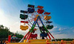
The Satkania Upazila is one of the locations of Chattogram District’s southern areas. Located about 61 kilometers from the metropolitan city, the Satkania area guide has been transformed due to the construction of the Chattogram-Cox’s Bazar railway route.<br><br> The upazila has a land area of about 282.40 square kilometers. It is bounded by Chandanaish Upazila in the north, Lohagora Upazila in the south, Bandarban Upazila in the east, and Bashkhali Upazila in the west. The population of the area is more than 3,84,806, and it has 75 villages, 17 unions, 73 mouzas, and 1 pourashava.<br><br> Traveling from the Chattogram city area to Stakania requires using the Arkan Road and Kalurghat Bridge to come across the Karnaphuli River. Then, the Arkan Road connects to the Chattogram-Cox’s Bazar Highway. It is the longest road connecting Satkania to Cox’s Bazar and other locations via the Dohazari Bridge, which is constructed over the Sangu River. The newly established roads and bridges have made traveling in and out of the upazila highly convenient.<br><br> The economy of Satkania is dependent on agriculture and trade. However, there are other industries as well, such as cottage industry, fisheries, dairies, etc. The area also has many healthcare institutions, including one Upazila health complex.<br><br> Satkania is religiously diverse, with over 1,000 mosques, 18 mazar/dargah, 75 Hindu temples, 8 Buddhist Temples, etc. There are multiple community centers, banks and finance offices, service centers, marketplaces, etc.<br><br> Satkania Upazila is also rich in historical landmarks and various tourist locations. Being located in the south of the country, Satkania has several hilly areas that offer natural beauty. People who live in Satkania or travel to the location also enjoy visiting Alinagar Eco Park, Boitoroni Forest Area, Baitul Izzat Jame Masjid Area, Holudia Palm Forest, Gyanapal Ratnapriya Forest Meditation Center, etc. One can also enjoy the beauty of the Sangu River and Dolu River.<br><br> Satkania is a rural area with gradually growing urban locations. Over time, it is likely to be one of the most important areas in the Chattogram District.
অন্তর্দৃষ্টি দেখুন
সোনাডাংগা প্রপার্টি গাইড
Rating icon
4.0

সোনাডাংগা
, খুলনা

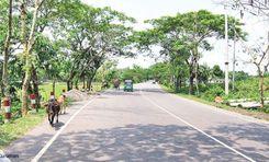
বেশ কিছু ঐতিহাসিক এবং পুরাতন নিদর্শন সহ, খুলনা জেলার সোনাডাঙ্গা সোনাডাঙ্গা এলাকার নির্দেশিকায় এর ভবনগুলির মতোই লম্বা। এটির ভূমি এলাকা ৮.৪২ বর্গ/কিমি এবং জনসংখ্যা ১৭৫,০০০ (খুলনা মেট্রোপলিটন পুলিশের মতে)।<br><br> খুলনা সিটি কর্পোরেশনের অধীন এই বিস্তীর্ণ এলাকা ৭টি ওয়ার্ড ও ৪২টি মৌজা/মহল্লা নিয়ে গঠিত। এর দক্ষিণ ও পূর্বে কোতোয়ালি থানা, পশ্চিমে বটিয়াঘাটা ও ডুমুরিয়া উপজেলা এবং উত্তরে খালিশপুর থানা রয়েছে। এটি একটি বৈচিত্র্যময় জীবনধারার একটি এলাকা কারণ বিভিন্ন অর্থনৈতিক পটভূমির লোকেরা এখানে বাস করে।<br><br> সোনাডাঙ্গার একটি সুপরিকল্পিত আবাসিক এলাকা রয়েছে যা খুলনা উন্নয়ন কর্তৃপক্ষ বা কেডিএ দ্বারা বিকশিত হয়েছে। শুধুমাত্র আবাসিক এলাকার ১ম ধাপে ৩০.৬৯ একর জমি রয়েছে এবং প্রায় ২০৫ টি প্লট রয়েছে। এর মধ্যে বেশিরভাগই ভাড়ার জন্য সাশ্রয়ী মূল্যের আবাসন এবং বাণিজ্যিক সম্পত্তি অফার করে। জায়গার কোন অংশের উপর ভিত্তি করে জমি বা প্লটের দাম পরিবর্তিত হয়।<br><br> যোগাযোগের ক্ষেত্রে, খুলনা-যশোর-ঢাকা মহাসড়ক, শের-ই-বাংলা রোড, আউটার বাইপাস রোড, ইত্যাদি শহরজুড়ে মানুষের যাতায়াতের প্রধান মাধ্যম। সোনাডাঙ্গা বাস টার্মিনাল হল একটি প্রধান বাস স্ট্যান্ড যা শহরের ভিতরে এবং বাইরে বিভিন্ন বাস রুটে ভ্রমণের অফার করে।<br><br> এই এলাকাটি বিভিন্ন সুযোগ-সুবিধাও অফার করে, যেমন ইনস, পার্ক, কমিউনিটি সেন্টার, শপিং মল, বাজার ইত্যাদি। রায়েরমহল জেনোসাইড ক্যাম্প, ১৯৭১: গণহত্যা-নির্যাতন সংরক্ষণাগার ও জাদুঘর, বাংলাদেশ বিমান মনুমেন্ট, বাংলাদেশ বেতার, ইত্যাদি। উল্লেখযোগ্য ল্যান্ডমার্ক। <br><br> খুলনা সিটি মেডিকেল কলেজ ও হাসপাতাল সোনাডাঙ্গার কেন্দ্রীয় চিকিৎসা প্রতিষ্ঠান। এছাড়াও সুপরিচিত শিক্ষা প্রতিষ্ঠান রয়েছে, যেমন বয়রা পোস্ট-অফিস হাই স্কুল, খুলনা ইসলামিয়া ডিগ্রি কলেজ, ইসলামাবাদ কলেজিয়েট স্কুল ইত্যাদি।<br><br> এলাকার কিছু ত্রুটিও রয়েছে, যেমন জল সরবরাহের সমস্যা, দুর্বল বর্জ্য নিষ্কাশন এবং ব্যবস্থাপনা, পরিবেশ দূষণ, দুর্ঘটনা এবং অপরাধ।
অন্তর্দৃষ্টি দেখুন
ঠাকুরগাঁও প্রপার্টি গাইড
Rating icon
4.0

ঠাকুরগাঁও
, রংপুর

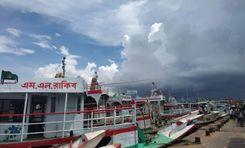
If you want a taste of the cultural diversity of Bangladesh, taking a tour through the Thakurgaon should be a priority. Known for its historical architecture and rich culture, Thakurgaon District is an administrative area of the Rangpur Division. It is bounded by the Panchagarh and Dinajpur districts of Bangladesh in the north and east, while West Bengal of India bounds it by both south and west.<br><br> Thakurgaon has a land area of 1,809.52 square kilometers and a population of 15,33,894. Other than Muslims and Hindus as majorities, the district's population also includes people of various minority communities, such as Santal, Koch, Onrao, Munda, Malo, Hari, and more. This is why people living or visiting Thakurgaon can explore many cultural programs throughout the year. You can still witness gatherings for story-telling, bhawaiya songs, palagan, and more traditions.<br><br> The main rivers in Thakurgaon are Tangon, Bhuli, Nagar, etc. Unfortunately, most of the rivers and canals of the area have been drying up day by day. However, you can still enjoy the Tangon River view sites and the orange and tangerine gardens located nearby.<br><br> The economy of the district is largely dependent on agriculture. Lately, Thakurgaon has been thriving in its agricultural productivity. Other than rice, wheat, seasonal fruits, and vegetables, the land is equally important for the poultry business and producing sugarcane. In fact, the Thakurgaon Sugar Mills is a notable location in the area. Since road and train communication connects the district to all other parts of Bangladesh, trade and businesses benefit greatly from this.<br><br> Living in Thakurgaon also comes with advantages. The Sadar area offers comparatively better living facilities with access to broader amenities, whether education, healthcare, recreation, and outings. House rents are also very affordable, attracting many people to move to the city area. However, with the development of roads and other necessities day by day all over the district, many people are choosing to settle in the rural parts.<br><br> In Thakurgaon, there are also many popular tourist sites and historical landmarks. The most popular ones are Balia Masjid, Jamalpur Jamidar Bari, Haripur Rajbari and ancient mango tree, Khuniya Dighi, Balaka Park, Thakurgaon DC Tourist Park, etc.
অন্তর্দৃষ্টি দেখুন
বড়লেখা প্রপার্টি গাইড
Rating icon
3.9

বড়লেখা
, সিলেট

Borolekha Upazila is situated in the Moulvi Bazar district of Sylhet Division, Bangladesh, and borders the northeastern region of India. This upazila covers an area of approximately 448.87 square kilometers, with a significant portion bordering the Indian state of Assam. The border with India spans around 20 kilometers, making it a key region for cross-border interactions.<br><br> The population is estimated to be around 2,82,449, comprising both urban and rural inhabitants. Borolekha area guide highlights its vibrant location, offering natural beauty, a mix of cultural heritage, and developing infrastructure, making it a vital upazila in the region.<br><br> The area is known for its natural resources, including fertile lands and acres and acres of tea gardens. Borolekha’s economy thrives primarily on agriculture, with rice, tea, and betel leaf being major products. Moreover, a substantial portion of the population is also involved in fishing, with many natural water bodies present in the region. <br><br> Communication infrastructure in Borolekha is improving, with well-maintained roads connecting it to Moulvi Bazar town and other regions. However, public transportation could still benefit from further development. Borolekha has a few government and private health centers, but access to specialized healthcare remains limited, with residents often traveling to larger towns for advanced medical services.<br><br> Borolekha is rich in cultural diversity, with Islam being the predominant religion. However, other faiths, such as Hinduism, are also practiced. Religious harmony is a key feature of this region. Financial institutions, including local banks and cooperatives, are present, catering to the economic needs of the community.<br><br> Traditional folk music, festivals, and cultural events mark Borolekha’s cultural landscape. Landmarks such as the Madhabkunda Waterfall, along with Hakaluki Haor, draw tourists from across the country.<br><br> While there aren’t many modern housing complexes in the area, Borolekha has potential for both housing and business development. Its scenic beauty, coupled with a growing economy, makes it an attractive location for real estate investments.
অন্তর্দৃষ্টি দেখুন
কুড়িগ্রাম প্রপার্টি গাইড
Rating icon
3.9

কুড়িগ্রাম
, রংপুর

In Bengali, kuri means twenty, and gram means village. It is said that Maharaja Bishwa Singh granted twenty Hindu fisherman families high-class recognition and sent them to a village to reign. Thus, the land is called Kurigram and, over time, people of different culture and ethnicity formed a new and diverse culture in the area.<br><br> Kurigram area is an administrative area of the Rangpur Division located at the northwest of Bangladesh. It is bounded by West Bengal of India in the north, Jamalpur and Gaibandha in the south, Assam of India in the east and Rangpur and Lalmonirhat in the west. The district has a land area of 2,255.29 square kilometers and the population is over 23 million.<br><br> The current administrative Kurigram district has 9 upazilas, 11 thanas, 3 pourashavas, 72 unions, 6,301 mouzas, and 1,585 villages. Kurigram also has 16 rivers, including Brahmaputra, Jamuna, Dharla, and Teesta. And because of its geographical location, the temperature of Kurigram remains higher in the summer and lower in the winter.<br><br> The economy of Kurigram is dependent on agriculture, which is over 70%. It is also religiously diverse and has many mosques, temples, and churches. The best way to communicate in and out of the district is by buses and trains. However, some areas can only be accessed by smaller vehicles and boats.<br><br> Kurigram is also famous for its rich history and as a birthplace of many notable people. The famous war heroine Taramon Bibi, and poet/writer Sayed Shamsul Haque are also from the area.<br><br> It has many historical architects and landmarks, such as the house of Taramon Bibi, Chandamari Masjid, Kurigram Rajbari, Ulipur Munshibari Palace, Rajarhat Shahi Jame Masjid, etc. There are also many parks and other recreational facilities. Despite all the development, Kurigram still suffers from a higher rate of poverty and heavy floods.
অন্তর্দৃষ্টি দেখুন
অলঙ্কার প্রপার্টি গাইড
Rating icon
3.9

অলঙ্কার
, চট্টগ্রাম

When you are crossing the Dhaka-Chattogram highway on your way to the commercial capital, you will enter it through Alankar More. That is because Alankar More is the entrance to Chattogram. Similarly, when you go outside Chattogram, Alankar More will be your place to buy a ticket and get on a bus. The area is typically known for its bus counter. <b><b> But there is more to it, of course. The Alankar area guide also says it has a remarkable landmark, the Alankar Mosque, which enhances the gaiety of life in the Alankar neighborhood. The presence of the mosque acts as a keystone for the Muslim dwellers in the locality. <b><b> However, the graceful design and flawless architecture will impress visitors, too. So, if you have a penchant for art and are wandering about the area, do pay the mosque a visit. Alankar is basically a part of Uttar Kattali, a residential district in Chattogram. That means it has all the good amenities essential for maintaining a standard lifestyle. For instance, you will have high convenience regarding accessing crucial trade hubs. Besides, it has medical facilities, schools, and colleges. <b><b> If you want to relax from your monotonous routine life, Alankar will entertain you with its recreational centers. Overall, you can say that the place is strategically positioned, checking all the boxes for working people and families altogether. <b><b> Then again, if we had to say whether Alankar is more like a commercial or a residential area, we might have to lean toward the first one. That is because there are a number of banks and financial institutions. Also, you will notice the small businesses emerging on footpaths and alongside the streets. <b><b> A positive part of Alankar is its Alankar Shopping Complex. The whole complex is dedicated to selling clothing, cosmetics, gadgets, and other necessities for people with a low to medium budget. Everything there is available at a reasonable price, catering to the needs of the locals with a modest earning.
অন্তর্দৃষ্টি দেখুন
উওর আলেকান্দা প্রপার্টি গাইড
Rating icon
3.9

উওর আলেকান্দা
, বরিশাল

Uttar Alekanda is an area under Barisal City Corporation located in the southern region of Bangladesh. Uttar Alekanda is a part of the larger Barisal Sadar Upazila located in the northern part of Barisal city. Its speed is only 2.1 km from Barisal zero point. Also this place is really interesting near Barisal launch ghat. The area is considered an ideal place to live, especially for those who prefer a mix of traditional and modern city life. This area has become more attractive to all as it offers essential amenities like schools, health care facilities, local markets and places of worship. Also, the location of the place near the Kirtonkhola river makes its strategic and natural value quite good and attractive.<br><br> The place is primarily a residential area, with an unmatched blend of traditional and modern attractions. The area is also known for its mixed community and has a nice mix of upper middle class to working class population which is great. On the other hand the place reflects the general cultural diversity of Barisal, where people of different religious and cultural preferences are living together in harmony. Here all religious and national festivals are celebrated with great pomp.<br><br> Uttar Alekanda being a part of Barisal, there are educational institutions for primary school to higher education, maintaining the continuity of education quality in Barisal. There are public and private universities in and around this place for primary and secondary education. For those interested in religious education, there are some madrasas that provide both general and religious education. Also for higher education there are nearby Barisal University and Barisal Medical College which really ensures the education aspect of the residents here.<br><br> Like education, medical and recreational facilities are also quite good here. Being close to Barisal Medical College is very convenient.<br><br> There are some small parks and open spaces where residents can spend time. There is an opportunity to feel the freshness of the river in the afternoon either near the Kirtonkhola river. Also, the hustle and bustle is a little less compared to the city and the peaceful atmosphere prevails which is impeccable.<br><br> Uttar Alekanda local economy is supported by small businesses, retail shops and services. And people of different professions live together here. The transport system here is also quite satisfactory. The area is well connected by road and with public transport access that connects it to other parts of Barisal. Autorickshaws, cycle rickshaws and buses are the common modes of transportation here.<br><br> If you are looking for a residential area in Barisal that offers a blend of tradition and modernity at the same time. On the other hand, a place with a strong sense of community might be the perfect choice for you.
অন্তর্দৃষ্টি দেখুন
কয়রা প্রপার্টি গাইড
Rating icon
3.9

কয়রা
, খুলনা

Koyra is an upazila located at the furthest south of the Khulna District. It is the second largest upazila in Bangladesh, with a land area of 1775.41 sq./km, and the Sundarbans Mangrove Forest covers a large part of this gigantic upazila. That makes Koyra area guide one of the most sought-after area guides for people who want to know more about the upazila.<br><br> It has Paikgacha in the north, Shundarban Mangrove Forest in the south and east, and Shaymnagar and Ashashuni Upazilas of Satkhira in the west. The upazila has 7 unions, 72 mouzas or mahallas, and 131 villages. According to the 2022 Census, there are around 2,20,100 people in Koyra.<br><br> Though Koyra Upazila does not have many developed roads, there has been a major communication development in the last few years. As a result, people in the upazila, especially in the remote areas, are gaining better accessibility to necessary amenities. However, some areas in and across the upazila are only accessible by water transports, such as ferries and launches.<br><br> The number of educational institutions and literacy rates of Koyra upazila have also increased. There are numerous religious institutions in the area, such as mosques, churches, temples, etc. The Mosjidkur Mosque is one such notable landmark. Other popular landmarks of Koyra Upazila are the Koyra Bridge, Khalishar Dighi, Koyra River, Keorakata Tourist Spot, etc. Other than the Shundarband Forest itself, Hiron Point of the upazila has also been declared as a World Heritage Site by UNESCO.<br><br> Though agriculture is the main source of the economy of the people, a large part of Koyra’s income source also depends on shrimp culture and export business. The water bodies of the area are used as shrimp ghers (a bounded area), and you are likely to come across many of them in most parts of the upazila.<br><br> The geographical location of Koyra makes it highly prone to natural disasters and heavy damage. But the Sundarbans Mangrove Forest keeps most of the upazila safe. However, many developments are still needed to offer better living conditions for all.
অন্তর্দৃষ্টি দেখুন
কাচারি বাজার প্রপার্টি গাইড
Rating icon
3.9

কাচারি বাজার
, রংপুর

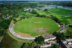
Kachari Bazaar is located in the heart of Rangpur district. Near the Collectorate building which is one of the main landmarks of Rangpur. It is close to Rangpur Central Bus Terminal and Rangpur Medical College Hospital. It grew up in Rangpur city about a few decades ago, serving as a central location for trade and commerce. As Kachari Bazaar is centrally located in Rangpur, it is easily accessible from various parts of the city. Kachari Bazaar is not only a place for shopping but also serves as a cultural center. The market is known for its lively atmosphere. As Rangpur Judge Kot is located in Kachari Bazaar, the administrative system here is also quite satisfactory.<br><br> The market plays an important role in the local economy and also enriches the economy of Rangpur district. Enables small business owners, shopkeepers and vendors to earn a living. The market also offers a wider range of products including fresh produce, spices, clothing and electronic unique household items. Which caters to the needs of local residents as well as distant people.<br><br> People who are close to the market are likely to have access to shopping, banking and everyday conveniences. Besides, the area's central location within Rangpur provides easy access to educational institutions, hospitals and other important offices including government offices. Rangpur's well-known schools, colleges and universities, medical colleges ensure the educational system here. There are various government and private hospitals and private clinics for treatment. And if the communication system is good here, people will be interested to live here. Especially the road connectivity is better.<br><br> The market is busy in the morning and late afternoon. Rangpur Kachari Bazaar also has many specialties. It is a commercial hub of Rangpur city. The famous street food of Rangpur is very good here. Besides, the market reflects Rangpur's place of Sanskrit tradition that gives a glimpse into the life of the city's residents. It is a place where cultures are exchanged and traditional practices are maintained.<br><br> Here the religious harmony is strong as well as the touch of communalism is quite evident. The coexistence of the people here, the sociability, the hospitality style, the ethics etc. it reminds me of the old traditions of Rangpur which is really nice.<br><br> Overall, Kachari Bazar reflects the economic heartbeat of Rangpur's historic culture, making this part an important part of the city that is admirable.
অন্তর্দৃষ্টি দেখুন
কালিজিরা প্রপার্টি গাইড
Rating icon
3.9

কালিজিরা
, বরিশাল

Kalizira is an area of ​​Barisal city located in the southern region of Bangladesh and is under the City Corporation. Kalizira is accessible from the central part of Barisal and is connected by local roads. Kalizira is just 4.3 km from Barisal Zero Point. Kalizira is mainly a residential area with traditional houses and modern buildings. The area has a vibrant community life with a mix of religious and cultural events. There are mosques and unique religious centers where residents have opportunities for prayer and religious activities that truly strengthen the bond of harmony.<br><br> Kalizira's economy is centered on small businesses, retail shops, bazaars and bazaars. Local people here are involved in market activities and small businesses. Besides, the people of this area are engaged in various professions including jobs which contribute to the local economy.<br><br> Kalizira, like the Ananya part of Barisal, is also slowly undergoing urbanization. Infrastructure is being improved with the development of new roads, buildings and amenities. Kalizira is also considered a safe area to live in with a relatively low crime rate. Along with this it will provide you a decent life.<br><br> There are area-based small health care centers and clinics that provide primary care to the locals. Barisal headquarters for emergency services have access to advanced medical facilities and are well connected by road. There are public and private primary and secondary schools for education here. Also for higher education there are Barisal University and Barisal Medical College which are within commuting distance of people here.<br><br> Kalizira is well connected with the rest of Barisal by local roads and public transport. Part of Barisal, Kalizira benefits from the natural beauty of the region, including the surrounding rivers and green spaces.<br><br> The area is still developing, with gradual urbanization and infrastructure improvements making it a promising area for long-term living. Benefit from ongoing projects to enhance the livability of the area.<br><br> Overall, people prefer living in Kalizira for its affordability, sense of community, convenient access to amenities and peaceful environment. It is particularly suitable for families and those looking for a balance between city life and a more relaxed lifestyle.
অন্তর্দৃষ্টি দেখুন
কোর্ট স্টেশন প্রপার্টি গাইড
Rating icon
3.9

কোর্ট স্টেশন
, রাজশাহী

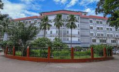
The Rajshahi Court Station was opened for railway commutes in 1930 and is only 1 kilometer from the Rajshahi District Judge Court. Over the years, the station has significantly improved the communication system of people traveling around the Rajshahi megacity and district. The area falls under the Rajpara Thana and partially under wards 1 and 2 of Rajshahi City Corporation.<br><br> Following the station, the Court Station area guide was established. The Court Station road connects the station to Judge Court, Lakshmipur Mor/Mintu Chattor, and it goes all the way to Darusha, crossing the Rajshahi City Bypass. These routes are also some of the busiest ones, as there are several bus stations nearby that offer convenient transportation facilities in and out of the district.<br><br> Some of the area's most significant landmarks are Court Station Jame Masjid, Court Station Bazaar, Shaheed Jamil Chattar/Circle, Mahisbathan Colony Playground, Lilly Hall Mor, etc. Notable educational institutions here are the Court Model High School, Balajan Nessa Girl's High School, Mollapara Government School, Rajshahi Court College, Bidya School and College, etc.<br><br> Other than the Judge Court and many retailers, business places, service centers, and market areas, the Court Station area has many public and government offices and cultural centers. Some of them are the Councilor Office of ward no. 02 and 06, PDB Office, NESCO Office, ICT Department Office, Rajshahi Divisional Ethnic Cultural Academy, etc.<br><br> The Court Station area and the localities near the Court Station roads give one the taste of both city and rural life. Depending on where you are located, you can easily come across affordable and comparatively higher-cost housing.<br><br> So, it is safe to say that the Rajshahi Court Station area offers a diverse lifestyle and many amenities for locals and travelers alike. However, the area needs to be upgraded to improve living conditions and add recreational facilities for the people in the neighborhood.
অন্তর্দৃষ্টি দেখুন
গোয়াইনঘাট প্রপার্টি গাইড
Rating icon
3.9

গোয়াইনঘাট
, সিলেট

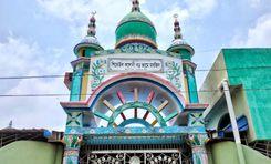
If you are a native Bangladeshi who loves exploring different places, it is hard not to hear the names Bisnadakandi and Jaflong. However, if you want to know more about the surrounding locations and the neighborhoods around them, all you have to do is look at the Gowainghat area guide. But before that, let’s learn about Gowainghat.<br><br> Gowainghat is an upazila of the Sylhet District in the northeast of Bangladesh. Since it is located near the Goyain River, the area was called Gowainghat. The British Government established the Gowainghat Thana in 1908, which included Araikha, Dhargram, Piyaingul, Panchbhag, and Jaflong. It also contains the history of the 1971 Liberation War and has 7 mass graves. In 1983, the Gowainghat Upazila was established, and now it has 13 unions and 264 villages.<br><br> The upazila has a land area of 486.10 square kilometers. According to the 2022 Census, the population of the area was 3,55,969. The other nearby locations of Gowainghat Upazila are the Jaintiapur Upazila, Sylhet Sadar Upazila, Companiganj Upazila, and Meghalaya of India. The main economy of the people in this upazila is agriculture. However, non-agricultural labor, trade and commerce, stone, coals, tea, tourists, etc., are also part of economic sources.<br><br> The Gowainghat Upazila has several notable locations and some of the most popular tourist spots in the country. Two of them are located in Jaflong and Bisnakandi. These are hilly areas, and they also have tee estates, river locations, waterfalls and attractive resorts. Another reason people like these places is because they provide an opportunity to get close to the Bangladesh-India border point.<br><br> Other than these, you can also enjoy the beauty of the Goyain River and Sari River. Some other notable locations of the Gowainghat Upazila include Ratargul Swamp Forest, Srihatta-Samdani Art Centre & Sculpture Park, Jaflong Khashia Jomidar Bari, Gowainghat Dighi, etc. The rural environment of the Gowainghat Upazila is a good place to live, as the Upazila Sadar area is developing. However, the rural areas still need better communication and lifestyle facilities. On top of that, several parts of the upazila are damaged every year due to floods and other natural causes.
অন্তর্দৃষ্টি দেখুন
গোল্লামারি প্রপার্টি গাইড
Rating icon
3.9

গোল্লামারি
, খুলনা

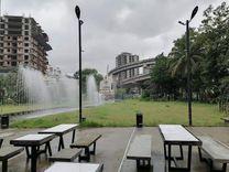
If you are looking into Gollamari of Khulna district, you can easily get confused as it is a part of several wards of the district. That is why it is essential to be familiar with the Gollamari area guide. <br><br> Though there is no solid information on the exact geographical land area of Gollamari, it is partially located under the Sonadanga and Batiaghata thanas. Surrounded by highways, bazars, residential areas, and commercial places, it is one of the busiest and most densely populated areas of Khulna. <br><br> The area is connected to various parts of Khulna with the Sher-E-Bangla Road, Khulna-Satkhira Highway, Khulna City Bypass, Gollamari-Sonadanga Bypass Road, M.A. Bari Street, etc. That is why locals can travel conveniently using the bus routes, as there are multiple bus stations across the area. Some such locations are Gollamari Mor, Zero Point Mor, Sonadanga Bus Terminal, etc. <br><br> The Gollamari Memorial Monument is a historical location in the area. During the Liberation War of 1971, many people were brought to the land and massacred. <br><br> The area is also popular because of its location, which is near the Moyur River. Residents prefer the area due to easy access to commutes, affordable lifestyle, and access to amenities. The Linear Amusement Park and Moyuri Residential Park are two of the popular destinations for locals and tourists. <br><br> There are also bazars, super shops, offices, schools, colleges, and hospitals nearby. The Khulna University is also near the area. Moreover, Gollamari Bridge is also one of the notable parts of the area. <br><br> However, the bridge is under reconstruction, as it is to be turned into an arched bridge, similar to the Hatirjheel Bridge of Dhaka. With that, the number of visitors and residents in the area is likely to increase in the future.
অন্তর্দৃষ্টি দেখুন
চক বাজার প্রপার্টি গাইড
Rating icon
3.9

চক বাজার
, বরিশাল

Chawkbazar is a city in the southern region of Bangladesh and a well-known market area in Barisal. The area is vibrant and bustling. which reflects the city's rich cultural heritage and serves as an important commercial hub. Being located in the city of Barisal, the touch of modernity prevails here. Chawk Bazar Barisal is located in the central part of the city. Also being included in the city corporation, all the urban amenities are available here. The area is vibrant and bustling, offering a rich cultural experience and a sense of community. The area also offers a blend of local culture, heritage, and lifestyle, making it a truly attractive place for people who prefer to live in the heart of the city.<br><br> Chawkbazar plays an important role in the local economy by providing livelihood opportunities to numerous small businesses, shopkeepers, and vendors. Also, people from different countries live here, there are several small and large industries that contribute to the local economy.<br><br> The market area of ​​Chawkbazar has a mixture of old and new buildings. Though modernized over time, the place retains its traditional beauty. Apart from the commercial center, it is also a cultural center. The market reflects the local culture and tradition of Barisal, and its products and environment showcase the lifestyle of the people of the region.<br><br> The Chawkbazar area is also very advanced in education and the medical field. Chawkbazar has several good hospitals, pharmacies, private hospitals, and health care clinics nearby which play a very important role in local treatment. On the other hand, in the field of education, Barisal University has several public and private primary, secondary, and higher secondary schools. For residents where education is open.<br><br> Along with education and medical facilities, the transport system here is also quite good. Local transport is well-connected here by rickshaws, auto rickshaws, and buses, making the place easily accessible to people from different parts of the city. It also has excellent road connectivity for long-distance travel, good river connectivity, and an air system that provides access to national and international levels of transport.<br><br> Chawkbazar is also known for all products, including clothing, textiles, spices, fresh produce, electronic and household items. It presents a picture of the Bangladesh market.<br><br> Despite the facilities, there are some drawbacks. Eg: Petty crime tends to thrive here. Living in this place may not be ideal for people who do not like so much noise. But considering employment, the city environment, and better living conditions, it is not a bad place to live. The market is an important part of the Barisal landscape, combining commerce with a deep sense of community and tradition.
অন্তর্দৃষ্টি দেখুন
জায়ন্তিয়াপুর প্রপার্টি গাইড
Rating icon
3.9

জায়ন্তিয়াপুর
, সিলেট

If you travel from Sylhet Sadar to Jaflong, you must first reach Jaintapur Upazila. Since Jaflong is one of Bangladesh's most popular tourist destinations, it is necessary to discuss the Jaintapur area guide. Closer to the Bangladesh-India borderline, Jaintapur Upazila stands with a mesmerizing and naturally beautiful landscape.<br><br> It is located in the northeast part of Sylhet City, 43 kilometers from it. The Jaintapur Upazila is bounded by India’s Meghalaya on the north, Golapganj and Kanaighat Upazilas on the south, Kanaighat Upazila on the east, and the Sylhet Sadar and Gowainghat Upazilas on the west. The upazila has 6 unions, 142 mouzas, and 174 villages.<br><br> According to the 2022 Census, the upazila has a population of 2,00,128, and the land area is around 256.69 square kilometers. The majority of the population in the upazila is Muslims, but there are also Hindus, Buddhists, Christians, and other religious people living together. The Khasia community also belongs to the Jaintapur upazila. As a result, it offers cultural and festival diversity in the area, making the community favorable to live in. Moreover, house rent in the upazila village areas is more affordable than in the upazila town areas.<br><br> The economy of the upazila is driven by agriculture and employs 53.38% of the population here. Tea, paddy, bay leaf, betel leaf, potato, etc, are some of the main crops of the upazila. However, industrial sectors, non-agricultural labor, businesses, transport and communication, etc., are also contributing to the economy of the upazila. There are many export products in the upazila, such as natural gas, limestone, pebble, tea, bay leaf, betel leaf, and nut.<br><br> The upazila offers a diverse range of public services and infrastructure, from a health complex, clinics, and post offices to educational institutions, banks, and haat-bazars. The most notable educational institutions in the upazila are Jaintiapur Government High School, Haripur High School, Jaintia Degree College, Jaintiapur Tayob Ali Degree College, etc.<br><br> Other than Jaflong tourist spots, you can enjoy many beautiful and notable landscapes in Jaintapur. Some of the popular ones are the Jaintia Rajbari, Shapla Beel, Mukambari Old Temple, Shreepur Tea Garden, etc. Tourists who want to stay overnight and spend their vacation in Jaintapur can stay at The Jaintia Resort & Park or the Nazimgarh Wilderness Resort. Notable waterbodies in the upazila are the Sari River, Kakai Beel, Lala Khal, and the Dalai Haor, which is also a popular tourist spot.
অন্তর্দৃষ্টি দেখুন
IconMap

ফিচারড প্রজেক্ট

সবগুলো দেখুন

Bangladesh-এর প্রপার্টি প্রাইস ট্রেন্ড

কেনা
ভাড়া
বেডরুম:
গড় মূল্য (বিগত ১২ মাসের)
Tk. 6,358.55 per sqft
বিগত ১২ মাসের বৃদ্ধি
5.85%
Positive Trend
বিগত ৩ মাসের বৃদ্ধি
5.2%
Positive Trend
Icon
দ্রষ্টব্য: মূল্য তথ্য Bikroy-এর পোস্ট করা বিজ্ঞাপন থেকে ঐতিহাসিক তথ্যের উপর ভিত্তি করে দেওয়া। সম্পূর্ণ মার্কেটের ডায়নামিক প্রতিফলিত নাও হতে পারে।
hero

Bikroy এ বিক্রি বা ভাড়া দিন: মাত্র ২ মিনিটেই প্রপার্টির বিজ্ঞাপন দিন!